Ashwick

Last updated

Ashwick
Ashwickchurch.jpg
Somerset UK location map.svg
Red pog.svg
Ashwick
Location within Somerset
Population1,352 (2011) [1]
OS grid reference ST637484
Unitary authority
Ceremonial county
Region
Country England
Sovereign state United Kingdom
Post town Radstock
Postcode district BA3
Police Avon and Somerset
Fire Devon and Somerset
Ambulance South Western
UK Parliament
List of places
UK
England
Somerset
51°14′01″N2°31′09″W / 51.2335°N 2.5192°W / 51.2335; -2.5192

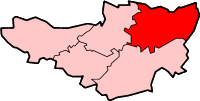
Ashwick is a village in Somerset, England, about three miles north of Shepton Mallet and seven miles east from Wells. It has also been a civil parish since 1826. The parish had a population of 1,352 according to the 2011 census, [1] and apart from Ashwick village also includes Gurney Slade and Oakhill.

Contents

History

The area around Ashwick has evidence of occupation since the Iron Age, being in close proximity to Maesbury Castle. In Roman Britain, Fosse Way was constructed, which passes to the east of the parish.

Although Oakhill is the larger village today, Ashwick is the older settlement, dating back to Anglo-Saxon times. It appears in the Domesday book as a settlement called Escewiche, which translates as 'the hamlet or farmstead by the ash trees'. [2] The parish of Ashwick was part of the Hundred of Kilmersdon. [3] [4]

The village is the site of Ashwick Court, a country house dating from the late 17th century and Grade II* listed. [5]

Anthony Newley's short-lived 1960 ATV series The Strange World of Gurney Slade continues to have a cult following owing to its postmodern premise that the Newley character is trapped inside a television programme. Newley's character is named "Gurney Slade"; in one typically surreal episode, he encounters a signpost that leads him in the direction of a locale called Gurney Slade, where he casually interacts with a talking dog.

Geology

The nearby Maesbury Railway Cutting of the Somerset and Dorset Joint Railway exposes approximately 135 metres of strata representing the middle and upper Lower Limestone Shales and the basal Black Rock Limestone. Both formations are of early Carboniferous (Courceyan) age.

Governance

The parish council has responsibility for local issues, including setting an annual precept (local rate) to cover the council’s operating costs and producing annual accounts for public scrutiny. The parish council evaluates local planning applications and works with the local police, district council officers, and neighbourhood watch groups on matters of crime, security, and traffic. The parish council's role also includes initiating projects for the maintenance and repair of parish facilities, as well as consulting with the district council on the maintenance, repair, and improvement of highways, drainage, footpaths, public transport, and street cleaning. Conservation matters (including trees and listed buildings) and environmental issues are also the responsibility of the council.

The village falls within the Non-metropolitan district of Mendip, which was formed on 1 April 1974 under the Local Government Act 1972, having previously been part of Shepton Mallet Rural District, [6] which is responsible for local planning and building control, local roads, council housing, environmental health, markets and fairs, refuse collection and recycling, cemeteries and crematoria, leisure services, parks, and tourism. Ashwick is art of the electoral ward called Ashwick, Chilcompton and Stratton. At the 2011 Census the population of this ward was 4,835. [7]

Somerset County Council is responsible for running the largest and most expensive local services such as education, social services, libraries, main roads, public transport, policing and fire services, trading standards, waste disposal and strategic planning.

It is also part of the Wells county constituency represented in the House of Commons of the Parliament of the United Kingdom. Prior to Brexit in 2020, it was in the South West England constituency of the European Parliament.

Church

The parish Church of St James is a Victorian Gothic building erected between 1876 and 1881 by Browne and Gill of Bath. [8] However, the church tower dates back to 1463. It is a Grade I listed building. [9] The earliest record of a church on the site is 1413, when Bishop Bubwith dedicated a churchyard at Ashwick and authorised burials to take place there, but it is not known when the church was first built. The church was originally a chapel of ease connected to the vicarage at Kilmersdon, near Radstock. It remained so until the formation of Ashwick parish. The benefice of Oakhill was added in 1923 and Binegar was added in 1969, since when one rector has overseen all three villages.

At the west end of the aisles in the Church of St James two memorial tablets can be seen. These are dedicated to John Billingsley, his wife Mary, and their family. [10] The writer of the 1794 Survey of Somerset, Billingsley was a leading agriculturalist who was one of the founders of the Bath and West Society, known today as the Royal Bath and West of England Society. He lived all his life at Ashwick Grove, which is in the nearby village of Oakhill.

Related Research Articles

<span class="mw-page-title-main">Shepton Mallet</span> Town in Somerset, England

Shepton Mallet is a market town and civil parish in Somerset, England, some 16 miles (26 km) south-west of Bath, 18 miles (29 km) south of Bristol and 5 miles (8.0 km) east of Wells. It had an estimated population of 10,810 in 2019. Mendip District Council was based there. The Mendip Hills lie to the north and the River Sheppey runs through the town, as does the route of the Fosse Way, the main Roman road between north-east and south-west England. There is evidence of Roman settlement. Its listed buildings include a medieval parish church. Shepton Mallet Prison was England's oldest, but closed in March 2013. The medieval wool trade gave way to trades such as brewing in the 18th century. It remains noted for cider production. It is the closest town to the Glastonbury Festival and nearby the Royal Bath and West of England Society showground.

<span class="mw-page-title-main">Mendip District</span> Former non-metropolitan district in England

Mendip was a local government district of Somerset in England. The district covered a largely rural area of 285 square miles (738 km2) with a population of approximately 112,500, ranging from the Wiltshire border in the east to part of the Somerset Levels in the west. The district took its name from the Mendip Hills. The administrative centre of the district was Shepton Mallet but the largest town was Frome.

<span class="mw-page-title-main">Chilcompton</span> Human settlement in England

Chilcompton is a village and civil parish in Somerset, England, situated in the Mendip Hills two miles south of Midsomer Norton and 3.0 miles south-west of Westfield. It is situated on the B3139 road between Radstock and Wells, close to the A37.

<span class="mw-page-title-main">Wells (UK Parliament constituency)</span> Parliamentary constituency in the United Kingdom, 1885 onwards

Wells is a constituency represented in the House of Commons of the UK Parliament since 2015 by James Heappey of the Conservative Party.

<span class="mw-page-title-main">Binegar</span> Human settlement in England

Binegar is a small village and civil parish in Somerset, England. It is located on the A37, 4 miles (6.4 km) east of Wells, between Shepton Mallet and Chilcompton. Its population in 2011 was 313. Binegar and Gurney Slade on the opposite side of the A37 are effectively a single village and share a sign on the main road. In Gurney Slade, the quarry and houses on the north side of Tape Lane are in Binegar parish whilst the south side is in Ashwick parish. In Binegar, some houses on the south side of Station Road are in Ashwick parish and some on the north side of the village are in Emborough parish.

<span class="mw-page-title-main">Holcombe, Somerset</span> Human settlement in England

Holcombe is a small village and civil parish in the Mendip local government district of Somerset, England. The parish contains the hamlets of Barlake and Edford. It is within easy commuting distance of both Bristol and Bath.

<span class="mw-page-title-main">Stratton-on-the-Fosse</span> Village in Somerset, England

Stratton-on-the-Fosse is a village and civil parish located on the edge of the Mendip Hills, 2 miles (3 km) south-west of Westfield, 6 miles (10 km) north-east of Shepton Mallet, and 9 miles (14 km) from Frome, in Somerset, England. It has a population of 1,108, and has a rural agricultural landscape, although it was part of the once-thriving Somerset coalfield. Within the boundaries of the parish are the hamlets of Benter and Nettlebridge.

<span class="mw-page-title-main">Oakhill</span> Human settlement in England

Oakhill is a village in the Mendip district of Somerset, England, in Ashwick parish approximately 2.5 miles (4 km) north of Shepton Mallet. It lies between the A37 and the A367. Oakhill is today mainly a commuter village of 0.4 square miles (1.0 km2) in size, and is notable for former activities which including brewing. The village contains a Church of England primary school and a surgery, as well as a public house, the Oakhill Inn.

<span class="mw-page-title-main">Cranmore, Somerset</span> Human settlement in England

Cranmore is a village and civil parish east of Shepton Mallet, in the Mendip district of Somerset, England. The parish includes the hamlets of Waterlip, East Cranmore and Dean.

<span class="mw-page-title-main">Croscombe</span> Human settlement in England

Croscombe is a village and civil parish 2 miles (3 km) west of Shepton Mallet and 4 miles (6 km) from Wells, in the Mendip district of Somerset, England. It is situated on the A371 road in the valley of the River Sheppey.

<span class="mw-page-title-main">Emborough</span> Human settlement in England

Emborough is a village and civil parish 5 miles (8.0 km) north of Shepton Mallet, and 5 miles (8.0 km) north east of Wells, in the Mendip district of Somerset, England. It adjoins the parish of Ston Easton. It is situated on the B3139 between Radstock and Wells, just off the A37 road.

<span class="mw-page-title-main">Evercreech</span> Human settlement in England

Evercreech is a village and civil parish 3 miles (4.8 km) southeast of Shepton Mallet, and 5 miles (8.0 km) northeast of Castle Cary, in the Mendip district of Somerset, England. The parish includes the hamlet of Stoney Stratton and the village of Chesterblade.

<span class="mw-page-title-main">Lamyatt</span> Human settlement in England

Lamyatt is a village and civil parish in the Mendip district of Somerset, England. It lies 5 miles (8 km) south east of Shepton Mallet, 2 miles (3 km) north east of Castle Cary, and 3 miles (5 km) south of Evercreech. The parish has a population of 183.

<span class="mw-page-title-main">Pylle</span> Human settlement in England

Pylle is a village and civil parish 4 miles (6.4 km) south west of Shepton Mallet, and 7 miles (11.3 km) from Wells, in the Mendip district of Somerset, England. It has a population of 160. The parish includes the hamlet of Street on the Fosse.

<span class="mw-page-title-main">John Billingsley (agriculturist)</span>

John Billingsley (1747–1811) was an agricultural pioneer in 18th century Somerset, England.

<span class="mw-page-title-main">Church of St James, Ashwick</span> Church in Somerset, England

The Church of St James in Ashwick, Somerset, England, is a church dating from 1881. It is a Grade I listed building, adjacent to Ashwick Court. It also houses a tower that dates back from 1450.

Shepton Mallet was a rural district in Somerset, England, from 1894 to 1974.

<span class="mw-page-title-main">Church of St John the Baptist, Chilcompton</span> Church in Somerset, England

The Anglican Church of St John the Baptist in Chilcompton, within the English county of Somerset, was built in the 15th century. It is a Grade II* listed building.

<span class="mw-page-title-main">Christ Church, Downside</span> Church in Somerset, England

Christ Church is a former Church of England church in Downside, Somerset, England. Designed by John Pinch the younger, it was built in 1837–38 and closed in 1983. The church, now a private residence, is a Grade II listed building.

References

  1. 1 2 "Ashwick Parish". Neighbourhood Statistics. Office for National Statistics. Retrieved 1 January 2014.
  2. "Ashwick Parish Design Statement" (PDF). Mendip Council. Archived from the original (PDF) on 11 June 2011. Retrieved 20 November 2010.
  3. "Somerset Hundreds". GENUKI. Retrieved 16 October 2011.
  4. http://opendomesday.org/place/ST6348/ashwick/ Open Domesday Map: Ashwick
  5. Historic England. "Ashwick Court (1058473)". National Heritage List for England . Retrieved 11 December 2006.
  6. "Shepton Mallet RD". A vision of Britain Through Time. University of Portsmouth. Retrieved 4 January 2014.
  7. "Ashwick, Chilcompton and Stratton ward population 2011" . Retrieved 23 October 2015.
  8. Atthill, Robin (1976). Mendip: A new study. Newton Abbot, Devon: David & Charles. ISBN   0-7153-7297-1.
  9. Historic England. "Church of St James (1058471)". National Heritage List for England . Retrieved 11 December 2006.
  10. Historic England. "Nicholas Billingsley tomb and railed enclosure in churchyard (1345208)". National Heritage List for England . Retrieved 11 December 2006.