
The River Severn, at 220 miles (354 km) long, is the longest river in Great Britain. It is also the river with the most voluminous flow of water by far in all of England and Wales, with an average flow rate of 107 m3/s (3,800 cu ft/s) at Apperley, Gloucestershire. It rises in the Cambrian Mountains in mid Wales, at an altitude of 2,001 feet (610 m), on the Plynlimon massif, which lies close to the Ceredigion/Powys border near Llanidloes. The river then flows through Shropshire, Worcestershire and Gloucestershire. The county towns of Shrewsbury, Gloucester and the City of Worcester lie on its course.

The River Avon is a river in the south west of England. To distinguish it from a number of other rivers of the same name, it is often called the Bristol Avon. The name 'Avon' is a cognate of the Welsh word afon, meaning 'river'.

Yatton is a village and civil parish within the unitary authority of North Somerset, which falls within the ceremonial county of Somerset, England. It is located 11 miles (18 km) south-west of Bristol. Its population in 2011 was 7,552. The parish includes Claverham, a small village which was originally a farming hamlet.
The River Chew is a small river in England that flows for some 17 miles (27 km) through the North Somerset countryside to form the Chew Valley before merging with the River Avon.
Congresbury is a village and civil parish on the northwestern slopes of the Mendip Hills in North Somerset, England, which in 2011 had a population of 3,497. It lies on the A370 between Junction 21 of the M5 and Bristol Airport, 13 miles (21 km) south of Bristol city centre, and 7 miles (11 km) east of Weston-super-Mare. The Congresbury Yeo river flows through the village. The parish includes the hamlet of Brinsea.

Weston-super-Mare is a constituency represented in the House of Commons of the UK Parliament since 2005 by John Penrose, a Conservative.

The Severn Estuary is the estuary of the River Severn in the south-west of Great Britain, flowing into the Bristol Channel between England and South Wales. Its high tidal range, approximately 50 feet (15 m), means that it has been at the centre of discussions in the UK regarding renewable energy.

Kingston Seymour is a small village and civil parish with royal status in Somerset, England. It is situated within the unitary authority of North Somerset, between Clevedon and Weston-super-Mare on the North Somerset Levels. The parish has a population of 388.
Wrington is a village and a civil and ecclesiastical parish on the north slopes of the Mendip Hills in North Somerset, England. Both include nearby Redhill. Wrington lies in the valley of the Congresbury Yeo river, about 9 miles (14 km) east of Weston-super-Mare and 3 miles (4.8 km) south-east of Yatton. Its population of 2,633 at the 2011 Census was estimated in 2019 to be 2,759.

Blagdon is a village and civil parish in the ceremonial county of Somerset, within the unitary authority of North Somerset, in England. It is located in the Mendip Hills, a recognised Area of Outstanding Natural Beauty. According to the 2011 census it has a population of 1,116. The village is about 12 miles (19 km) east of Weston-super-Mare on the A368 between Churchill and Compton Martin.

The Wrington Vale Light Railway was a railway from Congresbury on the Cheddar Valley line to Blagdon, and serving villages in the Yeo Valley, North Somerset, England. Construction of the line started in 1897 and it opened in 1901. Never more than a purely local line, it closed to passengers in 1931, and completely in 1963.

Blagdon Lake lies in a valley at the northern edge of the Mendip Hills, close to the village of Blagdon and approximately 10 miles (16 km) south of Bristol, England. The lake was created by Bristol Water, when it dammed the River Yeo, starting construction in 1898, to designs by Charles Hawksley, and completing this in 1905. The Wrington Vale Light Railway was constructed primarily to bring building materials for the lake.
The Chew Valley is an affluent area in North Somerset, England, named after the River Chew, which rises at Chewton Mendip, and joins the River Avon at Keynsham. Technically, the area of the valley is bounded by the water catchment area of the Chew and its tributaries; however, the name Chew Valley is often used less formally to cover other nearby areas, for example, Blagdon Lake and its environs, which by a stricter definition are part of the Yeo Valley. The valley is an area of rich arable and dairy farmland, interspersed with a number of villages.

The North Somerset Levels is a coastal plain, an expanse of low-lying flat ground, which occupies an area between Weston-super-Mare and Bristol in North Somerset, England. The River Banwell, River Kenn, River Yeo and Land Yeo are the three principal rivers draining the area.

Redhill is a compact village at the foot of a 173 m (AOD) hill of the same name to its east and north-east. Its lower level local authority is the civil parish of Wrington which is in North Somerset, England. It straddles the A38 Bridgwater-Bristol Road. It is about 8 miles (12.9 km) SSW of Bristol and close to Bristol Airport.

Blake's Pools are a 4 hectare nature reserve owned by Environment Agency and leased by the Avon Wildlife Trust, on the banks of the Congresbury Yeo close to its mouth, near Kingston Seymour, Somerset, in South West England.

Portbury Ashlands which is now known as Portbury Wharf Nature Reserve is a nature reserve between Portishead and the Royal Portbury Dock in Somerset, England. It was formed from the redevelopment of the area of Portishead formerly occupied by two power stations. To the east of the harbour, an area known as "the Ashlands" was used for over 50 years to get rid of power station waste which was dumped into lagoons on the site.

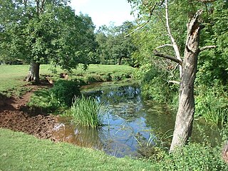
The Land Yeo is a small river which flows through North Somerset, England.

