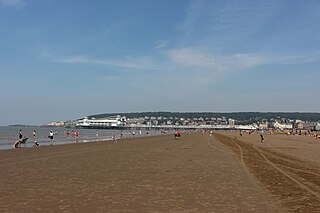
Weston-super-Mare, also known as Weston, is a seaside town in Somerset, England. It is part of the unitary authority of North Somerset. It lies by the Bristol Channel 18 miles (29 km) south west of Bristol between Worlebury Hill and Bleadon Hill. It includes the suburbs of Milton, Oldmixon, West Wick, Worlebury, Uphill and Worle. Its population at the 2011 census was 76,143. Since 1983, Weston has been twinned with Hildesheim in Germany.

North Somerset is a unitary district in Somerset, South West England. Whilst its area covers part of the ceremonial county of Somerset, it is administered independently of the non-metropolitan county. Its administrative headquarters is in the town hall in Weston-super-Mare.

Nailsea is a town in Somerset, England, 8 miles (13 km) southwest of Bristol, and 11 miles (18 km) northeast of Weston-super-Mare. The nearest village is Backwell, which lies south of Nailsea on the opposite side of the Bristol to Exeter railway line. Nailsea is a commuter town with a population of 15,630.
Congresbury is a village and civil parish on the northwestern slopes of the Mendip Hills in North Somerset, England, which in 2011 had a population of 3,497. It lies on the A370 between Junction 21 of the M5 and Bristol Airport, 13 miles (21 km) south of Bristol city centre, and 7 miles (11 km) east of Weston-super-Mare. The Congresbury Yeo river flows through the village. The parish includes the hamlet of Brinsea.

Weston-super-Mare is a constituency represented in the House of Commons of the UK Parliament since 2005 by John Penrose, a Conservative.

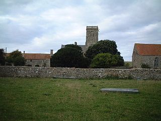
Kingston Seymour is a small village and civil parish with royal status in Somerset, England. It is situated within the unitary authority of North Somerset, between Clevedon and Weston-super-Mare on the North Somerset Levels. The parish has a population of 388.
Kewstoke is a civil parish and village in Somerset, England, within the unitary authority of North Somerset, located next to the strip of coast called Sand Bay. Its population in the 2011 census was 1,690.

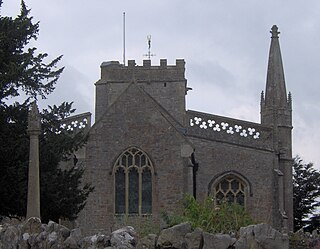
Bleadon is a village and civil parish in Somerset, England. It is about 4 miles (6.4 km) south of Weston-super-Mare and, according to the 2011 census, has a population of 1,079.

Weston-super-Mare Association Football Club is a semi-professional football club based in Weston-super-Mare, Somerset, England. Nicknamed "The Seagulls", the club is affiliated to the Somerset County Football Association and currently competes in the Southern Premier South, the seventh tier of English football.
Locking is a village and civil parish in Somerset, England. It is a predominantly quiet residential area of North Somerset, 3.5 miles (5.6 km) south east of the town of Weston-super-Mare.
Burrington is a small village and civil parish in Somerset, England. It is situated in the unitary authority of North Somerset, 5 miles (8.0 km) north east of Axbridge and about 10 miles (16 km) east of Weston-super-Mare. The parish includes the hamlets of Bourne and Rickford and has a population of 464.

Hutton is a village and civil parish in Somerset, England. The parish, which has a population of 2,582, is within the unitary authority of North Somerset and located on the western edge of the Mendip Hills, close to Weston-super-Mare.

Loxton is a village and civil parish in Somerset, England. It is close to the M5 motorway in the unitary authority of North Somerset. The parish includes the village of Christon and has a population of 192.

Puxton is a village and civil parish, 5 miles (8.0 km) north west of Axbridge in the unitary authority of North Somerset within the ceremonial county of Somerset, England.

Wick St. Lawrence is a civil parish and village in Somerset, England. It falls within the unitary authority of North Somerset. The population of the parish, which includes Bourton, in the 2011 census was 1,331.

St. Georges is a civil parish and village in the unitary authority of North Somerset, England. Its population in the 2011 census was 3,379.

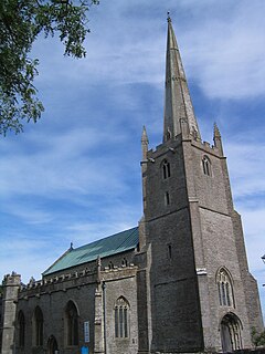
Banwell is a village and civil parish on the River Banwell in the North Somerset district of Somerset, England. Its population was 2,919 according to the 2011 census.

The Hundred of Winterstoke is one of the 40 historical Hundreds in the ceremonial county of Somerset, England, dating from before the Norman conquest during the Anglo-Saxon era although exact dates are unknown. Each hundred had a 'fyrd', which acted as the local defence force and a court which was responsible for the maintenance of the frankpledge system. They also formed a unit for the collection of taxes. The role of the hundred court was described in the Dooms (laws) of King Edgar. The name of the hundred was normally that of its meeting-place.
