South Somerset

Last updated

South Somerset
South Somerset District Council.svg
South Somerset UK locator map.svg
Shown within Somerset
Sovereign state United Kingdom
Constituent country England
Region South West England
Ceremonial county Somerset
Admin HQ Yeovil
Created1 April 1974
Government
  TypeSouth Somerset District Council
  LeaderVal Keitch
  Council 
Area
  Total370.29 sq mi (959.04 km2)
Population
 (2022) [1]
  Total173,173
  Density470/sq mi (180/km2)
Time zone UTC0 (GMT)
  Summer (DST) UTC+1 (BST)
Post Code
Area code 01935/01963
Website http://www.southsomerset.gov.uk/

South Somerset was a local government district in Somerset, England, from 1974 to 2023. The district covered an area of 370 square miles (958 km2) [2] ranging from the borders with Devon, Wiltshire and Dorset to the edge of the Somerset Levels. It had a population of approximately 158,000. [3] The administrative centre of the district was Yeovil.

Contents

On 1 April 2023, the district was abolished and replaced by Somerset Council, a unitary district for the area previously served by Somerset County Council. [4]

History

The district was formed on 1 April 1974, and was originally known as Yeovil, adopting the South Somerset name in 1985. It was formed by the merger of the municipal boroughs of Chard, Yeovil, along with Crewkerne and Ilminster urban districts and the Chard Rural District, Langport Rural District, Wincanton Rural District and Yeovil Rural District.

The district covered the whole of the Yeovil constituency, and part of Somerton and Frome. The district was governed by the South Somerset District Council, last elected in the 2019 South Somerset District Council election.

Abolition

On 1 April 2023, the district council was abolished and replaced by Somerset Council, a unitary authority for the area previously served by Somerset County Council. [4] Elections for the new council took place in May 2022. It ran alongside South Somerset and the other district councils in the county until their abolition. [5]

Towns

Its main towns included:

Wards

The electoral wards included: Camelot and Wessex.

Parishes

ImageNameStatusPopulationFormer local authorityCoordinatesRefs
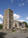
Templecombe in 2008.jpg Abbas and Templecombe Civil parish1,560 Wincanton Rural District 50°59′N2°25′W / 50.99°N 2.41°W / 50.99; -2.41 (Templecombe) [6] [7]
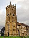
Alford church.jpg Alford Civil parish63 Wincanton Rural District 51°05′N2°34′W / 51.08°N 2.57°W / 51.08; -2.57 (Alford, Somerset) [7]
Old Pound Inn, Aller, Somerset.jpg Aller Civil parish410 Langport Rural District 51°03′N2°51′W / 51.05°N 2.85°W / 51.05; -2.85 (Aller, Somerset) [6] [8]
Ansford from Ditcheat Hill - geograph.org.uk - 454856.jpg Ansford Civil parish1,085 Wincanton Rural District 51°05′N2°31′W / 51.09°N 2.51°W / 51.09; -2.51 (Ansford) [6] [7]
Ash, Holy Trinity Church.jpg Ash Civil parish626 Yeovil Rural District 50°59′N2°45′W / 50.98°N 2.75°W / 50.98; -2.75 (Ash, South Somerset) [6] [9]
Ashill church.jpg Ashill Civil parish529 Chard Rural District 50°56′N2°58′W / 50.94°N 2.96°W / 50.94; -2.96 (Ashill, Somerset) [6] [10]
Babcary Church.jpg Babcary Civil parish248 Langport Rural District 51°03′N2°37′W / 51.05°N 2.62°W / 51.05; -2.62 (Babcary) [6] [8]
Barrington Ct.jpg Barrington Civil parish438 Langport Rural District 50°58′N2°52′W / 50.96°N 2.87°W / 50.96; -2.87 (Barrington, Somerset) [6] [8]
Barton St David.jpg Barton St David Civil parish561 Langport Rural District 51°05′N2°39′W / 51.08°N 2.65°W / 51.08; -2.65 (Barton St David) [6] [8]
RoyalOakStoford.jpg Barwick Civil parish1,221 Yeovil Rural District 50°55′N2°37′W / 50.92°N 2.62°W / 50.92; -2.62 (Barwick, Somerset) [6] [9]
Beercrocombe - the green - geograph.org.uk - 1132709.jpg Beercrocombe Civil parish134 Langport Rural District 50°59′N2°58′W / 50.98°N 2.97°W / 50.98; -2.97 (Beercrocombe) [6] [8]
Blackford church.jpg Compton Pauncefoot Civil parish130 Wincanton Rural District 51°02′N2°30′W / 51.03°N 2.50°W / 51.03; -2.50 (Compton Pauncefoot) [7]
St. Nicholas Bratton St. Maur - geograph.org.uk - 520316.jpg Bratton Seymour Civil parish104 Wincanton Rural District 51°04′N2°28′W / 51.07°N 2.47°W / 51.07; -2.47 (Bratton Seymour) [6] [7]
Duckpond at South Brewham - geograph.org.uk - 402415.jpg Brewham Civil parish441 Wincanton Rural District 51°08′N2°24′W / 51.13°N 2.40°W / 51.13; -2.40 (Brewham) [6] [7]
Porch House, Broadway - geograph.org.uk - 157055.jpg Broadway Civil parish740 Chard Rural District 50°56′N2°58′W / 50.93°N 2.97°W / 50.93; -2.97 (Broadway, Somerset) [6] [10]
Bruton.jpg Bruton Town2,907 Wincanton Rural District 51°07′N2°27′W / 51.11°N 2.45°W / 51.11; -2.45 (Bruton) [6] [7]
Brympton DEvercy House (geograph 3084630).jpg Brympton Civil parish7,308 Yeovil Rural District 50°56′N2°41′W / 50.94°N 2.68°W / 50.94; -2.68 (Brympton) [6] [9]
Buckland St Mary old rectory.jpg Buckland St Mary Civil parish521 Chard Rural District 50°55′N3°02′W / 50.91°N 3.04°W / 50.91; -3.04 (Buckland St Mary) [6] [10]
Castle Cary church.jpg Castle Cary Town2,276 Wincanton Rural District 51°05′N2°31′W / 51.09°N 2.51°W / 51.09; -2.51 (Castle Cary) [6] [7]
Church of St Michael and All Angels, Chaffcombe - geograph.org.uk - 245016.jpg Chaffcombe Civil parish229 Chard Rural District 50°53′N2°55′W / 50.89°N 2.92°W / 50.89; -2.92 (Chaffcombe) [6] [10]
Fore Street, Chard - geograph.org.uk - 755770.jpg Chard Town Town13,074 Chard Municipal Borough 50°52′N2°58′W / 50.87°N 2.96°W / 50.87; -2.96 (Chard, Somerset) [6] [10]
Parish Church of St Peter and St Paul - Charlton Horethorne - geograph.org.uk - 890899.jpg Charlton Horethorne Civil parish591 Wincanton Rural District 51°01′N2°29′W / 51.01°N 2.48°W / 51.01; -2.48 (Charlton Horethorne) [6]
Charlton Mackrell Church.jpg Charlton Mackrell Civil parish1,073 Langport Rural District 51°03′N2°41′W / 51.05°N 2.68°W / 51.05; -2.68 (Charlton Mackrell) [6] [8]
St. Johns, Charlton Musgrove - geograph.org.uk - 488263.jpg Charlton Musgrove Civil parish398 Wincanton Rural District 51°05′N2°23′W / 51.08°N 2.39°W / 51.08; -2.39 (Charlton Musgrove) [6] [7]
St. James Church, Chillington - geograph.org.uk - 508076.jpg Chillington Civil parish164 Chard Rural District 50°53′N2°52′W / 50.89°N 2.87°W / 50.89; -2.87 (Chillington, Somerset) [6] [10]
Church of the Blessed Virgin Mary - Chilthorne Domer - geograph.org.uk - 443998.jpg Chilthorne Domer Civil parish574 Yeovil Rural District 50°58′N2°41′W / 50.97°N 2.68°W / 50.97; -2.68 (Chilthorne Domer) [6] [9]
The Parish Church of St James - Chilton Cantelo - geograph.org.uk - 409126.jpg Chilton Cantelo Civil parish445 Yeovil Rural District 51°00′N2°36′W / 51.00°N 2.60°W / 51.00; -2.60 (Chilton Cantelo) [6] [9]
Chiselborough Church Exterior 01.JPG Chiselborough Civil parish275 Yeovil Rural District 50°56′N2°46′W / 50.93°N 2.76°W / 50.93; -2.76 (Chiselborough) [6] [9]
Closworth church.jpg Closworth Civil parish220 Yeovil Rural District 50°53′N2°37′W / 50.89°N 2.62°W / 50.89; -2.62 (Closworth) [6] [9]
Combe St Nicholas - the village - geograph.org.uk - 223385.jpg Combe St Nicholas Civil parish1,373 Chard Rural District 50°53′N2°59′W / 50.89°N 2.99°W / 50.89; -2.99 (Combe St Nicholas) [6] [10]
View towards Compton Dundon - geograph.org.uk - 892230.jpg Compton Dundon Civil parish705 Langport Rural District 51°05′N2°44′W / 51.09°N 2.73°W / 51.09; -2.73 (Compton Dundon) [6] [8]
Corton Denham Church - geograph.org.uk - 306403.jpg Corton Denham Civil parish189 Wincanton Rural District 51°00′N2°31′W / 51.00°N 2.52°W / 51.00; -2.52 (Corton Denham) [6] [7]
Crewkerne, Market Square - geograph.org.uk - 1720700.jpg Crewkerne Town7,000 Crewkerne Urban District 50°53′N2°47′W / 50.88°N 2.79°W / 50.88; -2.79 (Crewkerne) [6] [11]
Cricket saint thomas manor house arp.jpg Cricket St Thomas Civil parish50 Chard Rural District 50°52′N2°53′W / 50.87°N 2.89°W / 50.87; -2.89 (Cricket St Thomas) [10]
Cucklington - geograph.org.uk - 498012.jpg Cucklington Civil parish173 Wincanton Rural District 51°03′N2°21′W / 51.05°N 2.35°W / 51.05; -2.35 (Cucklington) [6] [7]
Cudworth church.jpg Cudworth Civil parish69 Chard Rural District 50°53′N2°53′W / 50.89°N 2.89°W / 50.89; -2.89 (Cudworth, Somerset) [10]
Pope's Cross Curry Mallet.jpg Curry Mallet Civil parish306 Langport Rural District 50°59′N2°58′W / 50.99°N 2.96°W / 50.99; -2.96 (Curry Mallet) [6] [8]
Curry Rivel - Manor Farmhouse and church - geograph.org.uk - 438592.jpg Curry Rivel Civil parish2,148 Langport Rural District 51°02′N2°52′W / 51.03°N 2.86°W / 51.03; -2.86 (Curry Rivel) [6] [8]
St Nicholas' Church, Dinnington - geograph.org.uk - 546314.jpg Dinnington Civil parish65 Chard Rural District 50°55′N2°51′W / 50.91°N 2.85°W / 50.91; -2.85 (Dinnington, Somerse) [10]
The Blessed Virgin Mary Church Donyatt.JPG Donyatt Civil parish347 Chard Rural District 50°56′N2°57′W / 50.93°N 2.95°W / 50.93; -2.95 (Donyatt) [6] [10]
Dowlish Wake packhorse bridge.jpg Dowlish Wake Civil parish277 Chard Rural District 50°55′N2°53′W / 50.91°N 2.89°W / 50.91; -2.89 (Dowlish Wake) [6] [10]
Stcatherinesdrayton.jpg Drayton Civil parish379 Langport Rural District 51°01′08″N2°51′00″W / 51.019°N 2.85°W / 51.019; -2.85 (Drayton, Somerset) [6] [8]
East Chinnock church.jpg East Chinnock Civil parish479 Yeovil Rural District 50°55′N2°43′W / 50.92°N 2.72°W / 50.92; -2.72 (The Chinnocks) [6] [9]
East Coker Church - geograph.org.uk - 542241.jpg East Coker Civil parish1,667 Yeovil Rural District 50°55′N2°39′W / 50.91°N 2.65°W / 50.91; -2.65 (East Coker) [6] [9]
Fivehead church.jpg Fivehead Civil parish609 Langport Rural District 50°59′N2°55′W / 50.99°N 2.92°W / 50.99; -2.92 (Fivehead) [6] [8]
Hambridge Mill House - geograph.org.uk - 558787.jpg Hambridge and Westport Civil parish514 Langport Rural District 50°59′N2°52′W / 50.99°N 2.86°W / 50.99; -2.86 (Hambridge and Westport) [6] [8]
Hardington Moor - geograph.org.uk - 962169.jpg Hardington Mandeville Civil parish585 Yeovil Rural District 50°54′N2°41′W / 50.90°N 2.69°W / 50.90; -2.69 (Hardington Mandeville) [6] [9]
St Michael's Church - Haselbury Plucknett - geograph.org.uk - 457453.jpg Haselbury Plucknett Civil parish744 Yeovil Rural District 50°53′N2°45′W / 50.89°N 2.75°W / 50.89; -2.75 (Haselbury Plucknett) [6] [9]
Henstridge church.jpg Henstridge Civil parish1,814 Wincanton Rural District 50°58′N2°23′W / 50.97°N 2.39°W / 50.97; -2.39 (Henstridge) [6]
High Ham church.jpg High Ham Civil parish909 Langport Rural District 51°05′N2°49′W / 51.08°N 2.82°W / 51.08; -2.82 (High Ham) [6] [8]
Hintonstgchurch.jpg Hinton St George Civil parish442 Chard Rural District 50°55′N2°49′W / 50.91°N 2.82°W / 50.91; -2.82 (Hinton St George) [6] [10]
Holton church.jpg Holton Civil parish238 Wincanton Rural District 51°02′N2°27′W / 51.04°N 2.45°W / 51.04; -2.45 (Holton, Somerset) [6] [7]
Horsington church.jpg Horsington Civil parish571 Wincanton Rural District 51°01′N2°26′W / 51.01°N 2.43°W / 51.01; -2.43 (Horsington, Somerset) [6] [7]
Thatched cottage Horton.jpg Horton Civil parish812 Chard Rural District 50°56′N2°58′W / 50.93°N 2.97°W / 50.93; -2.97 (Horton, Somerset) [6] [10]
Stmaryshuish.jpg Huish Episcopi Civil parish2,095 Langport Rural District 51°02′N2°49′W / 51.04°N 2.81°W / 51.04; -2.81 (Huish Episcopi) [6] [8]
Ilchester.jpg Ilchester Civil parish2,153 Yeovil Rural District 51°00′N2°41′W / 51.00°N 2.68°W / 51.00; -2.68 (Ilchester) [6] [9]
St Mary's church, Ilminster.jpg Ilminster Town5,808 Chard Rural District
Ilminster Urban District
50°56′N2°55′W / 50.93°N 2.91°W / 50.93; -2.91 (Ilminster) [6] [10]
Thatched house Ilton.jpg Ilton Civil parish854 Chard Rural District 50°57′N2°55′W / 50.95°N 2.92°W / 50.95; -2.92 (Ilton) [6] [10]
St Mary the Virgin's Church, Isle Abbotts, Somerset 01.jpg Isle Abbots Civil parish205 Langport Rural District 50°59′N2°55′W / 50.98°N 2.92°W / 50.98; -2.92 (Isle Abbots) [6] [8]
Isle Brewers church, All Saints - geograph.org.uk - 443496.jpg Isle Brewers Civil parish150 Langport Rural District 50°59′N2°54′W / 50.99°N 2.90°W / 50.99; -2.90 (Isle Brewers) [6]
Keinton Mandeville church.jpg Keinton Mandeville Civil parish1,068 Langport Rural District 51°04′N2°39′W / 51.07°N 2.65°W / 51.07; -2.65 (Keinton Mandeville) [6] [8]
Kingsburyepiscopi.jpg Kingsbury Episcopi Civil parish1,307 Langport Rural District 50°59′N2°49′W / 50.99°N 2.81°W / 50.99; -2.81 (Kingsbury Episcopi) [6] [8]
Kingsdonchurch.jpg Kingsdon Civil parish303 Langport Rural District 51°02′N2°41′W / 51.04°N 2.69°W / 51.04; -2.69 (Kingsdon, Somerset) [6] [8]
Church of St John the Evangelist and All Saints, Kingstone.jpg Kingstone Civil parish83 Chard Rural District 50°55′N2°53′W / 50.92°N 2.89°W / 50.92; -2.89 (Kingstone, Somerset) [10]
The Approach to Kingweston Church - geograph.org.uk - 444041.jpg Kingweston Civil parish128 Langport Rural District 51°05′N2°41′W / 51.08°N 2.68°W / 51.08; -2.68 (Kingweston) [8]
Malherbie Court Knowle St Giles.jpg Knowle St Giles Civil parish244 Chard Rural District 50°54′N2°56′W / 50.90°N 2.93°W / 50.90; -2.93 (Knowle St Giles) [6] [10]
Bow Street, Langport, looking west - geograph.org.uk - 1130430.jpg Langport Town1,081 Langport Rural District 51°02′N2°50′W / 51.04°N 2.83°W / 51.04; -2.83 (Langport) [6] [8]
Long Load bridge.JPG Long Load Civil parish332 Yeovil Rural District 51°01′N2°46′W / 51.01°N 2.76°W / 51.01; -2.76 (Long Load) [6] [9]
Quaker Meeting House and burial ground - geograph.org.uk - 1018765.jpg Long Sutton Civil parish833 Langport Rural District 51°02′N2°46′W / 51.03°N 2.76°W / 51.03; -2.76 (Long Sutton) [6] [8]
Church St Lopen.jpg Lopen Civil parish260 Chard Rural District 50°56′N2°49′W / 50.93°N 2.82°W / 50.93; -2.82 (Lopen) [6] [10]
Lovington church.jpg Lovington Civil parish141 Wincanton Rural District 51°04′N2°35′W / 51.07°N 2.58°W / 51.07; -2.58 (Lovington, Somerset) [6] [7]
Maperton church.jpg Maperton Civil parish140 Wincanton Rural District 51°02′N2°28′W / 51.04°N 2.46°W / 51.04; -2.46 (Maperton) [6] [7]
The former White Post Inn - geograph.org.uk - 408988.jpg Marston Magna Civil parish523 Yeovil Rural District 51°00′N2°35′W / 51.00°N 2.58°W / 51.00; -2.58 (Marston Magna) [6] [9]
Martockchurch.jpg Martock Civil parish4,766 Yeovil Rural District 50°58′N2°46′W / 50.97°N 2.77°W / 50.97; -2.77 (Martock) [6] [9]
All Saints Merriot.jpg Merriott Civil parish1,979 Chard Rural District 50°55′N2°47′W / 50.91°N 2.79°W / 50.91; -2.79 (Merriott) [6] [10]
Milborne Port Church1.jpg Milborne Port Civil parish2,802 Wincanton Rural District 50°58′N2°28′W / 50.97°N 2.46°W / 50.97; -2.46 (Milborne Port) [6] [7]
Misterton church.jpg Misterton Civil parish826 Chard Rural District 50°52′N2°47′W / 50.87°N 2.78°W / 50.87; -2.78 (Misterton, Somerset) [6] [10]
Montacute.jpg Montacute Civil parish831 Yeovil Rural District 50°57′N2°43′W / 50.95°N 2.72°W / 50.95; -2.72 (Montacute) [6] [9]
Priesthouse.jpg Muchelney Civil parish195 Langport Rural District 51°01′16″N2°49′12″W / 51.021°N 2.82°W / 51.021; -2.82 (Muchelney) [6] [8]
Mudford church.jpg Mudford Civil parish696 Yeovil Rural District 50°58′N2°37′W / 50.97°N 2.61°W / 50.97; -2.61 (Mudford) [6] [9]
North Barrow church.jpg North Barrow Civil parish233 Wincanton Rural District 51°04′N2°34′W / 51.06°N 2.57°W / 51.06; -2.57 (North Barrow) [6] [7]
Ncadburycourt.jpg North Cadbury Civil parish950 Wincanton Rural District 51°03′N2°31′W / 51.05°N 2.52°W / 51.05; -2.52 (North Cadbury) [6] [7]
North Chriton chapel.jpg North Cheriton Civil parish208 Wincanton Rural District 51°02′N2°26′W / 51.03°N 2.44°W / 51.03; -2.44 (North Cheriton) [6] [7]
North Perrott church.jpg North Perrott Civil parish246 Yeovil Rural District 50°53′N2°45′W / 50.88°N 2.75°W / 50.88; -2.75 (North Perrott) [6] [9]
St Mary the Virgin parish church, Norton-sub-Hamdon, Somerset, seen from the southeast.jpg Norton sub Hamdon Civil parish743 Yeovil Rural District 50°56′N2°46′W / 50.94°N 2.76°W / 50.94; -2.76 (Norton Sub Hamdon) [6] [9]
Odcombe church.jpg Odcombe Civil parish759 Yeovil Rural District 50°56′N2°42′W / 50.94°N 2.70°W / 50.94; -2.70 (Odcombe) [6] [9]
St. Michaels, Penselwood - geograph.org.uk - 188722.jpg Penselwood Civil parish273 Wincanton Rural District 51°05′N2°21′W / 51.08°N 2.35°W / 51.08; -2.35 (Penselwood) [6] [7]
Railway Viaduct at Pitcombe - geograph.org.uk - 567464.jpg Pitcombe Civil parish532 Wincanton Rural District 51°06′N2°28′W / 51.10°N 2.47°W / 51.10; -2.47 (Pitcombe) [6] [7]
Pitney.jpg Pitney Civil parish374 Langport Rural District 51°03′N2°47′W / 51.05°N 2.79°W / 51.05; -2.79 (Pitney) [6] [8]
St Andrews Church Puckington - geograph.org.uk - 419764.jpg Puckington Civil parish117 Langport Rural District 50°58′N2°53′W / 50.96°N 2.89°W / 50.96; -2.89 (Puckington) [6] [8]
Qcamelchurch.jpg Queen Camel Civil parish908 Wincanton Rural District 51°01′N2°35′W / 51.02°N 2.58°W / 51.02; -2.58 (Queen Camel) [6] [7]
Rimpton church - geograph.org.uk - 38571.jpg Rimpton Civil parish235 Yeovil Rural District 50°59′N2°34′W / 50.99°N 2.56°W / 50.99; -2.56 (Rimpton) [6] [9]
Seavington St Mary church.jpg Seavington St Mary Civil parish384 Chard Rural District 50°56′N2°52′W / 50.93°N 2.86°W / 50.93; -2.86 (Seavington St Mary) [6] [10]
Seavington St Michael.jpg Seavington St Michael Civil parish127 Chard Rural District 50°56′N2°50′W / 50.93°N 2.84°W / 50.93; -2.84 (Seavington St Michael) [6] [10]
Shepton Beauchamp church primary school.jpg Shepton Beauchamp Civil parish728 Chard Rural District 50°57′N2°51′W / 50.95°N 2.85°W / 50.95; -2.85 (Shepton Beauchamp) [6] [10]
Shepton Montague.jpg Shepton Montague Civil parish208 Wincanton Rural District 51°05′N2°28′W / 51.08°N 2.47°W / 51.08; -2.47 (Shepton Montague) [6] [7]
Somerton.jpg Somerton Town4,697 Langport Rural District 51°03′N2°44′W / 51.05°N 2.74°W / 51.05; -2.74 (Somerton) [6] [8]
South Barrow church.jpg South Barrow Civil parish162 Wincanton Rural District 51°03′N2°34′W / 51.05°N 2.56°W / 51.05; -2.56 (South Barrow) [6] [7]
South Cadbury, church - geograph.org.uk - 45566.jpg South Cadbury Civil parish284 Wincanton Rural District 51°02′N2°31′W / 51.03°N 2.52°W / 51.03; -2.52 (South Cadbury) [6] [7]
South Petherton Church.jpg South Petherton Civil parish3,367 Yeovil Rural District 50°57′N2°49′W / 50.95°N 2.81°W / 50.95; -2.81 (South Petherton) [6] [9]
Sparkford Inn.jpg Sparkford Civil parish617 Wincanton Rural District 51°02′N2°34′W / 51.04°N 2.57°W / 51.04; -2.57 (Sparkford) [6] [7]
Stocklinch Ottersey church - geograph.org.uk - 38503.jpg Stocklinch Civil parish154 Chard Rural District 50°57′N2°53′W / 50.95°N 2.88°W / 50.95; -2.88 (Stocklinch) [6] [10]
Stoke sub Hamdon church.jpg Stoke sub Hamdon Civil parish1,068 Yeovil Rural District 50°57′N2°45′W / 50.95°N 2.75°W / 50.95; -2.75 (Stoke-sub-Hamdon) [6] [9]
Stoke Trister Village Street - geograph.org.uk - 398296.jpg Stoke Trister Civil parish313 Wincanton Rural District 51°04′N2°23′W / 51.06°N 2.38°W / 51.06; -2.38 (Stoke Trister) [6] [7]
Tatworthchurch.jpg Tatworth and Forton Civil parish2,660 Chard Rural District 50°51′N2°58′W / 50.85°N 2.96°W / 50.85; -2.96 (Tatworth) [6] [10]
Tintinhull church.jpg Tintinhull Civil parish902 Yeovil Rural District 50°58′N2°43′W / 50.97°N 2.71°W / 50.97; -2.71 (Tintinhull) [6] [9]
Wambrook - geograph.org.uk - 27652.jpg Wambrook Civil parish184 Chard Rural District 50°52′N3°00′W / 50.86°N 3.00°W / 50.86; -3.00 (Wambrook) [6] [10]
Wayford Manor House.jpg Wayford Civil parish114 Chard Rural District 50°51′N2°51′W / 50.85°N 2.85°W / 50.85; -2.85 (Wayford) [10]
West Camel church.jpg West Camel Civil parish459 Yeovil Rural District 51°01′N2°36′W / 51.02°N 2.60°W / 51.02; -2.60 (West Camel) [6] [9]
West Chinnock church.jpg West and Middle Chinnock Civil parish592 Yeovil Rural District 50°55′N2°46′W / 50.92°N 2.76°W / 50.92; -2.76 (West Chinnock) [6] [9]
High Street, West Coker - geograph.org.uk - 1568973.jpg West Coker Civil parish2,018 Yeovil Rural District 50°55′N2°41′W / 50.92°N 2.69°W / 50.92; -2.69 (West Coker) [6] [9]
St Bartholomew Crewkerne.jpg West Crewkerne Civil parish631 Chard Rural District 50°53′N2°47′W / 50.88°N 2.79°W / 50.88; -2.79 (Crewkerne) [6] [10]
Whitelackington church.jpg Whitelackington Civil parish209 Chard Rural District 50°56′N2°53′W / 50.94°N 2.88°W / 50.94; -2.88 (Whitelackington) [6] [10]
Whitestaunton - St Andrews church - geograph.org.uk - 223373.jpg Whitestaunton Civil parish256 Chard Rural District 50°53′N3°01′W / 50.89°N 3.02°W / 50.89; -3.02 (Whitestaunton) [6] [10]
Wincanton high street.jpg Wincanton Town5,272 Wincanton Rural District 51°04′N2°25′W / 51.06°N 2.41°W / 51.06; -2.41 (Wincanton) [6] [7]
Winsham.jpg Winsham Civil parish748 Chard Rural District 50°51′N2°53′W / 50.85°N 2.89°W / 50.85; -2.89 (Winsham) [6] [10]
Yarlington church.jpg Yarlington Civil parish123 Wincanton Rural District 51°04′N2°29′W / 51.06°N 2.49°W / 51.06; -2.49 (Yarlington) [6] [7]
Yeovil County Court.jpg Yeovil Town30,378 Yeovil Municipal Borough 50°57′N2°38′W / 50.95°N 2.64°W / 50.95; -2.64 (Yeovil) [6] [12]
Yeovil shops.jpg Yeovil Without Civil parish6,834 Yeovil Rural District 50°58′N2°39′W / 50.96°N 2.65°W / 50.96; -2.65 (Yeovil Without) [6] [9]
Saint Bartholomew Yeovilton (geograph 3541120).jpg Yeovilton and District Civil parish1,425 Yeovil Rural District 51°00′N2°39′W / 51.00°N 2.65°W / 51.00; -2.65 (Yeovilton) [6] [9] [13]

Major roads

Railway stations

Heritage Railways

Education

County schools (those which are not independent) in the five non-metropolitan districts of the county were operated by Somerset County Council (now Somerset Council).

For a full list of schools see: List of schools in Somerset

See also

Related Research Articles

<span class="mw-page-title-main">Yeovil</span> Town in Somerset, England

Yeovil is a town and civil parish in Somerset, England. The population of Yeovil at the last census (2021) was 49,698. It is close to Somerset's southern border with Dorset, 126 miles (203 km) west of London, 41.8 miles (67.3 km) south of Bristol, 6 miles (9.7 km) west of Sherborne and 27.6 miles (44.4 km) east of Taunton. The aircraft and defence industries which developed in the 20th century made it a target for bombing in the Second World War; they are still major employers. Yeovil Country Park, which includes Ninesprings, is one of several open spaces with educational, cultural and sporting facilities. Religious sites include the 14th-century Church of St John the Baptist. The town is on the A30 and A37 roads and has two railway stations.

<span class="mw-page-title-main">Ilminster</span> Human settlement in England

Ilminster is a market town and civil parish in the South Somerset district of Somerset, England, with a population of 5,808. Bypassed in 1988, the town now lies just east of the junction of the A303 and the A358. The parish includes the hamlet of Sea.
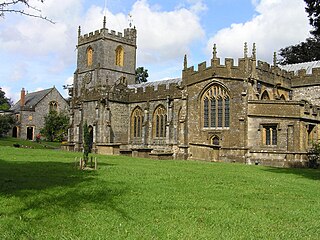
<span class="mw-page-title-main">Chard, Somerset</span> Town in Somerset, England

Chard is a town and a civil parish in the English county of Somerset. It lies on the A30 road near the Devon and Dorset borders, 15 miles (24 km) south west of Yeovil. The parish has a population of approximately 14,000 and, at an elevation of 121 metres (397 ft), Chard is the southernmost and one of the highest towns in Somerset. Administratively Chard forms part of the district of South Somerset.
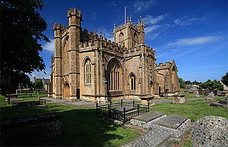
<span class="mw-page-title-main">Crewkerne</span> Town in Somerset, England

Crewkerne is a town and electoral ward in south Somerset, England, 9 miles (14 km) southwest of Yeovil and 7 miles (11 km) east of Chard. The civil parish of West Crewkerne includes the hamlets of Coombe, Woolminstone and Henley, and borders the county of Dorset to the south. The town is on the main headwater of the River Parrett, A30 road and West of England Main Line railway, in modern times the slower route between the capital and the southwest peninsula, having been eclipsed by the Taunton route.

<span class="mw-page-title-main">Creech St Michael</span> Human settlement in England

Creech St Michael is a village and civil parish in Somerset, three miles east of Taunton. The parish straddles the M5 motorway and includes several scattered settlements. The village of Creech St Michael and the hamlets of Charlton, Creech Heathfield, and Ham lie east of the motorway. The hamlets of Adsborough, Coombe, Langaller, and Walford lie west of the motorway. The parish has a population of 2,416.

<span class="mw-page-title-main">Yeovil (UK Parliament constituency)</span> Parliamentary constituency in the United Kingdom, 1918 onwards

Yeovil is a constituency in Somerset created in 1918 and represented in the House of Commons of the Parliament of the United Kingdom. Since the 2024 General Election, the constituency has been represented by Liberal Democrat MP Adam Dance.
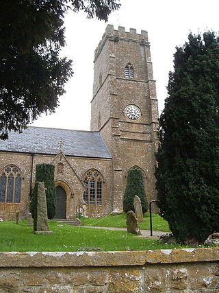
<span class="mw-page-title-main">Dowlish Wake</span> Human settlement in England

Dowlish Wake is a small village and civil parish in Somerset, England, 2 miles (3 km) south of Ilminster and 5 miles (8 km) northeast of Chard in the South Somerset district. With a population of 277, it has several thatched houses and a pub, the New Inn. Its post office closed in 1991.
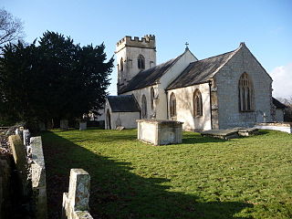
<span class="mw-page-title-main">Thornfalcon</span> Human settlement in England

Thornfalcon is a village and civil parish in Somerset, England, situated 4 miles (6.4 km) east of Taunton. The village has a population of 119. The parish includes the hamlet of Ash. The name comes from Thorn, and the personal name Fagun which was the Norman surname of Sir Gilbert of Thorn, whose family were lords of the manor until the 14th century.

<span class="mw-page-title-main">Donyatt</span> Human settlement in England

Donyatt is a village and civil parish in Somerset, England, situated at the source of the River Isle 5 miles (8.0 km) north of Chard in the South Somerset district. The village has a population of 347. The parish includes the hamlet of Peasmarsh.

The TA postcode area, also known as the Taunton postcode area, is a group of 24 postcode districts in South West England, within 19 post towns. These cover western Somerset, plus very small parts of Dorset and Devon.

<span class="mw-page-title-main">Misterton, Somerset</span> Human settlement in England

Misterton is a village and civil parish 1 mile (1.6 km) south-east of Crewkerne, Somerset, England.

<span class="mw-page-title-main">Chard Junction railway station</span> Disused railway station in England

Chard Junction railway station was situated on the London and South Western Railway’s West of England Main Line about 1 mile (1.6 km) southeast of the village of Tatworth in Somerset, England. It was the junction of a short branch line to Chard. It was opened in 1860 as Chard Road, and closed in 1966. An adjacent milk depot was served by its own sidings from 1937 to 1980. Chard Junction signal box remained open to control Station Road level crossing and a passing loop on the long section of single track railway between Yeovil Junction and Pinhoe until March 2021, when control was passed to Basingstoke.

<span class="mw-page-title-main">Transport in Somerset</span> Overview of transport in Somerset

The earliest known infrastructure for transport in Somerset is a series of wooden trackways laid across the Somerset Levels, an area of low-lying marshy ground. To the west of this district lies the Bristol Channel, while the other boundaries of the county of Somerset are along chains of hills that were once exploited for their mineral deposits. These natural features have all influenced the evolution of the transport network. Roads and railways either followed the hills, or needed causeways to cross the Levels. Harbours were developed, rivers improved, and linked to sources of traffic by canals. Railways were constructed throughout the area, influenced by the needs of the city of Bristol, which lies just to the north of Somerset, and to link the ports of the far south-west with the rest of England.

<span class="mw-page-title-main">South West Coaches</span>

South West Coaches is a privately owned bus company that operates services around Dorset, Somerset, and Wiltshire, in South West England.

<span class="mw-page-title-main">2015 South Somerset District Council election</span> 2015 UK local government election

The 2015 South Somerset District Council election took place on 7 May 2015 to elect members of South Somerset District Council in Somerset, England. This is on the same day as the general election, and other local elections. This election saw 29 Liberal Democrats, 28 Conservatives, and 3 Independents elected to the Council.

<span class="mw-page-title-main">2017 Somerset County Council election</span> 2017 UK local government election

The 2017 Somerset County Council election took place on 4 May 2017 as part of the 2017 local elections in the United Kingdom. All 55 councilors were elected from 54 electoral divisions, which each returned either one or two county councilors by first-past-the-post voting for a four-year term of office.
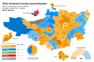
<span class="mw-page-title-main">2022 Somerset Council election</span> 2022 local election in Somerset

The 2022 Somerset Council election took place on 5 May 2022 to elect members of Somerset County Council. The number of councillors was doubled from 55 to 110 at this election, in preparation for the county council becoming a unitary authority on 1 April 2023, when it was renamed Somerset Council.

References

  1. "Mid-Year Population Estimates, UK, June 2022". Office for National Statistics . 26 March 2024. Retrieved 3 May 2024.
  2. "An introduction to South Somerset" (PDF). South Somerset District Council. Archived (PDF) from the original on 29 November 2014. Retrieved 6 June 2012.
  3. "Population of South Somerset". South Somerset District Council. Archived from the original on 30 October 2007. Retrieved 11 July 2009.
  4. 1 2 "Frequently asked questions". Somerset County Council. Archived from the original on 1 January 2022. Retrieved 1 January 2022.
  5. "Elections for new Somerset Council to be held in May 2022". BBC News. 2 December 2021. Archived from the original on 1 January 2022. Retrieved 1 January 2022.
  6. 1 2 3 4 5 6 7 8 9 10 11 12 13 14 15 16 17 18 19 20 21 22 23 24 25 26 27 28 29 30 31 32 33 34 35 36 37 38 39 40 41 42 43 44 45 46 47 48 49 50 51 52 53 54 55 56 57 58 59 60 61 62 63 64 65 66 67 68 69 70 71 72 73 74 75 76 77 78 79 80 81 82 83 84 85 86 87 88 89 90 91 92 93 94 95 96 97 98 99 100 101 102 103 104 105 106 107 108 109 110 111 112 "Statistics for Wards, LSOAs and Parishes — SUMMARY Profiles" (Excel). Somerset Intelligence. Archived from the original on 4 January 2014. Retrieved 4 January 2014.
  7. 1 2 3 4 5 6 7 8 9 10 11 12 13 14 15 16 17 18 19 20 21 22 23 24 25 26 27 28 29 "Wincanton RD". A vision of Britain Through Time. University of Portsmouth. Archived from the original on 5 January 2014. Retrieved 4 January 2014.
  8. 1 2 3 4 5 6 7 8 9 10 11 12 13 14 15 16 17 18 19 20 21 22 23 24 25 "Langport RD". A vision of Britain Through Time. University of Portsmouth. Archived from the original on 5 January 2014. Retrieved 4 January 2014.
  9. 1 2 3 4 5 6 7 8 9 10 11 12 13 14 15 16 17 18 19 20 21 22 23 24 25 26 27 28 29 "Yeovil RD". A vision of Britain Through Time. University of Portsmouth. Archived from the original on 8 December 2013. Retrieved 4 January 2014.
  10. 1 2 3 4 5 6 7 8 9 10 11 12 13 14 15 16 17 18 19 20 21 22 23 24 25 26 27 28 29 30 31 32 "Chard RD". A vision of Britain Through Time. University of Portsmouth. Archived from the original on 5 January 2014. Retrieved 4 January 2014.
  11. "Crewkerne UD". A vision of Britain Through Time. University of Portsmouth. Archived from the original on 5 January 2014. Retrieved 4 January 2014.
  12. "Yeovil MB". A vision of Britain Through Time. University of Portsmouth. Archived from the original on 5 January 2014. Retrieved 4 January 2014.
  13. "The South Somerset (Reorganisation of Community Governance) Order 2022" (PDF). Local Government Boundary Commission for England. Archived (PDF) from the original on 20 March 2022. Retrieved 21 May 2022.