Langport Rural District

Last updated

Langport Rural District
Area
  1911 59,407 [1]
  1961 59,407 [1]
Population
  1911 13,347 [2]
  1961 13,146 [2]
History
  Created 1894
  Abolished 1974
Status Rural district

Langport was a rural district in Somerset, England, from 1894 to 1974.

Rural districts were a type of local government area – now superseded – established at the end of the 19th century in England, Wales, and Ireland for the administration of predominantly rural areas at a level lower than that of the administrative counties.

Somerset County of England

Somerset is a county in South West England which borders Gloucestershire and Bristol to the north, Wiltshire to the east, Dorset to the south-east and Devon to the south-west. It is bounded to the north and west by the Severn Estuary and the Bristol Channel, its coastline facing southeastern Wales. Its traditional border with Gloucestershire is the River Avon. Somerset's county town is Taunton.

It was created in 1894 under the Local Government Act 1894.

Local Government Act 1894

The Local Government Act 1894 was an Act of the Parliament of the United Kingdom that reformed local government in England and Wales outside the County of London. The Act followed the reforms carried out at county level under the Local Government Act 1888. The 1894 legislation introduced elected councils at district and parish level.

In 1974 it was abolished under the Local Government Act 1972 to become part of South Somerset.

Local Government Act 1972 Act of Parliament in the United Kingdom

The Local Government Act 1972 is an Act of the Parliament of the United Kingdom that reformed local government in England and Wales on 1 April 1974.

South Somerset Non-metropolitan district in England

South Somerset is a local government district in Somerset, England.

The parishes which used to be in the district include Aller, Babcary, Barrington, Barton St David, Beercrocombe, Charlton Mackrell, Compton Dundon, Curry Mallet, Curry Rivel, Drayton, Fivehead, Hambridge and Westport, High Ham, Huish Episcopi, Isle Abbots, Isle Brewers, Keinton Mandeville, Kingsbury Episcopi, Kingsdon, Kingweston, Langport, Long Sutton, Muchelney, Pitney, Puckington and Somerton.

Aller, Somerset village and parish in Somerset, England

Aller is a village and parish in Somerset, England, situated 5 miles (8.0 km) west of Somerton on the A372 road towards Bridgwater in the South Somerset district. The village has a population of 410. The parish includes the hamlet of Beer and the deserted medieval village of Oath on the opposite bank of the River Parrett.

Babcary village in the United Kingdom

Babcary is a village and parish in Somerset, England, situated 5 miles (8.0 km) east of Somerton and 6 miles (9.7 km) south west of Castle Cary in the South Somerset district. The village has a population of 248. It lies close to the River Cary and the A37.

Barrington, Somerset village in Somerset

Barrington is a village and civil parish, situated 10 miles (16.1 km) south east of Taunton and 10 miles (16.1 km) west of Yeovil in the South Somerset district of Somerset, England. The village has a population of 438.

Related Research Articles
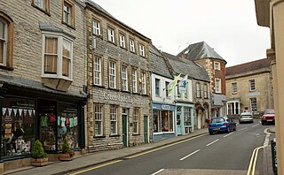
Langport a town in South Somerset, United Kindom

Langport is a small town and civil parish in Somerset, England, 5 miles (8.0 km) west of Somerton in the South Somerset district. The parish has a population of 1,081. Langport is contiguous with Huish Episcopi, a separate parish that includes much of the town's outskirts.
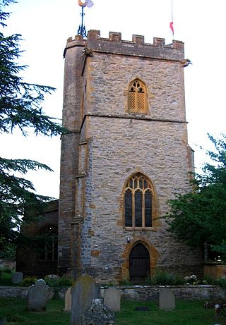
Drayton, Somerset village in the United Kingdom

Drayton is a village and civil parish in Somerset, England, focussed less than a mile from Curry Rivel and five miles southwest of Somerton in the South Somerset district. It adjoins the River Isle, near its confluence with the Parrett, and the former Westport Canal. The parish includes the hamlet of Midelney.

Huish Episcopi village in the United Kingdom

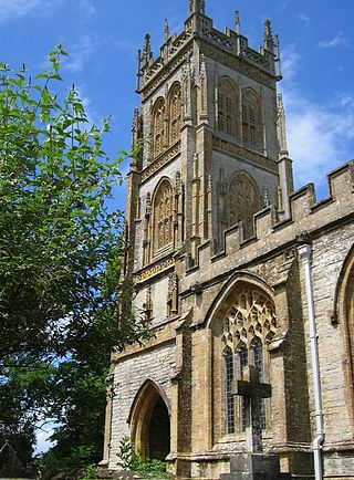
Huish Episcopi is a village and civil parish in Somerset, England, situated on the outskirts of Langport, 4 miles (6.4 km) south west of Somerton in the South Somerset district. The parish has a population of 2,095, and includes the hamlets of Bowdens, Combe, Pibsbury and Wearne.

Isle Brewers farm village in the United Kingdom

Isle Brewers is a village and parish in Somerset, England, situated on the River Isle, 7 miles (11.3 km) south east of Taunton in the South Somerset district. The village has a population of 150. The parish includes the hamlet of North Bradon.

Goole was a rural district in the West Riding of Yorkshire, England from 1894 to 1974.

Pitney village in the United Kingdom

Pitney is a village and parish in Somerset, England, located 2.5 miles (4.0 km) east of Langport and 3 miles (4.8 km) west of Somerton in the South Somerset district. In 2011, the village had a population of 374.

Hambridge and Westport village in the United Kingdom

Hambridge and Westport is a civil parish in Somerset, England. It has a population of 514.

Bridgwater was a rural district in Somerset, England, from 1894 to 1974.

Chard was a rural district in Somerset, England, from 1894 to 1974.

Clutton was a rural district in Somerset, England, from 1894 to 1974.

Dulverton was a rural district in Somerset, England, from 1894 to 1974.

Frome was a rural district in Somerset, England, from 1894 to 1974.

Long Ashton was a rural district in Somerset, England, from 1894 to 1974.

Shepton Mallet was a rural district in Somerset, England, from 1894 to 1974.

Taunton was a rural district in Somerset, England, from 1894 to 1974.

Wellington was a rural district in Somerset, England, from 1894 to 1974.

Wells was a rural district in Somerset, England, from 1894 to 1974.

Williton was a rural district in Somerset, England, from 1894 to 1974.

Wincanton was a rural district in Somerset, England, from 1894 to 1974.

Yeovil was a rural district in Somerset, England, from 1894 to 1974.

References

  1. 1 2 "Area". Langport Rural District. Britain Through Time. Retrieved 2009-11-14.
  2. 1 2 "Population". Langport Rural District. Britain Through Time. Retrieved 2009-11-14.

Coordinates: 51°02′17″N2°49′37″W / 51.038°N 2.827°W / 51.038; -2.827

Geographic coordinate system Coordinate system

A geographic coordinate system is a coordinate system that enables every location on Earth to be specified by a set of numbers, letters or symbols. The coordinates are often chosen such that one of the numbers represents a vertical position and two or three of the numbers represent a horizontal position; alternatively, a geographic position may be expressed in a combined three-dimensional Cartesian vector. A common choice of coordinates is latitude, longitude and elevation. To specify a location on a plane requires a map projection.