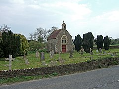
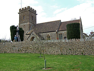
South Cadbury is a village and former civil parish, now in the parish of South Cadbury and Sutton Montis, in the Somerset district of the ceremonial county of Somerset, England. The parish includes the village of Sutton Montis.

Bratton Seymour is a village and civil parish in Somerset, England, situated on a tributary of the River Brue 4 miles (6.4 km) south-east of Castle Cary and 4 miles (6.4 km) north-west of Wincanton. The parish has a population of 104.

Brewham is a civil parish in Somerset, England, consisting of the villages of North Brewham and South Brewham, on either side of the river in the Brue Valley 3 miles (4.8 km) east of Bruton and 9 miles (14.5 km) south-west of Frome. The parish has a population of 441.
Charlton Horethorne is a village and civil parish in Somerset, England, situated 5 miles (8 km) south-west of Wincanton and 5 miles (8 km) north-east of Sherborne in the neighbouring county of Dorset. The village has a population of 591. The parish also includes Stowell.

Charlton Musgrove is a village and civil parish in Somerset, England, situated 1 mile (1.6 km) north east of Wincanton in the South Somerset district. The village has a population of 398. The parish includes the hamlets of Barrow, Holbrook, Southmarsh, and part of Shalford.
Compton Pauncefoot is a village and civil parish in Somerset, England, situated beside the A303 road, 5 miles (8.0 km) south west of Wincanton in the South Somerset district. The parish had a population of 139 in 2011. The civil parish also includes the village with Blackford and therefore population is based on the two villages together. Blackford parish was merged with Compton Pauncefoot on 1 April 1933. The civil parish holds a Parish Meeting twice a year and has no Parish Council.

Corton Denham is a village and parish in Somerset, England, situated seven miles north east of Yeovil in the South Somerset district. The village has a population of 189.

Cucklington is a village and parish in Somerset, England, situated on a hill 3 miles (4.8 km) south east of Wincanton and 4 miles (6.4 km) north west of Gillingham in the South Somerset district, near the Dorset border. The village has a population of 173.
Holton is a village and parish in Somerset, England, situated on the A303 road 2 miles (3.2 km) south west of Wincanton in the South Somerset district. The village has a population of 238.

Horsington is a village and civil parish in Somerset, England, situated 4 miles (6.4 km) south of Wincanton and 1 mile (1.6 km) north of Templecombe in the South Somerset district. The village lies on the edge of Horsington Marsh, part of the Blackmore Vale. In 2011 the population of the Parish, which includes the adjoining hamlets of Peckholdsash and Wilkin Throop and the village of South Cheriton was 571.

Isle Brewers is a village and parish in Somerset, England, situated on the River Isle, 7 miles (11.3 km) south east of Taunton in the South Somerset district. The village has a population of 150. The parish includes the hamlet of North Bradon.
Lovington is a village and civil parish in Somerset, England, situated 3 miles (4.8 km) south west of Castle Cary, between the River Brue and River Cary, in the South Somerset district. The parish, which includes the hamlet of Wheathill, has a population of 141.

Maperton is a village and civil parish in Somerset, England, situated 3 miles (4.8 km) south west of Wincanton in the South Somerset district. The village has a population of 140. However, this small number includes Elliscombe House care home which alone has an average of 40 residents.

Queen Camel is a village and civil parish, on the River Cam and the A359 road, in the unitary authority of Somerset, England. It is about 7 miles (11.3 km) north of Yeovil. According to the 2011 census it had a population of 908. The parish includes the hamlet of Wales. Nearby places are West Camel, Sparkford and Marston Magna.

Yarlington is a village and civil parish, near the source of the River Cam, in the English county of Somerset.

Pitcombe is a village and civil parish 1 mile (2 km) south-west of Bruton and 5 miles (8 km) from Wincanton in Somerset, England. It has a population of 532. The parish includes the hamlets of Cole and Godminster.
Rimpton is a village and civil parish 5 miles (8 km) north-west of Sherborne, and 6 miles (10 km) north-east of Yeovil on a tributary of the River Parret in the South Somerset district of Somerset, England.

Stoke Trister is a village and civil parish 2 miles (3 km) south-east of Wincanton and 5 miles (8 km) north-west of Gillingham close to the Dorset border in the South Somerset district of Somerset, England. The parish includes the hamlet of Bayford.

North Barrow is a village and civil parish 8 miles (13 km) to the north-east of Ilchester in the South Somerset district of Somerset, England.
South Barrow is a village and civil parish approximately 2 miles (3 km) north of Sparkford and 7 miles (11 km) north-east of Ilchester in the South Somerset district of Somerset, England.