Hinton St George

Last updated • 3 min readFrom Wikipedia, The Free Encyclopedia

Hinton St George
Hintonstgchurch.jpg
Somerset UK location map.svg
Red pog.svg
Hinton St George
Location within Somerset
Population442 (2011) [1]
OS grid reference ST425125
Civil parish
  • Hinton St George
District
Shire county
Region
Country England
Sovereign state United Kingdom
Post town HINTON ST. GEORGE
Postcode district TA17
Dialling code 01460
Police Avon and Somerset
Fire Devon and Somerset
Ambulance South Western
UK Parliament
Website hintonstgeorge.org.uk
List of places
UK
England
Somerset
50°54′32″N2°49′09″W / 50.9090°N 2.8191°W / 50.9090; -2.8191

Hinton St George is a village and parish in Somerset, England, situated 3 miles (4.8 km) outside Crewkerne, 10 miles (16.1 km) south west of Yeovil in the South Somerset district. The village has a population of 442. [1]

Contents

It has a wide main street lined with hamstone cottages, some thatched. The village has a thriving shop. The village does not lie on a major road, and has a few holiday cottages and second homes.

History

The village cross Cross at Hinton St. George (geograph 3078537).jpg
The village cross

The parish was part of the hundred of Crewkerne. [2] [3]

Much of the development of the village occurred under the lords Poulett extending their large house and estate (Hinton House). By the 1560s the three open arable fields had been enclosed and two large estates of 74 and 68 acres (280,000 m2) created, based on the now disappeared hamlet of Craft. The park contained deer and orchards, with cherry trees [4]

The village cross is an 8 feet 2 inches (2.49 m) high cross with a tapering octagonal shaft on stepped octagonal base. It is a scheduled monument and Grade II* listed building. [5] [6]

Governance

The parish council has responsibility for local issues, including setting an annual precept (local rate) to cover the council's operating costs and producing annual accounts for public scrutiny. The parish council evaluates local planning applications and works with the local police, district council officers, and neighbourhood watch groups on matters of crime, security, and traffic. The parish council's role also includes initiating projects for the maintenance and repair of parish facilities, as well as consulting with the district council on the maintenance, repair, and improvement of highways, drainage, footpaths, public transport, and street cleaning. Conservation matters (including trees and listed buildings) and environmental issues are also the responsibility of the council.

The village falls within the Non-metropolitan district of South Somerset, which was formed on 1 April 1974 under the Local Government Act 1972, having previously been part of Chard Rural District. [7] The district council is responsible for local planning and building control, local roads, council housing, environmental health, markets and fairs, refuse collection and recycling, cemeteries and crematoria, leisure services, parks, and tourism.

Somerset County Council is responsible for running the largest and most expensive local services such as education, social services, libraries, main roads, public transport, policing and fire services, trading standards, waste disposal and strategic planning.

It is also part of the Yeovil county constituency represented in the House of Commons of the Parliament of the United Kingdom. It elects one Member of Parliament (MP) by the first past the post system of election.

Church

In Hinton St George is the Church of St George. It includes 13th century work by masons of Wells Cathedral. The vestry and north chapel of 1814 are said to be by James Wyatt, however it is more likely to be by Jeffry Wyatt, (later Sir Jeffry Wyattville). The four-stage tower is dated to 1485–95. It is supported by full-height offset corner buttresses, and has battlemented parapets with quatrefoil panels below merlons on the corner and intermediate pinnacles. The weathervane was added in 1756 by Thomas Bagley of Bridgwater. There is a hexagonal south-east corner stair turret. Stage 2 has small light on the north side and a statue niche on the south. All the faces on the two upper stages 2-light mullioned, transomed and traceried window under pointed arched labels, with pierced stone baffles. The clockface is under the east window. [8] During restoration work the parapet of the tower was examined and a stone was discovered with a carved date of 1731 which suggests that the decorative parapet may have been added then. The tracery on the north side has been marked out but never cut. In general there is little sign of more than one phase of construction although repairs are evident. [9]

Almshouses

The Almshouses on Gas Lane were founded in 1872 by Lady Augusta Poulett, youngest daughter of the 4th Earl Poulett. She died in 1888, bequeathing funds to support the residents. [10]

Culture

Related Research Articles

<span class="mw-page-title-main">Ilminster</span> Human settlement in England

Ilminster is a minster town and civil parish in the South Somerset district of Somerset, England, with a population of 5,808. Bypassed in 1988, the town now lies just east of the junction of the A303 and the A358. The parish includes the hamlet of Sea.
<span class="mw-page-title-main">South Somerset</span> Former non-metropolitan district in England

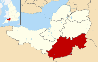
South Somerset was a local government district in Somerset, England. The district covered an area of 370 square miles (958 km2) ranging from the borders with Devon, Wiltshire and Dorset to the edge of the Somerset Levels. It had a population of approximately 158,000. The administrative centre of the district was Yeovil.
<span class="mw-page-title-main">Crewkerne</span> Human settlement in England

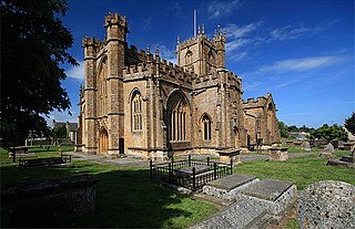
Crewkerne is a town and electoral ward in Somerset, England, 9 miles (14 km) southwest of Yeovil and 7 miles (11 km) east of Chard all in the South Somerset district. The civil parish of West Crewkerne includes the hamlets of Coombe, Woolminstone and Henley – and borders the county of Dorset to the south. The town is on the main headwater of the River Parrett, A30 road and West of England Main Line railway, in modern times the slower route between the capital and the southwest peninsula, having been eclipsed by the Taunton route.

<span class="mw-page-title-main">Merriott</span> Human settlement in England

Merriott is a village and civil parish in Somerset, England, near the town of Crewkerne and 7 miles (11.3 km) west of Yeovil in the South Somerset district. The village has a population of 1,979.
<span class="mw-page-title-main">Dowlish Wake</span> Human settlement in England

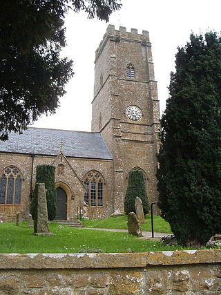
Dowlish Wake is a small village and civil parish in Somerset, England, 2 miles (3 km) south of Ilminster and 5 miles (8 km) northeast of Chard in the South Somerset district. With a population of 277, it has several thatched houses and a pub, the New Inn. Its post office closed in 1991.

<span class="mw-page-title-main">Broadway, Somerset</span> Human settlement in England

Broadway is a village and civil parish in Somerset, England, situated 3 miles (4.8 km) west of Ilminster and 5 miles (8.0 km) north of Chard. The parish has a population of 740. The parish includes the nearby hamlet of Hare.

<span class="mw-page-title-main">Chaffcombe</span> Human settlement in England

Chaffcombe is a village and civil parish in Somerset, England, situated 2 miles (3.2 km) north east of Chard in the South Somerset district. The village has a population of 229.

<span class="mw-page-title-main">Chillington, Somerset</span> Human settlement in England

Chillington is a village and parish in Somerset, England, situated 3 miles (5 km) west of Crewkerne and 5 miles (8 km) east of Chard in the South Somerset district. The parish has a population of 164.
<span class="mw-page-title-main">Cudworth, Somerset</span> Human settlement in England

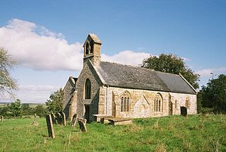
Cudworth is a village and parish in Somerset, England, situated 5 miles (8.0 km) north east of Chard in the South Somerset district. The village has a population of 69.

<span class="mw-page-title-main">Dinnington, Somerset</span> Human settlement in England

Dinnington is a village and civil parish in the English county of Somerset, situated 4 miles (6.4 km) north of Crewkerne in the South Somerset district. The village has a population of 65.
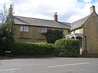
<span class="mw-page-title-main">Haselbury Plucknett</span> Human settlement in England

Haselbury Plucknett is a village and civil parish on the River Parrett in Somerset, England, situated 6 miles (9.7 km) south west of Yeovil in the South Somerset district. The village has a population of 744.

<span class="mw-page-title-main">Kingstone, Somerset</span> Human settlement in England

Kingstone is a village and civil parish in Somerset, England, situated near Ilminster, 5 miles (8.0 km) north east of Chard in the South Somerset district. The village has a population of 83.

<span class="mw-page-title-main">Lopen</span> Human settlement in England

Lopen is a village and civil parish in the South Somerset district of Somerset, England, situated 8 miles (12.9 km) west of Yeovil. The village has a population of 260 people.

<span class="mw-page-title-main">Mudford</span> Village in England

Mudford is a village and parish in Somerset, England, situated 3 miles (4.8 km) from Yeovil in the South Somerset district on the River Yeo. The village has a population of 696. The parish includes the hamlets of Mudford Sock, West Mudford and Up Mudford.

<span class="mw-page-title-main">Shepton Beauchamp</span> Human settlement in England

Shepton Beauchamp is a village and civil parish, 1 mile (2 km) from Barrington and 4 miles (6 km) north east of Ilminster between the Blackdown Hills and the Somerset Levels in the South Somerset district of Somerset, England.

<span class="mw-page-title-main">Misterton, Somerset</span> Human settlement in England

Misterton is a village and civil parish 1 mile (1.6 km) south-east of Crewkerne, Somerset, England.

<span class="mw-page-title-main">Wambrook</span> Human settlement in England

Wambrook is a village and civil parish in the Blackdown Hills, Somerset, England. The village lies about 2 miles (3 km) southwest of the town of Chard. The parish includes the hamlets of Higher Wambrook and Lower Wambrook which is sometimes known as Haselcombe.

<span class="mw-page-title-main">Wayford</span> Human settlement in England

Wayford is a village and civil parish on the River Axe, 3 miles (5 km) south-west of Crewkerne, in the South Somerset district of Somerset, England.

<span class="mw-page-title-main">South Petherton</span> Village and civil parish in Somerset, England

South Petherton is a large village and civil parish in the South Somerset district of Somerset, England, located 5 miles (8 km) east of Ilminster and 5 miles (8 km) north of Crewkerne. The parish had a population of 3,737 in 2021 and includes the smaller village of Over Stratton and the hamlets of Compton Durville, Drayton, Wigborough and Yeabridge. The River Parrett forms the eastern boundary of the parish. The village is approximately 2 miles (3 km) from East Lambrook, Martock and Lopen.
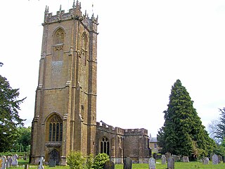
<span class="mw-page-title-main">St George's Church, Hinton St George</span> Church in Somerset, England

The Church of St George in Hinton St George, Somerset, England includes 13th-century work by masons of Wells Cathedral, and has been designated as a Grade I listed building.

References

  1. 1 2 "Statistics for Wards, LSOAs and Parishes — SUMMARY Profiles" (Excel). Somerset Intelligence. Retrieved 4 January 2014.
  2. "Somerset Hundreds". GENUKI. Retrieved 8 October 2011.
  3. Open Domesday Online: Hinton (St. George), accessed January 2018.
  4. Havinden, Michael (1982). The Somerset Landscape. The making of the English landscape. London: Hodder and Stoughton. p. 126. ISBN   0-340-20116-9.
  5. Historic England. "Village cross (1018634)". National Heritage List for England . Retrieved 22 November 2014.
  6. Historic England. "The Village Cross (1056096)". National Heritage List for England . Retrieved 23 December 2014.
  7. "Chard RD". A vision of Britain Through Time. University of Portsmouth. Retrieved 4 January 2014.
  8. Historic England. "Church of St George, Hinton St George (1056124)". National Heritage List for England . Retrieved 6 March 2008.
  9. "Church of St George and churchyard, Hinton St George". Somerset Historic Environment Record. Retrieved 6 March 2008.
  10. "Parishes: Hinton St. George Pages 38-52 A History of the County of Somerset: Volume 4". British History Online. Retrieved 1 October 2023.

Commons-logo.svg Media related to Hinton St George at Wikimedia Commons