Sedgemoor

Last updated

Sedgemoor
Sedgemoor UK locator map.svg
Shown within Somerset
Sovereign stateUnited Kingdom
Constituent country England
Region South West England
Ceremonial county Somerset
Administrative County Somerset Council
Area
  Total217.90 sq mi (564.36 km2)
Population
 (2021) [1]
  Total125,752
  Density580/sq mi (220/km2)
Time zone UTC0 (GMT)
  Summer (DST) UTC+1 (BST)
Post Code
Area code 01278
Website www.somerset.gov.uk

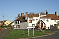
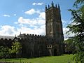
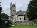
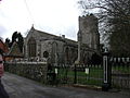
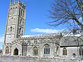
Sedgemoor is a low-lying area of land in Somerset, England. It lies close to sea level south of the Polden Hills, historically largely marsh (or "moor" in its older sense). [2] The eastern part is known as King's Sedgemoor, and the western part West Sedgemoor. Sedgemoor is part of the area now known as the Somerset Levels and Moors. Historically the area was known as the site of the Battle of Sedgemoor.

Contents

Sedgemoor gave its name to a local government district formed on 1 April 1974, under the Local Government Act 1972, by a merger of the municipal borough of Bridgwater, the Burnham-on-Sea urban district, Bridgwater Rural District and part of Axbridge Rural District. The district covered a larger area than the historical Sedgemoor, extending north of the Polden Hills across the Somerset Levels and Moors to the Mendip Hills.

On 1 April 2023 the district was abolished and replaced by a new unitary district for the area previously served by Somerset County Council. The replacement council is Somerset Council. [3] Elections for the new council took place in May 2022, and it ran alongside Sedgemoor and the other councils until their abolition in April 2023. [4]

Toponymy

Sedgemoor does not mean "sedge moor", but is instead "marsh of a man called Sicga" from the Old Norse personal name Sicga and Old English mor "moor". [5] The name was recorded as Secgamere in 1165.

Towns

Parishes

ImageNameStatusPopulation [6] Former local authorityCoordinatesRefs
Ashcott.jpg Ashcott Civil parish1,186 Bridgwater Rural District 51°07′N2°49′W / 51.12°N 2.81°W / 51.12; -2.81 (Ashcott) [7] [8]
AxbridgeSquare.jpg Axbridge Town2,057 Axbridge Rural District 51°17′N2°49′W / 51.29°N 2.82°W / 51.29; -2.82 (Axbridge) [7] [9]
Badgworth Church.jpg Badgworth Civil parish525 Axbridge Rural District 51°16′N2°52′W / 51.27°N 2.87°W / 51.27; -2.87 (Badgworth) [7] [9]
St Michael and All Angels Church, Bawdrip - geograph.org.uk - 85565.jpg Bawdrip Civil parish506 Bridgwater Rural District 51°09′N2°56′W / 51.15°N 2.94°W / 51.15; -2.94 (Bawdrip) [7] [8]
SS Nornen wreck.jpg Berrow Civil parish1,534 Axbridge Rural District 51°16′N3°01′W / 51.27°N 3.01°W / 51.27; -3.01 (Berrow, Somerset) [7] [9]
Brean Sands, Somerset, England, from Brean Down arp.jpg Brean Civil parish635 Axbridge Rural District 51°18′N3°01′W / 51.30°N 3.01°W / 51.30; -3.01 (Brean) [7] [9]
Brent Knoll vicarage.jpg Brent Knoll Civil parish1,271 Axbridge Rural District 51°15′N2°57′W / 51.25°N 2.95°W / 51.25; -2.95 (Brent Knoll) [7] [9]
Bridgwater cornexchange staute and church.jpg Bridgwater Town35,886 Bridgwater Municipal Borough 51°08′N2°59′W / 51.13°N 2.99°W / 51.13; -2.99 (Bridgwater) [7] [8]
Horsey A39.jpg Bridgwater Without Civil parish428 Bridgwater Rural District 51°08′N2°58′W / 51.14°N 2.97°W / 51.14; -2.97 (Bridgwater Without) [7] [8]
Broomfield church.jpg Broomfield Civil parish249 Bridgwater Rural District 51°05′N3°07′W / 51.08°N 3.11°W / 51.08; -3.11 (Broomfield, Somerset) [7] [8]
Pier Burnham-on-Sea.jpg Burnham on Sea and Highbridge Town19,576 Burnham on Sea Urban District 51°14′N2°59′W / 51.24°N 2.99°W / 51.24; -2.99 (Burnham-on-Sea and Highbridge) [7] [10]
Edithmead church.jpg Burnham Without Civil Parish1,636 Axbridge Rural District 51°14′N2°58′W / 51.23°N 2.96°W / 51.23; -2.96 (Burnham Without) [7] [9]
St Philips & St James Church. Burtle - geograph.org.uk - 117490.jpg Burtle Civil parish388 Bridgwater Rural District 51°10′N2°52′W / 51.17°N 2.87°W / 51.17; -2.87 (Burtle) [7] [8]
Cannington church.jpg Cannington Civil parish2,271 Bridgwater Rural District 51°09′N3°04′W / 51.15°N 3.07°W / 51.15; -3.07 (Cannington, Somerset) [7] [8]
Village of Catcott and part of church yard. From tower of St Peter's Church - geograph.org.uk - 124508.jpg Catcott Civil parish531 Bridgwater Rural District 51°09′N2°52′W / 51.15°N 2.87°W / 51.15; -2.87 (Catcott) [7] [8]
Chapel Allerton - Ashton Windmill - geograph.org.uk - 83605.jpg Chapel Allerton Civil parish401 Axbridge Rural District 51°15′N2°51′W / 51.25°N 2.85°W / 51.25; -2.85 (Chapel Allerton, Somerset) [7] [9]
Cheddar 09-06 9.jpg Cheddar Civil parish5,755 Axbridge Rural District 51°17′N2°47′W / 51.28°N 2.78°W / 51.28; -2.78 (Cheddar) [7] [9]
Chedzoy Church - geograph.org.uk - 153750.jpg Chedzoy Civil parish404 Bridgwater Rural District 51°08′N2°57′W / 51.13°N 2.95°W / 51.13; -2.95 (Chedzoy) [7] [8]
Chilton Priory.jpg Chilton Polden Civil parish698 Bridgwater Rural District 51°09′N2°54′W / 51.15°N 2.90°W / 51.15; -2.90 (Chilton Polden) [7] [8]
Chilton Trinity Church - geograph.org.uk - 1001082.jpg Chilton Trinity Civil parish260 Bridgwater Rural District 51°09′N3°01′W / 51.15°N 3.01°W / 51.15; -3.01 (Chilton Trinity) [7] [8]
Compton Bishop.jpg Compton Bishop Civil parish620 Axbridge Rural District 51°18′N2°52′W / 51.30°N 2.87°W / 51.30; -2.87 (Compton Bishop) [7] [9]
Cossington church.jpg Cossington Civil parish564 Bridgwater Rural District 51°10′N2°55′W / 51.16°N 2.92°W / 51.16; -2.92 (Cossington, Somerset) [7] [8]
West Bower Manor.jpg Durleigh Civil parish548 Bridgwater Rural District 51°07′N3°02′W / 51.12°N 3.04°W / 51.12; -3.04 (Durleigh) [7] [8]
East Brent - Crook Peak and East Brent Church - geograph.org.uk - 43849.jpg East Brent Civil parish1,302 Axbridge Rural District 51°16′N2°56′W / 51.26°N 2.94°W / 51.26; -2.94 (East Brent, Somerset) [7] [9]
East Huntspill.jpg East Huntspill Civil parish1,146 Bridgwater Rural District 51°12′N2°59′W / 51.20°N 2.98°W / 51.20; -2.98 (Huntspill) [7] [8]
Edington Holy Well - geograph.org.uk - 542761.jpg Edington Civil parish372 Bridgwater Rural District 51°09′N2°53′W / 51.15°N 2.88°W / 51.15; -2.88 (Edington, Somerset) [7] [8]
Enmore church.jpg Enmore Civil parish247 Bridgwater Rural District 51°07′N3°05′W / 51.11°N 3.09°W / 51.11; -3.09 (Enmore, Somerset) [7] [8]
Fiddington Church - geograph.org.uk - 1175231.jpg Fiddington Civil parish298 Bridgwater Rural District 51°10′N3°07′W / 51.16°N 3.12°W / 51.16; -3.12 (Fiddington) [7] [8]
Temple of Harmony, Goathurst, Somerset - geograph.org.uk - 920680.jpg Goathurst Civil parish193 Bridgwater Rural District 51°06′N3°04′W / 51.10°N 3.06°W / 51.10; -3.06 (Goathurst) [7] [8]
Greintonchurch.JPG Greinton Civil Parish71 Bridgwater Rural District 51°07′N2°50′W / 51.12°N 2.84°W / 51.12; -2.84 (Greinton) [8]
Cricket Pavilion - geograph.org.uk - 84650.jpg Lympsham Civil parish960 Axbridge Rural District 51°17′N2°57′W / 51.29°N 2.95°W / 51.29; -2.95 (Lympsham) [7] [9]
Cattle grazing in East Lyng, Somerset.jpg Lyng Civil parish338 Bridgwater Rural District 51°03′N2°58′W / 51.05°N 2.96°W / 51.05; -2.96 (Lyng, Somerset) [7] [8]
MARK, Somerset - geograph.org.uk - 66003.jpg Mark Civil parish1,478 Axbridge Rural District 51°14′N2°53′W / 51.23°N 2.89°W / 51.23; -2.89 (Mark, Somerset) [7] [9]
Middlezoychurch.JPG Middlezoy Civil parish725 Bridgwater Rural District 51°05′N2°53′W / 51.09°N 2.89°W / 51.09; -2.89 (Middlezoy) [7] [8]
St. Mary's Church, Moorlinch - geograph.org.uk - 253048.jpg Moorlinch Civil parish408 Bridgwater Rural District 51°08′N2°52′W / 51.13°N 2.86°W / 51.13; -2.86 (Moorlinch) [7] [8]
Netherstoweychurch.jpg Nether Stowey Civil parish1,373 Bridgwater Rural District 51°09′N3°09′W / 51.15°N 3.15°W / 51.15; -3.15 (Nether Stowey) [7] [8]
North Petherton church.jpg North Petherton Town6,730 Bridgwater Rural District 51°05′N3°01′W / 51.09°N 3.01°W / 51.09; -3.01 (North Petherton) [7] [8]
Otherychurch.JPG Othery Civil parish642 Bridgwater Rural District 51°05′N2°53′W / 51.08°N 2.88°W / 51.08; -2.88 (Othery) [7] [8]
Otterhampton church - geograph.org.uk - 95683.jpg Otterhampton Civil parish831 Bridgwater Rural District 51°11′N3°05′W / 51.18°N 3.08°W / 51.18; -3.08 (Otterhampton) [7] [8]
Church at Over Stowey.jpg Over Stowey Civil parish352 Bridgwater Rural District 51°09′N3°09′W / 51.15°N 3.15°W / 51.15; -3.15 (Over Stowey) [7] [8]
Pawlett village shop.jpg Pawlett Civil Parish1,038 Bridgwater Rural District 51°11′N3°00′W / 51.18°N 3.00°W / 51.18; -3.00 (Pawlett, Somerset) [7] [8]
Puriton-Church.jpg Puriton Civil parish1,068 Bridgwater Rural District 51°10′N2°58′W / 51.17°N 2.97°W / 51.17; -2.97 (Puriton) [7] [8]
Shapwick church.jpg Shapwick Civil parish536 Bridgwater Rural District 51°08′N2°50′W / 51.14°N 2.83°W / 51.14; -2.83 (Shapwick, Somerset) [7] [8]
Shipham.jpg Shipham Civil parish1,087 Axbridge Rural District 51°19′N2°48′W / 51.31°N 2.80°W / 51.31; -2.80 (Shipham) [7] [9]
The Lamb Inn Spaxton - geograph.org.uk - 160227.jpg Spaxton Civil parish1,012 Bridgwater Rural District 51°08′N3°07′W / 51.13°N 3.11°W / 51.13; -3.11 (Spaxton) [7] [8]
Stawell church.jpg Stawell Civil parish386 Bridgwater Rural District 51°08′N2°55′W / 51.14°N 2.91°W / 51.14; -2.91 (Stawell, Somerset) [7] [8]
Stockland Bristol from the east - geograph.org.uk - 95684.jpg Stockland Bristol Civil parish165 Bridgwater Rural District 51°11′N3°05′W / 51.19°N 3.08°W / 51.19; -3.08 (Stockland Bristol) [7] [8]
Maypole Inn, Thurloxton - geograph.org.uk - 91201.jpg Thurloxton Civil parish153 Bridgwater Rural District 51°04′N3°02′W / 51.07°N 3.04°W / 51.07; -3.04 (Thurloxton) [7] [8]
St Gregory's church Weare.jpg Weare Civil parish658 Axbridge Rural District 51°16′N2°50′W / 51.27°N 2.84°W / 51.27; -2.84 (Weare, Somerset) [7] [9]
Wedmore church.jpg Wedmore Civil Parish3,318 Axbridge Rural District 51°14′N2°49′W / 51.23°N 2.81°W / 51.23; -2.81 (Wedmore) [7] [9]
Wembdon church.jpg Wembdon Civil parish3,613 Bridgwater Rural District 51°08′N3°01′W / 51.13°N 3.02°W / 51.13; -3.02 (Wembdon) [7] [8]
West Huntspill church.jpg West Huntspill Civil parish1,414 Bridgwater Rural District 51°12′N2°59′W / 51.20°N 2.98°W / 51.20; -2.98 (Huntspill) [7] [8]
Westonzoylandchurch.JPG Westonzoyland Civil parish1,801 Bridgwater Rural District 51°07′N2°55′W / 51.11°N 2.92°W / 51.11; -2.92 (Westonzoyland) [7] [8]
Woolavington church.jpg Woolavington Civil parish2,115 Bridgwater Rural District 51°10′N2°56′W / 51.17°N 2.93°W / 51.17; -2.93 (Woolavington) [7] [8]

Rivers

"The Map of Sedgemoor, with adjacent Parts" from "The history of imbanking and drayning" by William Dugdale (1662). The Map of Sedgemoor, with adjacent Parts (1662).jpg
"The Map of Sedgemoor, with adjacent Parts" from "The history of imbanking and drayning" by William Dugdale (1662).

Battles

Industry

Light industry now predominates, but traditional trades including peat extraction, willow crafts and cider making may still be found, in addition to livestock farming. The River Parrett provides a source of eels (anguilla anguilla) and elvers from January through to May.

Also notable is the new Isleport trading estate at Highbridge, which houses many global businesses such as Geest (Isleport Foods) who make yoghurt under franchise to Ski & Muller, Brake Brothers who supply the catering trade, BFP wholesale who supply dry goods to bakeries etc., Woodbury & Haines who supply furniture globally, Polybeam Limited who supply GRP radio masts to customers such as Marconi, and also AT&T whose centre there controls all internet cable traffic to and from the US.

Industry in Bridgwater has also seen major growth recently with the opening of "Express Park" which houses Gerber Foods (a global fruit juice supplier), NHS Logistics depot and Eddie Stobart depot.

Governance

Sedgemoor District Council

The Sedgemoor district was established in 1974 and was based in Bridgwater. It covers a mostly rural area between the Quantock Hills and the Mendip Hills. The council, along with Somerset County Council, was replaced in April 2023 by Somerset Council, a unitary authority.

Education

Schools (those which are not independent) in Sedgemoor are operated the Children & Young People's Directorate of Somerset County Council, although some such as The Kings of Wessex School in Cheddar have distanced themselves from the county council by opting for foundation and then subsequently academy status.

See also

Related Research Articles

<span class="mw-page-title-main">River Parrett</span> River in Dorset and Somerset, England

The River Parrett flows through the counties of Dorset and Somerset in South West England, from its source in the Thorney Mills springs in the hills around Chedington in Dorset. Flowing northwest through Somerset and the Somerset Levels to its mouth at Burnham-on-Sea, into the Bridgwater Bay nature reserve on the Bristol Channel, the Parrett and its tributaries drain an area of 660 square miles (1,700 km2) – about 50 per cent of Somerset's land area, with a population of 300,000.

<span class="mw-page-title-main">Somerset Levels</span> Coastal plain and wetland area of Somerset, England

The Somerset Levels are a coastal plain and wetland area of Somerset, England, running south from the Mendips to the Blackdown Hills.

<span class="mw-page-title-main">Puriton</span> Village in Somerset, England

Puriton is a village and parish at the westerly end of the Polden Hills, in Somerset, England. The parish has a population of 1,968. The local parish church is dedicated to St Michael and All Angels. A chapel on Woolavington Road was converted to a private house some 20 years ago. The parish includes the hamlets of Dunball and Down End.

<span class="mw-page-title-main">North Somerset</span> District in England

North Somerset is a unitary authority in the ceremonial county of Somerset, England. The council is based in Weston-super-Mare, the area's largest town. The district also contains the towns of Clevedon, Nailsea and Portishead, along with a number of villages and surrounding rural areas. Some southern parts of the district fall within the Mendip Hills, a designated Area of Outstanding Natural Beauty.

<span class="mw-page-title-main">Ashcott</span> Village in Somerset, England

Ashcott is a small village and civil parish located in the Sedgemoor area of Somerset in the south-west of England. The village has a population of 1,186. The parish includes the hamlets of Ashcott Corner, Berhill, Buscott, Nythe and Pedwell.

<span class="mw-page-title-main">Wells (UK Parliament constituency)</span> Parliamentary constituency in the United Kingdom, 1885–2024

Wells was a constituency in Somerset in the House of Commons of the UK Parliament. Apart from between 2010–2015, Wells was represented by members of the Conservative Party since 1924.

<span class="mw-page-title-main">Edington, Somerset</span> Village in Somerset, England

Edington is a rural village, situated on the north side of the Polden Hills in Somerset, England.

<span class="mw-page-title-main">Geology of Somerset</span>

Somerset is a rural county in the southwest of England, covering 4,171 square kilometres (1,610 sq mi). It is bounded on the north-west by the Bristol Channel, on the north by Bristol and Gloucestershire, on the north-east by Wiltshire, on the south-east by Dorset, and on the south west and west by Devon. It has broad central plains with several ranges of low hills. The landscape divides into four main geological sections from the Silurian through the Devonian and Carboniferous to the Permian which influence the landscape, together with water-related features.

<span class="mw-page-title-main">Huntspill</span> Village in Somerset, England

Huntspill is a village and former civil parish on the Huntspill Level in Somerset, England. It lies on the A38 road, 1.5 miles (2.4 km) south of Highbridge. The village is the principal settlement in the civil parish of West Huntspill. In 2019 it had an estimated population of 1102.

<span class="mw-page-title-main">East Huntspill</span> Human settlement in England

East Huntspill is a village and civil parish on the Huntspill Level, near Highbridge, Somerset, England. The civil parish includes Cote, Hackness and Bason Bridge.

<span class="mw-page-title-main">Mark, Somerset</span> Village in Somerset, England

Mark is a village and civil parish which lies approximately 10 miles (16 km) from Bridgwater, 5 miles (8 km) from Axbridge, and 4 miles (6.4 km) from Highbridge in the county of Somerset, England. It includes the hamlets of Yarrow and Southwick. The Mark Yeo river has its source near the village.

<span class="mw-page-title-main">Catcott</span> Village in Somerset, England

Catcott is a rural village and civil parish, situated close to Edington 7 miles (11.3 km) to the east of Bridgwater on the Somerset Levels to the north of the Polden Hills in Somerset, England.

<span class="mw-page-title-main">Moorlinch</span> Village in Somerset, England

Moorlinch is a village and civil parish where the Polden Hills meet the Somerset Levels in Somerset, England.

<span class="mw-page-title-main">Burnham Without</span>

Burnham Without is a civil parish in the main located to the east of Burnham-on-Sea and to the north and northeast of Highbridge in Somerset, England.

<span class="mw-page-title-main">Geography of Somerset</span>

The county of Somerset is in South West England, bordered by the Bristol Channel and the counties of Bristol and Gloucestershire to the north, and Wiltshire to the east, Dorset to the south, and Devon to the west. The climate, influenced by its proximity to the Atlantic Ocean and the prevailing westerly winds, tends to be mild, damp and windy.

<span class="mw-page-title-main">Wells and Mendip Hills (UK Parliament constituency)</span> Parliamentary constituency in the United Kingdom, 2024 onwards

Wells and Mendip Hills is a constituency of the House of Commons in the UK Parliament. Further to the completion of the 2023 Periodic Review of Westminster constituencies, it was first contested at the 2024 general election.

References

  1. "Mid-Year Population Estimates, UK, June 2022". Office for National Statistics . 26 March 2024. Retrieved 3 May 2024.
  2. Robert Dunning, ed. (2004). "Introduction". A History of the County of Somerset: Volume 8: The Poldens and the Levels. Institute of Historical Research. Retrieved 1 August 2011.
  3. "Frequently asked questions". Somerset County Council . Retrieved 1 January 2022.
  4. "Elections for new Somerset Council to be held in May 2022". BBC News. 2 December 2021. Retrieved 1 January 2022.
  5. "Sedgemoor District Council". Ethnic Multicultural Media Academy. Retrieved 4 August 2008.
  6. "Sedgemoor parish population estimates for 2002" (PDF). Somerset County Council. 2002. Archived from the original (PDF) on 21 November 2009. Retrieved 17 October 2009.
  7. 1 2 3 4 5 6 7 8 9 10 11 12 13 14 15 16 17 18 19 20 21 22 23 24 25 26 27 28 29 30 31 32 33 34 35 36 37 38 39 40 41 42 43 44 45 46 47 48 49 50 51 52 53 "Statistics for Wards, LSOAs and Parishes – SUMMARY Profiles" (Excel). Somerset Intelligence. Retrieved 4 January 2014.
  8. 1 2 3 4 5 6 7 8 9 10 11 12 13 14 15 16 17 18 19 20 21 22 23 24 25 26 27 28 29 30 31 32 33 34 35 36 37 38 "Brdigwater RD". A vision of Britain Through Time. University of Portsmouth. Retrieved 4 January 2014.
  9. 1 2 3 4 5 6 7 8 9 10 11 12 13 14 15 "Axbridge RD". A vision of Britain Through Time. University of Portsmouth. Retrieved 4 January 2014.
  10. "Burnham UD". A vision of Britain Through Time. University of Portsmouth. Retrieved 4 January 2014.