Burtle

Last updated

Burtle
St Philips & St James Church. Burtle - geograph.org.uk - 117490.jpg
St Philips & St James Church
Farmhouse, North of Burtle - geograph.org.uk - 117513.jpg
Farmhouse, North of Burtle
Somerset UK location map.svg
Red pog.svg
Burtle
Location within Somerset
Population388 (2011) [1]
OS grid reference ST3942
Unitary authority
Ceremonial county
Region
Country England
Sovereign state United Kingdom
Post town Bridgwater
Postcode district TA7
Dialling code 01278
Police Avon and Somerset
Fire Devon and Somerset
Ambulance South Western
UK Parliament
List of places
UK
England
Somerset
51°10′N2°52′W / 51.17°N 02.87°W / 51.17; -02.87

Burtle is a village and civil parish on the Somerset Levels in Somerset, England.

Contents

History

Burtle Priory (also known as Burtle Moor Priory) originated as a hermitage on a site called Sprauellissmede, endowed by William son of Godfrey of Eddington in 1199. It was later known as St Stephens chapel and by 1312 a house of the Augustinian Canons Regular. [2]

It is close to the village of Edington and between them was Edington Burtle station on a branch of the Somerset and Dorset Joint Railway, which opened in 1890 and closed on 7 March 1966.

Governance

The parish council has responsibility for local issues, including setting an annual precept (local rate) to cover the council's operating costs and producing annual accounts for public scrutiny. The parish council evaluates local planning applications and works with the local police, district council officers, and neighbourhood watch groups on matters of crime, security, and traffic. The parish council's role also includes initiating projects for the maintenance and repair of parish facilities, as well as consulting with the district council on the maintenance, repair, and improvement of highways, drainage, footpaths, public transport, and street cleaning. Conservation matters (including trees and listed buildings) and environmental issues are also the responsibility of the council.

For local government purposes, since 1 April 2023, the village comes under the unitary authority of Somerset Council. Prior to this, it was part of the non-metropolitan district of Sedgemoor, which was formed on 1 April 1974 under the Local Government Act 1972, having previously been part of Bridgwater Rural District. [3]

It is also part of the Bridgwater and West Somerset county constituency represented in the House of Commons of the Parliament of the United Kingdom. It elects one Member of Parliament (MP) by the first past the post system of election, and was part of the South West England constituency of the European Parliament prior to Britain leaving the European Union in January 2020, which elected seven MEPs using the d'Hondt method of party-list proportional representation.

Educational and religious sites

The Anglican Church of St Philip and St James was built in 1838–1839 by Richard Carver, the County Architect and Surveyor. [4]

Burtle was home to the lower school of Shapwick School, known as Shapwick Prep. The special school for children with dyslexia was established in 1974 by Colin Atkinson, a former cricketer for Somerset County Cricket Club and head of Millfield. Originally called the Chalice School, it was expanded and renamed to Edington Senior School in 1981, before merging with Shapwick Senior School. [5] Shapwick School closed in 2020.

Related Research Articles

<span class="mw-page-title-main">Ashcott</span> Human settlement in England

Ashcott is a small village and civil parish located in the Sedgemoor area of Somerset in the south-west of England. The village has a population of 1,186. The parish includes the hamlets of Ashcott Corner, Berhill, Buscott, Nythe and Pedwell.

<span class="mw-page-title-main">Cheddon Fitzpaine</span> Human settlement in England

Cheddon Fitzpaine is a village and civil parish in Somerset, England, situated on the Quantock Hills 2 miles (3.2 km) north of Taunton. The village is situated near the Bristol and Exeter Railway, the Bridgwater and Taunton Canal, and the River Tone and has a population of 1,929.

<span class="mw-page-title-main">Shapwick, Somerset</span> Human settlement in England

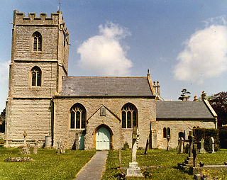
Shapwick is a village on the Polden Hills overlooking the Somerset Moors, in Somerset, England. It is situated to the west of Glastonbury.

<span class="mw-page-title-main">Durston</span> Human settlement in England

Durston is a village and civil parish in Somerset, England, situated on the A361 road 5 miles (8.0 km) north east of Taunton and 6 miles (9.7 km) south of Bridgwater. The parish lies on undulating ground between the lowest slopes of the Quantock Hills and the valley of the River Tone at the Curry and Hay Moors. The parish has a population of 136.

<span class="mw-page-title-main">Charlton Musgrove</span> Human settlement in England

Charlton Musgrove is a village and civil parish in Somerset, England, situated 1 mile (1.6 km) north east of Wincanton in the South Somerset district. The village has a population of 398. The parish includes the hamlets of Barrow, Holbrook, Southmarsh, and part of Shalford.

<span class="mw-page-title-main">Bawdrip</span> Human settlement in England

Bawdrip is a village and civil parish in Somerset, England. The village is on the south side of the Polden Hills about 4 miles (6.4 km) north-east of Bridgwater. At the 2011 census the parish had a population of 506. The parish includes the hamlets of Bradney, Horsey and Knowle.

<span class="mw-page-title-main">Edington, Somerset</span> Human settlement in England

Edington is a rural village, situated on the north side of the Polden Hills in Somerset, England.

<span class="mw-page-title-main">Chedzoy</span> Human settlement in England

Chedzoy is a civil parish village 3 miles (4.8 km) east of Bridgwater in Somerset, England.

<span class="mw-page-title-main">Woolavington</span> Human settlement in England

Woolavington is a village and civil parish on the Somerset Levels in the English county of Somerset. It is 5.2 miles (8.4 km) north east of Bridgwater, 7.2 miles (11.6 km) south east of Burnham on Sea and 11.9 miles (19.2 km) west of Glastonbury. At the 2021 census it had a population of 2,325.

<span class="mw-page-title-main">Huish Champflower</span> Human settlement in England

Huish Champflower is a village and civil parish in Somerset, England, three miles north-west of Wiveliscombe and ten miles north of Wellington. It has a population of 301.

<span class="mw-page-title-main">Mark, Somerset</span> Village in Somerset, England

Mark is a village and civil parish which lies approximately 10 miles (16 km) from Bridgwater, 5 miles (8 km) from Axbridge, and 4 miles (6.4 km) from Highbridge in the county of Somerset, England. It includes the hamlets of Yarrow and Southwick. The Mark Yeo river has its source near the village.

<span class="mw-page-title-main">Thurloxton</span> Human settlement in England

Thurloxton is a village and civil parish 5 miles (8 km) north-east of Taunton, and 5 miles south-west of Bridgwater on the south-eastern slopes of the Quantock Hills in the county of Somerset, England.

<span class="mw-page-title-main">Catcott</span> Human settlement in England

Catcott is a rural village and civil parish, situated close to Edington 7 miles (11.3 km) to the east of Bridgwater on the Somerset Levels to the north of the Polden Hills in Somerset, England.

<span class="mw-page-title-main">Chilton Polden</span> Human settlement in England

Chilton Polden is a rural village and civil parish, situated close to Edington on the Somerset Levels to the north of the Polden Hills in Somerset, England.

<span class="mw-page-title-main">Cossington, Somerset</span> Village in Somerset, England

Cossington is a village and civil parish close to Woolavington and 5 miles (8 km) north of Bridgwater, in Somerset, England. The village lies on the north side of the Polden Hills. It's population in 2021 was 640.

<span class="mw-page-title-main">Othery</span> Human settlement in England

The parish and village of Othery, established in 1515, sits on a detached extension of Sowy island on the Somerset Levels. It is 7 miles (11 km) east of Bridgwater and 4 miles (6 km) north-west of Langport. It borders the hamlets and villages of Pathe, Burrowbridge, Middlezoy, Westonzoyland and Aller, which it meets at Beer Wall. The border with Burrowbridge was defined in 1985, reducing Othery to 553 ha. Many of these borders are defined by ditches and walls created and rearranged, from the 13th century onwards, to drain and channel the waters of the River Cary and the River Parrett as they flooded the low-lying levels on their way to the Bristol Channel.

<span class="mw-page-title-main">Cannington, Somerset</span> Human settlement in England

Cannington is a village and civil parish 3 miles (5 km) northwest of Bridgwater in Somerset, England. It lies on the west bank of the River Parret, and contains the hamlet of Edstock.

<span class="mw-page-title-main">Fiddington</span> Human settlement in England

Fiddington is a village and civil parish 2.5 miles (4 km) north-east of Nether Stowey, and 6 miles (10 km) north-west of Bridgwater in Somerset, England. The parish includes the hamlets of Bonson and Whitnell.

<span class="mw-page-title-main">Middlezoy</span> Human settlement in England

Middlezoy is a village and civil parish on the Somerset Levels in Somerset, England. Situated between the two other villages of Westonzoyland and Othery and is about six miles from the town of Bridgwater which is on the tidal river Parret.

<span class="mw-page-title-main">Moorlinch</span> Human settlement in England

Moorlinch is a village and civil parish where the Polden Hills meet the Somerset Levels in Somerset, England.

References

  1. "Statistics for Wards, LSOAs and Parishes — SUMMARY Profiles" (Excel). Somerset Intelligence. Retrieved 4 January 2014.
  2. Bush, Robin (1994). Somerset: The complete guide. Wimborne, Dorset: Dovecote Press. pp.  54. ISBN   1-874336-26-1.
  3. "Bridgwater RD". A vision of Britain Through Time. University of Portsmouth. Retrieved 4 January 2014.
  4. Historic England. "Church of St Philip and St James (1344676)". National Heritage List for England . Retrieved 23 November 2008.
  5. "The Development of Shapwick School". Shapwick School. Archived from the original on 29 September 2010. Retrieved 22 November 2010.