Fiddington

Last updated • 2 min readFrom Wikipedia, The Free Encyclopedia

Fiddington
Fiddington Church - geograph.org.uk - 1175231.jpg
Somerset UK location map.svg
Red pog.svg
Fiddington
Location within Somerset
Population298 (2011) [1]
OS grid reference ST215405
Unitary authority
Ceremonial county
Region
Country England
Sovereign state United Kingdom
Post town BRIDGWATER
Postcode district TA5
Dialling code 01278
Police Avon and Somerset
Fire Devon and Somerset
Ambulance South Western
UK Parliament
List of places
UK
England
Somerset
51°09′29″N3°07′26″W / 51.158°N 3.124°W / 51.158; -3.124

Fiddington is a village and civil parish 2.5 miles (4 km) north-east of Nether Stowey, and 6 miles (10 km) north-west of Bridgwater in Somerset, England. The parish includes the hamlets of Bonson and Whitnell.

Contents

Governance

The parish council has responsibility for local issues, including setting an annual precept (local rate) to cover the council’s operating costs and producing annual accounts for public scrutiny. The parish council evaluates local planning applications and works with the local police, district council officers, and neighbourhood watch groups on matters of crime, security, and traffic. The parish council's role also includes initiating projects for the maintenance and repair of parish facilities, as well as consulting with the district council on the maintenance, repair, and improvement of highways, drainage, footpaths, public transport, and street cleaning. Conservation matters (including trees and listed buildings) and environmental issues are also the responsibility of the council.

For local government purposes, since 1 April 2023, the village comes under the unitary authority of Somerset Council. Prior to this, it was part of the non-metropolitan district of Sedgemoor, which was formed on 1 April 1974 under the Local Government Act 1972, having previously been part of Bridgwater Rural District. [2]

It is also part of the Bridgwater county constituency represented in the House of Commons of the Parliament of the United Kingdom. It elects one Member of Parliament (MP) by the first past the post system of election, and was part of the South West England constituency of the European Parliament prior to Britain leaving the European Union in January 2020, which elected seven MEPs using the d'Hondt method of party-list proportional representation.

Religious sites

The Church of St Martin dates from the 11th century and has been designated by English Heritage as a Grade II* listed building. [3] On the south wall of the nave is a 12 inches (30 cm) Sheela na Gig. [4] [5] It is unusual in having one arm aloft and the other resting on a knee. The part of the figure showing genitalia is less well defined than the upper body, possibly as a result of weathering or an attempt to obscure that part of the image at some time in the past. [6]

Related Research Articles

<span class="mw-page-title-main">Burrowbridge</span> Human settlement in England

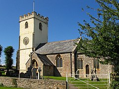
Burrowbridge is a village and civil parish in Somerset, England, situated on the River Parrett and the A361 road on the edge of the Somerset Levels. It is located 5 miles (8.0 km) southeast of Bridgwater, and has a population of 508.

<span class="mw-page-title-main">Donyatt</span> Human settlement in England

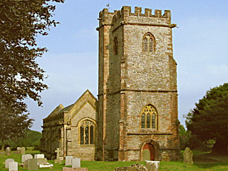
Donyatt is a village and civil parish in Somerset, England, situated at the source of the River Isle 5 miles (8.0 km) north of Chard in the South Somerset district. The village has a population of 347. The parish includes the hamlet of Peasmarsh.

<span class="mw-page-title-main">Bawdrip</span> Human settlement in England

Bawdrip is a village and civil parish in Somerset, England. The village is on the south side of the Polden Hills about 4 miles (6.4 km) north-east of Bridgwater. At the 2011 census the parish had a population of 506. The parish includes the hamlets of Bradney, Horsey and Knowle.

<span class="mw-page-title-main">Broomfield, Somerset</span> Human settlement in England

Broomfield is a village and civil parish in Somerset, England, situated about five miles north of Taunton. According to the 2011 census it had a population of 249.

<span class="mw-page-title-main">Chedzoy</span> Human settlement in England

Chedzoy is a civil parish village 3 miles (4.8 km) east of Bridgwater in Somerset, England.

<span class="mw-page-title-main">Goathurst</span> Human settlement in England

Goathurst is a small village and civil parish in the English county of Somerset, around 3 miles from the town of Bridgwater. The parish includes the hamlets of Andersfield and Huntstile. The village is on the route of the Samaritans Way South West.

<span class="mw-page-title-main">Woolavington</span> Human settlement in England

Woolavington is a village and civil parish on the Somerset Levels in the English county of Somerset. It is 5.2 miles (8.4 km) north east of Bridgwater, 7.2 miles (11.6 km) south east of Burnham on Sea and 11.9 miles (19.2 km) west of Glastonbury. At the 2021 census it had a population of 2,325.

<span class="mw-page-title-main">Burtle</span> Human settlement in England

Burtle is a village and civil parish on the Somerset Levels in Somerset, England.

<span class="mw-page-title-main">Thurloxton</span> Human settlement in England

Thurloxton is a village and civil parish 5 miles (8 km) north-east of Taunton, and 5 miles south-west of Bridgwater on the south-eastern slopes of the Quantock Hills in the county of Somerset, England.

<span class="mw-page-title-main">Greinton</span> Human settlement in England

Greinton is a village and civil parish in Somerset, England, situated on the Somerset Levels and Moors at the foot of the Polden Hills, 9 kilometres (5.6 mi) west southwest of Glastonbury and 7 miles (11 km) east of Bridgwater.

<span class="mw-page-title-main">Catcott</span> Human settlement in England

Catcott is a rural village and civil parish, situated close to Edington 7 miles (11.3 km) to the east of Bridgwater on the Somerset Levels to the north of the Polden Hills in Somerset, England.

<span class="mw-page-title-main">Cossington, Somerset</span> Village in Somerset, England

Cossington is a village and civil parish close to Woolavington and 5 miles (8 km) north of Bridgwater, in Somerset, England. The village lies on the north side of the Polden Hills. Its population in 2021 was 640.

<span class="mw-page-title-main">Cannington, Somerset</span> Human settlement in England

Cannington is a village and civil parish 3 miles (5 km) northwest of Bridgwater in Somerset, England. It lies on the west bank of the River Parret, and contains the hamlet of Edstock.

<span class="mw-page-title-main">Chilton Trinity</span> Human settlement in England

Chilton Trinity is a village and civil parish on the River Parrett, 2 miles (3 km) north of Bridgwater in Somerset, England.

<span class="mw-page-title-main">Durleigh</span> Human settlement in England

Durleigh is a village and civil parish on the outskirts of Bridgwater in Somerset, England. According to the 2011 Census, it had a population of 548. Its nearest town is Bridgwater, which lies approximately 1.6 miles (2.6 km) north-east from the village.

<span class="mw-page-title-main">Enmore, Somerset</span> Human settlement in England

Enmore is a village and civil parish 2 miles (3 km) west of Bridgwater on the Quantock Hills in Somerset, England. The parish includes the hamlet of Bare Ash.

<span class="mw-page-title-main">Moorlinch</span> Human settlement in England

Moorlinch is a village and civil parish where the Polden Hills meet the Somerset Levels in Somerset, England.

<span class="mw-page-title-main">Stawell, Somerset</span> Human settlement in England

Stawell is a village and civil parish 4.5 miles (7 km) north-east of Bridgwater, and 2 miles (3 km) north-west of Moorlinch, in Somerset, England. The civil parish includes the village of Sutton Mallet.

<span class="mw-page-title-main">Bridgwater Without</span> Human settlement in England

Bridgwater Without is a civil parish in the Sedgemoor district of Somerset, England.

<span class="mw-page-title-main">Church of St Martin, Fiddington</span> Church in Somerset, England

The Anglican Church of St Martin in Fiddington within the English county of Somerset dates from the 11th century and has been designated by English Heritage as a Grade II* listed building.

References

  1. "Statistics for Wards, LSOAs and Parishes — SUMMARY Profiles" (Excel). Somerset Intelligence. Retrieved 4 January 2014.
  2. "Bridgwater RD". A vision of Britain Through Time. University of Portsmouth. Retrieved 4 January 2014.
  3. Historic England. "Church of St Martin (1264213)". National Heritage List for England . Retrieved 2 February 2008.
  4. Adkins, Lesley; Roy Adkins (1992). A field guide to Somerset archaeology. Wimborne, Dorset: Dovecote Press. pp. 62–63. ISBN   0-946159-94-7.
  5. "The Fiddington Sheela Na Gig". Sheela Na Gig Project. Archived from the original on 23 March 2009. Retrieved 2 February 2008.
  6. Warren, Derrick (2005). Curious Somerset. Stroud: Sutton Publishing. p. 58. ISBN   978-0-7509-4057-3.