The River Parrett flows through the counties of Dorset and Somerset in South West England, from its source in the Thorney Mills springs in the hills around Chedington in Dorset. Flowing northwest through Somerset and the Somerset Levels to its mouth at Burnham-on-Sea, into the Bridgwater Bay nature reserve on the Bristol Channel, the Parrett and its tributaries drain an area of 660 square miles (1,700 km2) – about 50 per cent of Somerset's land area, with a population of 300,000.

The Somerset Levels are a coastal plain and wetland area of Somerset, England, running south from the Mendips to the Blackdown Hills.

Sedgemoor is a low-lying area of land in Somerset, England. It lies close to sea level south of the Polden Hills, historically largely marsh. The eastern part is known as King's Sedgemoor, and the western part West Sedgemoor. Sedgemoor is part of the area now known as the Somerset Levels and Moors. Historically the area was known as the site of the Battle of Sedgemoor.

The River Huntspill is an artificial river, in the Somerset Levels, in the Sedgemoor district of Somerset, England. It was built in 1940 to supply process water to ROF Bridgwater, and has resulted in reduced flooding of the lower Brue Valley. Huntspill Sluice at the river's western end, also known as West Huntspill Sluice, separates it from the River Parrett.

Edington is a rural village, situated on the north side of the Polden Hills in Somerset, England.

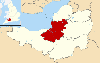
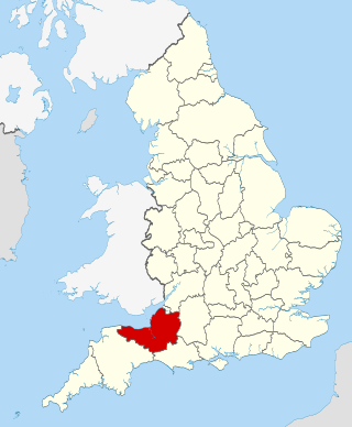
Somerset is a rural county in the southwest of England, covering 4,171 square kilometres (1,610 sq mi). It is bounded on the north-west by the Bristol Channel, on the north by Bristol and Gloucestershire, on the north-east by Wiltshire, on the south-east by Dorset, and on the south west and west by Devon. It has broad central plains with several ranges of low hills. The landscape divides into four main geological sections from the Silurian through the Devonian and Carboniferous to the Permian which influence the landscape, together with water-related features.

The River Brue originates in the parish of Brewham in Somerset, England, and reaches the sea some 50 kilometres (31 mi) west at Burnham-on-Sea. It originally took a different route from Glastonbury to the sea, but this was changed by Glastonbury Abbey in the twelfth century. The river provides an important drainage route for water from a low-lying area which is prone to flooding which man has tried to manage through rhynes, canals, artificial rivers and sluices for centuries.

King's Sedgemoor is a piece of rich animal habitat and farming land, that forms part of the Somerset Levels and Moors in South West England.

Westonzoyland is a village and civil parish in Somerset, England. It is situated on the Somerset Levels, 4 miles (6.4 km) south east of Bridgwater.

King's Sedgemoor Drain is an artificial drainage channel which diverts the River Cary in Somerset, England, along the southern flank of the Polden Hills, to discharge into the River Parrett at Dunball near Bridgwater. As the name suggests, the channel is used to help drain the peat moors of King's Sedgemoor. There was opposition to drainage schemes from the local inhabitants, who feared that they would lose their common grazing rights. However, the main channel was constructed between 1791 and 1795, and despite some defects, brought some relief from flooding to the area.

The Westonzoyland Pumping Station Museum of Steam Power and Land Drainage is a small industrial heritage museum dedicated to steam powered machinery at Westonzoyland in the English county of Somerset. It is a Grade II* listed building.
Fivehead Woods and Meadow is a 62.4 hectare biological Site of Special Scientific Interest near the village of Fivehead in Somerset, notified in 1989.

Westhay Moor is a 513.7-hectare (1,269-acre) biological Site of Special Scientific Interest 2.5 kilometres (1.6 mi) north-east of Westhay village and 4 kilometres (2.5 mi) from Wedmore in Somerset, England, notified in 1971. Westhay Moor is also notified as part of the Somerset Levels and Moors Special Protection Area under the EU Birds Directive and as a Ramsar site, and a National Nature Reserve.

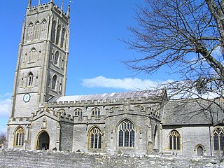
Catcott is a rural village and civil parish, situated close to Edington 7 miles (11.3 km) to the east of Bridgwater on the Somerset Levels to the north of the Polden Hills in Somerset, England.

The county of Somerset is in South West England, bordered by the Bristol Channel and the counties of Bristol and Gloucestershire to the north, and Wiltshire to the east, Dorset to the south, and Devon to the west. The climate, influenced by its proximity to the Atlantic Ocean and the prevailing westerly winds, tends to be mild, damp and windy.

The Sowy River is an artificial drainage channel in Somerset, England, designed to act as a flood relief channel for the River Parrett. Water from the Parrett can be diverted into it just below Langport, and is conveyed to the King's Sedgemoor Drain, which discharges back into the Parrett much nearer to its outfall into the Bristol Channel. Following extensive flooding of the surrounding land in 2014, new culverts to carry the river under the A372 road at Beer Wall were constructed, and a three-year project to raise the banks and widen the channel to increase its capacity was undertaken.

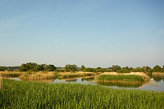
Ham Wall is an English wetland National Nature Reserve (NNR) 4 kilometres (2.5 mi) west of Glastonbury on the Somerset Levels. It is managed by the Royal Society for the Protection of Birds (RSPB). Since the last Ice Age, decomposing plants in the marshes of the Brue valley in Somerset have accumulated as deep layers of peat that were commercially exploited on a large scale in the twentieth century. Consumer demand eventually declined, and in 1994 the landowners, Fisons, gave their old workings to what is now Natural England, who passed the management of the 260 hectares Ham Wall section to the RSPB.

From December 2013 onwards the Somerset Levels suffered severe flooding as part of the wider 2013–2014 Atlantic winter storms in Europe and subsequent 2013–2014 United Kingdom winter floods. The Somerset Levels, or the Somerset Levels and Moors as they are less commonly but more correctly known, is a coastal plain and wetland area of central Somerset, in South West England, running south from the Mendip Hills to the Blackdown Hills.


