
In geography, a plain, commonly known as flatland, is a flat expanse of land that generally does not change much in elevation, and is primarily treeless. Plains occur as lowlands along valleys or at the base of mountains, as coastal plains, and as plateaus or uplands. Plains are one of the major landforms on earth, being present on all continents and covering more than one-third of the world's land area. Plains in many areas are important for agriculture. There are various types of plains and biomes on them.

Slash-and-burn agriculture is a farming method that involves the cutting and burning of plants in a forest or woodland to create a field called a swidden. The method begins by cutting down the trees and woody plants in an area. The downed vegetation, or "slash", is then left to dry, usually right before the rainiest part of the year. Then, the biomass is burned, resulting in a nutrient-rich layer of ash which makes the soil fertile, as well as temporarily eliminating weed and pest species. After about three to five years, the plot's productivity decreases due to depletion of nutrients along with weed and pest invasion, causing the farmers to abandon the field and move to a new area. The time it takes for a swidden to recover depends on the location and can be as little as five years to more than twenty years, after which the plot can be slashed and burned again, repeating the cycle. In Bangladesh and India, the practice is known as jhum or jhoom.
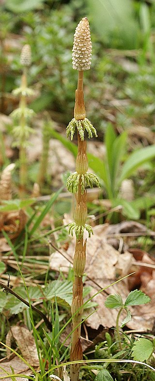
Equisetum sylvaticum, the wood horsetail, is a horsetail native to the Northern Hemisphere, occurring in North America and Eurasia. Because of its lacy appearance, it is considered among the most attractive of the horsetails.
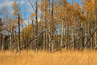
Aspen parkland refers to a very large area of transitional biome between prairie and boreal forest in two sections, namely the Peace River Country of northwestern Alberta crossing the border into British Columbia, and a much larger area stretching from central Alberta, all across central Saskatchewan to south central Manitoba and continuing into small parts of the US states of Minnesota and North Dakota. Aspen parkland consists of groves of aspen, poplar and spruce, interspersed with areas of prairie grasslands, also intersected by large stream and river valleys lined with aspen-spruce forests and dense shrubbery. This is the largest boreal-grassland transition zone in the world and is a zone of constant competition and tension as prairie and woodlands struggle to overtake each other within the parkland.

Cephalanthera rubra, known as red helleborine, is an orchid found in Europe, North Africa and southwest Asia. Although reasonably common in parts of its range, this Cephalanthera has always been one of the rarest orchids in Britain.
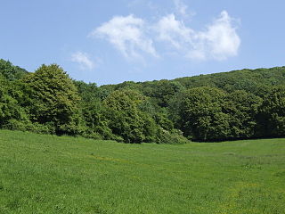
Cheddar Wood is an 86.9-hectare (215-acre) biological Site of Special Scientific Interest at Cheddar in the Mendip Hills, Somerset, England, notified in 1967.

Edford Woods and Meadows is a 54.3 hectare biological Site of Special Scientific Interest, between Nettlebridge, Holcombe and Stoke St Michael, Somerset, notified in 1957.
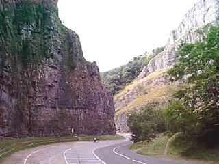
The Cheddar Complex is a 441.3-hectare (1,090-acre) biological Site of Special Scientific Interest near Cheddar around the Cheddar Gorge and north east to Charterhouse in the Mendip Hills, Somerset, England, notified in 1952.

Postlebury Wood is an 87 hectare biological Site of Special Scientific Interest south of Trudoxhill in Somerset, notified in 1987.

Barle Valley is a 1,540 acres (620 ha) Site of Special Scientific Interest within Exmoor National Park, situated in the counties of Devon and Somerset through which the River Barle flows. It was notified in its current form under the Wildlife and Countryside Act in 1988. The site includes the Somerset Wildlife Trust's Mounsey Wood Nature Reserve and the Knaplock and North Barton SSSI which has been notified since 1954.

Great Breach and Copley Woods is a 64.8 hectare biological Site of Special Scientific Interest 1 km south of Compton Dundon and 5 km south-east of Street in Somerset, England, notified in 1972.

Longleat Woods is a 249.9 hectare biological Site of Special Scientific Interest south of Frome in Somerset, notified in 1972.

Thurlbear Wood and Quarrylands is a 26.7 hectare biological Site of Special Scientific Interest south of Stoke St Mary in Somerset, notified in 1963.

Stockwood is a residential area and council ward in south Bristol, between Whitchurch and Brislington, and west of the Somerset town of Keynsham.

Sparkford is a village and civil parish in Somerset, England. The parish includes the village of Weston Bampfylde.

North Cadbury is a village and civil parish 5 miles (8 km) west of Wincanton, by the River Cam, in the Unitary Authority of Somerset, England. It shares its parish council with nearby Yarlington and its civil parish includes the village of Galhampton, which got its name from the settlement of the rent-paying peasants, and the hamlet of Woolston.
As is the case with most native populations that did not use systems of writing for most or all of their history, much of what is known about Native Americans comes from the records of the Europeans who first encountered them in the late 16th and early 17th centuries. Some of these accounts are accurate, while some include parts that are accurate and other parts that reflect their biases towards native peoples. One aspect of native life which the European colonists often remarked upon, when they left written records, was their system of agriculture.
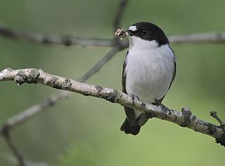
Nagshead SSSI is a 297 acres (120 ha) biological Site of Special Scientific Interest located within RSPB Nagshead, near Parkend, in the Forest of Dean, Gloucestershire.

Dingle Wood is a 9.95-hectare (24.6-acre) biological Site of Special Scientific Interest in Gloucestershire, notified in 1972. The site is listed in the 'Forest of Dean Local Plan Review' as a Key Wildlife Site (KWS). The wood is located within the Forest of Dean Forest Park and the Wye Valley Area of Outstanding Natural Beauty.
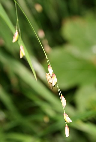
Melica uniflora, commonly known as wood melick, is a species of grass in the family Poaceae that is native to much of Europe, and to parts of South West Asia and North Africa.


