
The River Parrett flows through the counties of Dorset and Somerset in South West England, from its source in the Thorney Mills springs in the hills around Chedington in Dorset. Flowing northwest through Somerset and the Somerset Levels to its mouth at Burnham-on-Sea, into the Bridgwater Bay nature reserve on the Bristol Channel, the Parrett and its tributaries drain an area of 660 square miles (1,700 km2) – about 50 per cent of Somerset's land area, with a population of 300,000.

The Halvergate Marshes are an area of grazing marsh in the east of the English county of Norfolk. They form part of the area of The Broads and lie between the River Bure and the River Yare, bordering Breydon Water on the east. The marshes cover an area of around 2,642 hectares An area of 1,432.7-hectare (3,540-acre) is a biological Site of Special Scientific Interest. Some areas are also in the Breydon Water Local Nature Reserve, the Broadland and Breydon Water Ramsar sites, The Broads Special Area of Conservation, and The Broads and Breydon Water Special Protection Areas.
Bridgwater Bay is on the Bristol Channel, 5 kilometres (3.1 mi) north of Bridgwater in Somerset, England at the mouth of the River Parrett and the end of the River Parrett Trail. It stretches from Minehead at the southwestern end of the bay to Brean Down in the north. The area consists of large areas of mudflats, saltmarsh, sandflats and shingle ridges, some of which are vegetated. It has been designated as a Site of Special Scientific Interest (SSSI) covering an area of 3,574.1 hectares since 1989, and is designated as a wetland of international importance under the Ramsar Convention. The risks to wildlife are highlighted in the local Oil Spill Contingency Plan.
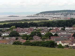
Weston-super-Mare, also known as just Weston is a seaside town in North Somerset, England, on the Bristol Channel 18 miles (29 km) south west of Bristol between Worlebury Hill and Bleadon Hill. It includes the suburbs of Oldmixon, West Wick and Worle. Its population at the 2011 census was 76,143. Since 1983, Weston has been twinned with Hildesheim, Germany.

Gordano is an area of North Somerset, in England. It has been designated as a National Nature Reserve.
Westonzoyland is a village and civil parish in Somerset, England. It is situated on the Somerset Levels, 4 miles (6.4 km) south east of Bridgwater.

Biddle Street, Yatton is a 44.8 hectare biological Site of Special Scientific Interest (SSSI) near the village of Yatton in North Somerset, notified in 1994.

Tickenham, Nailsea and Kenn Moors SSSI is a 129.4 hectare biological Site of Special Scientific Interest between Tickenham, Nailsea and Kenn on the North Somerset Levels, notified in 1995.

Draycott Sleights is a 61.95 hectares biological Site of Special Scientific Interest at Draycott in the Mendip Hills, Somerset, notified in 1987.

Catcott, Edington and Chilton Moors SSSI is a 1083 hectare biological Site of Special Scientific Interest in Somerset, England notified in 1967. It is close to the villages of Edington and Catcott.
North Moor is a 676.3 hectare biological Site of Special Scientific Interest near Lyng in Somerset, notified in 1986.

Curry and Hay Moors is a 472.8 hectare biological Site of Special Scientific Interest in Somerset, notified in 1992.

Great Breach and Copley Woods is a 64.8 hectare biological Site of Special Scientific Interest 1 km south of Compton Dundon and 5 km south-east of Street in Somerset, England, notified in 1972.

Tealham and Tadham Moors is a 917.6 hectare biological Site of Special Scientific Interest south of Wedmore in Somerset, notified in 1985.
West Moor is a 213.0 hectare biological Site of Special Scientific Interest on the River Parrett in Somerset, notified in 1985.

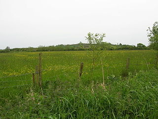
West Sedgemoor or West Sedge Moor is an area of the Somerset Levels, in Somerset, England, around 8 miles east of Taunton, which approximately coincides with the West Sedgemoor biological Site of Special Scientific Interest, a 1,016 hectare site notified as an SSSI in 1983. It is a flat, low-lying area of fields and meadows separated by water-filled rhynes and ditches. It is subject to controlled flooding in winter. It is drained by the River Parrett.

Westhay Moor is a 513.7-hectare (1,269-acre) biological Site of Special Scientific Interest 2.5 kilometres (1.6 mi) north-east of Westhay village and 4 kilometres (2.5 mi) from Wedmore in Somerset, England, notified in 1971. Westhay Moor is also notified as part of the Somerset Levels and Moors Special Protection Area under the EU Birds Directive and as a Ramsar Site, and a National Nature Reserve.

Ham Wall is an English wetland National Nature Reserve (NNR) situated 4 kilometres (2.5 mi) west of Glastonbury on the Somerset Levels and managed by the Royal Society for the Protection of Birds (RSPB). Since the last Ice Age, decomposing plants in the marshes of the Brue valley in Somerset have accumulated as deep layers of peat that were commercially exploited on a large scale in the twentieth century. Consumer demand eventually reduced, and in 1994 the landowners, Fisons, gave their old workings to what is now Natural England, who passed the management of the 260 hectares Ham Wall section to the RSPB.
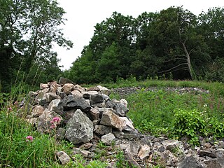
Worlebury Camp is the site of an Iron Age hillfort on Worlebury Hill, north of Weston-super-Mare in Somerset, England. The fort was designed for defence, as is evidenced by the number of walls and ditches around the site. Several large triangular platforms have been uncovered around the sides of the fort, lower down on the hillside. Nearly one hundred storage pits of various sizes were cut into the bedrock, and many of these had human remains, coins, and other artefacts in them. During the 19th and 20th centuries the fort has suffered damage and been threatened with complete destruction on multiple occasions. The site has been designated a Scheduled monument; it falls within the Weston Woods Local Nature Reserve which was declared to Natural England by North Somerset Council in 2005.

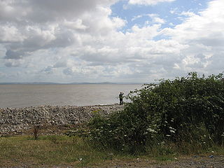
Sand Point in Somerset, England, is the peninsula stretching out from Middle Hope, an 84.1-hectare (208-acre) biological and geological Site of Special Scientific Interest. It lies to the north of the village of Kewstoke, and the stretch of coastline called Sand Bay north of the town of Weston-super-Mare. On a clear day it commands views over Flat Holm, of the Bristol Channel, South Wales, Clevedon, the Second Severn Crossing and the Severn Bridge. A line drawn between Sand Point and Lavernock Point in South Wales marks the lower limit of the Severn Estuary and the start of the Bristol Channel.


