The Avon Wildlife Trust aims to protect and promote wildlife in the area of the former county of Avon — now Bath and North East Somerset, Bristol, North Somerset and South Gloucestershire, in England. It has its headquarters in Bristol and runs wildlife centres at Folly Farm, Somerset and Feed Bristol, Frenchay, North Bristol.

Burrington Combe is a Carboniferous Limestone gorge near the village of Burrington, on the north side of the Mendip Hills Area of Outstanding Natural Beauty, in North Somerset, England.

Bishop Sutton is a village on the northern slopes of the Mendip Hills, within the affluent Chew Valley in Somerset. It lies east of Chew Valley Lake and north east of the Mendip Hills, approximately ten miles south of Bristol on the A368, Weston-super-Mare to Bath road between West Harptree and Chelwood. Bishop Sutton and the neighbouring village of Stowey form the civil parish of Stowey Sutton.

Dolebury Warren is a 90.6 hectares biological Site of Special Scientific Interest (SSSI) and ancient monument near the villages of Churchill and Rowberrow in North Somerset, part of South West England. It is owned by the National Trust, who acquired the freehold in 1983, and managed by the Avon Wildlife Trust.

Wurt Pit and Devil's Punchbowl is a 0.2 hectare geological Site of Special Scientific Interest between East Harptree and the Priddy Circles in the Mendip Hills, Somerset, notified in 1987.

Priddy is a village in Somerset, England in the Mendip Hills, close to East Harptree and 4 miles (6 km) north-west of Wells. It is in the local government district of Mendip.

Chancellor's Farm is a 34.2-hectare biological Site of Special Scientific Interest just north of Priddy in the Mendip Hills, Somerset, notified in 1984.

Draycott Sleights is a 61.95 hectares biological Site of Special Scientific Interest at Draycott in the Mendip Hills, Somerset, England, notified in 1987. The name is pronounced locally as "Slates", presumably a variation on the Saxon word Slade meaning amongst other things hillside, rather than in the same manner as the Yorkshire place of the same spelling.
Priddy Caves is an Area: 67.6 hectare geological Site of Special Scientific Interest at Priddy in the Mendip Hills, Somerset, notified in 1965.
Priddy Pools is a 52.7-hectare (130-acre) geological Site of Special Scientific Interest at Priddy in the Mendip Hills, Somerset, notified in 1972.

Priddy Mineries is a nature reserve previously run by the Somerset Wildlife Trust. It is in the village of Priddy, on the Mendip Hills in Somerset.

The Cheddar Complex is a 441.3 hectare biological Site of Special Scientific Interest near Cheddar around the Cheddar Gorge and north east to Charterhouse in the Mendip Hills, Somerset, England, notified in 1952.
Thrupe Lane Swallet is a 0.5 hectares geological Site of Special Scientific Interest in Somerset, notified in 1992. It is also a Geological Conservation Review site.

Charterhouse, also known as Charterhouse-on-Mendip, is a hamlet in the Mendip Hills Area of Outstanding Natural Beauty (AONB) in the English county of Somerset. The area between Charterhouse and Cheddar Gorge including Velvet Bottom and Ubley Warren is covered by the Cheddar Complex Site of Special Scientific Interest.

St Cuthbert's Swallet is the second longest, and most complex, cave on the Mendip Hills, in Somerset, England. It forms a major part of the Priddy Caves system and water entering this swallet re-emerges at Wookey Hole. St Cuthbert's Swallet is part of, and lies underneath, the Priddy Pools Site of Special Scientific Interest.

Seale Chalk Pit is a 1.2-hectare (3.0-acre) geological Site of Special Scientific Interest west of Guildford in Surrey. It is a Geological Conservation Review site and part of the Seale Chalk Pit and Meadow 3-hectare (7.4-acre) private nature reserve, which is managed by the Surrey Wildlife Trust.
Hunter's Hole is a cave in the Mendip Hills in Somerset, England. It is behind a pub, known as the Hunters Lodge Inn just outside Priddy where visitors can park. It is accessed via a permanent ladder, about 100m behind the pub in a small dip between some trees.

The Mells River flows through the eastern Mendip Hills in Somerset, England. It rises at Gurney Slade and flows east joining the River Frome at Frome.
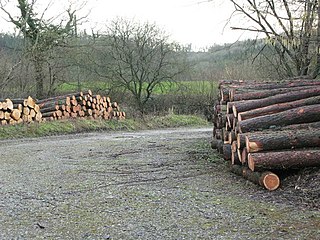
Harridge Wood is an area of woodland in Somerset, England. From about 1300 AD part of the wood was the scene of coal mining, which continued until around 1800. The traces of mining have been well preserved, and are now a scheduled site. The woodland is now part of the Harridge Woods Nature Reserve. Large areas were planted for timber in the mid-20th century, and this continues to be harvested. The nature reserve is steadily reintroducing the original flora.
