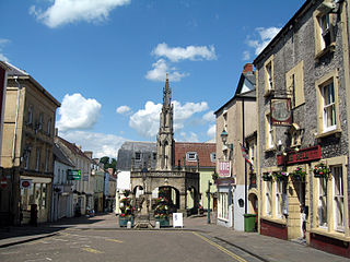
Shepton Mallet is a market town and civil parish in the Mendip District of Somerset, England, some 16 miles (26 km) south-west of Bath, 18 miles (29 km) south of Bristol and 5 miles (8.0 km) east of Wells. It had an estimated population of 10,810 in 2019. Mendip District Council is based there. The Mendip Hills lie to the north and the River Sheppey runs through the town, as does the route of the Fosse Way, the main Roman road between north-east and south-west England. There is evidence of Roman settlement. Its listed buildings include a medieval parish church. Shepton Mallet Prison was England's oldest, but closed in March 2013. The medieval wool trade gave way to trades such as brewing in the 18th century. It remains noted for cider production. It is the closest town to the Glastonbury Festival and nearby the Royal Bath and West of England Society showground.

Mendip is a local government district of Somerset in England. The district covers a largely rural area of 285 square miles (738 km2) with a population of approximately 112,500, ranging from the Wiltshire border in the east to part of the Somerset Levels in the west. The district takes its name from the Mendip Hills which lie in its northwest. The administrative centre of the district is Shepton Mallet but the largest town is Frome.

The East Somerset Railway is a 2+1⁄2-mile (4 km) heritage railway in Somerset, running between Cranmore and Mendip Vale. Prior to the Beeching Axe, the railway was once part of the former Cheddar Valley line that ran from Witham to Yatton, meeting the Somerset and Dorset Joint Railway at Wells.
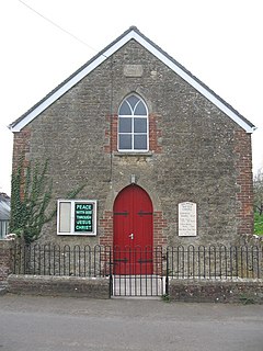
Brewham is a civil parish in Somerset, England, consisting of the villages of North Brewham and South Brewham, on either side of the river in the Brue Valley 3 miles (4.8 km) east of Bruton and 9 miles (14.5 km) south-west of Frome in the South Somerset district. The parish has a population of 441.

Binegar is a small village and civil parish in Somerset, England. It is located on the A37, 4 miles (6.4 km) east of Wells, between Shepton Mallet and Chilcompton. Its population in 2011 was 313. Binegar and Gurney Slade on the opposite side of the A37 are effectively a single village and share a sign on the main road. In Gurney Slade, the quarry and houses on the north side of Tape Lane are in Binegar parish whilst the south side is in Ashwick parish. In Binegar, some houses on the south side of Station Road are in Ashwick parish and some on the north side of the village are in Emborough parish.

Wellow is a village and civil parish in Somerset, England, about 5 miles (8.0 km) south of Bath. The parish, which includes the hamlets of Twinhoe, White Ox Mead, Baggridge and part of Midford has a population of 529. The village itself falls within the southernmost boundary of the Cotswolds Area of Outstanding Natural Beauty and is recognised as having special architectural and historic interest, which led to it being designated as a Conservation Area in 1983.
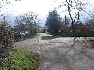
Shepton Montague is a village and civil parish in Somerset, England. It is situated on the River Pitt in the South Somerset district midway between Wincanton, Bruton and Castle Cary.

Midsomer Norton railway station was a station on the Somerset and Dorset Joint Railway between Bath Green Park and Shepton Mallet. It served the town of Midsomer Norton in the English county of Somerset, which was also served by a second station known as Midsomer Norton and Welton railway station on the Bristol and North Somerset Railway.

Witham (Somerset) railway station was a station serving the Somerset village of Witham Friary and was located on the Frome to Yeovil section of the Wilts, Somerset and Weymouth Railway that opened in 1856.

Cook's Wood Quarry also known as Holcombe Quarry is a 0.8 hectare geological Site of Special Scientific Interest near Stoke St Michael on the Mendip Hills in Somerset, notified in 1988.

Windsor Hill Quarry is a 0.8 hectare geological Site of Special Scientific Interest near Shepton Mallet on the Mendip Hills in Somerset, adjacent to the Windsor Hill Marsh biological Site of Special Scientific Interest. It was notified in 1971.

Windsor Hill Marsh is a 0.84 hectare biological Site of Special Scientific Interest, north of the town of Shepton Mallet in Somerset, and adjacent to the Windsor Hill Quarry geological Site of Special Scientific Interest. It was notified in January 1972.

Viaduct Quarry is a 0.3 hectare geological Site of Special Scientific Interest near Shepton Mallet on the Mendip Hills in Somerset, notified in 1984.
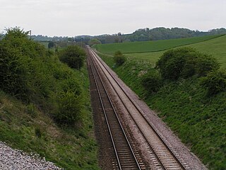
Laycock Railway Cutting is a 1.3 hectare geological Site of Special Scientific Interest near Milborne Port in Somerset, notified in 1993. It is a Geological Conservation Review site.
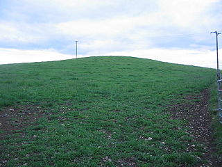
Maes Down is a 0.2 hectare geological Site of Special Scientific Interest between Shepton Mallet and Stoney Stratton in Somerset, notified in 1985. It is a Geological Conservation Review site.

Downhead is a village and civil parish close to Leigh-on-Mendip and 5 miles (8 km) north east of Shepton Mallet, in the Mendip district of Somerset, England. The parish includes the medieval settlement of Tadhill.
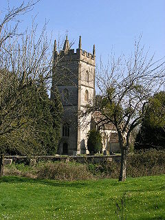
Pylle is a village and civil parish 4 miles (6.4 km) south west of Shepton Mallet, and 7 miles (11.3 km) from Wells, in the Mendip district of Somerset, England. It has a population of 160. The parish includes the hamlet of Street on the Fosse.

Stoke St Michael is a village and civil parish on the Mendip Hills 4 miles (6.4 km) north east of Shepton Mallet, and 8 miles (12.9 km) west of Frome, in the Mendip district of Somerset, England.
The Mendip Way is an 80-kilometre (50 mi) long-distance footpath across the Mendip Hills from Weston-super-Mare to Frome. It is divided into two sections.

Shepton Mallet was a railway station on the East Somerset Railway, serving the town of Shepton Mallet in the English county of Somerset.


