
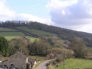
Cheddar is a large village and civil parish in the English county of Somerset. It is situated on the southern edge of the Mendip Hills, 9 miles (14 km) north-west of Wells, 11 miles (18 km) south-east of Weston-super-Mare and 18 miles (29 km) south-west of Bristol. The civil parish includes the hamlets of Nyland and Bradley Cross. The parish had a population of 5,755 in 2011 and an acreage of 8,592 acres (3,477 ha) as of 1961.

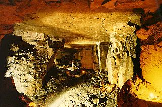
A site of special scientific interest (SSSI) in Great Britain, or an area of special scientific interest (ASSI) in the Isle of Man and Northern Ireland, is a conservation designation denoting a protected area in the United Kingdom and Isle of Man. SSSI/ASSIs are the basic building block of site-based nature conservation legislation and most other legal nature/geological conservation designations in the United Kingdom are based upon them, including national nature reserves, Ramsar sites, Special Protection Areas, and Special Areas of Conservation. The acronym "SSSI" is often pronounced "triple-S I".

Milborne Port is a village, electoral ward and civil parish in Somerset, England, east of Sherborne, and in the South Somerset district. It has a population of 2,802. The parish includes the hamlets of Milborne Wick and Kingsbury Regis.
Browne's Folly, or Brown's Folly, is a folly tower sitting within a 39.9 hectare biological and geological Site of Special Scientific Interest (SSSI) near the English village of Bathford in Somerset, notified in 1974: the site itself is known as the Farleigh Down Stone Quarry and is managed as a nature reserve by the Avon Wildlife Trust (AWT). The tower was built in 1848 and is a Grade II listed building.
Hinton Hill, Wellow is a 0.25 hectare geological Site of Special Scientific Interest (SSSI) near the village of Wellow in Somerset, notified in 1996.

Bruton Railway Cutting is a 1.7 hectare geological Site of Special Scientific Interest at Bruton in Somerset, notified in 1971.

Doulting Railway Cutting is a 2.8 hectare geological Site of Special Scientific Interest in Somerset, notified in 1971.
Shepton Montague Railway Cutting is a 1.61 hectare geological Site of Special Scientific Interest at Shepton Montague in Somerset, notified in 1992.
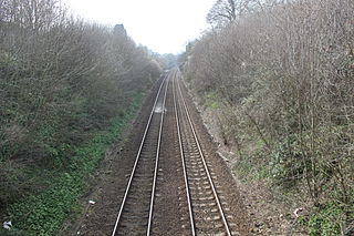
Godminster Lane Quarry and Railway Cutting is a 0.8 hectare geological Site of Special Scientific Interest at Pitcombe in Somerset, notified in 1971.

Langport Railway Cutting is a 0.5 hectare geological Site of Special Scientific Interest at Langport in Somerset, England, notified in 1992. It is a Geological Conservation Review site.
Veizey's Quarry is a 1.4 hectare geological Site of Special Scientific Interest near Tetbury in Gloucestershire, notified in 1974. It is in the Cotswold Area of Outstanding Natural Beauty. The site is listed in the 'Cotswold District' Local Plan 2001-2011 as a Key Wildlife Site (KWS) and a Regionally Important Geological Site (RIGS).
Easter Park Farm Quarry is a 0.15-hectare (0.37-acre) geological Site of Special Scientific Interest in Gloucestershire, notified in 1986. The site is listed in the ‘Stroud District’ Local Plan, adopted November 2005, Appendix 6 as an SSSI and a Regionally Important Geological Site (RIGS).
Harford Railway Cutting is a 1.2-hectare (3.0-acre) geological Site of Special Scientific Interest in Gloucestershire, notified in 1974. The site is listed in the 'Cotswold District' Local Plan 2001-2011 as a Regionally Important Geological Site (RIGS).
Kemble Railway Cuttings is a 2.72-hectare (6.7-acre) geological Site of Special Scientific Interest in Gloucestershire, England, notified in 1996. The site is listed in the Cotswold District Local Plan 2001–2011 as a Regionally Important Geological Site (RIGS).

Minchinhampton Common is a 182.7-hectare (451-acre) biological and geological Site of Special Scientific Interest in Minchinhampton, Gloucestershire, England, notified in 1972.
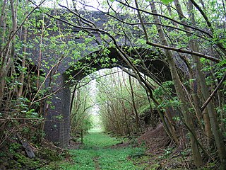
Notgrove Railway Cutting is a 1.7-hectare (4.2-acre) geological Site of Special Scientific Interest in Gloucestershire, notified in 1974. The site is listed in the 'Cotswold District' Local Plan 2001-2011 as a Key Wildlife Site (KWS) and Regionally Important Geological Site (RIGS).
Stony Furlong Railway Cutting is a 2.7-hectare (6.7-acre) geological Site of Special Scientific Interest in Gloucestershire, notified in 1987. The site is listed in the 'Cotswold District' Local Plan 2001-2011 as a Key Wildlife Site (KWS) and a Regionally Important Geological Site (RIGS).

Ardley Cutting and Quarry is a 40.1-hectare (99-acre) biological and geological Site of Special Scientific Interest north-west of Bicester in Oxfordshire. It is a Geological Conservation Review site and an area of 11 hectares is managed by the Berkshire, Buckinghamshire and Oxfordshire Wildlife Trust as Ardley Wood Quarry. The site contains a Scheduled Monument, Ardley Wood moated ringwork, a Norman defended enclosure.

