
Dundry Hill is immediately south of Bristol, England: it includes farmland, a small number of houses and a church. It stretches east–west for some two miles. Most of the hill is within the district of North Somerset. At the hill's eastern end the southern slopes are within Bath and North East Somerset, and the northern slopes are within the city and county of Bristol, including the highest point in that county.
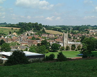
Bruton is a small town, electoral ward, and civil parish in Somerset, England, on the River Brue and the A359 between Frome and Yeovil. It is 7 miles south-east of Shepton Mallet, just south of Snakelake Hill and Coombe Hill, 10 miles north-west of Gillingham and 12 miles south-west of Frome in South Somerset district. The town and ward have a population of 2,907. The parish includes the hamlets of Wyke Champflower and Redlynch. Bruton has a museum of items from its past from the Jurassic onwards. It includes a table used by the author John Steinbeck on a six-month stay. The River Brue has a history of flooding. In 1768 it destroyed a stone bridge. On 28 June 1917, 242.8 mm of rain fell in 24 hours, leaving a watermark on a pub 20 feet above mean level. In 1984 a protective dam was built 1 km upstream.

Somerset is a rural county in the southwest of England, covering 4,171 square kilometres (1,610 sq mi). It is bounded on the north-west by the Bristol Channel, on the north by Bristol and Gloucestershire, on the north-east by Wiltshire, on the south-east by Dorset, and on the south west and west by Devon. It has broad central plains with several ranges of low hills. The landscape divides into four main geological sections from the Silurian through the Devonian and Carboniferous to the Permian which influence the landscape, together with water-related features.

Barns Batch Spinney is a 0.06-hectare geological Site of Special Scientific Interest near the village of Dundry, North Somerset, notified in 1987.

Dundry Main Road South Quarry is a 0.7 hectare geological Site of Special Scientific Interest near the village of East Dundry, North Somerset, notified in 1974.
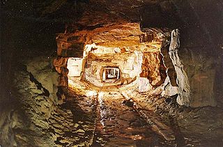
Combe Down and Bathampton Down Quarries make up a 6.22 hectare Site of Special Scientific Interest (SSSI) in Bath and North East Somerset, England, important for its bat population. The disused quarries date from the 17th and 18th centuries and were the source of Bath stone for the city of Bath and elsewhere in the UK. A five-year project to stabilise the quarry workings was largely completed by November 2009.

The Cheddar Complex is a 441.3 hectare biological Site of Special Scientific Interest near Cheddar around the Cheddar Gorge and north east to Charterhouse in the Mendip Hills, Somerset, England, notified in 1952.

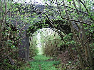
Doulting Railway Cutting is a 2.8 hectare geological Site of Special Scientific Interest in Somerset, notified in 1971.

Leighton Road Cutting is a 0.6 hectare geological Site of Special Scientific Interest between East Cranmore and Cloford in Somerset, notified in 1984. It is a Geological Conservation Review site
Frogden Quarry is a 0.2 hectare geological Site of Special Scientific Interest in Dorset, England, notified in 1954, by geologist Benjamin Starr. It exposes rocks of the Inferior Oolite, of Aalenian and Bajocian age. The sequence largely consists of limestone, with some marl and siltstone.
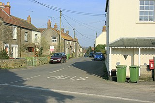
Wanstrow is a village and civil parish 6 miles (9.7 km) south west of Frome in the Mendip district of Somerset, England. The parish includes the village of Cloford.

Pitcombe is a village and civil parish 1 mile (2 km) south-west of Bruton and 5 miles (8 km) from Wincanton in Somerset, England. It has a population of 532. The parish includes the hamlets of Cole and Godminster.
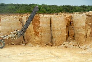
Doulting Stone Quarry is a limestone quarry at Doulting, on the Mendip Hills, Somerset, England.

The Inferior Oolite is a sequence of Jurassic age sedimentary rocks in Europe. It was deposited during the Middle Jurassic. The Inferior Oolite Group as more recently defined is a Jurassic lithostratigraphic group in southern and eastern England. It has been variously known in the past as the Under Oolite, the Inferior Oolite, the Inferior Oolite Series and the Redbourne Group.

Wotton Hill is a hill on the edge of the Cotswold Hills in Gloucestershire, England, 0.5 miles (0.80 km) north of Wotton-under-Edge. The Cotswold Way passes over the hill.

Harford Railway Cutting is a 1.2-hectare (3.0-acre) geological Site of Special Scientific Interest in Gloucestershire, notified in 1974. The site is listed in the 'Cotswold District' Local Plan 2001-2011 as a Regionally Important Geological Site (RIGS).

Nibley Knoll is a 3.2-hectare (7.9-acre) geological Site of Special Scientific Interest in Gloucestershire, notified in 1974. The site is listed in the ‘Stroud District’ Local Plan, adopted November 2005, Appendix 6 as an SSSI and a Regionally Important Geological Site (RIGS).
Notgrove Railway Cutting is a 1.7-hectare (4.2-acre) geological Site of Special Scientific Interest in Gloucestershire, notified in 1974. The site is listed in the 'Cotswold District' Local Plan 2001-2011 as a Key Wildlife Site (KWS) and Regionally Important Geological Site (RIGS).

The geology of the Isle of Wight is dominated by sedimentary rocks of Cretaceous and Paleogene age. This sequence was affected by the late stages of the Alpine Orogeny, forming the Isle of Wight monocline, the cause of the steeply-dipping outcrops of the Chalk Group and overlying Paleogene strata seen at The Needles, Alum Bay and Whitecliff Bay.

Finedon Top Lodge Quarry, also known as Finedon Gullet is a 0.9 hectare geological Site of Special Scientific Interest east of Wellingborough in Northamptonshire. It is a Geological Conservation Review site revealing a sequence of middle Jurassic limestones, sandstones and ironstones, and is the type section for a sequence of sedimentary rocks known as the 'Wellingborough Member'. It was created by quarrying for the underlying ironstone for use at Wellingborough and Corby Steelworks; the ore was transported by the 1,000 mm gauge Wellingborough Tramway.

