Hurcott Farm

Last updated
Hurcott Farm
Site of Special Scientific Interest
Somerset UK location map.svg
Red pog.svg
Location within Somerset
Area of Search Somerset
Grid reference ST511295
Coordinates 51°03′46″N2°41′57″W / 51.06274°N 2.69918°W / 51.06274; -2.69918 Coordinates: 51°03′46″N2°41′57″W / 51.06274°N 2.69918°W / 51.06274; -2.69918
Interest Geological
Area 26.3 hectares (0.263 km2; 0.102 sq mi)
Notification 1993 (1993)
Natural England website

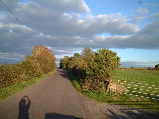
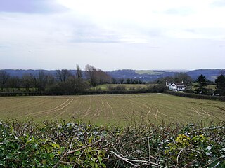
Hurcott Farm (grid reference ST511295 ) is a 26.3 hectare geological Site of Special Scientific Interest in Somerset, notified in 1993.

Ordnance Survey National Grid System of geographic grid references used in Great Britain

The Ordnance Survey National Grid reference system is a system of geographic grid references used in Great Britain, distinct from latitude and longitude. It is often called British National Grid (BNG).

Hectare metric unit of area

The hectare is an SI accepted metric system unit of area equal to a square with 100-metre sides, or 10,000 m2, and is primarily used in the measurement of land. There are 100 hectares in one square kilometre. An acre is about 0.405 hectare and one hectare contains about 2.47 acres.

Somerset County of England

Somerset is a county in South West England which borders Gloucestershire and Bristol to the north, Wiltshire to the east, Dorset to the south-east and Devon to the south-west. It is bounded to the north and west by the Severn Estuary and the Bristol Channel, its coastline facing southeastern Wales. Its traditional border with Gloucestershire is the River Avon. Somerset's county town is Taunton.

Corbicula fluminalis Corbicula fluminalis.jpg
Corbicula fluminalis

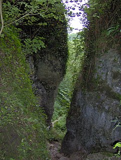
At this site heavily cemented Pleistocene terrace gravels of the River Cary have yielded an abundant freshwater and terrestrial molluscan fauna. The fauna has an interglacial aspect, and includes Corbicula fluminalis and Pisidium clessini. This site is of critical importance as the keystone of the Pleistocene stratigraphy of southern Somerset, and as a freshwater facies-equivalent of the Burtle Beds.

The Pleistocene is the geological epoch which lasted from about 2,588,000 to 11,700 years ago, spanning the world's most recent period of repeated glaciations. The end of the Pleistocene corresponds with the end of the last glacial period and also with the end of the Paleolithic age used in archaeology.

Mollusca Large phylum of invertebrate animals

Mollusca is the second largest phylum of invertebrate animals. The members are known as molluscs or mollusks. Around 85,000 extant species of molluscs are recognized. The number of fossil species is estimated between 60,000 and 100,000 additional species.

Fauna set of animal species in any particular region and time

Fauna is all of the animal life present in a particular region or time. The corresponding term for plants is flora. Flora, fauna and other forms of life such as fungi are collectively referred to as biota. Zoologists and paleontologists use fauna to refer to a typical collection of animals found in a specific time or place, e.g. the "Sonoran Desert fauna" or the "Burgess Shale fauna". Paleontologists sometimes refer to a sequence of faunal stages, which is a series of rocks all containing similar fossils. The study of animals of a particular region is called faunistics.

Sources

Related Research Articles

Weston in Gordano a village located in  Weston-in-Gordano, United Kingdom

Weston in Gordano is a village and civil parish in Somerset, England. It is situated in the middle of the Gordano valley on the north side, and in the Unitary Authority of North Somerset, on the road between Clevedon and Portishead. The parish has a population of 301.

Ebbor Gorge

Ebbor Gorge is a limestone gorge in Somerset, England, designated and notified in 1952 as a 63.5-hectare (157-acre) biological Site of Special Scientific Interest in the Mendip Hills. It was donated to the National Trust in 1967 and is now managed by Natural England as a National Nature Reserve.

Strandzha mountain range

Strandzha is a mountain massif in southeastern Bulgaria and the European part of Turkey. It is in the southeastern part of the Balkans between the plains of Thrace to the west, the lowlands near Burgas to the north, and the Black Sea to the east. Its highest peak is Mahya Dağı in Turkey, while the highest point on Bulgarian territory is Golyamo Gradishte. The total area is approximately 10,000 km2 (3,861 sq mi).

Bleadon Hill

Bleadon Hill is a 13.52 hectare geological Site of Special Scientific Interest just north of the village of Bleadon, North Somerset, notified in 1999.

Dundry Main Road South Quarry

Dundry Main Road South Quarry is a 0.7 hectare geological Site of Special Scientific Interest near the village of East Dundry, North Somerset, notified in 1974.

Biddle Street, Yatton

Biddle Street, Yatton is a 44.8 hectare biological Site of Special Scientific Interest (SSSI) near the village of Yatton in North Somerset, notified in 1994.

Ham Green SSSI

Ham Green SSSI is a 1.1 hectare geological Site of Special Scientific Interest near the village of Ham Green, North Somerset, notified in 1990.

Holly Lane SSSI

Holly Lane SSSI is a 0.5 hectare geological Site of Special Scientific Interest near the village of Walton St. Mary, North Somerset, notified in 1990.

Nightingale Valley

Nightingale Valley is a 5.4 hectare geological Site of Special Scientific Interest near the town of Portishead, North Somerset, notified in 1989.

Weston-in-Gordano SSSI

Weston-in-Gordano SSSI is a 12.55 hectare geological Site of Special Scientific Interest near the village of Weston in Gordano, North Somerset, notified in 1993.

Kenn Church, Kenn Pier & Yew Tree Farm SSSI

Kenn Church, Kenn Pier & Yew Tree Farm SSSI is a 15.37 hectare geological Site of Special Scientific Interest near the village of Kenn, Somerset, notified in 1997.

Brimble Pit and Cross Swallet Basins

Brimble Pit and Cross Swallet Basins is a 154.3 hectare geological Site of Special Scientific Interest between Wookey Hole and Priddy in the Mendip Hills, Somerset, notified in 1987.

Cheddar Complex

The Cheddar Complex is a 441.3 hectare biological Site of Special Scientific Interest near Cheddar around the Cheddar Gorge and north east to Charterhouse in the Mendip Hills, Somerset, notified in 1952.

Glenthorne

Glenthorne is a 13.3 hectare geological Site of Special Scientific Interest in the parish of Oare within the Exmoor National Park, on the border of Somerset and Devon, notified in 1989.

Greylake geological Site of Special Scientific Interest near Middlezoy in Somerset

Greylake is a 9.3 hectare geological Site of Special Scientific Interest near Middlezoy in Somerset, notified in 1987.

Langport Railway Cutting

Langport Railway Cutting is a 0.5 hectare geological Site of Special Scientific Interest at Langport in Somerset, England, notified in 1992. It is a Geological Conservation Review site.

Low Ham village in United Kingdom

Low Ham is a village in the civil parish of High Ham in the English county of Somerset.

Middlezoy village in the United Kingdom

Middlezoy is a village and civil parish on the River Parrett as it crosses the Somerset Levels in the Sedgemoor district of Somerset, England.

Picken's Hole is a small cave on the southern side of Crook Peak in the Mendip Hills in the English county of Somerset. It has been designated as a scheduled monument. It has sometimes been confused with a nearby cave called Scragg's Hole, including by the Somerset Historic Environment Record.