| Site of Special Scientific Interest | |
 | |
 Location within Somerset | |
| Area of Search | Somerset |
|---|---|
| Grid reference | ST647406 |
| Coordinates | 51°09′49″N2°30′22″W / 51.16355°N 2.50621°W Coordinates: 51°09′49″N2°30′22″W / 51.16355°N 2.50621°W |
| Interest | Geological |
| Area | 0.2 hectares (0.0020 km2; 0.00077 sq mi) |
| Notification | 1985 |
| Natural England website | |
Maes Down (grid reference ST647406 ) is a 0.2 hectare geological Site of Special Scientific Interest between Shepton Mallet and Stoney Stratton in Somerset, notified in 1985. It is a Geological Conservation Review site.

The Ordnance Survey National Grid reference system is a system of geographic grid references used in Great Britain, distinct from latitude and longitude. It is often called British National Grid (BNG).

The hectare is an SI accepted metric system unit of area equal to a square with 100-metre sides, or 10,000 m2, and is primarily used in the measurement of land. There are 100 hectares in one square kilometre. An acre is about 0.405 hectare and one hectare contains about 2.47 acres.
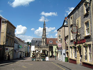
Shepton Mallet is an English town and civil parish in the Mendip District of Somerset, about 18 miles (29 km) south of Bristol and 5 miles (8.0 km) east of Wells. The town has an estimated population of 10,369. It houses the headquarters of Mendip District Council. The Mendip Hills lie to the north. The River Sheppey runs through the town, as does the route of the Fosse Way, the main Roman road into south-west England. There is evidence of Roman settlement. It contains a medieval parish church and many other listed buildings. Shepton Mallet Prison was England's oldest until its closure in March 2013. The wool trade, important in the medieval economy, was replaced by industries such as brewing in the 18th century. The town remains a prominent producer of cider. Shepton Mallet is the closest town to the Glastonbury Festival. Also nearby is the Royal Bath and West of England Society show ground.
The rocks seen at Maes Down were laid down about 190 million years ago, during the Upper Pliensbachian and Lower Toarcian Stages of the Jurassic Period of geological times, when this part of Britain lay beneath the sea.
The Pliensbachian is an age of the geologic timescale and stage in the stratigraphic column. It is part of the Early or Lower Jurassic epoch or series and spans the time between 190.8 ± 1.5 Ma and 182.7 ± 1.5 Ma. The Pliensbachian is preceded by the Sinemurian and followed by the Toarcian.
The Toarcian is, in the ICS' geologic timescale, an age and stage in the Early or Lower Jurassic. It spans the time between 182.7 Ma and 174.1 Ma. It follows the Pliensbachian and is followed by the Aalenian.
The Jurassic period was a geologic period and system that spanned 56 million years from the end of the Triassic Period 201.3 million years ago (Mya) to the beginning of the Cretaceous Period 145 Mya. The Jurassic constitutes the middle period of the Mesozoic Era, also known as the Age of Reptiles. The start of the period was marked by the major Triassic–Jurassic extinction event. Two other extinction events occurred during the period: the Pliensbachian-Toarcian extinction in the Early Jurassic, and the Tithonian event at the end; however, neither event ranks among the "Big Five" mass extinctions.