Wrington

Last updated • 5 min readFrom Wikipedia, The Free Encyclopedia

Wrington
Wringtonhighstreet.jpg
Wrington High Street
Somerset UK location map.svg
Red pog.svg
Wrington
Location within Somerset
Population2,633  [1]
OS grid reference ST470628
Unitary authority
Ceremonial county
Region
Country England
Sovereign state United Kingdom
Post town BRISTOL
Postcode district BS40
Dialling code 01934
Police Avon and Somerset
Fire Avon
Ambulance South Western
UK Parliament
List of places
UK
England
Somerset
51°21′40″N2°45′47″W / 51.361°N 2.763°W / 51.361; -2.763

Wrington is a village and a civil and ecclesiastical parish on the north slopes of the Mendip Hills in North Somerset, England. Both include nearby Redhill. Wrington lies in the valley of the Congresbury Yeo river, about 9 miles (14 km) east of Weston-super-Mare and 3 miles (4.8 km) south-east of Yatton. Its population was 2,633 at the 2011 Census. [1] [2]

Contents

History

The village was inhabited in Roman times and there is evidence of Saxon occupation as well. [3] Historically it was part of the hundred of Brent-cum-Wrington. [4]

Wrington Cottage Hospital Wrington Village Hospital. Wellcome L0001301.jpg
Wrington Cottage Hospital

Wrington Cottage Hospital opened in 1864, initially for 24 patients. [5] The first surgeon was Horace Swete, author of the Handy Book of Cottage Hospitals, [6] to which Florence Nightingale also referred in 1869. [7]

Wrington had a railway station between 1901 and 1963, on the Wrington Vale Light Railway that ran from Congresbury to Blagdon.

Governance

As a parish council, Wrington's sets an annual precept for operating costs and produces annual accounts for public scrutiny. It maintains and repairs parish facilities, [8] under the unitary authority of North Somerset, created in 1996 separately from today's non-metropolitan county and based at Weston-super-Mare. Before 1974 the parish belonged to Axbridge Rural District, [9] then in 1974–1996 to the Woodspring district of the county of Avon. [10]

An electoral ward bearing the same name includes Butcombe as well as Wrington. The ward population at the 2011 census was 2,851. [11] The parish is represented in Parliament by the North Somerset constituency, which elects one member by the first past the post system, currently Sadik Al-Hassan of the Labour Party.

Church

The church of All Saints Wringtonchurch.jpg
The church of All Saints
The old rectory with the church in the background Wringtonrectory.jpg
The old rectory with the church in the background

The Church of All Saints has 13th-century foundations. It was remodelled with a west tower added about 1450. Restoration occurred in 1859 and restoration of the tower in 1948. Either side of the door stone are busts of John Locke and Hannah More from the early 19th century. The chancel has an 1832 Gothic reredos by Charles Barry. The rood screen is from the 16th century. The tall four-stage tower has set-back buttresses crowned by crocketed pinnacles at the top stage, which displays moulded string courses and a trefoil-pierced triangular parapet with gargoyles and corner pinnacles. The building is Grade I listed [12] as "one of the highest achievements of architectural genius". [13] It dates from 1420 to 1450. [14] The belfry stairs are in the south-east turret. The tower stands 113.5 feet (35 m) to the tip of its pinnacles. [15]

The 17th-century rectory is Grade II listed. [16]

The church's bells ring automatically. Until 2012, they did so every 15 minutes even through the night, but after a noise abatement order was served, it was reduced to hourly at night. [17] [18]

Primary school

Wrington Primary School Wringtonschool.jpg
Wrington Primary School

The village primary school was opened on 1 May 1857. [19] Its premises are Grade II listed. [20]

Butcombe Brewery

A local institution is the Butcombe microbrewery, set up in nearby Butcombe in 1978 by Simon Whitmore, managing director of Courage Western, made redundant in a restructuring, and his wife Maureen. In 2003 the business was sold to Guy Newell and Paul Horsley and moved to a purpose-built brewery completed in March 2005 on an estate at Wrington. [21]

In the same year the brewery set up a joint venture with Thatchers Cider to produce a keg cider. Its 2008 output was 24,000 barrels a year through about 450 outlets. [22]

Notable residents

In birth order:

Sports

Wrington Redhill AFC plays at the recreation ground in Wrington. It has a first team, reserve team and A team. The first team plays in the Erra Somerset County League in the premier division, the reserve in Weston super Mare and District League Division 1, and A team in the W&D division 4. The club badge is a gold rampant dragon (wyvern), matching the emblem on the unofficial Flag of Somerset. The club colours are green and black.

Wrington has two senior cricket teams. The first XI is in the North Somerset Cricket League Saturday Division 1, the second in Saturday Division 3. The club's limited overs team finished as runners-up in the league's Butcombe Brewery KO Cup. The club also has youth in the North Somerset Youth Cricket Leagues at the under 17, 15, 13 and 11 levels. The facilities and pitch have been improved in the last few years. Additionally, it now has two nets for training sessions for all ages and levels.

Related Research Articles

<span class="mw-page-title-main">Cheddar, Somerset</span> Village in Somerset, England

Cheddar is a large village and civil parish in the English county of Somerset. It is situated on the southern edge of the Mendip Hills, 9 miles (14 km) north-west of Wells, 11 miles (18 km) south-east of Weston-super-Mare and 18 miles (29 km) south-west of Bristol. The civil parish includes the hamlets of Nyland and Bradley Cross. The parish had a population of 5,755 in 2011 and an acreage of 8,592 acres (3,477 ha) as of 1961.

<span class="mw-page-title-main">Mendip Hills</span> Range of limestone hills to the south of Bristol and Bath in Somerset, England

The Mendip Hills is a range of limestone hills to the south of Bristol and Bath in Somerset, England. Running from Weston-super-Mare and the Bristol Channel in the west to the Frome valley in the east, the hills overlook the Somerset Levels to the south and the Chew Valley and other tributaries of the Avon to the north. The highest point, at 325 metres (1,066 ft) above sea level, is Beacon Batch which is the summit area atop Black Down. The hills gave their name to the former local government district of Mendip, which administered most of the local area until April 2023. The higher, western part of the hills, covering 198 km2 (76 sq mi) has been designated an Area of Outstanding Natural Beauty (AONB), which gives it a level of protection comparable to a national park.

<span class="mw-page-title-main">North Somerset</span> District in England

North Somerset is a unitary authority in the ceremonial county of Somerset, England. The council is based in Weston-super-Mare, the area's largest town. The district also contains the towns of Clevedon, Nailsea and Portishead, along with a number of villages and surrounding rural areas. Some southern parts of the district fall within the Mendip Hills, a designated Area of Outstanding Natural Beauty.
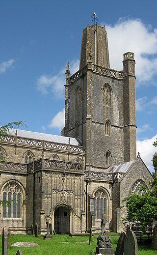
<span class="mw-page-title-main">Yatton</span> Human settlement in England

Yatton is a village and civil parish within the unitary authority of North Somerset, which falls within the ceremonial county of Somerset, England. It is located 11 miles (18 km) south-west of Bristol. Its population in 2011 was 7,552. The parish includes Claverham, a small village which was originally a farming hamlet.
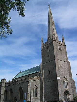
<span class="mw-page-title-main">Congresbury</span> Human settlement in England

Congresbury is a village and civil parish on the northwestern slopes of the Mendip Hills in North Somerset, England, which in 2011 had a population of 3,497. It lies on the A370 between Junction 21 of the M5 and Bristol Airport, 13 miles (21 km) south of Bristol city centre, and 7 miles (11 km) east of Weston-super-Mare. The Congresbury Yeo river flows through the village. The parish includes the hamlet of Brinsea.

<span class="mw-page-title-main">Weston-super-Mare (UK Parliament constituency)</span> Parliamentary constituency in the United Kingdom, 1918 onwards

Weston-super-Mare is a constituency represented in the House of Commons of the UK Parliament by Dan Aldridge from the Labour Party since 2024. Before then it was held since 2005 by John Penrose, a Conservative.

<span class="mw-page-title-main">Badgworth</span> Human settlement in England

Badgworth is a village and civil parish in Somerset, England, 2 miles (3.2 km) south west of Axbridge. According to the 2011 census it had a population of 525.
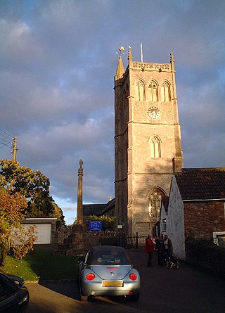
<span class="mw-page-title-main">Bleadon</span> Human settlement in England

Bleadon is a village and civil parish in Somerset, England. It is about 4 miles (6.4 km) south of Weston-super-Mare and, according to the 2021 census, has a population of 1,149.

<span class="mw-page-title-main">Blagdon</span> Human settlement in England

Blagdon is a village and civil parish in the ceremonial county of Somerset, within the unitary authority of North Somerset, in England. It is located in the Mendip Hills, a recognised Area of Outstanding Natural Beauty. According to the 2021 census it has a population of 1,184. The village is about 12 miles (19 km) east of Weston-super-Mare and 12 miles (19 km) south west of Bristol, on the A368 road to Bath.

<span class="mw-page-title-main">Churchill, Somerset</span> Village and civil parish in Somerset, England

Churchill is a village and civil parish in the unitary authority of North Somerset, part of the ceremonial county of Somerset. It is located on the western edge of the Mendip Hills, about 8 miles (12.9 km) east of Weston-super-Mare, and about 15 miles (24.1 km) south-west of Bristol. The parish, which includes the village of Lower Langford and the hamlet of Upper Langford, has a population of 2,250.

Axbridge was a rural district in Somerset, England, from 1894 to 1974. It was named after the town of Axbridge.

<span class="mw-page-title-main">Congresbury Yeo</span> River in North Somerset, England

The River Yeo is a river which flows through North Somerset, England.

<span class="mw-page-title-main">Westbury-sub-Mendip</span> Human settlement in England

Westbury-sub-Mendip is a village and civil parish in Somerset, England. The village is on the southern slopes of the Mendip Hills, 4 miles (6.4 km) from Wells and Cheddar.

<span class="mw-page-title-main">Crook Peak to Shute Shelve Hill</span> Geological and biological Site of Special Scientific Interest in Somerset, England

Crook Peak to Shute Shelve Hill is a 332.2 hectare (820.9 acre) geological and biological Site of Special Scientific Interest near the western end of the Mendip Hills, Somerset. The line of hills runs for approximately 5 kilometres (3.1 mi) from west to east and includes: Crook Peak, Compton Hill, Wavering Down, Cross Plain and Shute Shelve Hill. Most of the site is owned by the National Trust, which bought 725 acres (293 ha) in 1985, and much of it has been designated as common land. It was notified as an SSSI by Natural England in 1952.
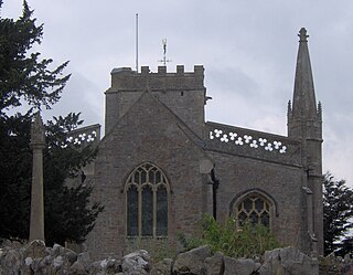
<span class="mw-page-title-main">Burrington, Somerset</span> Human settlement in England

Burrington is a small village and civil parish in Somerset, England. It is situated in the unitary authority of North Somerset, just off the A368 between Blagdon and Churchill. 5 miles (8.0 km) north east of Axbridge and about 10 miles (16 km) east of Weston-super-Mare. The parish includes the hamlets of Bourne and Rickford and has a population of 464.

<span class="mw-page-title-main">Redhill, Somerset</span> Village in Somerset, England

Redhill is a compact village at the foot of a 173 m (AOD) hill of the same name to its east and north-east. Its lower level local authority is the civil parish of Wrington which is in North Somerset, England. It straddles the A38 Bridgwater-Bristol Road. It is about 8 miles (12.9 km) SSW of Bristol and close to Bristol Airport.

<span class="mw-page-title-main">Butcombe</span> Village in Somerset, England

Butcombe is a village and civil parish in Somerset, England. The village is situated just north of Blagdon Lake, in North Somerset. The parish has a population of 218 and mainly consists of family-owned farmland. It no longer has any amenities apart from a telephone kiosk and a letter box.

William Talbot Aveline (1822–1903) was a British geologist and archaeologist.

References

  1. 1 2 "2011 Census Profile". North Somerset Council. Archived from the original (Excel) on 4 January 2014. Retrieved 4 January 2014.
  2. City Population. Retrieved 16 December 2020.
  3. "Roman Wrington". Wrington Website. Archived from the original on 6 June 2007. Retrieved 26 February 2007.
  4. "Militia in the Brent-cum-Wrington Hundred". Wrington Somerset. Archived from the original on 23 March 2012. Retrieved 12 September 2011.
  5. "Wrington village hospital". Wrington Village Records Studies of the history of a Somerset Village. Wrington. Archived from the original on 4 March 2016. Retrieved 21 January 2015.
  6. Swete, Horace (1987). Handy Book of Cottage Hospitals. Hamilton, Adams and Co.
  7. Nightiongale, Florence (2012). McDonald, Lynn (ed.). Florence Nightingale and Hospital Reform: Collected Works of Florence Nightingale, volume 16. Wilfrid Laurier Univ. Press. ISBN   9780889204713.
  8. "Local Environment". Wrington Parish Council. Archived from the original on 14 July 2014. Retrieved 2 July 2014.
  9. "Axbridge RD". A Vision of Britain Through Time. University of Portsmouth. Archived from the original on 13 October 2013. Retrieved 4 January 2014.
  10. "The Avon (Structural Change) Order 1995". HMSO. Archived from the original on 30 January 2008. Retrieved 9 December 2007.
  11. "Ward population 2011". Archived from the original on 2 April 2015. Retrieved 10 March 2015.
  12. Historic England. "Church of All Saints (1129227)". National Heritage List for England . Retrieved 26 February 2007.
  13. Brereton, R. P. (1904). "Somerset Church Towers". The Archaeological Journal. lxii. 60 collotypes prepared for a planned monograph are in the British Library, Add MSS 37260-37263, were published by the Society. Somersetshire Archaeological Society at Gillingham.
  14. Wickham, Archdale Kenneth (1965). Churches of Somerset. London: David & Charles.
  15. "Description of the church". All Saints Wrington. Archived from the original on 16 December 2007. Retrieved 5 March 2008.
  16. Historic England. "The Old Rectory (1320920)". National Heritage List for England . Retrieved 26 February 2007.
  17. Wrington All Saints Church clock silenced in noise row Archived 13 December 2012 at the Wayback Machine , BBC News, 25 April 2012.
  18. Somerset church bell to ring again after agreement reached Archived 2 December 2012 at the Wayback Machine , BBC News, 2 December 2012.
  19. Wrington's Victorian Schools, Mark Bullen 2012
  20. Historic England. "Wrington Primary School (1320923)". National Heritage List for England . Retrieved 26 February 2007.
  21. "Timeline". Butcombe Brewery. Archived from the original on 1 October 2008. Retrieved 30 September 2008.
  22. Pints West, No. 79. Autumn 2008, Campaign for Real Ale, Bristol, p. 12.
  23. Hunt, William Samuel Crooke Dictionary of National Biography 1885–1900 Vol. 13, p. 205.
  24. Alastair Bellany, "Carr, Robert, earl of Somerset (1585/6?–1645)", Oxford Dictionary of National Biography (Oxford: OUP, 2004) Retrieved 2 July 2014. Pay-walled.
  25. Nicholas Keene, "Roberts, Francis (1609–1675)", Oxford Dictionary of National Biography (Oxford, OUP 2004) Retrieved 2 July 2014. Pay-walled.
  26. "John Locke". Encyclopedia of Philosophy. UC San Diego. Archived from the original on 30 June 2010. Retrieved 27 April 2010.
  27. "Rogers, John (1679–1729)". Dictionary of National Biography (London: Smith, Elder & Co., 1885–1900).
  28. Journal of the History of Medicine and Allied Sciences (Yale University, Department of the History of Science and Medicine, Vol. 5, 1950, p. 299.
  29. W. H. Smith history site. Retrieved 2 July 2014. Archived 29 December 2011 at the Wayback Machine
  30. Toulson, Shirley (1984). The Mendip Hills: A Threatened Landscape. London: Victor Gollancz. ISBN   0-575-03453-X.
  31. Historic England. "More Family Monument in churchyard (1311579)". National Heritage List for England . Retrieved 26 February 2007.
  32. "Leeves, William". Oxford Dictionary of National Biography (online ed.). Oxford University Press. doi:10.1093/ref:odnb/16334.(Subscription or UK public library membership required.)
  33. William Arthur: The Successful Merchant (London, 1852).
  34. J. Boycott and L. J. Wilson: The Aveline Brothers at Aveline's Hole. Proc. Univ. Bristol Spelaeol. Soc." 201210, 25 (3), pp. 302–312. Retrieved 2 July 2014. Archived 14 July 2014 at the Wayback Machine
  35. "Howell, George (1833–1910) politician and writer". Bishopsgate Institute. Archived from the original on 24 May 2011. Retrieved 27 April 2010.
  36. "Henry Herbert Wills". The Thompsons, Shipbuilders of Sunderland. Archived from the original on 12 January 2010. Retrieved 13 November 2010.
  37. Jeremy Dibble, "Davies, Sir (Henry) Walford (1869–1941)". Oxford Dictionary of National Biography (Oxford: OUP, 2004) Retrieved 3 July 2014. Pay-walled.
  38. The New Encyclopaedia of Fly Fishing by Conrad Voss Bark, Robert Hale Ltd (1992), p. 31.
  39. "Papers of Frank Cousins".
  40. ODNB entry Retrieved 24 July 2011. Subscription required. Archived 16 December 2012 at archive.today