Butcombe

Last updated

Butcombe
Butcombechurch.jpg
Somerset UK location map.svg
Red pog.svg
Butcombe
Location within Somerset
Population220 (2011) [1]
OS grid reference ST515615
Unitary authority
Ceremonial county
Region
Country England
Sovereign state United Kingdom
Post town BRISTOL
Postcode district BS40
Dialling code 01761
Police Avon and Somerset
Fire Avon
Ambulance South Western
UK Parliament
List of places
UK
England
Somerset
51°21′01″N2°41′45″W / 51.3504°N 2.6957°W / 51.3504; -2.6957

Butcombe is a village and civil parish in Somerset, England. The village is situated just north of Blagdon Lake, in North Somerset. The parish has a population of 218 [1] and mainly consists of family-owned farmland. It no longer has any amenities apart from a telephone kiosk and a letter box.

Contents

History

The parish was part of the hundred of Hartcliffe. [2]

The village gave its name to the Butcombe Brewery. The microbrewery was set up in 1978 by Simon Whitmore. In 2003 the business was sold and moved to an industrial estate at Wrington, [3] to be housed in a purpose-built brewery completed in March 2005.

Governance

The parish council has responsibility for local issues, including setting an annual precept (local rate) to cover the council's operating costs and producing annual accounts for public scrutiny. The parish council evaluates local planning applications and works with the local police, district council officers, and neighbourhood watch groups on matters of crime, security, and traffic. The parish council's role also includes initiating projects for the maintenance and repair of parish facilities, such as the village hall or community centre, playing fields and playgrounds, as well as consulting with the district council on the maintenance, repair, and improvement of highways, drainage, footpaths, public transport, and street cleaning. Conservation matters (including trees and listed buildings) and environmental issues are also of interest to the council.

The parish falls within the unitary authority of North Somerset which was created in 1996, as established by the Local Government Act 1992. It provides a single tier of local government with responsibility for almost all local government functions within its area including local planning and building control, local roads, council housing, environmental health, markets and fairs, refuse collection, recycling, cemeteries, crematoria, leisure services, parks, and tourism. They are also responsible for education, social services, libraries, main roads, public transport, trading standards, waste disposal and strategic planning, although fire, police and ambulance services are provided jointly with other authorities through the Avon Fire and Rescue Service, Avon and Somerset Constabulary and the Great Western Ambulance Service.

North Somerset's area covers part of the ceremonial county of Somerset but it is administered independently of the non-metropolitan county. Its administrative headquarters is in the town hall in Weston-super-Mare. Between 1 April 1974 and 1 April 1996, it was the Woodspring district of the county of Avon. [4] Before 1974 that the parish was part of the Axbridge Rural District. [5]

The parish is represented in the House of Commons of the Parliament of the United Kingdom as part of the North Somerset county constituency. It elects one Member of Parliament (MP) by the first past the post system of election. It was also part of the South West England constituency of the European Parliament prior to Britain leaving the European Union in January 2020.

Landmarks

Butcombe Court is a late 18th-century grade II listed manor house which was built on the site of a medieval building. It is now in 3 separate ownerships. [6] During World War II, Clifton College used Butcombe Court as a safe extension of the school, away from the bombs. [7] [8] The pre-preparatory school at Clifton College for younger children aged 3 to 8 is called Butcombe after the house.

Butcombe Court Butcombe Court.jpg
Butcombe Court

Religious sites

The Church of St Michael and All Angels dates from the 15th century and is a Grade II* listed building. [9]

Notable people

Related Research Articles

<span class="mw-page-title-main">Combe Hay</span> Village and civil parish in England

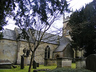
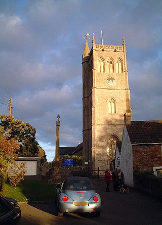
Combe Hay is a village and civil parish in the English county of Somerset. It falls within the Cotswolds Area of Outstanding Natural Beauty. The parish has a population of 147.

<span class="mw-page-title-main">Monkton Combe</span> Human settlement in England

Monkton Combe is a village and civil parish in north Somerset, England, 3 miles (4.8 km) south of Bath. The parish, which includes the hamlet of Tucking Mill, had a population of 554 in 2013. It was formerly known as Combe, owing to its geography, while it was also known as Monckton Combe and Combe Monckton until last century.

<span class="mw-page-title-main">Kingston Seymour</span> Human settlement in England

Kingston Seymour is a small village and civil parish with royal status in Somerset, England. It is situated within the unitary authority of North Somerset, between Clevedon and Weston-super-Mare on the North Somerset Levels. The parish has a population of 388.

<span class="mw-page-title-main">Clapton in Gordano</span> Human settlement in England

Clapton in Gordano is a village and civil parish in Somerset, England. It is situated within the unitary authority of North Somerset on the southern side of the Gordano Valley, immediately adjacent to the M5 motorway. The parish has a population of 348. There is a village football club, Clapton in Gordano FC. They currently run two sides with a view to continue progressing throughout the leagues. Their home ground is currently Clapton Lane, Portishead.

<span class="mw-page-title-main">Walton in Gordano</span> Human settlement in England

Walton in Gordano is a village and civil parish in North Somerset, England. It is situated in a small valley at the side of the south-western end of the Gordano Valley, about a mile from Clevedon. The parish has a population of 273.

<span class="mw-page-title-main">Camerton, Somerset</span> Human settlement in England

Camerton is a village and civil parish in Somerset, 6 miles (9.7 km) south west of Bath, lying on the Cam Brook. The parish has a population of 655.

<span class="mw-page-title-main">Kewstoke</span> Human settlement in England

Kewstoke is a civil parish and village in Somerset, England, within the unitary authority of North Somerset, located next to the strip of coast called Sand Bay. Its population in the 2011 census was 1,690.

<span class="mw-page-title-main">Bleadon</span> Human settlement in England

Bleadon is a village and civil parish in Somerset, England. It is about 4 miles (6.4 km) south of Weston-super-Mare and, according to the 2021 census, has a population of 1,149.

<span class="mw-page-title-main">Brockley, Somerset</span> Human settlement in England

Brockley is a village and civil parish in Somerset, England. The parish is within the unitary authority of North Somerset, about 3 miles (4.8 km) south of Nailsea, and includes the village of Chelvey. According to the 2011 census it had a population of 277.

<span class="mw-page-title-main">Kelston</span> Human settlement in England

Kelston is a small village and civil parish in Somerset, 4 miles (6.4 km) north west of Bath, and 8 miles (12.9 km) east of Bristol, on the A431 road. It is situated just north of the River Avon, close to the Kelston and Saltford locks. The parish has a population of 248.

<span class="mw-page-title-main">Claverton, Somerset</span> Human settlement in England

Claverton is a small village and civil parish about 2 miles (3 km) east of Bath at the southern end of the Cotswolds Area of Outstanding Natural Beauty, in Somerset, England. The parish has a population of 115.

<span class="mw-page-title-main">Burrington, Somerset</span> Human settlement in England

Burrington is a small village and civil parish in Somerset, England. It is situated in the unitary authority of North Somerset, 5 miles (8.0 km) north east of Axbridge and about 10 miles (16 km) east of Weston-super-Mare. The parish includes the hamlets of Bourne and Rickford and has a population of 464.

<span class="mw-page-title-main">Dunkerton, Somerset</span> Human settlement in England

Dunkerton is a small village in the civil parish of Dunkerton and Tunley, 4 miles (6.4 km) north east of Radstock, and 5 miles (8.0 km) south west of Bath, in the Bath and North East Somerset unitary authority, Somerset, England. The parish has a population of 502.

<span class="mw-page-title-main">Shoscombe</span> Human settlement in England

Shoscombe is a small village and civil parish in the valley of the Wellow Brook in north-east Somerset, about 7 miles (11 km) south of Bath, England. The parish has a population of 443.

<span class="mw-page-title-main">Hutton, Somerset</span> Human settlement in England

Hutton is a village and civil parish in Somerset, England. The parish, which has a population of 2,582, is within the unitary authority of North Somerset and located on the western edge of the Mendip Hills, close to Weston-super-Mare.

<span class="mw-page-title-main">Loxton, Somerset</span> Human settlement in England

Loxton is a village and civil parish in Somerset, England. It is close to the M5 motorway in the unitary authority of North Somerset. The parish includes the village of Christon and has a population of 214.

<span class="mw-page-title-main">Puxton</span> Village in Somerset, England

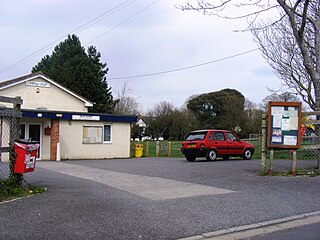
Puxton is a village and civil parish, 5 miles (8.0 km) north west of Axbridge in the unitary authority of North Somerset within the ceremonial county of Somerset, England.

<span class="mw-page-title-main">St. Georges, North Somerset</span> Human settlement in England

St. Georges is a civil parish and village in the unitary authority of North Somerset, England. Its population in the 2011 census was 3,379.

<span class="mw-page-title-main">Corston, Somerset</span> Human settlement in England

Corston is a small village and civil parish close to the River Avon and situated on the A39 road in the Bath and North East Somerset unitary authority, Somerset, England. The parish has a population of 494.

<span class="mw-page-title-main">North Stoke, Somerset</span> Human settlement in England

North Stoke is a village within the civil parish of Kelston in the Bath and North East Somerset (BANES) unitary authority within the historic county of Somerset, England, and close to the border with South Gloucestershire. The parish has a population of 72.

References

  1. 1 2 "2011 Census Profile". North Somerset Council. Archived from the original (Excel) on 4 January 2014. Retrieved 4 January 2014.
  2. "Somerset Hundreds". GENUKI. Retrieved 9 October 2011.
  3. "Timeline". Butcombe Brewery. Archived from the original on 1 October 2008. Retrieved 30 September 2008.
  4. "The Avon (Structural Change) Order 1995". HMSO. Archived from the original on 30 January 2008. Retrieved 9 December 2007.
  5. "Axbridge RD". A vision of Britain Through Time. University of Portsmouth. Retrieved 4 January 2014.
  6. "Butcombe Court". historicengland.org.uk. Retrieved 25 November 2008.
  7. "Butcombe". Bristol and Avon Family History Society. Retrieved 20 September 2012.
  8. "Clifton College". The history of the preparatory school. Retrieved 20 September 2012.
  9. "Church of St Michael and All Angels". historicengland.org.uk. Retrieved 25 November 2006.

Commons-logo.svg Media related to Butcombe at Wikimedia Commons