Chilcompton

Last updated

Chilcompton
Chilcompton St John the Baptist's Church - geograph.org.uk - 137564.jpg
Chilcompton St Aldhelm's Church - geograph.org.uk - 137562.jpg
St Aldhelm's Church
Somerset UK location map.svg
Red pog.svg
Chilcompton
Location within Somerset
Area7.06 km2 (2.73 sq mi)
Population2,062 (2011) [1]
  Density 292/km2 (760/sq mi)
OS grid reference ST645515
Unitary authority
Ceremonial county
Region
Country England
Sovereign state United Kingdom
Post town RADSTOCK
Postcode district BA3
Dialling code 01761
Police Avon and Somerset
Fire Devon and Somerset
Ambulance South Western
UK Parliament
List of places
UK
England
Somerset
51°16′07″N2°30′09″W / 51.2686°N 2.5025°W / 51.2686; -2.5025

Chilcompton is a village and civil parish in Somerset, England, in the Mendip Hills two miles south of Midsomer Norton and 3.0 miles south-west of Westfield. It is on the B3139 road between Radstock and Wells, close to the A37 (between Shepton Mallet and Bristol).

Contents

History

The parish was part of the hundred of Chewton. [2]

The village's history is mainly that of farming and mining. There is a coal waste mound in the north-east end of the village. The village used to have Chilcompton railway station on the Somerset and Dorset Joint Railway, which closed in 1966.

Governance

The parish council has responsibility for local issues, including setting an annual precept (local rate) to cover the council’s operating costs and producing annual accounts for public scrutiny. The parish council evaluates local planning applications and works with the local police, district council officers, and neighbourhood watch groups on matters of crime, security, and traffic. The parish council's role also includes initiating projects for the maintenance and repair of parish facilities, as well as consulting with the district council on the maintenance, repair, and improvement of highways, drainage, footpaths, public transport, and street cleaning. Conservation matters (including trees and listed buildings) and environmental issues are also the responsibility of the council.

The village falls within the Non-metropolitan district of Mendip, which was formed on 1 April 1974 under the Local Government Act 1972, having previously been part of Clutton Rural District, [3] which is responsible for local planning and building control, local roads, council housing, environmental health, markets and fairs, refuse collection and recycling, cemeteries and crematoria, leisure services, parks, and tourism.

Somerset County Council is responsible for running the largest and most expensive local services such as education, social services, libraries, main roads, public transport, policing and fire services, trading standards, waste disposal and strategic planning.

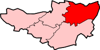
The village falls in the Ashwick, Chilcompton and Stratton electoral ward. From Chilcompton the ward stretches south to Ashwick. The ward total population taken at the 2011 census was 4,835. [4]

It is also part of the Frome and East Somerset constituency represented in the House of Commons of the Parliament of the United Kingdom. It elects one Member of Parliament (MP) by the first past the post system of election. It was part of the South West England constituency of the European Parliament prior to Britain leaving the European Union in January 2020, which elected seven MEPs using the d'Hondt method of party-list proportional representation.

Geography

Chilcompton has a population of 1,918. [1] The village is situated one mile west of the Fosse Way Roman road, Downside Abbey, and Downside School, and one mile north-east of Blacker's Hill fort. The only bus service that serves Chilcompton is the 173 Bath to Wells Mendip Xplorer service operated by First West of England. There are also several bus routes running between neighbouring villages and the town of Midsomer Norton.

The village has a well called Fry's Well which lends its name to a road.

The River Somer rises in small streams around Chilcompton. [5]

Education

Chilcompton has a primary school called St. Vigor and St. John. The village also has four nearby state secondary schools, The Blue School in Wells, Norton Hill School and Somervale School in Midsomer Norton and Writhlington School in Radstock. There are two private schools nearby, Wells Cathedral School and Downside School. The nearest universities are in Bath and Bristol.

Economy

Chilcompton is the headquarters of the fashion company Mulberry Group plc. [6]

There is a local store which belongs to the co-operative society, as a branch of the Radstock district co-operative society. There are also two hairdressers in the village, along with a small industrial estate in the north-east of the village. This estate has a few units of small businesses such as Nova fitness equipment and a small fruit machine distributor. There were four pubs in the village some time ago; currently there are two left: The Somerset Wagon (previously The Railway) and The Redan Inn. The Britannia and Naishes Crossing had been the other two, The Britannia being the later of the two to close in the 1980s.

Religious sites

The former Christ Church Downside - The old church - geograph.org.uk - 137573.jpg
The former Christ Church

The Church of St John The Baptist dates from the 15th century and was largely rebuilt in the 19th. The perpendicular embattled tower dates from around 1460 and contains six bells. The nave and aisles were completed in 1839 by Jesse Gane and the chancel and flanking chapels in 1897 by Frederick Bligh Bond. An enclosed modern structure links it to the adjoining parish hall. It is a Grade II* listed building and lies a short distance to the north of the village. [7] The ecclesiastical parish is now united with that of Saint Vigor's at Stratton-on-the-Fosse.

The former Christ Church on Stockhill Road, Downside, was built in 1838 by John Pinch the Younger. It was a Commissioners' church, which means it was built with money voted by Parliament as a result of the Church Building Acts of 1818 and 1824. The 1818 Act supplied a grant of money and established the Church Building Commission to direct its use, and in 1824 made a further grant of money. The building is no longer used for its religious function. [8] It has been converted to a private residence. [9]

Near the village cross there is a modern Catholic church dedicated to St Aldhelm. It is served by monks from the nearby Downside Abbey.

Recreation

There is a skateboarding park in the north end of the village on the recreational ground, which also has a football pitch, a sports clubhouse and a tennis/basketball court. There are two more parks in the village, one of which is in the south end with a 5-a-side football pitch and a small playpark. There is another in a small cul-de-sac in the east side of the village. The primary school also hosts a multi-sports facility.

Events

The village holds a village day fete every year, hosting live acts, games, stalls and foodstuffs, along with guest speakers such as Michael Eavis (owner of Glastonbury Festival). There have also been some charity events such as sports relief run-a-mile held in the recreational grounds. The primary school hosts summer and winter fairs. The village hall holds many events from the team at Take Art, a group providing a variety of entertainment, such as stand-up comedy, musical acts and other entertaining acts. The local actors guild (CADS — Chilcompton Amateur Dramatics Society) led by a headmaster of a nearby school, Andrew Morris, put on productions every year, traditionally comic, though recently they have moved to more serious plays, such as Shakespeare's Macbeth .

The Redan Inn won the award for the best rural pub in Mendip in Bloom competition 2006. [10]

Sports clubs

The Chilcompton football team is in division 2 of the junior league. A cricket team is being organised to play the local village rival Stratton-on-the-Fosse.

Related Research Articles

<span class="mw-page-title-main">Mendip District</span> Former non-metropolitan district in England

Mendip was a local government district of Somerset in England. The district covered a largely rural area of 285 square miles (738 km2) with a population of approximately 112,500, ranging from the Wiltshire border in the east to part of the Somerset Levels in the west. The district took its name from the Mendip Hills. The administrative centre of the district was Shepton Mallet but the largest town was Frome.

<span class="mw-page-title-main">Radstock</span> Human settlement in England

Radstock is a town and civil parish on the northern slope of the Mendip Hills in Somerset, England, about 9 miles (14 km) south-west of Bath and 8 miles (13 km) north-west of Frome. It is within the area of the unitary authority of Bath and North East Somerset. The Radstock built-up area had a population of 9,419 at the 2011 Census.

<span class="mw-page-title-main">Midsomer Norton</span> Town in Somerset, England

Midsomer Norton is a town near the Mendip Hills in Bath and North East Somerset, England, 10 miles (16 km) south-west of Bath, 10 miles (16 km) north-east of Wells, 10 miles (16 km) north-west of Frome, 12 miles (19 km) west of Trowbridge and 16 miles (26 km) south-east of Bristol. It has a population of around 13,000. Along with Radstock and Westfield it used to be part of the conurbation and large civil parish of Norton Radstock, but is now a town council in its own right. It is also part of the unitary authority of Bath and North East Somerset.

<span class="mw-page-title-main">North East Somerset (UK Parliament constituency)</span> Parliamentary constituency in the United Kingdom, 2010–2024

North East Somerset was a constituency represented in the House of Commons of the UK Parliament from 2010 to 2024. For the whole of its existence its Member of Parliament (MP) was Jacob Rees-Mogg of the Conservative Party.

<span class="mw-page-title-main">Binegar</span> Human settlement in England

Binegar is a small village and civil parish in Somerset, England. It is located on the A37, 4 miles (6.4 km) east of Wells, between Shepton Mallet and Chilcompton. Its population in 2011 was 313. Binegar and Gurney Slade on the opposite side of the A37 are effectively a single village and share a sign on the main road. In Gurney Slade, the quarry and houses on the north side of Tape Lane are in Binegar parish whilst the south side is in Ashwick parish. In Binegar, some houses on the south side of Station Road are in Ashwick parish and some on the north side of the village are in Emborough parish.

<span class="mw-page-title-main">Peasedown St John</span> Human settlement in England

Peasedown St John is a village and civil parish in Somerset, England, standing on a hilltop roughly 5 miles (8 km) south-southwest of the city of Bath, and 2 miles (3 km) north-east of the town of Radstock at the foot of the Mendip Hills. Peasedown used to be a coal mining village, and after the last of the mines shut in the 1970s it became a dormitory village for Bath, Trowbridge and to a lesser extent Bristol. Its size was increased by substantial housing developments in the 1960s, 1970s and late 1990s, making it one of the largest villages in Somerset.

<span class="mw-page-title-main">Ashwick</span> Human settlement in England

Ashwick is a village in Somerset, England, about three miles north of Shepton Mallet and seven miles east from Wells. It has also been a civil parish since 1826. The parish had a population of 1,352 according to the 2011 census, and apart from Ashwick village also includes Gurney Slade and Oakhill.

Clutton is a village and civil parish on the eastern edge of the Chew Valley, close to the Cam Brook river, in the Bath and North East Somerset Council area, within the ceremonial county of Somerset, England. The village lies east of the A37 road between Bristol and Shepton Mallet, and west of the A39 between Bath and Wells. It is 9 miles (14 km) from Bristol and Bath, and 11 miles (18 km) from Wells. Close by are the villages of Temple Cloud and High Littleton. The town of Midsomer Norton is 5 miles (8 km) away. The parish, which includes the hamlets of Clutton Hill and Northend, had a population of 1,602 in 2011.

<span class="mw-page-title-main">Temple Cloud</span> Village in the Chew Valley, Somerset, England

Temple Cloud is a village in the Chew Valley in Somerset on the A37 road. It is in the civil parish of Temple Cloud with Cameley and in the council area of Bath and North East Somerset. It is 10 miles (16 km) from Bristol and 5 miles (8 km) from the town of Midsomer Norton. The villages of Cameley and Clutton are nearby.

<span class="mw-page-title-main">Stratton-on-the-Fosse</span> Village in Somerset, England

Stratton-on-the-Fosse is a village and civil parish located on the edge of the Mendip Hills, 2 miles (3 km) south-west of Westfield, 6 miles (10 km) north-east of Shepton Mallet, and 9 miles (14 km) from Frome, in Somerset, England. It has a population of 1,108, and has a rural agricultural landscape, although it was part of the once-thriving Somerset coalfield. Within the boundaries of the parish are the hamlets of Benter and Nettlebridge.

<span class="mw-page-title-main">Midsomer Norton railway station</span> Former railway station in England

Midsomer Norton railway station was a station on the Somerset and Dorset Joint Railway between Bath Green Park and Shepton Mallet. It served the town of Midsomer Norton in the English county of Somerset, which was also served by a second station known as Midsomer Norton and Welton railway station on the Bristol and North Somerset Railway.

<span class="mw-page-title-main">Ston Easton</span> Human settlement in England

Ston Easton is a linear village and civil parish in the English county of Somerset. It is 14 miles (23 km) southwest of Bath and 7 miles (11 km) north of Shepton Mallet. It forms part of the Mendip district and lies along the A37 road 11 miles (18 km) south of the cities of Bristol and Bath and to the west of the town of Midsomer Norton. The parish includes the hamlet of Clapton.

<span class="mw-page-title-main">Somerset Coalfield</span> Coalfield in northern Somerset, England

The Somerset Coalfield in northern Somerset, England is an area where coal was mined from the 15th century until 1973. It is part of a larger coalfield which stretched into southern Gloucestershire. The Somerset coalfield stretched from Cromhall in the north to the Mendip Hills in the south, and from Bath in the east to Nailsea in the west, a total area of about 240 square miles (622 km2). Most of the pits on the coalfield were concentrated in the Cam Brook, Wellow Brook and Nettlebridge Valleys and around Radstock and Farrington Gurney. The pits were grouped geographically, with clusters of pits close together working the same coal seams often under the same ownership. Many pits shared the trackways and tramways which connected them to the Somerset Coal Canal or railways for distribution.

<span class="mw-page-title-main">Somer Valley FM</span> Radio station in Midsomer Norton

Somer Valley FM is a local community radio station in North East Somerset that serves Midsomer Norton, Radstock, Westfield and surrounding areas. It was launched in 2008.

<span class="mw-page-title-main">Westfield, Somerset</span> Human settlement in England

Westfield is a village and civil parish in Bath and North East Somerset in the ceremonial county of Somerset, England. The village lies on the Fosse Way between the towns of Radstock and Midsomer Norton.

<span class="mw-page-title-main">Church of St John the Baptist, Chilcompton</span> Church in Somerset, England

The Anglican Church of St John the Baptist in Chilcompton, within the English county of Somerset, was built in the 15th century. It is a Grade II* listed building.

<span class="mw-page-title-main">Christ Church, Downside</span> Church in Somerset, England

Christ Church is a former Church of England church in Downside, Somerset, England. Designed by John Pinch the younger, it was built in 1837–38 and closed in 1983. The church, now a private residence, is a Grade II listed building.

References

  1. 1 2 UK Census (2011). "Local Area Report – Chilcompton Parish (1170218001)". Nomis. Office for National Statistics . Retrieved 17 March 2018.
  2. "Somerset Hundreds". GENUKI. Retrieved 8 October 2011.
  3. "Clutton RD". A vision of Britain Through Time. University of Portsmouth. Retrieved 4 January 2014.
  4. "Ashwick,Chilcompton and Stretton ward 2011" . Retrieved 6 March 2015.
  5. "River Somer". Somerset Rivers. Retrieved 31 August 2016.
  6. "Mulberry Group plc Homepage". Mulberry Group plc website. Retrieved 3 September 2008.
  7. Historic England. "Church of St John The Baptist (1345096)". National Heritage List for England . Retrieved 10 May 2010.
  8. Historic England. "Former Christ Church (1175589)". National Heritage List for England . Retrieved 10 May 2010.
  9. "Homes for sale in former churches". Guardian Property.
  10. "Mendip in Bloom – The Winners" (PDF). It's your Mendip. Mendip District Council. 2006. p. 21. Archived from the original (PDF) on 11 June 2011. Retrieved 4 August 2008.

Further reading