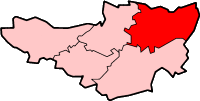
Selwood, Somerset

Last updated
Milestone at East Woodlands, near the toll house, erected by the Frome Turnpike Trust. The square design is known as 'Frome Square Plate'. Milestone at East Woodlands.jpg
Milestone at East Woodlands, near the toll house, erected by the Frome Turnpike Trust. The square design is known as 'Frome Square Plate'.

Selwood
Somerset UK location map.svg
Red pog.svg
Selwood
Location within Somerset
Population798 (2011) [2]
OS grid reference ST787486
District
Shire county
Region
Country England
Sovereign state United Kingdom
Post town FROME
Postcode district BA11
Dialling code 01373
Police Avon and Somerset
Fire Devon and Somerset
Ambulance South Western
UK Parliament
List of places
UK
England
Somerset
51°14′12″N2°18′21″W / 51.2366°N 2.3057°W / 51.2366; -2.3057 Coordinates: 51°14′12″N2°18′21″W / 51.2366°N 2.3057°W / 51.2366; -2.3057

Selwood used to be a village but is now part of the suburbs of Frome. It is a civil parish in the Mendip district of Somerset, England. The parish includes the villages of East and West Woodlands, Rodden and the hamlets of Alder Row and Blatchbridge.

Contents

History

Roddenbury Hillfort is a univallate Iron Age hill fort. It is a Scheduled Ancient Monument [3] and on the Heritage at Risk Register. [4]

The ancient Selwood Forest stretched approximately between Gillingham in Dorset and Chippenham in Wiltshire. Between the eighth and early eleventh centuries it was an important boundary between east and west Wessex, and in 705 the bishopric of Sherborn was established for those "west of Selwood" [5] Only a few fragments of the forest now survive.

The parish was part of the hundred of Frome. [6]

Governance

The parish council has responsibility for local issues, including setting an annual precept (local rate) to cover the council's operating costs and producing annual accounts for public scrutiny. The parish council evaluates local planning applications and works with the local police, district council officers, and neighbourhood watch groups on matters of crime, security, and traffic. The parish council's role also includes initiating projects for the maintenance and repair of parish facilities, as well as consulting with the district council on the maintenance, repair, and improvement of highways, drainage, footpaths, public transport, and street cleaning. Conservation matters (including trees and listed buildings) and environmental issues are also the responsibility of the council.

The village falls within the Non-metropolitan district of Mendip, which was formed on 1 April 1974 under the Local Government Act 1972, having previously been part of Frome Rural District, [7] which is responsible for local planning and building control, local roads, council housing, environmental health, markets and fairs, refuse collection and recycling, cemeteries and crematoria, leisure services, parks, and tourism.

Somerset County Council is responsible for running the largest and most expensive local services such as education, social services, libraries, main roads, public transport, policing and fire services, trading standards, waste disposal and strategic planning.

It is also part of the Somerton and Frome county constituency represented in the House of Commons of the Parliament of the United Kingdom. It elects one Member of Parliament (MP) by the first past the post system of election.

Landmarks

Manor Farmhouse in West Woodlands provides a particularly good survival of 17th century interior features in a very fine state of preservation, [8] while St. Algars Farmhouse (named after Ælfgar of Selwood) dates from the 14th century. [9] In Rodden the Manor House dates from the late 16th century. [10]

Religious sites

The Church of All Saints in Rodden dates from 1640, and was rebuilt in the mid 19th century. [11]

The church in East Woodlands was completed in 1714 having been paid for by the Longleat estate, then patrons of the parish. It is now dedicated to St Katharine. It was extensively restored in the 1870s by Pearson, [12] the architect who also designed Truro Cathedral.

Related Research Articles

Frome Town in Somerset, England

Frome is a town and civil parish in eastern Somerset, England. The town is built on uneven high ground at the eastern end of the Mendip Hills, and centres on the River Frome. It is approximately 13 miles (21 km) south of Bath, 43 miles (69 km) east of the county town, Taunton and 107 miles (172 km) west of London. In the 2011 census, the population was given as 26,203. The town is the largest in the Mendip district of Somerset and is part of the parliamentary constituency of Somerton and Frome.

River Frome, Somerset River in Somerset, United Kingdom

The River Frome is a river in Somerset, England. It rises near Bungalow Farm on Cannwood Lane, south-west of Witham Friary, flows north through Blatchbridge to the town of Frome, and continues in a generally northerly direction passing between the eastern edge of the Mendip Hills and Trowbridge before joining the Bristol Avon at Freshford, below Bradford on Avon.

Whatley, Mendip Human settlement in England

Whatley is a small rural village and civil parish near Frome in the English county of Somerset. Whatley is located near rural villages such as Chantry, Mells and Nunney.

Beckington Human settlement in England

Beckington is a village and civil parish in the Mendip district of Somerset, England, across the River Frome from Lullington about three miles north of Frome. According to the 2011 census the parish, which includes the hamlet of Rudge, which has a population of 983, and the hamlet of Standerwick.

Berkley, Somerset Human settlement in England

Berkley is a village and civil parish in the Mendip district of Somerset, England. According to the 2011 census it had a population of 344. The village is north-east of Frome.

Witham Friary Human settlement in England

Witham Friary is a small English village and civil parish located between the towns of Frome and Bruton in the county of Somerset. It is in the Cranborne Chase and West Wiltshire Downs Area of Outstanding Natural Beauty and the ancient Forest of Selwood.

West Harptree Human settlement in England

West Harptree is a small village and civil parish in the Chew Valley, Somerset within the unitary district of Bath and North East Somerset. The parish has a population of 439.

Norton Malreward Village an civil parish in Somerset, England

Norton Malreward is a small Somerset village and civil parish 4 miles (6.4 km) south of Bristol, England at the northern edge of the Chew Valley. In 1895 Norton Malreward was combined with the neighbouring hamlet of Norton Hawkfield into a single parish, which has a population of 246.

Mells, Somerset Human settlement in England

Mells is a village and civil parish in Somerset, England, near the town of Frome.

Compton Bishop Human settlement in England

Compton Bishop is a small village and civil parish, at the western end of the Mendip Hills in the English county of Somerset. It is located close to the historic town of Axbridge. Along with the village of Cross and the hamlets of Rackley and Webbington it forms the parish of Compton Bishop and Cross.

Corsley Human settlement in England

Corsley is a hamlet and civil parish 3 miles (5 km) west of Warminster in Wiltshire, England. The parish is on the county border with Somerset; the Somerset town of Frome is about 3 miles (5 km) to the northwest. The largest settlement in the parish is Corsley Heath, which is on the A362 Warminster-Frome road.

Cranmore, Somerset Human settlement in England

Cranmore is a village and civil parish east of Shepton Mallet, in the Mendip district of Somerset, England. The parish includes the hamlets of Waterlip, East Cranmore and Dean.

Emborough Human settlement in England

Emborough is a village and civil parish 5 miles (8.0 km) north of Shepton Mallet, and 5 miles (8.0 km) north east of Wells, in the Mendip district of Somerset, England. It adjoins the parish of Ston Easton. It is situated on the B3139 between Radstock and Wells, just off the A37 road.

Great Elm Human settlement in England

Great Elm is a village and civil parish between Mells and Frome in the Mendip district of Somerset, England. The parish includes the hamlet of Hapsford.

Lullington, Somerset Human settlement in England

Lullington is a village and civil parish just across the Mells River from Beckington and 2.5 miles (4.0 km) north east of Frome, in the Mendip district of Somerset, England.

Milton Clevedon Human settlement in England

Milton Clevedon is a village and civil parish 1 mile (1.6 km) south of Evercreech in the Mendip district of Somerset, England.

Stoke St Michael Human settlement in England

Stoke St Michael is a village and civil parish on the Mendip Hills 4 miles (6.4 km) north east of Shepton Mallet, and 8 miles (12.9 km) west of Frome, in the Mendip district of Somerset, England.

Trudoxhill Human settlement in England

Trudoxhill is a village and civil parish near Nunney in the Mendip district of Somerset, England.

Wanstrow Human settlement in England

Wanstrow is a village and civil parish 6 miles (9.7 km) south west of Frome in the Mendip district of Somerset, England. The parish includes the village of Cloford.

West Pennard Human settlement in England

West Pennard is a village and civil parish east of Glastonbury, situated at the foot of Pennard Hill, in the Mendip district of Somerset, England. The parish includes the hamlets of Coxbridge and Woodlands.

References

  1. "Frome Turnpike Trust". Turnpikes.org.uk. 23 September 2013. Retrieved 31 May 2020.
  2. "Selwood Parish". Neighbourhood Statistics. Office for National Statistics. Retrieved 1 January 2014.
  3. "Roddenbury Hillfort, Longleat Wood, Selwood". Somerset Historic Environment Record. Somerset County Council . Retrieved 15 January 2011.
  4. "Hillfort on Roddenbury Hill". Heritage at Risk. English Heritage . Retrieved 10 February 2011.
  5. Nelson, Janet (1995). Wessex in the Early Middle Ages. London, UK: Leicester University Press. pp. 23–24, 85, 325. ISBN   978-0-7185-1856-1.
  6. "Somerset Hundreds". GENUKI. Retrieved 8 October 2011.
  7. "Frome RD". A vision of Britain Through Time. University of Portsmouth. Retrieved 4 January 2014.
  8. Historic England. "Manor Farmhouse, West Woodlands (1176081)". National Heritage List for England . Retrieved 28 January 2009.
  9. Historic England. "St. Algars Farmhouse (1058902)". National Heritage List for England . Retrieved 28 January 2009.
  10. Historic England. "Manor Farmhouse (1058894)". National Heritage List for England . Retrieved 28 January 2009.
  11. Historic England. "Church of All Saints (1058893)". National Heritage List for England . Retrieved 28 January 2009.
  12. Historic England. "Church of St. Katherine (1175821)". National Heritage List for England . Retrieved 28 January 2009.