
Staffordshire is a landlocked ceremonial county in the West Midlands region of England. It borders Cheshire to the northwest, Derbyshire and Leicestershire to the east, Warwickshire to the southeast, the West Midlands and Worcestershire to the south, and Shropshire to the west. The largest settlement is the city of Stoke-on-Trent, and the county town is Stafford.

The Midlands are a part of England that broadly correspond to the Kingdom of Mercia of the Early Middle Ages, bordered by Wales, Northern England, Southern England and the North Sea. The Midlands were important in the Industrial Revolution of the 18th and 19th centuries. They are split into the West Midlands and East Midlands. The region's biggest city, Birmingham – often considered the social, cultural, financial and commercial centre of the Midlands, – is the second-largest city and metropolitan area in the United Kingdom.
Newcastle-under-Lyme is a market town and the administrative centre of the Borough of Newcastle-under-Lyme in Staffordshire, England. It is adjacent to the city of Stoke-on-Trent. In 2011 the population was 75,082.

Rugeley is a market town and civil parish in the Cannock Chase District, in Staffordshire, England. It lies on the north-eastern edge of Cannock Chase next to the River Trent; it is situated 8 miles (13 km) north of Lichfield, 10 miles (16 km) south-east of Stafford, 5 miles (8.0 km) north-east of Hednesford and 11 miles (18 km) south-west of Uttoxeter. At the 2021 Census, the population was 24,386.

East Staffordshire is a local government district with borough status in Staffordshire, England. Its two main towns are Burton upon Trent and Uttoxeter.

Staffordshire is a landlocked county in the West Midlands of England. It adjoins Cheshire to the north west, Derbyshire and Leicestershire to the east, Warwickshire to the south east, West Midlands and Worcestershire to the south, and Shropshire to the west. The historic county of Staffordshire includes Wolverhampton, Walsall, and West Bromwich, these three being removed for administrative purposes in 1974 to the new West Midlands authority. The resulting administrative area of Staffordshire has a narrow southwards protrusion that runs west of West Midlands to the border of Worcestershire. The city of Stoke-on-Trent was removed from the admin area in the 1990s to form a unitary authority, but is still part of Staffordshire for ceremonial and traditional purposes.

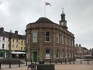
Stone is a constituency represented in the House of Commons of the UK Parliament since its 1997 recreation by Sir Bill Cash, a Conservative.
Staffordshire Fire and Rescue Service is the statutory fire and rescue service responsible for fire protection, prevention, intervention and emergency rescue in the county of Staffordshire and unitary authority of Stoke-on-Trent. The county has a population of 1,126,200 and covers a total area of 2,260 km2. Staffordshire shares the majority of its border with Derbyshire, Cheshire, West Midlands (County) and Shropshire; although, in much shorter stretches, the county also butts up against Worcestershire, Warwickshire and Leicestershire.
Kingstone is a village and civil parish within the English county of Staffordshire.

Pirehill is a hundred in the county of Staffordshire, England. The Hundred is located in the north-west and toward the upper centre of Staffordshire. It is about 28 miles in length, north to south, and around 8 to 20 miles in breadth. It is bounded on the north-east by Totmonslow (Totmanslow) Hundred, on the east by Offlow Hundred, on the south by Cuttleston Hundred, and on the west and north-west by Shropshire and Cheshire.
There are over 20,000 Grade II* listed buildings in England. This page is a list of these buildings in the district of Cannock Chase in Staffordshire.
Healthcare in Staffordshire was the responsibility of six clinical commissioning groups until July 2022, covering Stafford & Surrounds, North Staffordshire, South East Staffordshire and Seisdon Peninsula, East Staffordshire, Cannock Chase, and Stoke-on-Trent.

The West Midlands Green Belt is a statutory green belt environmental and planning policy that regulates the rural space within the West Midlands region of England. It is contained within the counties of the West Midlands, Shropshire, Staffordshire, Warwickshire and Worcestershire. Essentially, the function of the green belt is to more rigorously manage development around the cities, towns and villages in the large West Midlands conurbations centred around Birmingham and Coventry, discouraging convergence. It is managed by local planning authorities on guidance from central government.

Offlow is a hundred in the county of Staffordshire, England, located in the south-east of that county. It is named after a tumulus or mound in the parish of Swinfen and Packington, 2+1⁄2 miles south of Lichfield. The hundred is recorded in the Domesday Book under the name "Offelav".
There are a number of listed buildings in Staffordshire. The term "listed building", in the United Kingdom, refers to a building or structure designated as being of special architectural, historical, or cultural significance. Details of all the listed buildings are contained in the National Heritage List for England. They are categorised in three grades: Grade I consists of buildings of outstanding architectural or historical interest, Grade II* includes significant buildings of more than local interest and Grade II consists of buildings of special architectural or historical interest. Buildings in England are listed by the Secretary of State for Culture, Media and Sport on recommendations provided by English Heritage, which also determines the grading.
