River Tonge | |
---|---|
Location | |
Country | England |
District | Bolton MBC |
Physical characteristics | |
Source | |
• location | northeast Bolton |
• coordinates | 53°35′44.58″N2°25′30.42″W / 53.5957167°N 2.4251167°W |
Mouth | |
• location | River Croal, southeast Bolton |
• coordinates | 53°34′1.56″N2°24′12.96″W / 53.5671000°N 2.4036000°W Coordinates: 53°34′1.56″N2°24′12.96″W / 53.5671000°N 2.4036000°W |
Discharge | |
• location | Darcy Lever |
Basin features | |
Tributaries | |
• left | Bradshaw Brook |
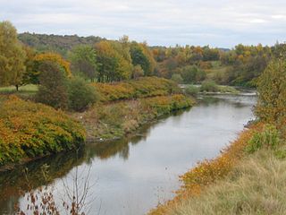
The River Tonge is a short river, splitting Bolton from contiguous Tonge, both in Greater Manchester, England.
The Tonge is formed at the Meeting of the Waters, where Astley Brook, from Smithills in the west, meets the Eagley Brook drawing on more sources to the north. The Tonge meanders southwards, to the east of Bolton, past Springfield where it is joined by Bradshaw Brook, at the end of its route from the Jumbles and Wayoh reservoirs, close to Tonge Fold. The Tonge joins the smaller and thus counterintuitively superseding Croal at Darcy Lever, shortly before the Croal's confluence with the River Irwell.
Tonge Bridge section is a tract north of Tonge Bridge designated as a site of special scientific interest (SSSI). [1] [2] The 0.7-hectare (1.7-acre) site comprises the steep west right bank of the river. It was designated an SSSI 1987 for its geological interest, principally the fluvial sandstone which has yielded pteridosperm seeds, known as Trigonocarpus . The well preserved nature of the seeds make it of considerable sedimentological and palaeogeographic interest. [1] It is one of only seven geological SSSIs in Greater Manchester.
In 2017, invasive walking catfish Clarias were recovered from the river. [3]
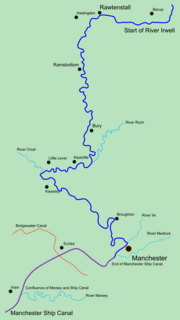
The River Irwell is a tributary of the River Mersey in north west England. It rises at Irwell Springs on Deerplay Moor, approximately 1+1⁄2 miles north of Bacup and flows southwards for 39 mi (63 km) to meet the Mersey near Irlam. The Irwell marks the boundary between Manchester and Salford, and its lower reaches have been canalised and now form part of the Manchester Ship Canal.
The River Croal is a river located in Greater Manchester, England. It is a tributary of the River Irwell.
Bolton North East is a constituency represented in the House of Commons of the UK Parliament since 2019 by Mark Logan, a Conservative.
Eagley Brook is a small river of Lancashire and Greater Manchester in England.
Astley Brook is a river in Greater Manchester, England.
Dean Brook is a river in Smithills, Bolton, Greater Manchester, historically within Lancashire.
Bradshaw Brook is a river draining parts of Lancashire and Greater Manchester in Northern England.
Nob End is the site of a former waste tip which is now a Site of Special Scientific Interest and Local Nature Reserve near Little Lever and Kearsley, in Greater Manchester, England.
Moses Gate Country Park, part of which is also known as Crompton Lodges, is a 750 acre site situated at Moses Gate in the Croal and Irwell Valleys 3 miles south of Bolton town centre on the A6053 road which connects Farnworth to Little Lever. It is a Local Nature Reserve.
The River Doe Lea is a river which flows near Glapwell and Doe Lea in Derbyshire, England. The river eventually joins the River Rother near Renishaw. The river contained 1,000 times the safe level of dioxins in 1991, according to a statement made by Dennis Skinner, (MP) in the House of Commons in 1992. The river flows through the site of the former Coalite plant near Bolsover, where coke, tar and industrial chemicals were manufactured until the plant closed in 2004.
The Irwell Valley in North West England extends from the Forest of Rossendale through the cities of Salford and Manchester. The River Irwell runs through the valley, along with the River Croal.
Tonge is an outlying area of Bolton, in Greater Manchester, England. The name is supposed to be derived from the Old English "tang" or "twang" meaning a fork in a river. Tonge comprises two areas, namely Tonge Fold and Tonge Moor. Tonge Fold sits upon the River Tonge, a region of whose banks are a geological site of special scientific interest (SSSI).
Eagley Mills is a complex of former cotton mills in Eagley, Bolton, England. The complex is adjacent to a model village originally built for the millworkers. The surviving mill buildings have since been converted to residential use.
South Turton is an unparished area in the Metropolitan Borough of Bolton, Greater Manchester, England, and includes the settlements of Bradshaw, Bromley Cross, Harwood, Dunscar, Eagley, and Egerton, and the surrounding countryside. The area contains 28 listed buildings that are recorded in the National Heritage List for England. Of these, two are listed at Grade II*, the middle of the three grades, and the others are at Grade II, the lowest grade. The listed buildings include houses and associated structures, farmhouses, farm buildings, former cotton mills, a church and an isolated church tower, a former school, a railway station, and a war memorial.
Astley Bridge is predominantly a residential district of Bolton in Greater Manchester, England. It is 2.5 miles (4 km) north of Bolton town centre, 11.7 miles (19 km) south of Blackburn, and 14.3 miles (23 km) northwest of Manchester.