Related Research Articles

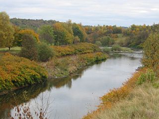
The River Tame flows through Greater Manchester, England. It rises on Denshaw Moor and flows to Stockport where it joins the River Goyt to form the River Mersey.

Westy is a suburban district in Warrington, England. It lies between the River Mersey and the Manchester Ship Canal. The village of Westy is a suburban area, itself unofficially a suburb of Latchford. The area features mainly inter-war council housing, however some of these homes are now privately owned. There is an apparent strong community spirit with its hub at the community centre and also a thriving community hall based within St Margaret's Community Centre on Lindley Avenue, hosting activities for all age groups.
Bruche is a large suburb of Warrington, Cheshire, England.

The River Bollin is a major tributary of the River Mersey in the north-west of England.
The River Croal is a river located in Greater Manchester, England. It is a tributary of the River Irwell.

Adswood is a suburb of Stockport, Greater Manchester, England. The name is said to be derived from "Adders wood"; in the reign of King Charles, the area was royal hunting grounds with a large population of snakes. Adswood has its own coat of arms, a snake wrapped around a tree.
The River Sett is a river that flows through the High Peak borough of Derbyshire, in north western England. It rises near Edale Cross on Kinder Scout and flows through the villages of Hayfield and Birch Vale to join the River Goyt at New Mills. The River Goyt is one of the principal tributaries of the River Mersey. In the past, the river was known as the River Kinder; the modern River Kinder is a right tributary of the Sett, joining the river at Bowden Bridge above Hayfield.

Chew Valley in Saddleworth, Greater Manchester, England, follows the course of Chew Brook on the western slopes of Black Chew Head to where it joins the River Tame at Greenfield, east of Manchester. Part of the higher fringes of the valley towards the peak of Black Chew Head lie across the boundary in Derbyshire. The eastern part of the valley including the reservoirs of Dovestone and Chew are within the north western extremity of the Peak District National Park.

The River Calder is a major tributary of the River Ribble in Lancashire, England and is around 20 miles (32 km) in length.
The River Tonge is a short river, splitting Bolton from contiguous Tonge, both in Greater Manchester, England.

Eagley Brook is a small river of Lancashire and Greater Manchester in England.

Dean Brook is a river near Bolton in Greater Manchester.

Bradshaw Brook is a river draining parts of Lancashire and Greater Manchester in Northern England.

Midford Brook is a small river in Somerset, England.

The Black Brook is a small river in Calderdale, West Yorkshire, England.
Westleigh or West Leigh was a station in Leigh, Greater Manchester, England on the Bolton and Leigh Railway line. Westleigh was situated within the historic county of Lancashire. Its station opened in 1831 and closed in 1954.

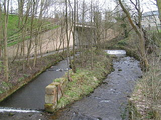
Moston Brook is a stream in Greater Manchester in north-west England and a tributary of the River Irk. The brook is formed at the confluence of Bower Brook and Hole Bottom Brook. This occurs near the Rochdale Canal in Failsworth in the Metropolitan Borough of Oldham. It flows southwest, forming the border between Moston, Manchester and Failsworth before being culverted almost all of the remaining route to its meeting the River Irk. It has a total length of about 3.7 miles.

Mearley Brook is a minor river in Lancashire, England. It is approximately 4.5 miles (7.2 km) long and has a catchment area of 8.79 square miles (22.77 km2).

Kirklees Brook is a minor river in Greater Manchester, England. It is 6.56 miles (10.556 km) long and including tributaries has a catchment area of 5.23 square miles (13.547 km2).
References
- ↑ Ordnance Survey: Landranger map sheet 109 Manchester (Bolton & Warrington) (Map). Ordnance Survey. 2014. ISBN 9780319231555.
| | This Greater Manchester location article is a stub. You can help Wikipedia by expanding it. |