Wythenshawe Park

Last updated

Wythenshawe Park
Wythenshawe park - geograph.org.uk - 49571.jpg
The Driveway in Wythenshawe Park
Wythenshawe Park
TypePublic
Location Wythenshawe, Manchester
Coordinates 53°24′15″N2°16′29″W / 53.40422°N 2.27461°W / 53.40422; -2.27461
Area270 acres
Created1926
Operated by Manchester City Council
AwardsGreen Flag
Public transit access Metrolink generic.png Wythenshawe Park tram stop
Website manchester.gov.uk

Wythenshawe Park is located in Northern moor & borders into Baguley England, covers an area of 270 acres. Wythenshawe Hall lies at its centre.

Contents

The park features woodland, bedding, grassland and meadows, sporting facilities, Wythenshawe community farm and a horticulture centre. [1] [2]

History

Wythenshawe Park North Lodge Wythenshawe Park North Lodge, March 2016 031.jpg
Wythenshawe Park North Lodge
The 16th-century Wythenshawe Hall Wyhtenshawe Hall in 2005.jpg
The 16th-century Wythenshawe Hall

The land now bounded by Wythenshawe Park was originally demesne land belonging to the wealthy Tatton family, from at least 1297 onwards. According to documents from the 13th century, the land was enclosed as a deer park for the purpose of hunting. [3] [4]

There is no evidence of any manor house until the 16th century, when Robert Tatton of Chester built a new family home here around 1540. Wythenshawe (or Withenshawe) Hall was built as a timber-framed Tudor house, possibly surrounded originally by a moat. It became the home of the Tatton Family for almost 400 years. [3] [4]

In 1641, Robert Tatton of Chester's descendant, also named Robert Tatton, commissioned a survey of the estate from a Richard Martinscroft, who prepared a map of the tenanted and demesne lands. [3] [4]

Soon after, Wythenshawe Hall was caught up in the hostilities of the English Civil War. Robert Tatton was a Royalist, and in the winter of 1643–44, the house was besieged by Parliamentarian forces and seized. After the Restoration of the monarchy, Wythenshawe Hall was returned to the Tatton Family. [3] [4]

The first evidence of landscaping in the grounds date to the 1641 estate map. Further landscaping was added in about 1830, replacing fields. [3]

The structures of a farm that was located west of Wythenshawe Hall have survived as park maintenance buildings. [3] North Lodge, a Grade II-listed gate lodge at the northern entrance to the park was built in the Tudor style in the mid to late 19th century. [5]

The Wythenshawe estate remained in the Tatton family possession until 1926, when the Hall and 250 acres of the estate were purchased by Sir Ernest Simon and his wife Shena Simon. They presented Wythenshawe Park and the Hall to the Manchester Corporation "to be kept forever as an open space for the people of Manchester". At this time, the Corporation was developing Wythenshawe as a new garden suburb of Manchester to provide housing for families who were moved out of the city to allow slum clearance, and Wythenshawe Park was set aside to provide a recreational green space for the new Wythenshawe housing estate. [3] [4]

Statue of Oliver Cromwell in the park Oliver Cromwell statue, Wythenshawe Park, March 2016 025.jpg
Statue of Oliver Cromwell in the park

In 1968, a 7.16-metre (23.5 ft)-tall bronze statue of Oliver Cromwell on a granite plinth and pedestal was relocated to Wythenshawe Park. Sculpted by Matthew Noble, it had originally stood on Deansgate in Manchester city centre. From its inception, the statue had proved politically controversial, advocated by Radical Liberals but denounced by conservatives. Eventually, its location was found to be obstructing traffic, and the statue was re-sited to Wythenshawe Park, commemorating Wythenshawe Hall's association with the Civil War. Within weeks, the statue was vandalised with paint and Cromwell's sword was stolen. The statue was listed Grade II in 1994 by English Heritage. [6] [7] [8] [5]

In 2016, Wythenshawe Hall was severely damaged by fire during an arson attack. The structure is currently undergoing restoration work and is closed to the public. [9]

Facilities

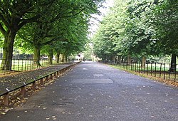
Wythenshawe Park has a range of leisure, sporting, and educational facilities open to the public, including an athletics track, café, a baseball field, football pitches, a pavilion, an orienteering course, horse riding facilities and tennis courts. It is also home to a horticultural centre and the Wythenshawe community farm, which has been set up to educate urban children about food production in a working farm setting. [1] [10]

See also

Related Research Articles

<span class="mw-page-title-main">Wentworth Woodhouse</span> Grade I listed country house in South Yorkshire, England

Wentworth Woodhouse is a Grade I listed country house in the village of Wentworth, in the Metropolitan Borough of Rotherham in South Yorkshire, England. It is currently owned by the Wentworth Woodhouse Preservation Trust. The building has more than 300 rooms, although the precise number is unclear, with 250,000 square feet (23,000 m2) of floorspace, including 124,600 square feet (11,580 m2) of living area. It covers an area of more than 2.5 acres (1.0 ha), and is surrounded by a 180-acre (73 ha) park, and an estate of 15,000 acres (6,100 ha).

<span class="mw-page-title-main">Wythenshawe Hall</span> Historic site in Wythenshawe, Manchester

Wythenshawe Hall is a 16th-century timber-framed historic house and former manor house in Wythenshawe, Manchester, England, five miles (8 km) south of Manchester city centre in Wythenshawe Park. Built for Robert Tatton, it was home to the Tatton family for almost 400 years. Its basic plan is a central hall with two projecting wings.

<span class="mw-page-title-main">Knutsford</span> Town in Cheshire, England

Knutsford is a market town in Cheshire, England, 14 miles southwest of Manchester, 9 miles northwest of Macclesfield and 12+12 miles southeast of Warrington. The population at the 2011 Census was 13,191.

<span class="mw-page-title-main">Wythenshawe</span> Human settlement in England

Wythenshawe is a town located in the county of Greater Manchester, England. Historically part of the county of Cheshire, in 1931, Wythenshawe was transferred to the City of Manchester, which had begun building a large new housing estate there in the 1920s. With an area of approximately 11 square miles (28 km2), Wythenshawe became the largest council estate in Europe. Despite it not having official town status, the tram stop which serves the main district centre is known as "Wythenshawe Town Centre tram stop".

<span class="mw-page-title-main">Northenden</span> Suburb in Manchester, Greater Manchester, England

Northenden is a suburb of Manchester, Greater Manchester, England, with a population of 14,771 at the 2011 census. It lies on the south side of the River Mersey, 4.2 miles (6.8 km) west of Stockport and 5.2 miles (8.4 km) south of Manchester city centre, bounded by Didsbury to the north, Gatley to the east, Sale to the west and Wythenshawe to the south.

<span class="mw-page-title-main">Tabley House</span> Country house in Tabley Inferior, Cheshire, England

<span class="mw-page-title-main">Heaton Park</span> Public park in Manchester, England

Heaton Park is a public park in Manchester, England, covering an area of over 600 acres (242.8 ha). The park includes the grounds of a Grade I listed, neoclassical 18th century country house, Heaton Hall. The hall, remodelled by James Wyatt in 1772, is now only open to the public on an occasional basis as a museum and events venue. It is the biggest park in Greater Manchester, and also the largest municipal park in Europe.

<span class="mw-page-title-main">Tatton Park</span> Historic estate in Cheshire, England

Tatton Park is a historic estate in Cheshire, England, north of the town of Knutsford. It contains a mansion, Tatton Hall, a medieval manor house, Tatton Old Hall, Tatton Park Gardens, a farm and a deer park of 2,000 acres (8.1 km2). It is a popular visitor attraction and hosts over a hundred events annually. The estate is owned by the National Trust, and managed under lease by Cheshire East Council . Since 1999, it has hosted North West England's annual Royal Horticultural Society flower show.

<span class="mw-page-title-main">Cheshire East</span> Borough in England

Cheshire East is a unitary authority area with borough status in Cheshire, England. The local authority is Cheshire East Council. Towns within the area include Crewe, Macclesfield, Congleton, Sandbach, Wilmslow, Handforth, Knutsford, Poynton, Bollington, Alsager and Nantwich. The council is based in the town of Sandbach.


Bolesworth Castle is a country house 2 miles (3 km) south of the village of Tattenhall, Cheshire, England. It is recorded in the National Heritage List for England as a designated Grade II* listed building.

<span class="mw-page-title-main">Baguley Hall</span> Building in Greater Manchester, UK

Baguley Hall is a 14th-century timber-framed building in Baguley, Greater Manchester, North West England.

<span class="mw-page-title-main">Dorfold Hall</span> Historic site in Cheshire, England

Dorfold Hall is a Grade I listed Jacobean mansion in Acton, Cheshire, England, considered by Nikolaus Pevsner to be one of the two finest Jacobean houses in the county. The present owners are the Roundells.

<span class="mw-page-title-main">Northern Moor</span>

Northern Moor is an area of Manchester, England, north of Baguley, west of Northenden and east of Sale, 5 miles south of Manchester city centre. The Tatton family lived from 1540 to 1926 at Wythenshawe Hall in Northern Moor; land around it is now Wythenshawe Park, which was a deer park from 1200 to 1540. In former centuries it was spelt "Northen Moor" and meant "the moor area belonging to Northenden". Until 1931, Northern Moor was part of Cheshire, before Manchester expanded south of the River Mersey and its borders were changed to include Northern Moor and Northenden. The area includes Lawton Moor, and the northern border is now with Sale Moor.

<span class="mw-page-title-main">Chapel-en-le-Frith</span> Human settlement in England

Chapel-en-le-Frith is a town and civil parish in the Borough of High Peak in Derbyshire, England.

<span class="mw-page-title-main">Church of St Wilfrid, Northenden</span> Church in Greater Manchester, England

The Church of St Wilfrid is an Anglican church in the suburb of Northenden in Manchester, England. It stands on Ford Lane, close to the River Mersey, approximately 8 kilometres (5.0 mi) south of Manchester city centre.

Tatton is a former civil parish in Cheshire East, England. It contained 26 buildings that are recorded in the National Heritage List for England as designated listed buildings. Of these, one is listed at Grade I, the highest grade, two are listed at Grade II*, the middle grade, and the others are at Grade II. The major building in the parish was Tatton Hall, and all the listed buildings in the parish are related to it. These include the hall itself, Tatton Old Hall, the Home Farm, structures in the gardens and park, and lodges at the entrances to Tatton Park.

<span class="mw-page-title-main">Statue of Oliver Cromwell, Warrington</span> Sculpture by John Bell in Warrington, Cheshire, England

A statue of Oliver Cromwell stands on Bridge Street in Warrington in Cheshire, England. It is a sculpture of Oliver Cromwell, Lord Protector of the Commonwealth of England, Scotland and Ireland. The statue was designed by John Bell and erected in 1899. The statue is one of four public statues of Cromwell in the United Kingdom and has been Grade II listed since September 1973 for its architectural merit.

Manchester is a city in Northwest England. The M23 postcode area of the city includes parts of the suburbs of Wythenshawe and Northenden. The postcode area contains eleven listed buildings that are recorded in the National Heritage List for England. Of these, one is listed at Grade I, the highest of the three grades, two are at Grade II*, the middle grade, and the others are at Grade II, the lowest grade. The area is almost completely residential, and the listed buildings include two former manor houses and associated structures, a former farm and outbuildings, a house, a church, and a vicarage.

<span class="mw-page-title-main">Brabyns Park</span> Park in England

Brabyns Park is a public park in Marple Bridge, Stockport, Greater Manchester, England.

References

  1. 1 2 "Facilities in the park". Manchester Council. Retrieved 19 March 2016.
  2. "About the park". Manchester Council. Retrieved 19 March 2016.
  3. 1 2 3 4 5 6 7 Historic England. "Wythenshaw Park (1000857)". National Heritage List for England . Retrieved 23 March 2016.
  4. 1 2 3 4 5 "Wythenshawe Park". Manchester Council. Retrieved 18 March 2016.
  5. 1 2 Historic England. "North Lodge of Wythenshawe Hall (Grade II) (1255036)". National Heritage List for England . Retrieved 18 March 2016.
  6. Historic England. "Statue of Oliver Cromwell approx.100m east of Wythenshawe Hall (Grade II) (1255035)". National Heritage List for England . Retrieved 18 March 2016.
  7. "Oliver Cromwell". Public Monument and Sculpture Association. Retrieved 18 March 2016.
  8. "Listed buildings in Manchester by street (W)". Manchester City Council. Retrieved 18 March 2016.
  9. "Wythenshawe Hall fire: Man jailed for arson attack". BBC News. 18 August 2017. Retrieved 9 September 2021.
  10. "Community Farm". Wythenshawe Park. Manchester City Council. Retrieved 9 September 2021.

Commons-logo.svg Media related to Wythenshawe Park at Wikimedia Commons