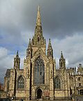
Manchester Tennis and Racquet Club | |
---|---|
General information | |
Location | Salford, Greater Manchester, United Kingdom |
Address | 33 Blackfriars Road, Salford M3 7AQ |
Coordinates | 53°29′09″N2°15′09″W / 53.4859°N 2.2524°W |
Completed | 1880 |
Inaugurated | December 1880 |
Renovated | 1925 |
Owner | Manchester Tennis and Racquet Club |
Design and construction | |
Architect(s) | George Tunstal Redmayne |
Designations | |
Listed Building – Grade II* | |
Official name | Manchester Tennis and Racquet Club |
Designated | 21 January 1996 |
Reference no. | 1386080 |
Website | |
mtrc.co.uk | |
References | |
[1] |
Manchester Tennis and Racquet Club is a sports club based in Salford, just outside Manchester, England. It is the oldest sports facility in Greater Manchester to have retained its use to the present day.
The history of the club did not begin at these premises, however, but in Manchester at Miller Street in 1876. Due to the subsequent expansion of the railways in Manchester, it was relocated to its current location. The last major modification came in 1925 when a squash court was added to the facility. [2] [3]
On 21 January 1996, English Heritage awarded the building Grade II* status. [4]
Greater Manchester is a ceremonial county in North West England. It borders Lancashire to the north, Derbyshire and West Yorkshire to the east, Cheshire to the south, and Merseyside to the west. Its largest settlement is the city of Manchester.
Salford is a city in Greater Manchester, England. The city is situated in a meander on the western bank of the River Irwell which forms its boundary with Manchester and its city centre. Landmarks in the city include the 100 Greengate skyscraper, the old town hall, cathedral and St Philips Church. It is the main settlement of the wider City of Salford metropolitan borough.
Trafford is a metropolitan borough of Greater Manchester, England, with an estimated population of 235,546 in 2021. It covers 106 square kilometres (41 sq mi) and includes the area of Old Trafford and the towns of Altrincham, Stretford, Urmston, Partington and Sale. The borough was formed in 1974 as a merger of six former districts and part of a seventh. The River Mersey flows through the borough, separating North Trafford from South Trafford, and the historic counties of Lancashire and Cheshire. Trafford is the seventh-most populous district in Greater Manchester.
Irlam is a suburb in the City of Salford, Greater Manchester, England. In 2011, it had a population of 19,933. It lies on flat ground on the south side of the M62 motorway and the north bank of the Manchester Ship Canal, 6.7 miles (10.8 km) southwest of Salford, 7.6 miles (12.2 km) southwest of Manchester and 8.3 miles (13.4 km) northeast of Warrington. Irlam forms a continuous urban area with Cadishead to the southwest, and is divided from Flixton and the Metropolitan Borough of Trafford to the southeast by the Manchester Ship Canal. The main road through Irlam, linking it to Cadishead and Eccles, is the A57. Irlam railway station also serves the district.
Rochdale is a town in Greater Manchester, England, and the administrative centre of the Metropolitan Borough of Rochdale. In the 2021 census the town had a population of 111,261, compared to 223,773 for the wider borough. Rochdale is in the foothills of the South Pennines and lies in the dale (valley) of the River Roch, 5 miles (8 km) northwest of Oldham, and 10 miles (16 km) northeast of Manchester.
Salford, also known as the City of Salford, is a metropolitan borough with city status in Greater Manchester, England. The borough is named after its main settlement, Salford, but covers a larger area which includes the towns of Eccles, Swinton, Walkden and Pendlebury. The borough had a population of 270,764 in 2021, and is administered from the Salford Civic Centre in Swinton.
Prestwich is a town in the Metropolitan Borough of Bury, Greater Manchester, England, 3 miles (4.8 km) north of Manchester, 3 miles (5 km) north of Salford and 5 miles (8.0 km) south of Bury.
Eccles is a market town in the City of Salford in Greater Manchester, England, 3 miles (4.8 km) west of Salford and 4 miles (6.4 km) west of Manchester, split by the M602 motorway and bordered by the Manchester Ship Canal to the south. The town is famous for the Eccles cake.
Barton Aerodrome is an airport in Barton-upon-Irwell, Greater Manchester, England, 5 nautical miles west of Manchester. Formerly known as City Airport and City Airport Manchester, It is known by the Civil Aviation Authority (CAA) as Manchester/Barton and rebranded as Manchester Barton Aerodrome on 3rd April 2023.
Salford Lads' Club is a recreational club in the Ordsall area of Salford, Greater Manchester, England. The club, on the corner of St. Ignatius Walk and Coronation Street, was established in 1903 as a boys' club but today welcomes people of both sexes and organises activities including sports and exhibitions.
Kersal is a suburb and district of Salford in Greater Manchester, England, 3 miles (4.8 km) northwest of Manchester and is part of the historic county of Lancashire.
Manchester Royal Eye Hospital is an ophthalmic hospital in Oxford Road, Manchester, England, managed by the Manchester University NHS Foundation Trust. It is on the same site as Manchester Royal Infirmary and St Mary's Hospital for Women and Children.
Little Hulton is an area in the City of Salford, Greater Manchester, England, 3.4 miles (5.5 km) south of Bolton, 7 miles (11.3 km) northwest of Salford, and 9 miles (14.5 km) northwest of Manchester. Within the boundaries of the historic county of Lancashire, Little Hulton is bordered by Farnworth to the north, Walkden to the east and Tyldesley to the south.
Weaste is an inner-city suburb of Salford, Greater Manchester, England. In 2014, Weaste and Seedley ward had a population of 12,616.
There are 236 Grade II* listed buildings in Greater Manchester, England. In the United Kingdom, the term listed building refers to a building or other structure officially designated as being of special architectural, historical or cultural significance; Grade II* structures are those considered to be "particularly significant buildings of more than local interest". In England, the authority for listing under the Planning Act 1990 rests with English Heritage, a non-departmental public body sponsored by the Department for Culture, Media and Sport.
Cheadle Royal Hospital is a psychiatric hospital in Heald Green, Greater Manchester, England, built between 1848 and 1849. The main building is Grade II listed.
St Clement's Church is a Grade II listed building on Hulton Street, Ordsall, Salford, Greater Manchester, England. It is an active Anglican parish church in the Anglican Diocese of Manchester.
There are 48 Grade I listed buildings in Greater Manchester, England. In the United Kingdom, the term listed building refers to a building or other structure officially designated as being of special architectural, historical or cultural significance; Grade I structures are those considered to be "buildings of exceptional interest". In England, the authority for listing under the Planning Act 1990 rests with Historic England, a non-departmental public body sponsored by the Department for Culture, Media and Sport.
The Greater Manchester Police Museum is a former police station converted into a museum and archives detailing the history of policing in Greater Manchester, England. It was home to Manchester City Police and then its successors Manchester and Salford Police and Greater Manchester Police from 1879 until 1979.
Salford Town Hall is the former town hall of Salford, Greater Manchester, England. It was the meeting place of the County Borough of Salford. Following the abolition of the county borough, it became Salford Magistrates' Court and continued to be used as such until 2011. The court was then merged with the court of Manchester to form the Manchester and Salford Magistrates' Court. The building is now in residential use and is a Grade II Listed Building being designated in January 1952.