Coldhurst

Last updated

Coldhurst
Horsedge Street, Coldhurst.jpg
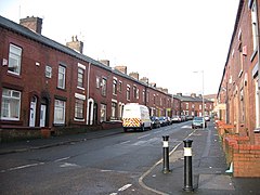
Horsedge Street in Coldhurst
Greater Manchester UK location map 2.svg
Red pog.svg
Coldhurst
Location within Greater Manchester
Population13,201 (2011 Census)
  Density 58.1
OS grid reference SD921058
Metropolitan borough
Metropolitan county
Region
Country England
Sovereign state United Kingdom
Post town OLDHAM
Postcode district OL1
Dialling code 0161
Police Greater Manchester
Fire Greater Manchester
Ambulance North West
UK Parliament
List of places
UK
England
Greater Manchester
53°32′56″N2°07′07″W / 53.548981°N 2.118491°W / 53.548981; -2.118491 Coordinates: 53°32′56″N2°07′07″W / 53.548981°N 2.118491°W / 53.548981; -2.118491

Coldhurst (or more rarely Cold Hurst) is an area of Oldham and an electoral ward of the wider Metropolitan Borough of Oldham in Greater Manchester, England. At the time of the United Kingdom Census 2001, it had a population of 11,935, [1] increasing to 13,201 at the 2011 Census. [2] The electoral ward spans most of Oldham's town centre, [3] although the name Coldhurst conventionally applies to the area immediately north of the centre. The district of Westwood and a small adjoining part of Chadderton in the Busk area also lie within the Coldhurst ward district.

Contents

Historically a part of Lancashire, Coldhurst was formerly a chapelry within the ancient ecclesiastical parish of Prestwich-cum-Oldham, in the Salfordshire hundred. [4]

An old hall existed in the locality belonging to Abram Crompton Esq, which gave its name to Crompton Street.

Coldhurst is said to have been the scene of an action in the English Civil War in which the parliamentarians were defeated. [4]

Following the Industrial Revolution, Coldhurst was the site of considerable industry and commerce, including coal mining, cotton spinning and hat manufacture. [4]

Coldhurst is the home of a significant community of South Asian (particularly Bangladeshi) heritage. [1] 37% of the population is non-white and most of the white residents live in what have been described as "bleak council developments". [3] In 2001, Coldhurst was in the 5% most deprived wards in the United Kingdom. [5]

A photograph of Coldhurst during the Victorian era was used as part of the "Made of Manchester" promotion of the home strip worn by Manchester United F.C. for the 2012–13 season. [6]

Related Research Articles

<span class="mw-page-title-main">Oldham</span> Town in Greater Manchester, England

Oldham is a large town in Greater Manchester, England, amid the Pennines and between the rivers Irk and Medlock, 5.3 miles (8.5 km) southeast of Rochdale and 6.9 miles (11.1 km) northeast of Manchester. It is the administrative centre of the Metropolitan Borough of Oldham, which had a population of 237,110 in 2019.

<span class="mw-page-title-main">Chadderton</span> Town in England

Chadderton is a town in the Metropolitan Borough of Oldham, Greater Manchester, England, on the River Irk and Rochdale Canal. It is located in the foothills of the Pennines, 1 mile (1.6 km) west of Oldham, 4.5 miles (7.2 km) south of Rochdale and 6 miles (9.7 km) north-east of Manchester.

Glodwick is an area of Oldham, Greater Manchester, England. It is south-east of Oldham town centre.

<span class="mw-page-title-main">Failsworth</span> Town in Greater Manchester, England

Failsworth is a town in the Metropolitan Borough of Oldham in Greater Manchester, England, 3.7 miles (6.0 km) north-east of Manchester city centre and 2.9 miles (4.7 km) south-west of Oldham. The orbital M60 motorway skirts it to the east. The population at the 2011 census was 20,680. Historically in Lancashire, Failsworth until the 19th century was a farming township linked ecclesiastically with Manchester. Inhabitants supplemented their farming income with domestic hand-loom weaving. The humid climate and abundant labour and coal led to weaving of textiles as a Lancashire Mill Town with redbrick cotton mills. A current landmark is the Failsworth Pole. Daisy Nook is a country park on the southern edge.

<span class="mw-page-title-main">Saddleworth</span> Human settlement in England

Saddleworth is a civil parish of the Metropolitan Borough of Oldham in Greater Manchester, England. It comprises several villages and hamlets as well as suburbs of Oldham on the west side of the Pennine hills.

<span class="mw-page-title-main">Metropolitan Borough of Oldham</span> Borough of Greater Manchester, England

The Metropolitan Borough of Oldham is a metropolitan borough of Greater Manchester in North West England. It is named after its largest town, Oldham, The borough had a population of 237,628 making it the seventh-largest district by population in Greater Manchester. The borough spans 55 square miles (142 km2).

<span class="mw-page-title-main">Milnrow</span> Human settlement in England

Milnrow is a town within the Metropolitan Borough of Rochdale, in Greater Manchester, England. It lies on the River Beal at the foothills of the South Pennines, and forms a continuous urban area with Rochdale. It is 1.9 miles (3.1 km) east of Rochdale town centre, 10.4 miles (16.7 km) north-northeast of Manchester, and spans urban, suburban and rural locations—from Windy Hill in the east to the Rochdale Canal in the west. Milnrow is adjacent to junction 21 of the M62 motorway, and includes the village of Newhey, and hamlets at Tunshill and Ogden.

<span class="mw-page-title-main">Royton</span> Human settlement in England

Royton is a town in the Metropolitan Borough of Oldham, Greater Manchester, England, with a population of 21,284 in 2011. Close to the source of the River Irk, near undulating land at the foothills of the South Pennines, it is 1.7 miles (2.7 km) northwest of Oldham, 3.2 miles (5.1 km) southeast of Rochdale and 7.6 miles (12.2 km) northeast of Manchester.

<span class="mw-page-title-main">Oldham West and Royton (UK Parliament constituency)</span> Parliamentary constituency in the United Kingdom, 1997 onwards

Oldham West and Royton is a constituency represented in the House of Commons of the UK Parliament. It has been represented by Jim McMahon of the Labour Co-op party since 4 December 2015, after winning a by-election following the death of Michael Meacher on 21 October 2015.

<span class="mw-page-title-main">Hollinwood, Greater Manchester</span> Human settlement in England

Hollinwood is an area and electoral ward of the Metropolitan Borough of Oldham, Greater Manchester, England. The population at the 2011 census was 10,920.

<span class="mw-page-title-main">Shaw and Crompton</span> Civil parish in Greater Manchester, England

Shaw and Crompton is a civil parish in the Metropolitan Borough of Oldham, Greater Manchester, England, which contains the town of Shaw and lies on the River Beal at the foothills of the South Pennines. It is located 2.3 miles (3.7 km) north of Oldham, 3.6 miles (5.8 km) south-east of Rochdale and 8.7 miles (14 km) north-east of Manchester.

<span class="mw-page-title-main">Werneth, Greater Manchester</span> Human settlement in England

Werneth is an area of Oldham, Greater Manchester, England. The population at the 2011 census was 12,348. It is 1 mile (1.6 km) west-southwest of Oldham's commercial centre and one of its most ancient localities. It is contiguous with Westwood, Hollinwood, Hollins and Chadderton. Werneth includes Freehold between Werneth Park and Oldham's border with Chadderton at Block Lane.

<span class="mw-page-title-main">Waterhead, Greater Manchester</span> Human settlement in England

Waterhead, is an area of Oldham, and an electoral ward of the Metropolitan Borough of Oldham, in Greater Manchester, England. Historically in Lancashire, an upland area in the Pennines, the ward of Waterhead has population of 12,876, decreasing to 12,029 at the 2011 Census.

<span class="mw-page-title-main">Demography of Greater Manchester</span>

The demography of Greater Manchester is analysed by the Office for National Statistics and data is produced for each of its ten metropolitan boroughs, each of the Greater Manchester electoral wards, the NUTS3 statistical sub-regions, each of the Parliamentary constituencies in Greater Manchester, the 15 civil parishes in Greater Manchester, and for all of Greater Manchester as a whole; the latter of which had a population of 2,682,500 at the 2011 UK census. Additionally, data is produced for the Greater Manchester Urban Area. Statistical information is produced about the size and geographical breakdown of the population, the number of people entering and leaving country and the number of people in each demographic subgroup.

<span class="mw-page-title-main">Trent Mill</span> Cotton mill in Greater Manchester, England

Trent Mill was a cotton spinning mill on Duchess Street in Shaw and Crompton, Greater Manchester, England. It was built by F.W. Dixon & Son in 1908. It closed and was taken over by the Lancashire Cotton Corporation in 1929 reopened in 1938 and closed again in 1962, and was demolished in 1967.

<span class="mw-page-title-main">Rutland Mill</span> Cotton mill in Greater Manchester, England

Rutland Mill was a cotton spinning mill on Linney Lane, in Shaw and Crompton, Greater Manchester, England. It was built by F. W. Dixon & Son in 1907 for the Rutland Mill Co. Ltd. It was taken over by the Lancashire Cotton Corporation in 1935. By 1964, it was in the Courtaulds Group. In the late 1980s, as Courtaulds moved operations to other parts of the world, the mill was bought by Littlewoods who demolished it and replaced it with a new automated storage warehouse.

<span class="mw-page-title-main">Hawk Mill, Shaw</span> Cotton mill in Greater Manchester, England

Hawk Mill, Shaw was a cotton spinning mill in Shaw, Oldham, Greater Manchester. It was built in 1908. It was taken over by the Lancashire Cotton Corporation in the 1931 and passed to Courtaulds in 1964. The mill closed in 1967, and was demolished in 1991.

<span class="mw-page-title-main">Dawn Mill, Shaw</span> Cotton mill in Greater Manchester, England

Dawn Mill, Shaw was a cotton spinning mill in Shaw and Crompton, Oldham, Greater Manchester. It was built on the site of Shaw Mill at the "dawn" of the 20th century. Dawn Mill was equipped with mule weft spindles in 1950. It was powered by Engines named Venus and Mars, 1800 hp twin tandem compound engine by George Saxon of Manchester. It was taken over by the Lancashire Cotton Corporation in the 1930s and passed to Courtaulds in 1964. It was sold again and used by distribution company DTS Logistics for storing and distributing clothing. It was demolished in 2006 to make way for an Asda supermarket.

<span class="mw-page-title-main">Newby Mill, Shaw</span> Cotton mill in Greater Manchester, England

Elm Mill, was a four-storey cotton spinning mill in Shaw and Crompton, Greater Manchester, England. It was built in 1890 for the Elm Spinning Company Ltd., and was called Elm Mill until it closed in 1928. It was revived by the Lancashire Cotton Corporation in 1929 and called Newby Mill. LCC and all their assets passed to Courtaulds in 1964. Production at Newby finished in 1970, and it was used for warehousing. Subsequently, named Shaw No 3 Mill, it became part of Littlewood's Shaw National Distribution Centre. It was demolished to make way for housing in 2022.

<span class="mw-page-title-main">Oldham Council</span>

Oldham Metropolitan Borough Council, branded and commonly referred to as Oldham Council, is the local authority of the Metropolitan Borough of Oldham in Greater Manchester, England. It is a metropolitan district council, one of ten in Greater Manchester and one of 36 in the metropolitan counties of England, and provides the majority of local government services in Oldham. It is composed of 60 councillors, three for each of the 20 electoral wards of the borough.

References

Notes

  1. 1 2 United Kingdom Census 2001. "Coldhurst (Ward)". neighbourhood.statistics.gov.uk. Archived from the original on 15 May 2011. Retrieved 7 April 2007.
  2. "Oldham ward population 2011" . Retrieved 5 January 2016.
  3. 1 2 Criddle & Waller 2002 , p. 602.
  4. 1 2 3 British History Online (1848). "'Cold-Ashby - Coley' A Topographical Dictionary of England". Victoria County History. Retrieved 7 April 2007.
  5. David Ritchie (11 December 2001). "The Ritchie Report" (PDF). Oldham Independent Review. Archived from the original (PDF) on 7 October 2007. Retrieved 7 April 2007.
  6. Keegan, Mike (16 May 2012). "United's kit Made of Manchester? Actually that's Oldham..." Manchester Evening News . menmedia.co.uk. Retrieved 4 November 2012.

Bibliography