Brighouse is a town within the metropolitan borough of Calderdale, in West Yorkshire, England. Historically within the West Riding of Yorkshire, it is situated on the River Calder, 4 miles (6.4 km) east of Halifax. It is served by Junction 25 of the M62 motorway and Brighouse railway station on the Caldervale Line and Huddersfield Line. In the town centre is a mooring basin on the Calder and Hebble Navigation. The United Kingdom Census 2001 gave the Brighouse / Rastrick subdivision of the West Yorkshire Urban Area a population of 32,360. The Brighouse ward of Calderdale Council gave a population of 11,195 at the 2011 Census. Brighouse has a HD6 postcode.

Elland is a market town in Calderdale, in the county of West Yorkshire, England. It is situated south of Halifax, by the River Calder and the Calder and Hebble Navigation. Elland was recorded as Elant in the Domesday Book of 1086. It had a population in 2001 of 14,554, with the ward being measured at 11,676 in the 2011 Census.

Mytholmroyd is a large village and former civil parish, now in the parish of Hebden Royd, in the Calderdale district, in West Yorkshire, England, 2 miles (3 km) east of Hebden Bridge. It lies in the Upper Calder Valley, 10 miles (16 km) east of Burnley and 7 miles (11 km) west of Halifax. The village, which has a population of approximately 4,000, is in the Luddendenfoot Ward of Calderdale Council.
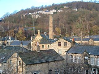
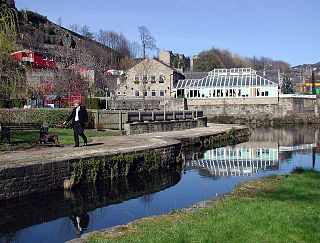
Hebden Bridge is a market town in the Calderdale district of West Yorkshire, England. It is in the Upper Calder Valley, 8 miles (13 km) west of Halifax and 14 miles (21 km) north-east of Rochdale, at the confluence of the River Calder and the Hebden Water. The town is the largest settlement in the civil parish of Hebden Royd.

Rastrick is a village in the county of West Yorkshire, England, between Halifax, 5 miles (8 km) north-west and Huddersfield, 4 miles (7 km) south.

Sowerby Bridge is a market town in the Upper Calder Valley in Calderdale in West Yorkshire, England. The Calderdale Council ward population at the 2011 census was 11,703.

The Calder Valley line is a railway route in Northern England between the cities of Leeds and Manchester as well as the seaside resort of Blackpool. It is the slower of the two main rail routes between Leeds and Manchester, and the northernmost of the three main trans-Pennine routes.

Calder Valley is a constituency in West Yorkshire represented in the House of Commons of the UK Parliament since 2024 by Josh Fenton-Glynn of the Labour Party.
Hebden Royd is a civil parish in the Metropolitan Borough of Calderdale in West Yorkshire, England. According to the 2001 census it had a population of 9,092, rising to 9,558 at the 2011 census. It includes market town of Hebden Bridge and the villages of Mytholmroyd and Cragg Vale. The parish was an urban district before 1974, created in 1937 by the merger of Hebden Bridge and Mytholmroyd urban districts.
Salterhebble is an area of Halifax, a town within the Metropolitan Borough of Calderdale, in West Yorkshire, England. The town falls within the Skircoat ward of Calderdale Council. Salterhebble is located where the Hebble Brook flows into the River Calder. It is on the main route into Halifax from Huddersfield and Brighouse. Salterhebble is the home of Calderdale Royal Hospital, a school, a fast food restaurant, a funeral parlour and one active pub, The Watermill. Some former pubs in the village included The Punch Bowl, The Falcon and The Stafford Arms.

Sowerby was a county constituency centred on the village of Sowerby in Calderdale, West Yorkshire. It returned one Member of Parliament (MP) to the House of Commons of the Parliament of the United Kingdom.

The Upper Calder Valley lies in West Yorkshire, in northern England, and covers the towns of Todmorden, Hebden Bridge, Mytholmroyd, Luddendenfoot, and Sowerby Bridge, as well as a number of smaller settlements such as Portsmouth, Cornholme, Walsden, and Eastwood. The valley is the upper valley of the River Calder. Major tributaries of the Upper Calder include the Walsden Water, which flows through the large village of Walsden to join the Calder at Todmorden; the Hebden Water, which flows through Hebden Dale to join the Calder at Hebden Bridge; Cragg Brook, which flows through Cragg Vale to join the Calder at Mytholmroyd, and the largest, the River Ryburn, which joins the Calder at Sowerby Bridge.

Eastwood is a place within the civil parish of Todmorden and Metropolitan Borough of Calderdale, in West Yorkshire, England. It lies 8 miles (12.9 km) west from Halifax, roughly equidistant from Todmorden's town centre, which is 2 miles (3.2 km) to the southwest, and Hebden Bridge, which is 2 miles to the northeast, along the course of the River Calder. Eastwood falls within the Calder ward of Calderdale council.

The Municipal Borough of Brighouse was a local government district in the West Riding of Yorkshire from 1873 to 1974 around the town of Brighouse, covering Clifton, Hipperholme, Hove Edge, Lightcliffe, Rastrick and Southowram.

The River Calder is a river in West Yorkshire, in Northern England.

Calderdale Metropolitan Borough Council, also known as Calderdale Council, is the local authority for the Metropolitan Borough of Calderdale in West Yorkshire, England. It is a metropolitan borough council and provides the majority of local government services in the borough. Since 2014 the council has been a constituent member of the West Yorkshire Combined Authority.
The first elections to the newly created Calderdale Metropolitan Borough Council were held on 10 May 1973, with the entirety of the 51 seat council — three seats for each of the 17 wards — up for vote. The Local Government Act 1972 stipulated that the elected members were to shadow and eventually take over from the predecessor corporation on 1 April 1974. The order in which the councillors were elected dictated their term serving, with third-place candidates serving two years and up for re-election in 1975, second-placed three years expiring in 1976 and 1st-placed five years until 1978.