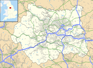
This is a list of settlements in West Yorkshire by population based on the results of the 2011 census. The next United Kingdom census will take place in 2021. In 2011, there were 50 built-up area subdivisions with 5,000 or more inhabitants in West Yorkshire, shown in the table below.
| # | Settlement | Population | |
|---|---|---|---|
| 2001 [1] | 2011 [2] | ||
| 1 | Leeds | 445,260 | 474,632 |
| 2 | Bradford | 309,020 | 349,561 |
| 3 | Huddersfield | 147,280 | 162,949 |
| 4 | Wakefield | 96,290 | 99,251 |
| 5 | Halifax | 83,440 | 88,134 |
| 6 | Batley | 76,270 | 80,485 |
| 7 | Dewsbury | 57,780 | 62,945 |
| 8 | Keighley | 48,920 | 53,331 |
| 9 | Castleford | 36,300 | 39,192 |
| 10 | Brighouse | 31,870 | 33,286 |
| 11 | Pudsey | 31,850 | 32,216 |
| 12 | Morley | 27,480 | 29,673 |
| 13 | Pontefract | 28,250 | 29,305 |
| 14 | Shipley | 26,040 | 28,694 |
| 15 | Bingley | 19,890 | 22,493 |
| 16 | Holmfirth | 20,138 | 21,706 |
| 17 | Normanton | 20,280 | 21,317 |
| 18 | Ossett | 21,076 | 21,231 |
| 19 | Yeadon | 20,270 | 19,668 |
| 20 | Rothwell | 19,400 | 19,512 |
| 21 | Mirfield | 18,390 | 19,330 |
| 22 | Horsforth | 18,930 | 18,895 |
| 23 | Liversedge | 16,930 | 17,697 |
| 24 | Baildon | 15,569 | 15,944 |
| 25 | Elland | 14,560 | 15,625 |
| 26 | Garforth | 15,394 | 14,838 |
| 27 | Ilkley | 13,828 | 14,809 |
| 28 | Otley | 14,641 | 14,215 |
| 29 | Knottingley | 13,797 | 13,971 |
| 30 | Heckmondwike | 10,717 | 12,085 |
| 31 | Guiseley | 11,130 | 11,960 |
| 32 | Todmorden | 11,555 | 11,690 |
| 33 | Cleckheaton | 10,480 | 11,648 |
| 34 | Wetherby | 11,710 | 11,242 |
| 35 | Featherstone | 11,660 | 11,060 |
| 36 | South Elmsall | 10,211 | 10,366 |
| 37 | Horbury | 10,002 | 10,361 |
| 38 | Kippax | 10,422 | 10,083 |
| 39 | Hemsworth | 9,145 | 9,246 |
| 40 | South Kirkby | 8,220 | 8,533 |
| 41 | Silsden | 7,681 | 7,912 |
| 42 | Meltham | 7,382 | 7,836 |
| 43 | Burley | 6,400 | 7,041 |
| 44 | Haworth | 6,078 | 6,379 |
| 45 | Upton | 6,070 | 5,874 |
| 46 | Shepley | 5,242 | 5,444 |
| 47 | Thornton | 4,998 | 5,289 |
| 48 | Ackworth | 4,784 | 5,281 |
| 49 | Crofton | 5,414 | 5,258 |
| 50 | Ryhill | 4,731 | 5,150 |
| 51 | Allerton Bywater | 3,950 | 4,717 |
| 52 | Ripponden | 3,780 | 4,665 |
| 53 | Boston Spa | 4,628 | 4,662 |
| 54 | Sowerby Bridge | 4,420 | 4,601 |
| 55 | Skelmanthorpe | 4,141 | 4,549 |

The demography of England has since 1801 been measured by the decennial national census, and is marked by centuries of population growth and urbanization. Due to the lack of authoritative contemporary sources, estimates of the population of England for dates prior to the first census in 1801 vary considerably. The population of England at the 2021 census was 56,489,800.

The counties for the purposes of the lieutenancies in England, also referred to as the lieutenancy areas of England and informally known as ceremonial counties, are areas of England to which lords-lieutenant are appointed. Legally, the areas in England, Wales and Scotland are defined by the Lieutenancies Act 1997 as "counties and areas for the purposes of the lieutenancies in Great Britain", in contrast to the metropolitan and non-metropolitan counties of England used for local government. They are also informally known as "geographic counties", to distinguish them from other types of counties of England.

Lieutenancy areas, officially counties and areas for the purposes of the lieutenancies, are the separate areas of the United Kingdom appointed a lord-lieutenant – a representative of the British monarch. In many cases they have similar demarcation and naming to, but are not necessarily coterminate with, the counties of the United Kingdom.

Queensbury is a large village in the metropolitan borough of Bradford, West Yorkshire, England. Perched on a high vantage point above Halifax, Clayton and Thornton and overlooking Bradford itself, Queensbury is one of the highest parishes in England, with views beyond the West Yorkshire conurbation to the hills of Brontë Country and the Yorkshire Dales to the north and north west. It had a population of 8,718 in 2001 which increased to 16,273 in the 2011 Census.

The West Yorkshire Built-up Area, previously known as the West Yorkshire Urban Area is a term used by the Office for National Statistics (ONS) to refer to a conurbation in West Yorkshire, England, based on the cities of Leeds, Bradford and Wakefield, and the large towns of Huddersfield and Halifax. It is the 4th largest urban area in the United Kingdom. However, it excludes other towns and villages such as Featherstone, Normanton, Castleford, Pontefract, Hemsworth, Todmorden, Hebden Bridge, Knottingley, Wetherby and Garforth which, though part of the county of West Yorkshire are considered independently. There are substantial areas of agricultural land within the designated area – more than in any other official urban area in England – many of the towns and cities are only just connected with one another by narrow outlying strips of development.

Stanley is a village in the Metropolitan Borough of Wakefield in West Yorkshire, England. It is about 2.5 miles (4.0 km) north-east of Wakefield city centre. Stanley was an Urban District in the West Riding of Yorkshire before 1974, being made up the four electoral wards of Lake Lock, Outwood, Stanley and Wrenthorpe. The Lofthouse / Stanley area of West Yorkshire has a combined population of 22,947. The ward remaining at the 2011 Census was called Stanley and Outwood East. The population of this ward at the 2011 Census was 15,314.

Brotherton is a village and civil parish in the Selby District of North Yorkshire, England. The village is on a border with the City of Wakefield and West Yorkshire.
The Leicester Urban Area or Leicester Built Up Area is an urban agglomeration defined by the Office of National Statistics (ONS), centred on the City of Leicester in the English Midlands. With a population of 559,017 at the time of the 2021 census, increased from 508,916 at the time of the 2011 census, the Built Up Area is the eleventh largest in England and thirteenth largest in the United Kingdom. It comprises Leicester itself and its suburbs, all of which are contiguous with, or situated in close proximity to, the city.

White British is an ethnicity classification used for the native white population identifying as English, Scottish, Welsh, Cornish, Northern Irish, or British in the United Kingdom Census. In the 2011 census, the White British population was 49,997,686, 81.5% of Great Britain's total population. For the United Kingdom entirely, due to different reporting measures within Northern Ireland which includes all those who identified as British with those who identified as Irish, an amalgamated total of 52,320,080 including those who identified as White Irish in Great Britain is given making up 82.8% of the population.
A census of the population of the United Kingdom is taken every ten years. The 2011 census was held in all countries of the UK on 27 March 2011. It was the first UK census which could be completed online via the Internet. The Office for National Statistics (ONS) is responsible for the census in England and Wales, the General Register Office for Scotland (GROS) is responsible for the census in Scotland, and the Northern Ireland Statistics and Research Agency (NISRA) is responsible for the census in Northern Ireland.

Bradford, England is an ethnically and culturally diverse city. The City of Bradford metropolitan borough is the sixth most populous local authority district in the United Kingdom, and includes not only Bradford but also the towns and villages of Keighley, Shipley, Bingley, Ilkley, Haworth, Silsden, Queensbury, Thornton and Denholme.

Leeds, England is the third most populous city in the United Kingdom.