Kippax, West Yorkshire

Last updated

Kippax
Kippax High Street - geograph.org.uk - 740935.jpg
Kippax High Street, 2008
Leeds UK location map.svg
Red pog.svg
Kippax
West Yorkshire UK location map.svg
Red pog.svg
Kippax
Location within West Yorkshire
Population9,785 (2011 census) [1]
Civil parish
  • Kippax
Metropolitan borough
Metropolitan county
Region
Country England
Sovereign state United Kingdom
Post town LEEDS
Postcode district LS25
Police West Yorkshire
Fire West Yorkshire
Ambulance Yorkshire
UK Parliament
List of places
UK
England
Yorkshire
53°46′01″N1°22′14″W / 53.7669°N 1.3705°W / 53.7669; -1.3705

Kippax is a town and civil parish in the City of Leeds, West Yorkshire, England. It is situated to the east of the city, near to Garforth and Great Preston.

Contents

The Kippax and Methley ward of Leeds City Council is part of the UK Parliament constituency of Selby. The population of Kippax parish at the 2011 census was 9,785. [1] Kippax was a separate civil parish, in Tadcaster Rural District, until 1939, when it was annexed to Garforth. It re-acquired civil parish status and a parish council on 1 April 2004.

History

The name Kippax is of Anglo-Saxon origin and is first attested as Chipesch in the Domesday Book of 1086, and as "Kippeys" in charters from the 1090s to the 1270s, and Kypask and Kypax from the 13th century onwards. [2] The placename seems to be composed of an Anglo-Saxon personal name Cippa (with initial [tʃ-], suggested by the Domesday Book form) or Cyppa (with initial [k-]) + æsc [æʃ] 'ash-tree'. This suggests that the village was first established in a wooded area of ash trees. The pronunciation of the name seems to show Scandinavian influence, perhaps in the change from initial [tʃ-] to [k-], and more clearly in the change of [-æʃ] to [-ask] (and thereafter [-aks]). [3]

Locational surnames such as Kippax developed when former inhabitants of a place moved to another area, usually to seek work, and were best identified by the name of their birthplace. The surname first appears in the late-14th century and other early recordings include: Johannes de Kypax, Johanna Kepas, and Johannes de Kepax, who were all recorded in the Poll Tax Records for Yorkshire in 1379. [4]

The village's historical roots are evidenced by the presence of an originally Anglo-Saxon church which underwent significant modification in Norman times. [5] Typical Saxon herring-bone masonry can be seen in the church tower. Despite being an administrative centre for hundreds of years, the population remained small and it was mostly agricultural until the late-18th century when coal mining began on a small scale in bell pits. The advent of deeper mining and the discovery of coal seams in Allerton Bywater saw Kippax undergo a rapid expansion into a typical northern mining community in the 19th century.

Exploitation of the coal led to a railway being built between Garforth and Castleford in 1873. The single line had two intermediate stations at Kippax and Ledston. It was closed to passengers in 1951. [6] The decline in deep mining saw Allerton Bywater pit close in the 1990s having been in decline since the 1970s. [7]

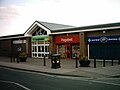
Kippax adjusted to its new status as a commuter village. Its proximity to the A1/M1/M62 means that many residents now commute to Leeds, Castleford, London, Wakefield or York. The high street has a mix of independent butchers, grocers and newsagents and a small co-op store.

Sport and notable people

The village is the home of the Kippax Welfare rugby league club. Its first team plays as the Kippax Knights.

Musician Robert Harvey, of the band The Music, is from Kippax. [8]

See also

Related Research Articles

<span class="mw-page-title-main">Ledsham, West Yorkshire</span> Village and civil parish in West Yorkshire, England

Ledsham is a village and civil parish 4 miles (6 km) north of Castleford and 11 miles (18 km) east of Leeds in the county of West Yorkshire, England. The village is in the City of Leeds metropolitan borough and near to the A1(M) motorway. It had a population of 162 at the 2001 Census, increasing to 181 at the 2011 Census.

<span class="mw-page-title-main">Ledston</span> Village and civil parish in West Yorkshire, England

Ledston is a village in the Leeds metropolitan borough, in the county of West Yorkshire, England. It is 3 miles (5 km) north of Castleford and 10 miles (16 km) east of Leeds. The parish had a population of 400 in 2001, which decreased slightly to 394 at the 2011 Census.

<span class="mw-page-title-main">Austhorpe</span> Civil parish and suburb of Leeds, West Yorkshire, England

Austhorpe is a civil parish and residential suburb of east Leeds, West Yorkshire, England. It is 5 miles (8 km) to the east of city centre and close to the A6120 dual carriageway and the M1 motorway.

<span class="mw-page-title-main">Garforth</span> Town in West Yorkshire, England

Garforth is a town in the metropolitan borough of the City of Leeds, West Yorkshire, England.

Kildwick, or Kildwick-in-Craven, is a village and civil parish of the district of Craven in North Yorkshire, England. It is situated between Skipton and Keighley and had a population of 191 in 2001, rising slightly to 194 at the 2011 census. Kildwick is a landmark as where the major road from Keighley to Skipton crosses the River Aire. The village's amenities include a primary school, church and public house.

<span class="mw-page-title-main">Barwick-in-Elmet</span> Village in West Yorkshire, England

Barwick-in-Elmet is a village in West Yorkshire, 7 miles (11 km) east of Leeds city centre. It is one of only three places in the area to be explicitly associated with the ancient Romano-British kingdom of Elmet, the others being Scholes-in-Elmet and Sherburn-in-Elmet.

<span class="mw-page-title-main">Methley</span> Village in West Yorkshire, England

Methley is a dispersed village in the City of Leeds metropolitan borough, south east of Leeds, West Yorkshire, England. It is located near Rothwell, Oulton, Woodlesford, Mickletown and Allerton Bywater. The Leeds City Ward is called Kippax and Methley. It is within the triangle formed by Leeds, Castleford and Wakefield, and between the confluence of the River Aire and River Calder. The latter is crossed by Methley Bridge, the A639 road, about a mile south-east of the village.

<span class="mw-page-title-main">Allerton Bywater</span> Village and civil parish in West Yorkshire, England

Allerton Bywater is a semi-rural village and civil parish in the south-east of the City of Leeds metropolitan borough in West Yorkshire, England. The population of the civil parish at the 2011 census was 4,717. The village itself is 2 miles (3.2 km) north of Castleford, with neighbouring villages Kippax and Great Preston all providing local amenities. St Aidan's Nature reserve borders the village attracting many visitors with its beauty and charm. Additionally "The Lines Way" bridle path which runs from Garforth through to Allerton following the old train track provides a pleasant route for walkers, joggers and cyclists alike. The River Aire flows through the village to the south-west.

<span class="mw-page-title-main">Great Preston</span>

Great Preston is a small rural village in the City of Leeds metropolitan borough, West Yorkshire, England. It has incorporated the once neighbouring hamlet of Little Preston.

<span class="mw-page-title-main">Elmet and Rothwell (UK Parliament constituency)</span> Parliamentary constituency in the United Kingdom, 2010–2024

Elmet and Rothwell was a constituency for the House of Commons of the UK Parliament in West Yorkshire. In the 2017 general election, Elmet and Rothwell recorded the largest turnout of any seat in West or South Yorkshire, with almost 60,000 electors casting a vote.

<span class="mw-page-title-main">South Milford</span> Village and civil parish in North Yorkshire, England

South Milford is a village and civil parish in the county of North Yorkshire, England. The civil parish includes the hamlet of Lumby, located south-west of the main village.

<span class="mw-page-title-main">Swillington</span> Village and civil parish in West Yorkshire, England

Swillington is a village and civil parish near Leeds, West Yorkshire, England, in the City of Leeds metropolitan borough. It is situated 5 miles (8 km) east from Leeds city centre, north of the River Aire, and is surrounded by streams including Fleakingley Beck. In 2001, Swillington had a population of about 3,530, reducing to 3,381 at the 2011 Census.

<span class="mw-page-title-main">Brigshaw High School</span> Academy in Allerton Bywater, West Yorkshire, England

Brigshaw High School is a coeducational secondary school and sixth form located in the village of Allerton Bywater, West Yorkshire, England.

<span class="mw-page-title-main">Leeds Country Way</span> Long-distance footpath, West Yorkshire, England

The Leeds Country Way (LCW) is a circular long-distance footpath of 62 miles (99 km) around Leeds, West Yorkshire, England. It is never more than 7 miles (11 km) from the city centre of Leeds, but is mainly rural with extensive views in the outlying areas of the Leeds metropolitan district. It follows public Rights of Way including footpaths, bridleways and minor lanes, with a few short sections along roads.

<span class="mw-page-title-main">East Hardwick</span> Village and civil parish in West Yorkshire, England

East Hardwick is a village and civil parish in the City of Wakefield in West Yorkshire, England. It has a population of 191, reducing to 173 at the 2011 Census. Until 1974 it was part of Osgoldcross Rural District.

<span class="mw-page-title-main">Castleford–Garforth line</span> Railway line in the UK

The Castleford–Garforth line was a single-track railway line in West Yorkshire, England, connecting Castleford with Garforth east of Leeds. The route was developed to allow coal to be transported from the area, though a passenger service was operated between 1878 and 1951. Initially promoted by Leeds, Castleford and Pontefract Junction Railway, it was taken over by the North Eastern Railway before the line was completed.

<span class="mw-page-title-main">Kippax and Methley (ward)</span> Electoral ward in Leeds, England

Kippax and Methley is an electoral ward of Leeds City Council in south east Leeds, West Yorkshire, including the villages and civil parishes of Allerton Bywater, Kippax and Methley.

Ledston railway station was a railway station on the now disused Castleford–Garforth line in West Yorkshire, England. The station opened in 1878 and was closed in January 1951, well before the Beeching Axe took effect.

<span class="mw-page-title-main">Church of All Saints, Ledsham</span> Anglican church in West Yorkshire, England

The Church of All Saints is an Anglican building in the village of Ledsham, West Yorkshire, England, some 10 miles (16 km) east of Leeds. Parts of the church are originally from the Anglo-Saxon period, which has been the basis of the claim that it is the oldest church still standing within West Yorkshire, and one of the county's oldest buildings. Although Yorkshire has several Anglo-Saxon structures, the church is noted as a rare survivor despite several renovations. In his book, England's Thousand Best Churches, Simon Jenkins rates it with two stars out five, and it is one of only nine recommended for West Yorkshire.

References

  1. 1 2 UK Census (2011). "Local Area Report – Kippax Parish (E04000219)". Nomis. Office for National Statistics . Retrieved 20 May 2019.
  2. Ekwall, Eilert (1960). The concise Oxford dictionary of English place-names (4 ed.). Oxford: Oxford University Press. p. 279. ISBN   0-19-869103-3.
  3. Victor Watts (ed.), The Cambridge Dictionary of English Place-Names, Based on the Collections of the English Place-Name Society (Cambridge: Cambridge University Press, 2004), s.v. KIPPAX.
  4. "Surname Database: Kippax Last Name Origin". 2012. Retrieved 22 April 2012.
  5. "GENUKI: Kippax". www.genuki.org.uk. Retrieved 6 December 2009.
  6. Young, Alan (2015). Lost Stations of Yorkshire; the West Riding. Kettering: Silver Link. p. 83. ISBN   978-1-85794-438-9.
  7. Rockett, Ron (2003). Leeds Castleford and Pontefract Junction Railway. Farsley: Martin Bairstow. p. 32. ISBN   1-871944-27-9.
  8. Sullivan, Caroline (13 January 2003). "The Music, Brixton Academy, London". The Guardian. Retrieved 20 May 2019.