
Haworth is a village in City of Bradford, West Yorkshire, England, in the Pennines, 3 miles (5 km) southwest of Keighley, 10 miles (16 km) west of Bradford and 10 miles (16 km) east of Colne in Lancashire. The surrounding areas include Oakworth and Oxenhope. Nearby villages include Cross Roads, Stanbury and Lumbfoot.
Bingley is a market town and civil parish in the metropolitan borough of the City of Bradford, West Yorkshire, England, on the River Aire and the Leeds and Liverpool Canal, which had a population of 18,294 at the 2011 Census.

Riddlesden is a suburb of Keighley in the county of West Yorkshire, England and on the Leeds and Liverpool Canal.

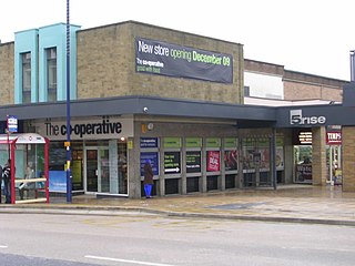
Keighley is a large market town and a civil parish in West Yorkshire, England. It is the largest settlement in the City of Bradford borough, after Bradford city.

Baildon is a town and civil parish in the Bradford Metropolitan Borough in West Yorkshire, England and within the historic boundaries of the West Riding of Yorkshire.

Wilsden is a village and civil parish in west Bradford, in West Yorkshire, England. Wilsden is 6 miles (9.7 km) west of Bradford and is close to the Aire Valley and the nearby villages of Denholme, Cullingworth, Harden, Cottingley and Allerton. Wilsden re-acquired civil parish status in 2004. The 2001 census revealed a population of 3,697, increasing to 4,807 at the 2011 Census.

The City of Bradford is a local government district of West Yorkshire, England, with the status of a city and metropolitan borough. It is named after its largest settlement, Bradford, but covers a far larger area which includes the towns and villages of Keighley, Shipley, Bingley, Ilkley, Haworth, Silsden, Queensbury, Thornton and Denholme. Bradford has a population of 528,155, making it the fourth-most populous metropolitan district and the sixth-most populous local authority district in England. It forms part of the West Yorkshire Urban Area conurbation which in 2011 had a population of 1,777,934, and the city is part of the Leeds-Bradford Larger Urban Zone (LUZ), which, with a population of 2,393,300, is the fourth largest in the United Kingdom after London, Birmingham and Manchester.

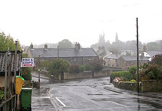
Cullingworth is a village and civil parish in the City of Bradford, West Yorkshire, England. Historically part of the West Riding of Yorkshire, it is 7 miles (11 km) west of Bradford and 3 miles (5 km) south of Keighley. The surrounding countryside is mainly used for sheep and cattle farming, with areas of moorland lying to the north and west. The village has undergone expansion in recent years, including a new primary school and housing estates. Cullingworth is now a popular commuter settlement serving the nearby towns of Keighley, Bradford and Halifax. The village had a population of 2,932 at the 2011 Census.

Clayton, or Clayton Village, is a civil parish in the City of Bradford metropolitan borough in West Yorkshire, England, situated 3 miles to the west of Bradford city centre. It is listed in the Domesday Book, meaning it dates back to at least the 11th century and was privately owned from 1160 to 1866. It was noted for its clay. More recently, Clayton was a key location in the British and international wool trade, being the home of the British Wool Marketing Board headquarters. The old building was demolished and converted into housing in the late 1990s. The village re-acquired civil parish status with a parish council in 2004.

Queensbury is a large village in the metropolitan borough of Bradford, West Yorkshire, England. Perched on a high vantage point above Halifax, Clayton and Thornton and overlooking Bradford itself, Queensbury is one of the highest parishes in England, with fine views beyond the West Yorkshire conurbation to the hills of Brontë Country and the Yorkshire Dales to the north and north west. It had a population of 8,718 in 2001 which increased to 16,273 in the 2011 Census.

Worth Valley is a ward in the City of Bradford Metropolitan District Council, West Yorkshire. The population of the ward taken at the 2011 Census was 14,387. It is named after the River Worth that runs through the valley to the town of Keighley where it joins the River Aire. In the north it is bounded by North Yorkshire, in the west by Lancashire and in the south by Calderdale District.
Addingham is a village and civil parish in the English county of West Yorkshire. It is situated near the A65, 6 miles (10 km) south east of Skipton, 3 miles (5 km) west of Ilkley, 19 miles (31 km) north west of Bradford and around 20 miles (32 km) north west of Leeds. Historically part of the West Riding of Yorkshire, it is located in the valley of the River Wharfe and is only 1 mile (2 km) from the Yorkshire Dales National Park. The name is thought to mean "homestead associated with a man called Adda", although in the Domesday Book, the village was referred to as "Ediham", which may have referred to Earl Edwin of Bolton Abbey. The 2001 census numbered Addingham's population at 3,599, increasing to 3,730 at the 2011 Census.

Denholme is a town and civil parish in the Bradford Metropolitan Borough, West Yorkshire, England. It is 8 miles (13 km) west of Bradford, 7 miles (11 km) from Keighley and roughly the same distance from Halifax. Administratively, it is part of the Bingley Rural ward of the City of Bradford. Denholme has a population of 2,976, increasing to 3,489 at the 2011 Census.

Gildersome is a village and civil parish in the City of Leeds metropolitan borough 5 miles (7 km) south-west of Leeds city centre in West Yorkshire, England. Glidersome forms part of the Heavy Woollen District.

Cougar Park is a rugby league stadium in Keighley, England, which is the home stadium of Keighley Cougars. Its capacity is 7,800 people. It also hosted a match during the 1995 Rugby League World Cup. From 1899 until 1995, it was known as "Lawkholme Lane". Football has also played at the ground, Silsden F.C. had played their home matches at the venue between 2003 and 2010. and Steeton A.F.C. played at the ground in 2018 and 2019.
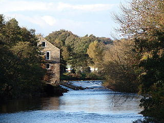
Harden is a civil parish and village within the City of Bradford Metropolitan District, West Yorkshire, England, 2 miles (3.2 km) west of Bingley. It had a population of 1,615 in the 2001 census, but by 2011 this had risen to 1,900.
Utley is a village that forms a suburb of the town of Keighley within the county of West Yorkshire, England, approximately 1.5 miles (2.4 km) from the town centre.

Steeton is a village in the Metropolitan District of Bradford, West Yorkshire, England. Historically part of the West Riding of Yorkshire, it is situated approximately 5 miles (8 km) south-east from Skipton, 3 miles (5 km) north-west from Keighley and just south of the A629 road. The village is part of Steeton with Eastburn civil parish.
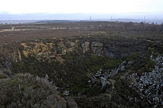
Harden Moor is an expanse of moorland that lies north of the village of Harden in West Yorkshire, England. The moor encompasses stretches of heather, woodland and former quarry workings and is bordered by Airedale to the east, the Worth Valley to the north and Catstones Moor and the village of Cullingworth to the west. Historically, Harden Moor occupied the high ground between Bingley, Keighley, Cullingworth and Harden. Altar Lane, an unmade road which runs from the Brown Cow Inn in Bingley to Keighley Road on Harden Moor is an unofficial border between the estate of St Ives and Harden Moor, but when the St Ives Estate was created, a large swathe of Harden Moor was taken over.

Hainworth is a hamlet 1 mile (2 km) south of Keighley in West Yorkshire, England. The hamlet faces north across the lower end of the Worth Valley with a steep wooded incline towards Keighley.

