Related Research Articles

The Lyke Wake Walk is a 40-mile (64 km) challenge walk across the highest and widest part of the North York Moors National Park in North Yorkshire, England. The route remembers the many corpses carried over the moors on old coffin routes and the ancient burial mounds encountered on the way; the name derives from a lyke, the corpse and the wake - watching over the deceased. Its associated club has a social structure, culture and rituals based on the walk and Christian and folklore traditions from the area through which it passes.
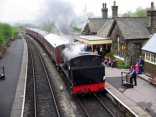
The Embsay and Bolton Abbey Steam Railway (E&BASR) is a heritage railway in North Yorkshire, England, formed in 1979 and opened in 1981.

Bolton Abbey Estate in Wharfedale, North Yorkshire, England, takes its name from a 12th-century Augustinian monastery of canons regular, now known as Bolton Priory. The priory, which was closed in the 1539 Dissolution of the Monasteries ordered by King Henry VIII, is in the Yorkshire Dales, which lies next to the village of Bolton Abbey.

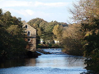
The River Wharfe is a river in Yorkshire, England originating within the Yorkshire Dales National Park. For much of its middle course it is the county boundary between West Yorkshire and North Yorkshire. Its valley is known as Wharfedale.

Ilkley is a spa town and civil parish in the City of Bradford in West Yorkshire, in Northern England. Historically part of the West Riding of Yorkshire, Ilkley civil parish includes the adjacent village of Ben Rhydding and is a ward within the City of Bradford. Approximately 12 miles (19 km) north of Bradford and 17 miles (27 km) north-west of Leeds, the town lies mainly on the south bank of the River Wharfe in Wharfedale, one of the Yorkshire Dales.

Wharfedale is one of the Yorkshire Dales. It is situated at source in North Yorkshire and then flows into West Yorkshire and forms the upper valley of the River Wharfe. Towns and villages in Wharfedale include Buckden, Kettlewell, Conistone, Grassington, Hebden, Bolton Abbey, Addingham, Ilkley, Burley-in-Wharfedale, Otley, Pool-in-Wharfedale, Arthington, Collingham and Wetherby. Beyond Wetherby, the valley opens out and becomes part of the Vale of York.

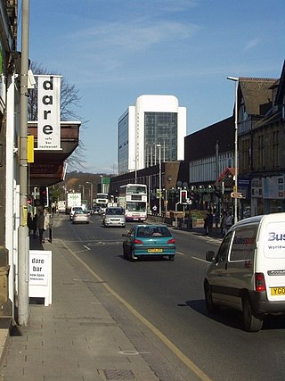
Skipton is a market town and civil parish in North Yorkshire, England. Historically in the East Division of Staincliffe Wapentake in the West Riding of Yorkshire, it is on the River Aire and the Leeds and Liverpool Canal to the south of the Yorkshire Dales. It is situated 27 miles (43 km) north-west of Leeds and 38 miles (61 km) west of York. At the 2021 Census, the population was 15,042. The town has been listed as one of the best and happiest places to live in the UK.
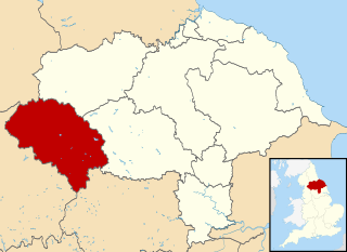
Craven was a non-metropolitan district in the west of North Yorkshire, centred on the market town of Skipton. The name Craven is much older than the modern district and encompassed a larger area. This history is also reflected in the way the term is still commonly used, such as by the Church of England.
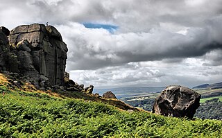
Ilkley Moor is part of Rombalds Moor, the moorland between Ilkley and Keighley in West Yorkshire, England. The moor, which rises to 402 m (1,319 ft) above sea level, is well known as the inspiration for the Yorkshire "county anthem" On Ilkla Moor Baht 'at.

The A65 is a major road in England. It runs north west from Leeds in West Yorkshire via Kirkstall, Horsforth, Yeadon, Guiseley, Ilkley and Skipton, west of Settle, Ingleton and Kirkby Lonsdale before terminating at Kendal in Cumbria.
The Dales Way is an 78.5-mile (126.3 km) long-distance footpath in Northern England, from Ilkley, West Yorkshire, to Bowness-on-Windermere, Cumbria. This walk was initially devised by the West Riding Ramblers' Association with the 'leading lights' being Colin Speakman and Tom Wilcock. The route was announced to the public in 1968 and the first recorded crossing was by a group of Bradford Grammar School Venture Scouts in 1969.

The Wharfedale line is one of the rail services in the West Yorkshire Metro area of northern England. The service connects Ilkley with Leeds and Bradford, and is operated by Northern Trains. West Yorkshire Metrocards are available for use on the line, covering Zones 3–5. The line is served predominantly by four-coach Class 333 electric multiple units as well as some three-coach Class 331 EMUs.

Bradford Forster Square railway station serves Bradford, West Yorkshire, England. The majority of services to and from the station use Class 333 and Class 331 electric multiple units operated by Northern Trains; they run on the Airedale line to Skipton, the Wharfedale line to Ilkley and the Leeds-Bradford line to Leeds.
Addingham is a village and civil parish in the City of Bradford in West Yorkshire, England. It is situated near the A65, 6 miles (10 km) south-east of Skipton, 3 miles (5 km) west of Ilkley, 12 miles (19 km) north-west of Bradford and around 20 miles (32 km) north-west of Leeds. Historically part of the West Riding of Yorkshire, it is located in the valley of the River Wharfe and is only 1 mile (2 km) from the Yorkshire Dales National Park. The name is thought to mean "homestead associated with a man called Adda", although in the Domesday Book, the village was referred to as "Ediham", which may have referred to Earl Edwin of Bolton Abbey. The 2001 census numbered Addingham's population at 3,599, increasing to 3,730 at the 2011 Census.

Ilkley railway station serves Ilkley in the City of Bradford, West Yorkshire, England. On the Wharfedale Line, it is served by Class 333 electric trains run by Northern Trains, which also manages the station.
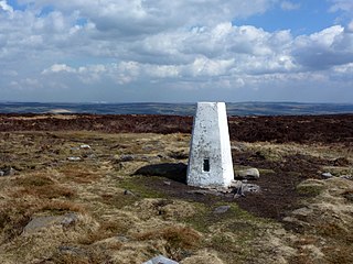
Rombalds Moor is an area of moorland in West Yorkshire, England, between the Airedale and Wharfedale valleys. The towns of Ilkley and Keighley lie to its northern and southern edges, respectively. The moor is sometimes referred to as Ilkley Moor, though technically this refers to the section of moor on the northern flank, above the town of Ilkley.
The A660 is a major road in the Leeds and Bradford districts of West Yorkshire, England that runs from Leeds city centre to Burley-in-Wharfedale where it meets the A65. The A660 is approximately 10 miles (16 km) long, and crosses the watershed from Airedale to lower Wharfedale. For most of its length the road is in the metropolitan district of the City of Leeds; the last 0.4 miles (0.6 km) is in City of Bradford district.

The South Pennines is a region of moorland and hill country in northern England lying towards the southern end of the Pennines. In the west it includes the Rossendale Valley and the West Pennine Moors. It is bounded by the Greater Manchester conurbation in the west and the Bowland Fells and Yorkshire Dales to the north. To the east it is fringed by the towns of West Yorkshire whilst to the south it is bounded by the Peak District. The rural South Pennine Moors constitutes both a Site of Special Scientific Interest and Special Area of Conservation.
Beacons Metro is a music festival that took place at various venues in Leeds, Liverpool and Manchester in October 2015–2017. The festival was formerly named simply Beacons and took place on the middle weekend of August 2011–2014 at Heslaker Farm on the Funkirk Estate, Skipton, England.
A Dales High Way is a long-distance footpath in northern England. It is 90 miles (140 km) long and runs from Saltaire in West Yorkshire to Appleby-in-Westmorland, Cumbria, roughly parallel to the line of the Settle and Carlisle Railway.
References
- ↑ O'Connor, Rachel (1 May 2009). "Moor Music festival quits Addingham". Ilkley Gazette. Retrieved 1 June 2017.
- ↑ "The Moor Music Festival". Contactmusic.com. 1 April 2000. Retrieved 1 June 2017.
- ↑ Chalmers, Graham (11 August 2011). "Shock news asBeacons Festival is cancelled". www.wetherbynews.co.uk. Retrieved 1 June 2017.
- ↑ Glover, Chloe (23 February 2015). "No go for Skipton-based Beacons Festival this year after decision made to host events in cities around North England". huddersfieldexaminer. Retrieved 1 June 2017.