Ireland Bridge

Last updated

Ireland Bridge
Bingley Ireland Bridge 1.jpg
Coordinates 53°51′01″N1°50′30″W / 53.850293°N 1.84157°W / 53.850293; -1.84157
Crosses River Aire
Locale Bingley
Maintained by Bradford District Council
Characteristics
MaterialDressed stone [1]
No. of spans7
History
Opened1686
Location
Ireland Bridge

Bingley's Ireland Bridge is a Grade II* listed structure [1] and a historically significant crossing point over the River Aire in West Yorkshire, England. It is now the main route between Bingley & the nearby villages of Harden, Wilsden & Cullingworth (the B6429).

Contents

History

A bridge has existed at this point over the river since mediaeval times. The current bridge dates from 1686 and replaced an earlier timber structure. [2] During renovations in 2010, engineers found unique stonemason marks carved into sections of the bridge that were previously inaccessible until the scaffolding went up around it. [3] The bridge was widened and a parapet added in 1775. [4] Previous to the bridge being built, visitors to the town would ford the river at a crossing just south of the bridge that would lead them to the bottom of what is now Ferrand Lane. When the water is low enough, the stones of this crossing are said to be visible. [4]

The All Saints Parish Church and the Old White Horse Inn, a Coaching inn were constructed very close to the eastern bank and Bingley's modern town centre spread south from these beginnings. A mill extended on the east bank for which a weir was built across the Aire. The water was then funnelled under the mill to power the works which started out as a Corn Mill, a forge and for much of the 20th century was a fat refinery. The mill was demolished in 1984 [5] and the site has now been replaced by housing. [6]

In the 18th century, the middle of the bridge was an area where locals would congregate and 'gossip'. This would also entail talking to travellers who were using the bridge to get from Halifax and beyond to Otley and Ilkley. [7]

The bridge was originally named Bingley Bridge, but an influx of Irish immigrants caused a name change. They came to work in the Bingley mills and they also visited the Brown Cow Inn, which meant going across the bridge. The Brown Cow acquired the nickname of 'The Irish Inn'; this also led to the bridge being similarly named. [8] Harry Speight in his book The Chronicles of Old Bingley suggests the name came about due to the crossing of the Aire being like going over the water to Ireland.

Strengthening works

Despite previous strengthening works, the bridge was deemed unfit for two-way traffic, and traffic lights were installed for a time at either end. These allowed only a single lane across for some time – disrupting local traffic at peak times.[ citation needed ]

In January 2010, Bradford Council closed the bridge completely, and commenced works to strengthen the bridge. These works resulted in the closure of Harden Road to vehicles over the bridge. The works were originally due to take place in June 2009, but were postponed owing to the presence of rare Daubenton's bats roosting in the spans of the bridge. [3] [9] After a £1.6 million project, [10] Ireland Bridge reopened to two-way traffic in June 2010. [11]

See also

Related Research Articles

<span class="mw-page-title-main">Bingley</span> Town in West Yorkshire, England

Bingley is a market town and civil parish in the metropolitan borough of the City of Bradford, West Yorkshire, England, on the River Aire and the Leeds and Liverpool Canal, which had a population of 18,294 at the 2011 Census.

<span class="mw-page-title-main">River Aire</span> River in Yorkshire, England

The River Aire is a major river in Yorkshire, England, 92 miles (148 km) in length. Part of the river below Leeds is canalised, and is known as the Aire and Calder Navigation.

<span class="mw-page-title-main">Wilsden</span> Village and civil parish in West Yorkshire, England

Wilsden is a village and civil parish in west Bradford, in West Yorkshire, England. Wilsden is 6 miles (9.7 km) west of Bradford and is close to the Aire Valley and the nearby villages of Denholme, Cullingworth, Harden, Cottingley and Allerton. Wilsden re-acquired civil parish status in 2004. The 2001 census revealed a population of 3,697, increasing to 4,807 at the 2011 Census.

<span class="mw-page-title-main">Airedale</span> Valley in North and West Yorkshire, England

Airedale is a valley, or dale, in North Yorkshire and West Yorkshire, England. It is named after the River Aire, which flows through it. The upper valley, from Malham Cove to Airton, is known as Malhamdale, named after the village of Malham. At Airton the valley widens and becomes Airedale proper. The river flows past Skipton on to Keighley, Bingley, Shipley, and Leeds.

<span class="mw-page-title-main">Bradford Canal</span> English canal

The Bradford Canal was a 3.5-mile (5.6 km) English canal which ran from the Leeds and Liverpool Canal at Shipley into the centre of Bradford. It opened in 1774, and was closed in 1866, when it was declared to be a public health hazard. Four years later it reopened with a better water supply, and closed for the second time in 1922. It was subsequently filled in, although consideration has been given to restoring it. There are some remains, including a short section of canal at the junction and a pumping station building, which is now a dwelling.

Kildwick, or Kildwick-in-Craven, is a village and civil parish of the district of Craven in North Yorkshire, England. It is situated between Skipton and Keighley and had a population of 191 in 2001, rising slightly to 194 at the 2011 census. Kildwick is a landmark as where the major road from Keighley to Skipton crosses the River Aire. The village's amenities include a primary school, church and public house.

<span class="mw-page-title-main">Cottingley, Bradford</span> Village in West Yorkshire, England

Cottingley is a suburban village within the City of Bradford district in West Yorkshire, England between Shipley and Bingley. It is known for the Cottingley Fairies, which appeared in a series of photographs taken there during the early 20th century.

<span class="mw-page-title-main">Bingley St Ives</span>

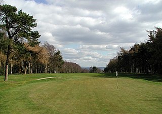
Bingley St. Ives, or St. Ives Estate is a 550-acre (2.2 km2) country park and former estate between Bingley and Harden in West Yorkshire, England now owned by Bradford Council. The park has Grade II listing in the English Heritage National Register of Historic Parks and Gardens of Special Interest. The park has been given Accredited Country Park status by Natural England.

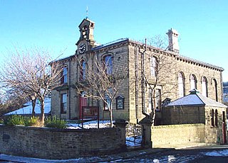
Harden is a civil parish and village within the City of Bradford Metropolitan District, West Yorkshire, England, 2 miles (3.2 km) west of Bingley. It had a population of 1,615 in the 2001 census, but by 2011 this had risen to 1,900.

<span class="mw-page-title-main">A650 road</span> Road in Yorkshire, England

A650 road is a main route through the West Yorkshire conurbation in England. The road goes from Keighley to Wakefield on a rough north west/south east axis for 25 miles (40 km). The route is mostly single carriageway with some dualled sections in the Aire Valley, Bradford and the approach to Wakefield from the M1.

<span class="mw-page-title-main">Nidd Aqueduct</span> A freshwater aqueduct in Yorkshire, England

The Nidd Aqueduct is an aqueduct or man-made watercourse in North Yorkshire, England. It feeds water from Angram and Scar House reservoirs in upper Nidderdale, North Yorkshire 32 mi (51 km) to Bradford in West Yorkshire. The aqueduct supplies 21,000,000 imp gal (95,000 m3) of water per day to Chellow Heights water treatment works. The aqueduct and the reservoirs it connects to are all maintained by Yorkshire Water.

<span class="mw-page-title-main">Harden Beck</span> Beck in West Yorkshire, England

Harden Beck is a stream that flows from Hewenden Reservoir, over Goit Stock Waterfall to the River Aire in Bingley, West Yorkshire. The route starts out further up the valley as Denholme Beck, Hewenden Beck and Hallas Beck. Its waters are fed by Thornton Moor Reservoir, Stubden Reservoir, Doe Park Reservoir and Hewenden Reservoir.

<span class="mw-page-title-main">John Nicholson (poet)</span> English poet (1790–1843)

John Nicholson was popularly known as the Airedale Poet and also as the Bingley Byron. His most notable work was Airedale in Ancient Times. He died trying to cross the swollen River Aire near to Dixon's mill in Saltaire.

<span class="mw-page-title-main">Harden Moor</span> Moorland in West Yorkshire, England

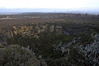
Harden Moor is an expanse of moorland that lies north of the village of Harden in West Yorkshire, England. The moor encompasses stretches of heather, woodland and former quarry workings and is bordered by Airedale to the east, the Worth Valley to the north and Catstones Moor and the village of Cullingworth to the west. Historically, Harden Moor occupied the high ground between Bingley, Keighley, Cullingworth and Harden. Altar Lane, an unmade road which runs from the Brown Cow Inn in Bingley to Keighley Road on Harden Moor is an unofficial border between the estate of St Ives and Harden Moor, but when the St Ives Estate was created, a large swathe of Harden Moor was taken over.

<span class="mw-page-title-main">The Great Northern Railway Trail</span> Footpath in England

The Great Northern Railway Trail is a cycleway and footpath in the Bradford District of West Yorkshire, England. The path follows the route of a former railway, that of the Great Northern railway line between Bradford and Keighley that went via Queensbury and Cullingworth. The path has been designated as part of the National Cycle Route number 69.

<span class="mw-page-title-main">Hainworth</span> Hamlet in West Yorkshire, England

Hainworth is a hamlet 1 mile (2 km) south of Keighley in West Yorkshire, England. The hamlet faces north across the lower end of the Worth Valley with a steep wooded incline towards Keighley.

<span class="mw-page-title-main">Ryecroft, West Yorkshire</span> Hamlet in West Yorkshire, England

Ryecroft is a hamlet near to the village of Harden in West Yorkshire, England. The hamlet is on the road between Harden and Haworth, 1.9 miles (3 km) south of Keighley, 1.9 miles (3 km) west of Bingley and 0.6 miles (1 km) west of the centre of Harden.

<span class="mw-page-title-main">Worth Valley (dale)</span> Valley in West Yorkshire, England

The Worth Valley is a geographic area in West Yorkshire, England, that extends eastwards from Crow Hill and Oxenhope Moor, providing drainage for the River Worth for nearly 10 miles (16 km) to the River Aire. It is a side valley to Airedale, with the River Worth being a major tributary of the River Aire. The Worth Valley was important for its contribution to the textiles industry of the West Riding of Yorkshire and was furnished with several reservoirs to allow mills to operate within the valley. Most of the reservoirs are still in use into the modern day.

<span class="mw-page-title-main">Newlay</span> Suburb of Horsforth, West Yorkshire, England

Newlay is a suburb of Horsforth, in West Yorkshire, England. Originally a hamlet, it is now part of Horsforth parish in the City of Leeds District, and has its own conservation area. Newlay is situated on the Leeds and Liverpool Canal and the River Aire, some 5 miles (8 km) north west of Leeds city centre.

References

  1. 1 2 Historic England. "Ireland Bridge (Grade II*) (1133377)". National Heritage List for England . Retrieved 5 September 2017.
  2. "Bingley Conservation Area" (PDF). Bradford.gov.uk. Bradford Council. March 2004. p. 12. Archived from the original (PDF) on 11 January 2016. Retrieved 5 September 2017.
  3. 1 2 "Bridging the past with historic find in Bingley". Keighley News. Retrieved 20 October 2015.
  4. 1 2 "Bingley Conservation Area" (PDF). Bradford.org.uk. Bradford Council. March 2004. p. 20. Archived from the original (PDF) on 11 January 2016. Retrieved 5 September 2017.
  5. Burrows, Dorothy (1985). Bingley – a Look at the Past. Pudsey: Allanwood Press. p. 21.
  6. Firth, Gary; Hitt, Malcolm (2009). Bingley Past and Present. History Press. p. 56. ISBN   978-0-7524-5345-3.
  7. Speight, Harry (1898). Chronicles of Old Bingley. Eliot Stock. p. 78. Retrieved 4 December 2015.
  8. "More on Ireland Bridge". Bradford Telegraph and Argus. Retrieved 20 October 2015.
  9. Winrow, Jo (1 June 2010). "Ireland Bridge, Bingley, to be open to traffic by 19 June". Bradford Telegraph and Argus. Retrieved 1 February 2015.
  10. "Relief as Bingley bridge re-opens". Keighley News. Retrieved 20 October 2015.
  11. "City of Bradford Council Ireland Bridge website". Archived from the original on 24 September 2011.