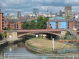
West Yorkshire is a metropolitan and ceremonial county in the Yorkshire and the Humber region of England. It is an inland and upland county having eastward-draining valleys while taking in the moors of the Pennines. West Yorkshire came into existence as a metropolitan county in 1974 after the reorganisation of the Local Government Act 1972 which saw it formed from a large part of the West Riding of Yorkshire. The county had a population of 2.3 million in the 2011 census making it the fourth-largest by population in England. The largest towns are Huddersfield, Castleford, Batley, Bingley, Pontefract, Halifax, Brighouse, Keighley, Pudsey, Morley and Dewsbury. The three cities of West Yorkshire are Bradford, Leeds and Wakefield.

Wakefield is a cathedral city in West Yorkshire, England located on the River Calder. The city had a population of 109,766 in the 2021 census, up from 99,251 in the 2011 census. The city is the administrative centre of the wider City of Wakefield metropolitan district, which had a 2021 population of 353,368, the 23rd most populous district in England. It is part of the West Yorkshire Built-up Area and the Yorkshire and The Humber region.

Otley is a market town and civil parish at a bridging point on the River Wharfe, in the City of Leeds metropolitan borough in West Yorkshire, England. Historically a part of the West Riding of Yorkshire, the population was 13,668 at the 2011 census. It is in two parts: south of the river is the historic town of Otley and to the north is Newall, which was formerly a separate township. The town is in lower Wharfedale on the A660 road which connects it to Leeds.

Saltaire is a Victorian model village in Shipley, West Yorkshire, England, on the River Aire by Salt's Mill and the Leeds and Liverpool Canal. It is a UNESCO World Heritage Site and on the European Route of Industrial Heritage.

Shipley is a historic market town and civil parish in the City of Bradford, West Yorkshire, England, by the River Aire and the Leeds and Liverpool Canal, north of Bradford. The population of the Shipley ward on Bradford City Council taken at the 2011 Census was 15,483.

Baildon is a town and civil parish in the Bradford Metropolitan Borough in West Yorkshire, England and within the historic boundaries of the West Riding of Yorkshire.

Wilsden is a village and civil parish in west Bradford, in West Yorkshire, England. Wilsden is 6 miles (9.7 km) west of Bradford and is close to the Aire Valley and the nearby villages of Denholme, Cullingworth, Harden, Cottingley and Allerton. Wilsden re-acquired civil parish status in 2004. The 2001 census revealed a population of 3,697, increasing to 4,807 at the 2011 Census.

Settle is a market town and civil parish in the Craven district of North Yorkshire, England. Historically in the West Riding of Yorkshire, it is served by Settle railway station located near the town centre, and Giggleswick railway station which is a mile away. It is 29 miles (47 km) from Leeds Bradford Airport. The main road through Settle is the B6480, which links to the A65, connecting Settle to Leeds, Ilkley, Skipton and Kendal. The town had a population of 2,421 in the 2001 Census, increasing to 2,564 at the 2011 Census.

Yeadon is a town within the metropolitan borough of the City of Leeds, West Yorkshire, England.

The City of Bradford is a local government district of West Yorkshire, England, with the status of a city and metropolitan borough. It is named after its largest settlement, Bradford, but covers a large area which includes the towns and villages of Keighley, Shipley, Bingley, Ilkley, Haworth, Silsden, Queensbury, Thornton and Denholme. Bradford has a population of 528,155, making it the fourth-most populous metropolitan district and the sixth-most populous local authority district in England. It forms part of the West Yorkshire Urban Area conurbation which in 2011 had a population of 1,777,934, and the city is part of the Leeds-Bradford Larger Urban Zone (LUZ), which, with a population of 2,393,300, is the fourth largest in the United Kingdom after London, Birmingham and Manchester.

Heaton is a ward within the City of Bradford Metropolitan District Council, West Yorkshire, England. The population at the 2001 census was 16,913, which had increased to 17,121 at the 2011 Census. Historically part of the West Riding of Yorkshire, the ward includes the villages of Frizinghall, Heaton and Daisy Hill, extending to Chellow Heights Reservoir on the western edge and the Bradford-Shipley railway line on the eastern edge. Frizinghall railway station is on the edge of the ward.

Eccleshill is an area, former village, and ward within the City of Bradford Metropolitan District Council in the county of West Yorkshire, England. The ward population of Eccleshill is 17,540, increasing at the 2011 Census to 17,945. Eccleshill is a more or less completely residential urban area with very little open space although there is substantial open land directly to the east.
Birstall is a large village in the metropolitan borough of Kirklees, West Yorkshire, England. It is part of the Birstall and Birkenshaw ward, which had a population of 16,298 at the 2011 census. Historically in the West Riding of Yorkshire, and part of the Heavy Woollen District, the village is approximately 6 miles (10 km) south-west of Leeds and situated close to the M62 motorway. The village is situated between Leeds, Bradford, Huddersfield and Wakefield.

Idle is a residential suburban area in the city of Bradford, West Yorkshire, in England and was a separate village, and before that it was the Manor of Idle. Idle is loosely bordered by the areas of Eccleshill, Wrose, Thackley, Apperley Bridge, and Greengates, in the north-east of the city.

Bradford is a city in West Yorkshire, England. It is governed by a metropolitan borough named after the city, the wider county has devolved powers. It had a population of 349,561 at the 2011 census; the second-largest subdivision of the West Yorkshire Built-up Area after Leeds, which is approximately 9 miles (14 km) to the east. The borough had a population of 546,412, making it the 7th most populous district in England.

Roberts Park is a 14 acres (5.7 ha) public urban park in Saltaire, West Yorkshire, England. Higher Coach Road, Baildon, is to the north and the park is bounded to the south by the River Aire. A pedestrian footbridge crosses the Aire and links the park to the village of Saltaire. The park is an integral part of the Saltaire World Heritage site.

Wakefield Town Hall is a municipal building in Wood Street in Wakefield, West Yorkshire, England. It remains a venue for weddings and civil partnerships but is no longer the headquarters of Wakefield Council which is now based at County Hall. The town hall is a Grade I listed building.

Silsden Town Hall is a municipal building in Kirkgate, Silsden, West Yorkshire, England. The town hall is the meeting place of Silsden Town Council.

Bexhill Town Hall is a municipal building in the London Road, Bexhill-on-Sea, East Sussex, England. The town hall, which is the headquarters of Rother District Council, is a Grade II listed building.

Myrtle Grove, also known since 1926 as Bingley Town Hall, is a municipal building in Myrtle Park, Bingley, West Yorkshire, England. The building, which was the headquarters of Bingley Urban District Council, is a Grade II listed building.

