Blackwell Bridge

Last updated

Blackwell Bridge
Blackwell Bridge.jpg
Blackwell Bridge straddling the River Tees between North Yorkshire and Darlington
Coordinates 54°30′29″N1°35′03″W / 54.5080°N 1.5842°W / 54.5080; -1.5842
OS grid reference NZ270106
CarriesA66
Crosses River Tees
Characteristics
No. of spans3
History
ArchitectJohn Green
Opened1832
Rebuilt1961
Location
Blackwell Bridge

Blackwell Bridge is a masonry road bridge spanning the River Tees between County Durham and North Yorkshire, in Northern England. The bridge was built in 1832, and widened in 1961. It carries the A66 road, which stems from the A66(M) spur off the A1(M) motorway. It used to be the main route north on the A1 until a bypass was opened in 1965.

Contents

History

Blackwell Bridge was planned in the early part of the nineteenth century; the tolls for use of the bridge and the associated turnpike received Royal Assent in 1831. [1] The bridge was built in 1832, but before this, most traffic going south from Darlington used Croft Bridge, though a ford did exist at the point where Blackwell Bridge was constructed, however, many lives are recoded as lost at this point due to being swept away by the waters. [2] [3] The main thrust for building the bridge was the transport of coal from Durham into North Yorkshire, which had to use the bridges at either Piercebridge, or Croft, so private finance was raised to enable the building of the bridge. However, within a few years of its construction, the railway to Richmond was built, which effectively took the coal trade away from the road through Stapleton and over the bridge. [4] The bridge is a masonry bridge designed by John Green, however, he initially suggested that a suspension bridge be installed at Blackwell, akin to his design for Whorlton Bridge (also on the River Tees). [5] The proposal for a suspension bridge was due to the turnpike trust advertising for architects and engineers to submit their designs for a suspension bridge at Blackwell. [6]

The bridge has three semi-elliptical arches, with the two side arches being 68 feet (21 m) across, and the centre span some 78 feet (24 m) across. [7] [8] The two end arches reach about 20 feet 6 inches (6.25 m) above the normal water line, whereas the centre arch, reaches a height of 22 feet 6 inches (6.86 m). [9] The parapet is long and sweeps out at the riverbank edges with octagonal piers, [10] and the whole masonry bridge is ashlar, using stone from Gatherley Moor Quarry. [11] [12] Francis Watt stated that Blackwell Bridge was "pretty", and Pevsner described the bridge as "beautiful". [13] [14] Due to the shifting nature of the riverbed, the pillars were set into bales of wool, which was the solution at the time to the possibility of moving foundations. The bridge was originally built to a width of 19 feet (5.8 m) which could only sustain a single carriageway, but just before the A66(M) motorway spur was built, the bridge was disassembled on the south side and was widened to 33 feet (10 m) in 1961. [11] [15] [16]

A cottage for the tollkeeper to work and live in was installed on the Yorkshire side at the northern end. The cottage is still there and is now a private residence, however, tolls on the road and bridge were abolished in 1879, and the tollhouse has been altered from the original design. [12] [17] [18] The old sign displayed on the tollhouse with a list of charges for crossing the bridge, is on display in the Bridge Inn at Stapleton in North Yorkshire. [19] A great flood in 1883, swept the bridge away and took a labourer with it. He was rescued from the river after passing Croft Bridge. [20]

The bridge used to carry a turnpike road from Scotch Corner through Newton Morrell and into Darlington built in 1832. [21] [22] From the 1930s, when roads were classified in Great Britain, the bridge carried the A1 Great North Road until 1965, when the A1(M) Darlington Bypass was built, it now carries the A66 road which now uses the widened bridge. [23] [24] The bridge is a grade II listed structure. [10]

Related Research Articles

<span class="mw-page-title-main">North Yorkshire</span> County of England

North Yorkshire is a ceremonial county in the Yorkshire and the Humber and North East regions of England. It borders County Durham to the north, the North Sea to the east, the East Riding of Yorkshire to the south-east, South Yorkshire to the south, West Yorkshire to the south-west, and Cumbria and Lancashire to the west. Northallerton is the county town. The county was historically part of Yorkshire.

<span class="mw-page-title-main">Darlington</span> Town in County Durham, England

Darlington is a market and industrial town in County Durham, England. It is the main administrative centre of the unitary authority Borough of Darlington. The borough is a constituent member of the devolved Tees Valley area.

<span class="mw-page-title-main">River Tees</span> East coast river of Northern England

The River Tees, in England, rises on the eastern slope of Cross Fell in the North Pennines and flows eastwards for 85 miles (137 km) to reach the North Sea in the North East of England. The modern-day history of the river has been tied with the industries on Teesside in its lower reaches, where it has provided the means of import and export of goods to and from the North East England. The need for water further downstream also meant that reservoirs were built in the extreme upper reaches, such as Cow Green.

<span class="mw-page-title-main">Yarm</span> Town and civil parish in North Yorkshire, England

Yarm, also referred to as Yarm-on-Tees, is a market town and civil parish in the Borough of Stockton-on-Tees, North Yorkshire, England. It is in Teesdale with a town centre on a small meander of the River Tees. To the south-east, it extends to the River Leven, to the south it extends into the Kirklevington.

<span class="mw-page-title-main">A66 road</span> Trans-Pennine A road in Northern England

The A66 is a major road in Northern England, which in part follows the course of the Roman road from Scotch Corner to Penrith. It runs from east of Middlesbrough in North Yorkshire to Workington in Cumbria. The road has been progressively improved with dual carriageway sections, but with stretches of single carriageway road. The road is set to be completely dualled between Scotch Corner and Penrith, with a £1.3 billion scheme being announced in March 2024.

Scotch Corner is a junction of the A1(M) and A66 trunk roads near Richmond in North Yorkshire, England. It has been described as "the modern gateway to Cumbria, the North East and Scotland", and is a primary destination signed from as far away as the M6 motorway, 50 miles away. The junction's name is derived from the fact that it is the point of divergence for traffic coming from London, the East Midlands and Yorkshire wishing to continue either to Edinburgh and eastern Scotland or to Glasgow and western Scotland.

<span class="mw-page-title-main">A167 road</span> Road in north east England

The A167 and A167(M) is a road in North East England. It is partially a trunk road and partially a motorway, where it is commonly referred to as Newcastle Central Motorway. Most of the road’s route was formerly that of the A1, until it was re-routed with the opening of the A1(M) in the 1960s.

<span class="mw-page-title-main">Archdeacon Newton</span> Human settlement in England

Archdeacon Newton is a hamlet and rural parish of several farms in the borough of Darlington and the ceremonial county of County Durham, in England. The population taken at the 2011 Census was less than 100. Details are maintained in the parish of Walworth. It is associated with an abandoned village site under pasture and farm buildings, and situated a short distance to the north-west of Darlington. The lost settlement was in existence by the early 15th century, and remained inhabited at least until the 1890s. There was a moated manor house at the southern end, part of which remains as the Old Hall, now a barn. At the north end of the site was the chapel, and in the middle were tofts and enclosures, with a ridge and furrow field and a trackway leading to the south-east. The site of the abandoned village is now a scheduled monument and the Old Hall is a listed building.

<span class="mw-page-title-main">Merrybent</span> Human settlement in England

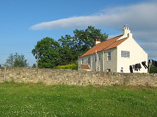
Merrybent is a linear village in the civil parish of Low Coniscliffe and Merrybent in County Durham, in England. It is situated on the A67 road to the west of Darlington, a short distance to the north of the River Tees and the Teesdale Way. At the beginning of the 20th century there were hardly any buildings here, and its main feature at that time was Merrybent Nurseries with its many glasshouses. The nursery was cut through by the A1 road in the 1960s; at this point it runs on the trackbed of the old Merrybent railway. The village is now a settlement of modern housing.

<span class="mw-page-title-main">Winston, County Durham</span> Village in County Durham, England

Winston is a village and civil parish in County Durham, England. It is situated approximately 6 miles (9.7 km) east of Barnard Castle, on a crossroads between the A67 and B6274 roads. According to the 2011 UK Census the population was 431, the parish includes the hamlets of Little Newsham and South Cleatlam.

<span class="mw-page-title-main">Hurworth Place</span> Village in County Durham, England

Hurworth Place is a village in County Durham, in England. It lies south of Darlington on the northern bank of the River Tees, opposite the village of Croft-on-Tees in North Yorkshire to which it is linked by Croft Bridge, a Grade I listed structure dating from the 14th century, which marks the county boundary. It is part of the civil parish of Hurworth.

<span class="mw-page-title-main">Aldbrough St John</span> Village and civil parish in North Yorkshire, England

Aldbrough St John is a village and civil parish in the Richmondshire district in North Yorkshire, England. The parish has a population of 325, increasing to 392 at the 2011 Census.

<span class="mw-page-title-main">A67 road</span> Road in England

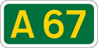
The A67 is a road in England that links Bowes in County Durham with Crathorne in North Yorkshire. The road from Middlesbrough to Darlington was previously the A66 road, the road also starts and ends on the A66.

<span class="mw-page-title-main">Croft-on-Tees</span> Village and civil parish in North Yorkshire, England

Croft-on-Tees is a village and civil parish in North Yorkshire, England. It has also been known as Croft Spa, and from which the former Croft Spa railway station took its name. It lies 11 miles (18 km) north-north west of the county town of Northallerton.

<span class="mw-page-title-main">Tees Victoria Bridge</span> Road bridge over the River Tees in Northern England

The Victoria Jubilee Bridge, also known as Victoria Bridge, is a road bridge carrying Bridge Road (A1130) east west across the River Tees between Stockton and Thornaby in Northern England. Commonly referred to as the Victoria Bridge, it is located just south east of Stockton town centre and in the town's namesake borough.

<span class="mw-page-title-main">Surtees Rail Bridge</span> Rail-bridge over the River Tees, Northern England

The Surtees Rail Bridge is a rail bridge on the Tees Valley Line over the River Tees in the Borough of Stockton-on-Tees. The bridge is south of Stockton-on-Tees town centre and just north of the adjacent Surtees Bridge which carries the A66 road. The bridge is built on the site of a series of Tees Bridges alternating between two adjacent crossing sites.

<span class="mw-page-title-main">Yarm Viaduct</span> Railway viaduct over the River Tees in England

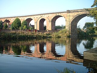
Yarm Viaduct is a railway viaduct carrying the railways above the town of Yarm in North Yorkshire, England. It crosses the River Tees which forms the boundary between North Yorkshire and County Durham. The railway runs between Northallerton and Eaglescliffe, and was opened in 1852 as part of the extension of the Leeds Northern Railway to Stockton-on-Tees. The line and viaduct are currently owned and maintained by Network Rail and carries passenger traffic for TransPennine Express and Grand Central train operating companies. It also sees a variety of freight traffic.

<span class="mw-page-title-main">Croft Bridge</span> Listed building in North Yorkshire, England

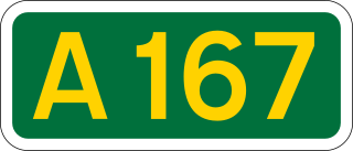
Croft Bridge is a road bridge over the River Tees, straddling the border between North Yorkshire and County Durham, in the north of England. The road over the bridge is now the A167, previously a second branch of the Great North Road, meeting the old road in Darlington. The bridge dates back to Medieval times, and is the setting for the awarding of a sword to the incoming Bishop of Durham.

<span class="mw-page-title-main">Croft Viaduct</span> Railway bridge in Northern England

Croft Viaduct is a railway bridge carrying the East Coast Main Line between Northallerton and Darlington in Northern England. The viaduct crosses the River Tees, the border between North Yorkshire and County Durham. Although it was an early example of a stone viaduct in the railway system, it is not the first true railway viaduct, however, it was the first railway viaduct in the United Kingdom to have been built with an oblique arch. It was grade II listed in 1988, and had overhead line equipment installed in the early 1990s.

References

  1. "Blackwell Bridge". The Northern Echo. No. 3, 055. 31 October 1879. p. 4. OCLC   6685296.
  2. Longstaffe 1854, p. 11.
  3. Graham, Frank (1975). The bridges of Northumberland and Durham. Newcastle upon Tyne: Graham. p. 4. ISBN   0902833138.
  4. "Blackwell Bridge". The North Star. No. 7, 596. 1 July 1905. p. 4. OCLC   751720286.
  5. Bell, P. W. R. (2018). "The work and professional status of John (1787–1852) and Benjamin Green (1813–1858) architects and engineers". In Wouters, Ine; Van de Voorde, Stephanie; Bertels, Inge; De Jonge, Krista; Zastavni, Denis (eds.). Building knowledge; constructing histories volume 1. Boca Raton: CRC Press. p. 359. ISBN   978-1-138-33230-0.
  6. "To architects and engineers: Blackwell Bridge". The York Herald. No. 3092. 14 January 1832. p. 1. OCLC   1325754826.
  7. Longstaffe 1854, pp. 40–41.
  8. Rennison, Robert William; Barbey, M. F. (1996) [1981]. Civil engineering heritage. Northern England (2 ed.). London: T. Telford. p. 95. ISBN   0-7277-2518-1.
  9. Chettoe, C. S.; Henderson, W. (August 1957). "Structural paper no. 53; Masonry Arch Bridges". Proceedings of the Institution of Civil Engineers. 7 (4). London: Institute of Civil Engineers: 726. ISSN   0537-9946.
  10. 1 2 Historic England. "Blackwell Bridge (Grade II) (1121318)". National Heritage List for England . Retrieved 13 July 2024.
  11. 1 2 Betteney, Alan (2019). "Crossing the Tees" (PDF). teesarchaeology.com. Cleveland Industrial Archaeology Society & Tees Archaeology. p. 13. Retrieved 19 June 2024.
  12. 1 2 Jervoise, E. (1973) [1931]. The ancient bridges of the North of England. Wakefield: EP Publishing. p. 53. ISBN   0-85409-952-2.
  13. Watt, Francis (1889). The rivers of Great Britain. Descriptive, historical, pictorial. Rivers of the east coast. London: Cassell. p. 216. OCLC   1152770381.
  14. Pevsner, Nikolaus (2002) [1966]. Yorkshire, the North Riding. London: Yale University Press. p. 133. ISBN   0-300-09665-8.
  15. Lloyd, Chris (15 November 2014). "Bite-sized Blackwell" . infoweb.newsbank.com. Retrieved 13 July 2024.
  16. Lloyd, Chris (1 June 2012). "The 180-year-old bridge built on wool". The Northern Echo. Retrieved 13 July 2024.
  17. "Toll road that left its mark - ProQuest" . The Northern Echo. 24 November 2012. ProQuest   1197480955 . Retrieved 13 July 2024.
  18. "Reader pinpoints location of 1930s road haulage accident - ProQuest" . The Northern Echo. 12 March 2018. ProQuest   2013168130 . Retrieved 13 July 2024.
  19. Hatcher, Jane (1990). Richmondshire architecture. Richmond: Hatcher. p. 232. ISBN   0951588001.
  20. Longstaffe 1854, p. 41.
  21. "Georeferenced Maps - Map images - National Library of Scotland". maps.nls.uk. Retrieved 13 July 2024. Use the slider on the bottom left (named "Change transparency of overlay") to toggle between old mapping and modern-day satellite imagery
  22. "Echo memories - Roman milestone that provided clues about unhappy emperor - ProQuest" . The Northern Echo. 25 April 2007. ProQuest   329220483 . Retrieved 13 July 2024.
  23. "View map: Ordnance Survey, Durham LV.13 (Blackwell; Cleasby; Darlington; Stapleton) - Ordnance Survey 25 inch England and Wales, 1841-1952". maps.nls.uk. Retrieved 13 July 2024.
  24. McCoubrey, William James (2002). The motorway achievement. London: Thomas Telford. p. 186. ISBN   9780727731982.

Source