Related Research Articles

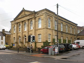
Keighley is a former mill and market town as well as a civil parish in the City of Bradford, West Yorkshire, England, 11 miles (18 km) north-west of Bradford, 11 miles (18 km) south of Ilkley, 13 miles (21 km), north of Halifax, 12 miles (19 km) south-east of Skipton, and 20 miles (32 km) north-west of Leeds at the confluence of the rivers Aire and Worth. Historically in the West Riding of Yorkshire, Keighley lies between Airedale and Keighley Moors. The town is the terminus of the Keighley and Worth Valley Railway, a heritage steam branch line which has been restored and runs through the Worth Valley to Oxenhope via Oakworth and Haworth. At the 2011 census, Keighley had a population of 56,348.

The West Riding of Yorkshire is one of the three historic subdivisions of Yorkshire, England. From 1889 to 1974 the administrative county, County of York, West Riding, was based closely on the historic boundaries. The lieutenancy at that time included the City of York and as such was named West Riding of the County of York and the County of the City of York.
Craven is a local government district of North Yorkshire, England centred on the market town of Skipton. In 1974, Craven district was formed as the merger of Skipton urban district, Settle Rural District and most of Skipton Rural District, all in the West Riding of Yorkshire. The population of the Local Authority at the 2011 Census was 55,409. It comprises the upper reaches of Airedale, Wharfedale, Ribblesdale, and includes most of the Aire Gap and Craven Basin.
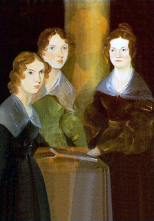
Brontë Country is a name given to an area of south Pennine hills west of Bradford in West Yorkshire, England. The name comes from the Brontë sisters, who wrote such literary classics as Jane Eyre, Wuthering Heights, and The Tenant of Wildfell Hall while living in the area.

Keighley is a constituency in West Yorkshire created in 1885 represented in the House of Commons of the UK Parliament since 2019 by Robbie Moore of the Conservative Party.

Oldfield is a small hamlet within the county of West Yorkshire, England, situated north of Stanbury and near to Oakworth. It is approximately 4 miles (6.5 km) west of the town of Keighley. It mainly consists of farmland and has panoramic views across the Worth Valley towards Brontë Country. Top Withens, the house featured in the novel Wuthering Heights, is clearly visible.

Ingrow is a suburb of Keighley, West Yorkshire, England that lies on the River Worth. The name Ingrow comes from Old Scandinavian which means 'corner of land in the meadow.' The suburb is located on the A629 road and is 0.93 miles (1.5 km) south west of Keighley town centre.

Long Lee and Thwaites Brow is a suburb about one mile to the south east of the centre of the town of Keighley, West Yorkshire, England.

Greengates is a small suburban area in the north-east of the city of Bradford, West Yorkshire, in England. The area is bordered by Idle and Thackley to the north-west, and the large council estate known as Thorpe Edge to the west. To the south of Greengates is Ravenscliffe housing estate with the village of Eccleshill beyond that. The village of Apperley Bridge lies to the north. To the east in the Leeds Metropolitan District is the village of Calverley.

The Craven Fault System is the name applied by geologists to the group of crustal faults in the Pennines that form the southern edge of the Askrigg Block and which partly bounds the Craven Basin. Sections of the system's component faults which include the North, Middle and South Craven faults and the Feizor Fault are evident at the surface in the form of degraded faults scarps where Carboniferous Limestone abuts millstone grit. The fault system is approximately coincident with the southwestern edge of the Yorkshire Dales National Park and the northeastern edge of the Bowland Fells.
Otley bus station serves the town of Otley, West Yorkshire, England.
Utley is a village that forms a suburb of the town of Keighley within the county of West Yorkshire, England, approximately 1.5 miles (2.4 km) from the town centre.

The Puget Sound faults under the heavily populated Puget Sound region of Washington state form a regional complex of interrelated seismogenic (earthquake-causing) geologic faults. These include the:

Frizinghall is a district in the Heaton ward of the City of Bradford, West Yorkshire, lying 2 miles (3 km) north of the city centre close to the town of Shipley, itself a part of the City of Bradford Metropolitan District along with such other nearby towns as Keighley and Ilkley.

The Dent Fault is a major fault zone on the boundary between the counties of Cumbria and North Yorkshire in northern England. It is named after the village of Dent in Dentdale, on the western margin of the Yorkshire Dales.

Scar Top is a farming hamlet near the tourist village of Haworth in the City of Bradford metropolitan borough, West Yorkshire in England. It is in the BD22 postcode area. Located west of Stanbury on a minor road connecting Haworth to Laneshaw Bridge, the hamlet contains a chapel, a farm and a collection of cottages; an infrequent bus service, route 916, runs to Keighley. Scar Top Chapel and Sunday School was built in 1869, replacing one built in 1818; it formerly belonged to the Methodists but since the 1970s has been independent. Ponden Mill, on the road to Haworth, was one of the main employers in the area. Moor Lodge, located northwest of the hamlet, is a former shooting lodge, built by Amos Nelson, that has been converted to a furniture and gift shop and tearooms'. It is thought to be the inspiration behind Ferndean Manor in Charlotte Brontë's 'Jane Eyre".

Bradford Dale, is a side valley of Airedale that feeds water from Bradford Beck across the City of Bradford into the River Aire at Shipley in West Yorkshire, England. Whilst it is in Yorkshire and a dale, it is not part of the Yorkshire Dales and has more in common with Lower Nidderdale and Lower Airedale for its industrialisation.

Egypt is a hamlet near Thornton, in the City of Bradford, West Yorkshire, England.

Watersheddles Reservoir is an upland artificial lake in Lancashire, England. The reservoir was opened in 1877 by the Keighley Corporation Water Works, and is now owned by Yorkshire Water. It supplies water to the Worth Valley and Keighley area and compounds several streams at the source of the River Worth.
References
- ↑ Holmgren, Dennis A. (1974). Western and Central Europe Major Fracture Patterns in the British Isles. pp. 263–278.
- ↑ Stephens, John Victor; Mitchell, G H; Edwards, Wilfrid (1953). "VII; Structure". Geology of the country between Bradford and Skipton. London: H.M.S.O. p. 119. OCLC 5097198.
- ↑ C N Waters; et al. (1996). C N Waters; et al. (eds.). A geological background for planning and development in the City of Bradford Metropolitan district (PDF). Keyworth, Nottingham: British Geological Survey. p. 20. Map 2
| This West Yorkshire location article is a stub. You can help Wikipedia by expanding it. |