Ryhill

Last updated • 5 min readFrom Wikipedia, The Free Encyclopedia

Ryhill
West Yorkshire UK location map.svg
Red pog.svg
Ryhill
Location within West Yorkshire
Population2,894 (2011)
OS grid reference SE395135
Civil parish
  • Ryhill
Metropolitan borough
Metropolitan county
Region
Country England
Sovereign state United Kingdom
Post town Wakefield
Postcode district WF4
Dialling code 01226
Police West Yorkshire
Fire West Yorkshire
Ambulance Yorkshire
List of places
UK
England
Yorkshire
53°37′00″N1°24′07″W / 53.616764°N 1.402057°W / 53.616764; -1.402057

Ryhill is a small village and civil parish situated on the B6428 road in West Yorkshire, England approximately 6 miles (10 km) north-east of Barnsley. It has a population of 2,628, [1] increasing to 2,894 at the 2011 census. [2]

Contents

Like many of the surrounding villages, it is still recovering from the effects of pit closures which has seen the demise of the many collieries which once surrounded the village. The local economy is currently enjoying a return to prosperity as new housing developments have made the village popular with commuters to nearby towns.

The first mention of Ryhill in recorded history is an entry in the 1086 Domesday Book which describes 'Rihella' as having 4 ploughlands and an area of pasturable woodland.

The name "Ryhill" itself is almost self-explanatory: it simply means "hill where rye is grown". Originating in Old English, the name is formed of the elements ryge and hyll. [3]

An alternative interpretation is for 'Ra', which refers to Roe Deer. Both of the interpretations seem feasible; the village itself has a long-standing history in farming, but the naming of surrounding connected areas poses an interesting possibility for Roe Deer, Wintersett immediately below Ryhill being a place to take livestock during the winter months, Nostell being a Roman stable, Newstead being grazing land, Cold Hiendley and South Hiendley also suggestive of clearings for livestock, possibly with connections to the larger settlement at Ringstone Hill, Brierley.

Ryhill's entry in the Domesday Book Doomsday1.jpg
Ryhill's entry in the Domesday Book

Mining

There are historical accounts recorded of mining by monks at Nostell Priory just down the road from Ryhill going back 900 years and more, the area still shows several former bell pit sites on the road from Station Road, Ryhill through to Nostell. It is fair to surmise that mining for local use has also been active in Ryhill since settlement.

Ryhill Main Colliery was situated on West Fields, Ryhill and had a tramway that connected up to the Barnsley Canal, Old Royston junction of the Midland Railway and the Barnsley Coal Railway which ran through Ryhill. There was also a second pumping shaft situated at the bottom of Newstead hill.

The first sinking was opened by Henry Lodge Snr, a former weaver from Skelmanthorpe in 1874 to a depth of 324 feet, and taken over by his son Henry Lodge Jnr following his death in 1889, running through to 1922 when, after the stresses of consecutive strikes and spiralling costs of deeper shafts, safety regulations and mechanisation by its competitors, Ryhill Main closed. During the sinking of July 1874 the sinkers fell short of blasting powder and a young lad called Edward Schofield was sent to Staincross to get some. On securing 16lbs of powder he put it in a bag and carried it over his shoulder on a stick. On his return to Ryhill he stopped off at the blacksmith's in Royston where a spark ignited the powder causing a huge explosion. Edward, the blacksmith Charles Pickard and his apprentice were all seriously burnt from the blast.

Mr John Sutcliffe was the original manager of the colliery when it opened. In 1885 Mr Jonathan Isherwood was certified manager. In 1887 Herbert Fisher was manager. In 1908 Henry Lodge Ltd was managed by Henry Fisher and the under-manager Herbert Hall.

The main buildings in the yard were the wooden headgear, the winding engine house, the boiler house with its square bricked chimney and the fan house for ventilating the underground workings. A small steam driven power plant supplied the electricity. The fitters', the blacksmiths' and the joiners' shops were all combined into one building.

The early years of transport would have involved coal being carted by horse to the Barnsley Canal at Old Royston where a terminus with screens and chutes had been erected to facilitate the loading of barges. The original Royston railway station was situated here before being moved nearer Monckton Main at the bottom of Lund Hill. A tramline was built to connect up to Notton Cut Barnsley railway and canal. As the full tubs came off the cage they were coupled together and sent down the tramway, which ran through the fields, to the Midland Railway sidings and the Barnsley Canal coal dock at Old Royston. A cinder cart track would have run direct to Ryhill station. Spoil from the pit was carted away to make roads around the district.

On 26 May 1884, at about 6 pm a fire was discovered in the underground engine house. The engine was fed with steam from the surface and sat on a wooden foundation, it was used to draw coal from the deep workings to the bottom of the shaft. 30 Men and 21 horses and ponies were in the pit at the time. Colliery manager, Mr John Sutcliffe, immediately set about rescuing the remaining men inside. Some men hearing of a fire rushed to get out and were unnecessarily scorched. The damage put 200 men temporarily out of work. The pit employed 322 men in 1901 and 299 in 1918.

Smaller mines like Ryhill were usually passengers through many of the strikes with little by the way of incidents. One such incident, on 2 August 1919, when the loyal workmen, volunteers and others, who were keeping the pumps going at Ryhill Colliery were about to go on duty, they were surrounded by a large crowd of strikers and prevented from resuming work. Fortunately there was no actual violence, the crowd adopted the "peaceful persuasion" method. The demonstrators achieved their objective so the naval ratings were called upon to man the pumps. Thirty men were at once dispatched to this pit. At this point in the strike there were 477 naval ratings attached to 22 collieries including New Monckton a few days earlier after 384 miners stormed it.

Other collieries Ryhill miners may have worked in over the years include Ellis Laithe, Havercroft Main, Hodroyd, Monckton Main 1,2 & 6 also Royston Drift (Havercroft/Royston border), Monckton 3&4 (Havercroft), Monckton 5 (Chevet), Nostell, Shafton, Wharncliffe Woodmoor 1 & 2 (Carlton) 3 & 4 (Grimethorpe), Sharlston, Fitwilliam, Hemsworth, etc. All within close proximity.

See also

Related Research Articles

<span class="mw-page-title-main">Walton, Wakefield</span> Human settlement in England

Walton is a village and civil parish in the City of Wakefield in the county of West Yorkshire, England, 4 miles south-east of Wakefield. At the time of the 2011 Census, the parish had a population of 3,231. At the time of the 2011 Census the parish was part of the City of Wakefield's ward of Crofton, Ryhill and Walton. The population of this ward at the Census was 15,144.

<span class="mw-page-title-main">Barnsley Canal</span> Canal that ran from Barnby Basin, through Barnsley, South Yorkshire, England

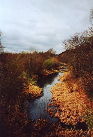
The Barnsley Canal is a canal that ran from Barnby Basin, through Barnsley, South Yorkshire, England, to a junction with the Aire and Calder Navigation near Wakefield, West Yorkshire. It was built in the 1790s, to provide a transport link from coal reserves at Barnsley to a wider market. Both the Aire and Calder Navigation and the River Don Navigation took a keen interest in the project, the former buying many of the initial shares, and the latter constructing the Dearne and Dove Canal to link the canal to their waterway. Water supply issues meant that the Aire and Calder proposed pumping all of the water for the canal from the River Calder, using steam pumps, but a reservoir was built at Cold Hiendley instead, increasing the construction costs, but reducing the running costs. The canal as built was 14.5 miles (23.3 km) long and included 15 locks.

<span class="mw-page-title-main">Royston, South Yorkshire</span> Village in South Yorkshire, England

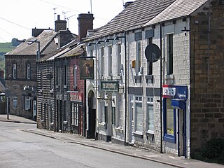
Royston is a suburban village within the Metropolitan borough of Barnsley, in South Yorkshire, England. Historically, the village formed part of the West Riding of Yorkshire, but was incorporated into the Metropolitan borough of Barnsley in 1974 and is now on the border with West Yorkshire. It is part of the Barnsley Central borough constituency, and has a population of 10,728. It is situated 4 miles (6.4 km) north-east of Barnsley, and 6 miles (9.7 km) south-east of Wakefield.

<span class="mw-page-title-main">Worsbrough</span> Area in South Yorkshire, England

Worsbrough is a district to the south of Barnsley in the metropolitan borough of Barnsley, South Yorkshire, England. Before 1974, Worsbrough had its own urban district council in the West Riding of Yorkshire. Much of Worsbrough is now part of Barnsley Metropolitan Borough Council's, Worsbrough ward, although certain parts of the historic Worsbrough district, such as Birdwell, Rockley and Blacker Hill, currently lie within neighbouring council wards.

<span class="mw-page-title-main">Poynton</span> Town in Cheshire, England

Poynton is a town in the civil parish of Poynton-with-Worth, in the Cheshire East district and the ceremonial county of Cheshire, England; from 1974 to 2009 it was in Macclesfield district. It is located on the easternmost fringe of the Cheshire Plain, 11 miles (18 km) south-east of Manchester, 7 miles (11 km) north of Macclesfield and 5 miles (8 km) south of Stockport.

Hemsworth was, from 1894 to 1974, a rural district in the West Riding of Yorkshire, England.

<span class="mw-page-title-main">Caphouse Colliery</span> Coal mine in West Yorkshire, England

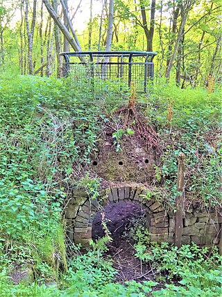
Caphouse Colliery, originally known as Overton Colliery, was a coal mine in Overton, near Wakefield, West Yorkshire, England. It was situated on the Denby Grange estate owned by the Lister Kaye family, and was worked from the 18th century until 1985. It reopened as the Yorkshire Mining Museum in 1988, and is now the National Coal Mining Museum for England.

<span class="mw-page-title-main">Havercroft</span> Village in West Yorkshire, England

Havercroft is a small village situated on the B6428 in West Yorkshire, England, approximately 6½ miles north-east of Barnsley. It forms part of the civil parish of Havercroft with Cold Hiendley, which has a population of 2,103, increasing to 2,256 at the 2011 Census.

Agecroft Colliery was a coal mine on the Manchester Coalfield that opened in 1844 in the Agecroft district of Pendlebury, Lancashire, England. It exploited the coal seams of the Middle Coal Measures of the Lancashire Coalfield. The colliery had two spells of use; the first between 1844 and 1932, when the most accessible coal seams were exploited, and a second lease of life after extensive development in the late 1950s to access the deepest seams.

<span class="mw-page-title-main">Somerset Coalfield</span> Coalfield in northern Somerset, England

The Somerset Coalfield in northern Somerset, England is an area where coal was mined from the 15th century until 1973. It is part of a larger coalfield which stretched into southern Gloucestershire. The Somerset coalfield stretched from Cromhall in the north to the Mendip Hills in the south, and from Bath in the east to Nailsea in the west, a total area of about 240 square miles (622 km2). Most of the pits on the coalfield were concentrated in the Cam Brook, Wellow Brook and Nettlebridge Valleys and around Radstock and Farrington Gurney. The pits were grouped geographically, with clusters of pits close together working the same coal seams often under the same ownership. Many pits shared the trackways and tramways which connected them to the Somerset Coal Canal or railways for distribution.

<span class="mw-page-title-main">Barnsley Coal Railway</span> United Kingdom legislation

The Barnsley Coal Railway was a short railway which, when fully opened, ran between Stairfoot Junction, on the Mexborough to Barnsley line of the South Yorkshire Railway (SYR) and a triangular junction at Nostell on the line of the West Riding and Grimsby Railway (WR&GR).

Tinsley Park Collieries were a group of coal mines situated in the Tinsley / Darnall area to the east of the City of Sheffield, South Yorkshire, England.

The Elsecar Collieries were the coal mines sunk in and around Elsecar, a small village to the south of Barnsley in what is now South Yorkshire, but was traditionally in the West Riding of Yorkshire.

The South Yorkshire Coalfield is so named from its position within Yorkshire. It covers most of South Yorkshire, West Yorkshire and a small part of North Yorkshire. The exposed coalfield outcrops in the Pennine foothills and dips under Permian rocks in the east. Its most famous coal seam is the Barnsley Bed. Coal has been mined from shallow seams and outcrops since medieval times and possibly earlier.

Frickley & South Elmsall Colliery was opened by the Carlton Main Colliery Company Ltd in 1903 in South Elmsall, in Yorkshire, England.

<span class="mw-page-title-main">Notton and Royston railway station</span> Former railway station in England

Notton and Royston railway station was a railway station that served the village of Royston, South Yorkshire, England. It was situated on the Barnsley Coal Railway between Staincross and Mapplewell and Ryhill.

<span class="mw-page-title-main">Wharncliffe Woodmoor 1, 2 & 3 Colliery</span> Former coal mine in South Yorkshire, England

Wharncliffe Woodmoor 1, 2 and 3 colliery was a coal mine that was located at the junction of Laithes Lane and Carlton Road, about 2 miles (3.2 km) north-east of Barnsley, South Yorkshire and a quarter mile east of Staincross and Mapplewell railway station, on the Great Central Railway. The branch line junction was about 200 feet (61 m) from Staincross that connected it to the colliery via a private line. The line finished up between the three main shafts and the coking ovens.

<span class="mw-page-title-main">Ingleton Coalfield</span> Coalfield in North Yorkshire, England

The Ingleton Coalfield is in North Yorkshire, close to its border with Lancashire in north-west England. Isolated from other coal-producing areas, it is one of the smallest coalfields in Great Britain.

<span class="mw-page-title-main">Towneley Colliery</span> Coal mine in Burnley, England

Towneley Colliery or Towneley Desmesne was a coal mine on the Burnley Coalfield in Burnley, Lancashire, England. Sunk in the late 1860s, it was linked to the Lancashire and Yorkshire Railway's Burnley to Todmorden line which became known as the Copy Pit route and, by tramway, to the Leeds and Liverpool Canal.

<span class="mw-page-title-main">Monckton Coke Works</span> Former coking plant in South Yorkshire, England

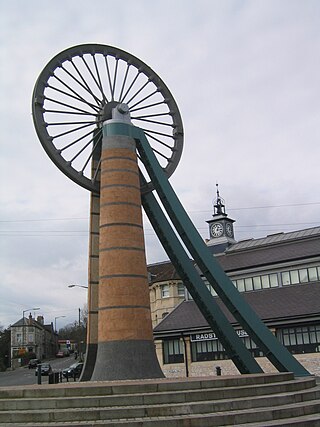
Monckton Coke Works was a coking plant near Royston in South Yorkshire, England. The plant opened in 1884 and was closed 130 years later in 2014, being one of the last remnants of the coal industry in Yorkshire. In the 21st century, it was known as being the last independent coke works in the United Kingdom. For many years it was known for its high-quality coking coal, even being exported to coal-rich South Africa for use in steelmaking. However, in 2013/2014, the market was swamped with cheap imports from the Far East, spelling the demise of Monckton due to it being uneconomical.

References

  1. "Census 2001 : Parish Headcounts : Wakefield". Neighbourhood Statistics. Office for National Statistics. Archived from the original on 13 June 2011. Retrieved 11 September 2009.
  2. "Civil Parish population 2011". Neighbourhood Statistics. Office for National Statistics. Retrieved 2 March 2016.
  3. 'Oxford Dictionary of British Place-Names', A.D. Mills, Oxford University Press.