
West Yorkshire is a metropolitan and ceremonial county in the Yorkshire and the Humber region of England. It borders North Yorkshire to the north and east, South Yorkshire and Derbyshire to the south, Greater Manchester to the south-west, and Lancashire to the west. The city of Leeds is the largest settlement.

Brighouse is a town within the metropolitan borough of Calderdale, in West Yorkshire, England. Historically within the West Riding of Yorkshire, it is situated on the River Calder, 4 miles (6.4 km) east of Halifax. It is served by Junction 25 of the M62 motorway and Brighouse railway station on the Caldervale Line and Huddersfield Line. In the town centre is a mooring basin on the Calder and Hebble Navigation. The United Kingdom Census 2001 gave the Brighouse / Rastrick subdivision of the West Yorkshire Urban Area a population of 32,360. The Brighouse ward of Calderdale Council gave a population of 11,195 at the 2011 Census. Brighouse has a HD6 postcode.

Elland is a market town in Calderdale, in the county of West Yorkshire, England. It is situated south of Halifax, by the River Calder and the Calder and Hebble Navigation. Elland was recorded as Elant in the Domesday Book of 1086. It had a population in 2001 of 14,554, with the ward being measured at 11,676 in the 2011 Census.
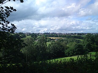
Greetland is a village situated within the metropolitan borough of Calderdale, West Yorkshire, England. It falls within the Calderdale Ward of Greetland and Stainland. According to the 2011 Census, this ward had a population of 11,389. Geographically, Greetland is approximately 1 mile west of Elland and 2.5 miles south of Halifax.

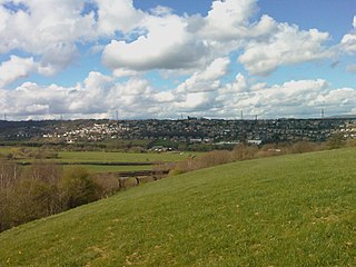
Rastrick is a village in the county of West Yorkshire, England, between Halifax, 5 miles (8 km) north-east and Huddersfield, 4 miles (7 km) south.

Calderdale is a metropolitan borough of West Yorkshire, England, which had a population of 211,439. It takes its name from the River Calder, and dale, a word for valley. The name Calderdale usually refers to the borough through which the upper river flows, while the actual landform is known as the Calder Valley. Several small valleys contain tributaries of the River Calder. The main towns of the borough are Brighouse, Elland, Halifax, Hebden Bridge, Sowerby Bridge and Todmorden.
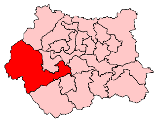
Calder Valley is a constituency in West Yorkshire represented in the House of Commons of the UK Parliament since 2010 by Craig Whittaker, a Conservative.

Outlane is a village in Kirklees, West Yorkshire, England, situated approximately 2.5 miles (4 km) south-west of Elland, 3.7 miles (6 km) north-west of Huddersfield and 4.5 miles (7 km) south of Halifax.

Southowram is a village and former civil parish in Calderdale, West Yorkshire, England. It stands on hill top between Halifax and Brighouse, on the south side of the Shibden Valley. Northowram is on the northern side of the valley. Southowram falls within the Town ward of Calderdale Council. The village is included within the Halifax built-up area as defined by the Office for National Statistics.
Luddendenfoot or Luddenden Foot is a village in West Yorkshire, England. It is in the borough of Calderdale, to the northwest of Sowerby Bridge and west of Halifax. The population of Luddendenfoot is 2,547, with the wider Calderdale Ward having a population of 10,653 at the 2011 Census. The village lies along the Upper Calder Valley below Luddenden, between Sowerby Bridge and Mytholmroyd.

Eastwood is a place within the civil parish of Todmorden and Metropolitan Borough of Calderdale, in West Yorkshire, England. It lies 8 miles (12.9 km) west from Halifax, roughly equidistant from Todmorden's town centre, which is 2 miles (3.2 km) to the southwest, and Hebden Bridge, which is 2 miles to the northeast, along the course of the River Calder. Eastwood falls within the Calder ward of Calderdale council.

Norland is a dispersed village south of Sowerby Bridge in the metropolitan borough of Calderdale in West Yorkshire, England.
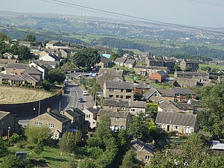
Stainland is a village in the civil parish of Stainland and District, in Calderdale, West Yorkshire, England. The village is part of the Greetland and Stainland ward of Calderdale Council and is approximately 2 miles (3 km) west of Elland, 3.5 miles (6 km) south of Halifax and 4.3 miles (7 km) north-west of Huddersfield.

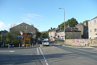
Barkisland is a village in Calderdale, West Yorkshire, England. Historically part of the West Riding of Yorkshire, it is 1 mile (1.6 km) east of Ripponden, 2 miles (3.2 km) south of Sowerby Bridge and 4 miles (6.4 km) south-west of Halifax town centre.
Sowood is a village in the civil parish of Stainland and District, in the Calderdale district of West Yorkshire, England. The village is in the Greetland and Stainland ward of Calderdale Council. It is 2.3 miles (3.7 km) south-west of Elland, 4.1 miles (6.6 km) north-west of Huddersfield and 4.2 miles (6.8 km) south of Halifax.
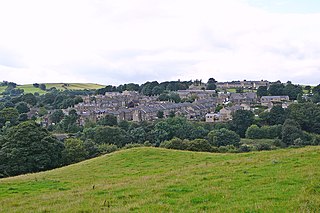
Holywell Green is a village in the civil parish of Stainland and District, in the Calderdale, district, in the county of West Yorkshire, England. The village is situated approximately 1.4 miles (2 km) south-west of Elland, 3.3 miles (5 km) south of Halifax and 3.9 miles (6 km) north-west of Huddersfield. Holywell Green is part of the Greetland and Stainland Ward of Calderdale Council.

West Vale is a village in Calderdale, West Yorkshire, England. The village falls within the Greetland and Stainland parish of the Calderdale Council. It is 2.5 miles (4.0 km) south of Halifax, 2 miles (3.2 km) west of Elland and 4 miles (6.4 km) north-west of Huddersfield.

Old Lindley or Over Lindley is a hamlet in the civil parish of Stainland and District, in the Calderdale district, in the county of West Yorkshire, England. It is near the hamlet of Jagger Green, the village of Holywell Green and the town of Elland. Old Lindley has a moor called Old Lindley Moor.

The Municipal Borough of Brighouse was a local government district in the West Riding of Yorkshire from 1873 to 1974 around the town of Brighouse, covering Clifton, Hipperholme, Hove Edge, Lightcliffe, Rastrick and Southowram.

Calderdale Metropolitan Borough Council is the local authority for the Metropolitan Borough of Calderdale in West Yorkshire, England. The council styles itself Calderdale Council. It is a metropolitan district council, one of five in West Yorkshire and one of 36 in the metropolitan counties of England. It provides the majority of local government services in Calderdale. Since 2014 the council has been a constituent member of the West Yorkshire Combined Authority.


