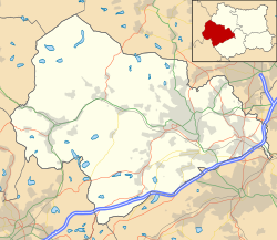
Warley Town

Last updated

Warley Town
MaypoleInnWarleyTown(MarkAnderson)Jun2005.jpg
Maypole Inn, Warley Town, looking east
Calderdale UK location map.svg
Red pog.svg
Warley Town
West Yorkshire UK location map.svg
Red pog.svg
Warley Town
Location within West Yorkshire
Population12,215 (Warley Ward. 2011)
OS grid reference SE057248
Metropolitan borough
Metropolitan county
Region
Country England
Sovereign state United Kingdom
Post town HALIFAX
Postcode district HX2
Police West Yorkshire
Fire West Yorkshire
Ambulance Yorkshire
List of places
UK
England
Yorkshire
53°43′11″N1°54′49″W / 53.719696°N 1.913602°W / 53.719696; -1.913602

Warley Town is a settlement near Halifax, in the Calderdale district, in the county of West Yorkshire, England. [1] Warley is a ward of Calderdale. The population of this ward as taken at the 2011 Census was 12,215. [2]

Contents

History

Warley Town was listed in the Domesday book as Werlafeslei. [3]

Warley township, one of 23 townships in the ancient parish of Halifax, was also one of the biggest, stretching as far as Luddenden and what was to become Sowerby Bridge. The township consisted of many tiny settlements essentially based on the local farmsteads, places such as Lane End, Warley Edge, Winterburn Hill, Cliff Hill [4] and Warley itself.

Warley was formerly a township in the parish of Halifax, [5] in 1866 Warley became a separate civil parish, [6] in 1894 Warley became an urban district, in 1900 the urban district was abolished [7] and the parish was abolished and merged with Halifax on 9 November 1900. [8] In 1891 the parish had a population of 9249. [9]

Warley remained a small settlement until the beginning of the 18th century. Then the consolidation of the Cliff Hill estate into a major land holding, coupled with the establishment of the Congregational chapel, formed the core, around which the present village grew. In 1977 the chapel was closed and converted into housing now called Chantry House.

In front of the chapel, cottages were built for agricultural workers as well as larger houses for local businessmen who preferred to live in the country away from the smog of Halifax.

Wilfred Pickles and his wife Mabel were residents of Warley for many years, and Wilfred could occasionally be seen enjoying a pint of Webster's beer in the village pub, The Maypole. During the late 1960s, and 1970s The Maypole was run by Jack Wilkinson and his wife June; Jack had previously been a well-known rugby league player and had played for Wakefield Trinity and Halifax rugby league football clubs. He also appeared as himself on the rugby pitch in the film This Sporting Life .

The writer Dr Phyllis Bentley was also a famous and long-term Warley resident.

Patrick Brontë, father of the writers Charlotte, Emily and Anne Brontë, and of Branwell Brontë, lived for a time in Warley Town in a house called "The Grange" next to the congregational chapel. The Church of St John the Evangelist was completed in 1878. [10]

As part of British Telecom's ‘Adopt a Kiosk’ programme, the Warley Community Association adopted the disused BT telephone box and transformed it into a museum of local history, said to be the smallest museum in England. [11]

Sports

Warley Town is home to the amateur football team Warley Rangers. Warley Cricket Club plays in the Halifax Cricket League.

See also

Related Research Articles

<span class="mw-page-title-main">Elland</span> Town in West Yorkshire, England

Elland is a market town in Calderdale, in the county of West Yorkshire, England. It is situated south of Halifax, by the River Calder and the Calder and Hebble Navigation. Elland was recorded as Elant in the Domesday Book of 1086. It had a population in 2001 of 14,554, with the ward being measured at 11,676 in the 2011 Census.

<span class="mw-page-title-main">Sowerby Bridge</span> Market town in West Yorkshire, England

Sowerby Bridge is a market town in the Upper Calder Valley in Calderdale in West Yorkshire, England. The Calderdale Council ward population at the 2011 census was 11,703.

<span class="mw-page-title-main">Calderdale</span> Metropolitan borough in West Yorkshire, England

Calderdale is a metropolitan borough of West Yorkshire, England, which had a population of 211,439. It takes its name from the River Calder, and dale, a word for valley. The name Calderdale usually refers to the borough through which the upper river flows, while the actual landform is known as the Calder Valley. Several small valleys contain tributaries of the River Calder. The main towns of the borough are Brighouse, Elland, Halifax, Hebden Bridge, Sowerby Bridge and Todmorden.

<span class="mw-page-title-main">Thornton, West Yorkshire</span> Village in West Yorkshire, England

Thornton is a village and former civil parish, within the metropolitan borough of the City of Bradford, in West Yorkshire, England. It lies 6 miles (9.7 km) to the west of the city centre of Bradford, and together with neighbouring Allerton, had a total resident population in 2001 of 15,004, increasing to 17,276 at the 2011 Census. Its most famous residents were the Brontës.

<span class="mw-page-title-main">Clifton, West Yorkshire</span> Village in West Yorkshire, England

Clifton is a village on the eastern outskirts of Brighouse in the Calderdale district of West Yorkshire, England.

<span class="mw-page-title-main">Luddenden</span> District of Calderdale, West Yorkshire, England

Luddenden is a district of Calderdale 3.1 miles (5 km) west of Halifax on the Luddenden Brook in the county of West Yorkshire, England.

<span class="mw-page-title-main">Hebden Royd</span> Town and Civil Parish in West Yorkshire, England

Hebden Royd is a civil parish in the Metropolitan Borough of Calderdale in West Yorkshire, England. According to the 2001 census it had a population of 9,092, rising to 9,558 at the 2011 census. It includes market town of Hebden Bridge and the villages of Mytholmroyd and Cragg Vale. The parish was an urban district before 1974, created in 1937 by the merger of Hebden Bridge and Mytholmroyd urban districts.

<span class="mw-page-title-main">Sowerby, West Yorkshire</span> Village in West Yorkshire, England

Sowerby is a village in the Metropolitan Borough of Calderdale, in West Yorkshire, England. It lies in the Pennines, contiguous with Sowerby Bridge, 3.7 miles (6.0 km) west-southwest of Halifax.

<span class="mw-page-title-main">Southowram</span> Village in West Yorkshire, England

Southowram is a village and former civil parish in Calderdale, West Yorkshire, England. It stands on hill top between Halifax and Brighouse, on the south side of the Shibden Valley. Northowram is on the northern side of the valley. Southowram falls within the Town ward of Calderdale Council. The village is included within the Halifax built-up area as defined by the Office for National Statistics.

<span class="mw-page-title-main">Northowram</span> Village in West Yorkshire, England

Northowram is a village lying north-east of the town of Halifax in Calderdale, West Yorkshire, England. It stands on the north side of Shibden valley. Southowram stands on the southern side of the valley.

<span class="mw-page-title-main">Luddendenfoot</span> Human settlement in England

Luddendenfoot or Luddenden Foot is a village and former civil parish, lying north-west of Sowerby Bridge and west of Halifax, in Calderdale, West Yorkshire, England. The population of Luddendenfoot is 2,547, with the wider Calderdale Ward at the 2011 Census as 10,653. It lies along the Upper Calder Valley below the village of Luddenden, between Sowerby Bridge and Mytholmroyd.

<span class="mw-page-title-main">Hipperholme</span> Village in West Yorkshire, England

Hipperholme is a village in West Yorkshire, England, located between the towns of Halifax and Brighouse in the Hipperholme and Lightcliffe ward of the Metropolitan Borough of Calderdale. The population of this ward at the 2011 Census was 11,308.

<span class="mw-page-title-main">Shelf, West Yorkshire</span> Village in West Yorkshire, England

Shelf is a village in Calderdale in West Yorkshire, England. The village is situated approximately 3 miles (4.8 km) north-east of Halifax and 5 miles (8 km) south-west of Bradford, on the A6036 road. In 2001 it had a population of 4,496. At the 2011 Census Shelf was measured as part of the Calderdale ward of Northowram and Shelf.

<span class="mw-page-title-main">Eastwood, West Yorkshire</span> Human settlement in England

Eastwood is a place within the civil parish of Todmorden and Metropolitan Borough of Calderdale, in West Yorkshire, England. It lies 8 miles (12.9 km) west from Halifax, roughly equidistant from Todmorden's town centre, which is 2 miles (3.2 km) to the southwest, and Hebden Bridge, which is 2 miles to the northeast, along the course of the River Calder. Eastwood falls within the Calder ward of Calderdale council.

<span class="mw-page-title-main">Halifax, West Yorkshire</span> Minster and market town in West Yorkshire, England

Halifax is a minster and market town in the metropolitan borough of Calderdale in West Yorkshire, England. It is the commercial, cultural and administrative centre of the borough, and the headquarters of Calderdale Council. In the 15th century, the town became an economic hub of the old West Riding of Yorkshire, primarily in woollen manufacture. Halifax is the largest town in the wider Calderdale borough. Halifax was a thriving mill town during the Industrial Revolution. In 2011, it had a population of 88,134.

<span class="mw-page-title-main">Barkisland</span> Village in West Yorkshire, England

Barkisland is a village in Calderdale, West Yorkshire, England. Historically part of the West Riding of Yorkshire, it is 1 mile (1.6 km) east of Ripponden, 2 miles (3.2 km) south of Sowerby Bridge and 4 miles (6.4 km) south-west of Halifax town centre.

<span class="mw-page-title-main">Midgley</span> Human settlement in England

Midgley is a hill-top village in Calderdale, West Yorkshire, England. It is situated approximately 12 miles (20 km) east from Burnley and 4 miles (6 km) west-north-west of Halifax, and just north of the A646 road. Nearby villages are Mytholmroyd 1 mile (1.6 km) to the west-south-west, and Hebden Bridge 2.5 miles (4.0 km) to the west-north-west.

<span class="mw-page-title-main">Rishworth</span> Village in West Yorkshire, England

Rishworth is a village in Calderdale, West Yorkshire, England. Historically in the West Riding of Yorkshire, it has a small church, farms and schools, including Rishworth School. In 1931 the parish had a population of 838.

<span class="mw-page-title-main">Friendly, West Yorkshire</span>

Friendly is a settlement near Sowerby Bridge in Calderdale, West Yorkshire, England, lying on the A646 road in the valley of the River Calder. It was described in Bartholomew's 1887 Gazetteer of the British Isles as a village 3 miles west of Halifax.

<span class="mw-page-title-main">Stansfield, West Yorkshire</span> Human settlement in Todmorden, West Yorkshire, England

Stansfield is a place and township in the civil parish of Todmorden and Metropolitan Borough of Calderdale, in West Yorkshire, England, which gave its name to Stansfield Hall, Stansfield Hall Railway Station, and an electoral ward in Todmorden, Calderdale.

References

  1. Ordnance Survey: Landranger map sheet 104 Leeds & Bradford (Harrogate & Ilkley) (Map). Ordnance Survey. 2014. ISBN   9780319231654.
  2. "Calderdale Ward population 2011". Neighbourhood Statistics. Office for National Statistics. Retrieved 23 February 2016.
  3. "Warley | Domesday Book". opendomesday.org.
  4. "Cliff Hill, Cliff Hill Lane". Primelocation. Retrieved 7 May 2018.
  5. "History of Warley, in Calderdale and West Riding". A Vision of Britain through Time . Retrieved 24 December 2023.
  6. "Relationships and changes Warley CP/Tn through time". A Vision of Britain through Time. Retrieved 24 December 2023.
  7. "Relationships and changes Warley UD through time". A Vision of Britain through Time. Retrieved 24 December 2023.
  8. "Halifax Registration District". UKBMD. Retrieved 24 December 2023.
  9. "Population statistics Warley CP/Tn through time". A Vision of Britain through Time. Retrieved 24 December 2023.
  10. Historic England. "Church of St John the Evangelist,Warley, Halifax, West Yorkshire (1259129)". National Heritage List for England . Retrieved 29 January 2014.
  11. "Warley Museum". 9 March 2013.

Commons-logo.svg Media related to Warley Town at Wikimedia Commons