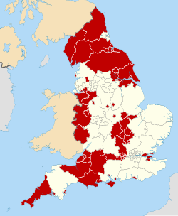
North Yorkshire (district)

Last updated

North Yorkshire
Ripon, The Minster, seen from Kirkgate - geograph.org.uk - 1879079.jpg
Ripon, the only city in the district and its third-largest settlement
North Yorkshire District UK locator map (2023).svg
North Yorkshire district shown within North Yorkshire ceremonial county
Coordinates: 54°10′N1°20′W / 54.167°N 1.333°W / 54.167; -1.333
Sovereign state United Kingdom
Country England
Region Yorkshire and the Humber
Ceremonial county North Yorkshire
Combined authority York and North Yorkshire
Incorporated 1 April 2023
Administrative HQ County Hall, Northallerton
Government
[1]
  Type Unitary authority
  Body North Yorkshire Council
   Executive Leader and cabinet
   Control No overall control
Area
[2]
  Total
8,037 km2 (3,103 sq mi)
  Rank 1st
Population
 (2024) [2]
  Total
635,270
  Rank 3rd
  Density79/km2 (200/sq mi)
Ethnicity (2021)
[3]
   Ethnic groups
List
Religion (2021)
[3]
   Religion
List
Time zone UTC+0 (GMT)
  Summer (DST) UTC+1 (BST)
Postcode areas
List
  • BD20, BD22–24
  • DL6–11
  • HG
  • LA2, LA6
  • LS17, LS21–25, LS29
  • TS9
  • YO7, YO8, YO11–14, YO17–24, YO26, YO30, YO51, YO60–62
GSS code E06000065
Website northyorks.gov.uk

North Yorkshire is a unitary authority area in the ceremonial county of North Yorkshire, England. Officially the County of North Yorkshire, the area is both a non-metropolitan county and district for local government purposes. It covers a large, mostly rural area in northern Yorkshire, stretching from the North York Moors on the eastern coast to the Yorkshire Dales in the west.

Contents

The non-metropolitan county is the largest local government area in England, with an area of 2,483 square miles (6,430 km2). Alongside the City of York and the boroughs of Middlesbrough, Redcar and Cleveland and Stockton-on-Tees (south of the River Tees), forms the ceremonial county of North Yorkshire. [4]

It is governed by the North Yorkshire Council, which has been a unitary authority since 2023, when it took over the functions of the councils of seven thereafter-abolished districts: Craven, Hambleton, Harrogate, Scarborough, Richmondshire, Ryedale and Selby. [5]

History

Boundaries of the seven defunct districts within North Yorkshire District Defunct districts within North Yorkshire District.svg
Boundaries of the seven defunct districts within North Yorkshire District
Former non-metropolitan districts [5]
#Local authority2011 census2021 census
1 Harrogate 157,869 [6] 164,105
2 Scarborough 108,793 [7] 108,959
3 Hambleton 89,140 [8] 91,037
4 Selby 83,449 [9] 92,401
5 Craven 55,409 [10] 57,090
6 Richmondshire 51,965 [11] 50,358
7 Ryedale 51,751 [12] 54,897

The non-metropolitan county became a unitary authority area on 1 April 2023, following the merger of the above boroughs and districts as part of the 2019–2023 structural changes to local government in England.

Governance

County Hall, the district administrative centre in Northallerton County Hall - geograph.org.uk - 1583476.jpg
County Hall, the district administrative centre in Northallerton

North Yorkshire Council has 90 councillors which elect a council leader, who in turn appoints up to nine councillors to form an executive cabinet. It replaces the former non-metropolitan county which had a cabinet-style council of 72 councillors. [13]

Geography

The area is the largest local authority area in England. Larger towns and settlements include Harrogate, Scarborough, Northallerton, Selby, Skipton, Richmond, Malton, Thirsk, Stokesley, Great Ayton, Norton-on-Derwent, Catterick Garrison, Pickering, Helmsley and Knaresborough while Ripon is the only city in the area.

Neighbouring council areas
Local authorityIn relation to North Yorkshire
County Durham North
Darlington North
Stockton-on-Tees North east
Middlesbrough North east
Redcar and Cleveland North east
East Riding of Yorkshire South east
City of York South east
City of Doncaster South
City of Wakefield South west
City of Leeds South west
City of Bradford South west
Pendle West
Ribble Valley West
City of Lancaster West
Westmorland and Furness North west

Education

North Yorkshire LEA has a mostly comprehensive education system with 42 state schools secondary (not including sixth form colleges) and 12 independent schools.

References

  1. "Your council". North Yorkshire Council. Retrieved 29 December 2024.
  2. 1 2 "Mid-Year Population Estimates, United Kingdom, June 2024". Office for National Statistics . 26 September 2025. Retrieved 26 September 2025.
  3. 1 2 UK Census (2021). "2021 Census Area Profile – North Yorkshire Local Authority (E10000023)". Nomis. Office for National Statistics . Retrieved 29 December 2024.
  4. Calkin, Sarah (31 March 2023). "North Yorkshire: 'It's going to be very intense'". Local Government Chronicle (LGC). Retrieved 17 April 2023.
  5. 1 2 "Transport map of shire county divided into districts". North Yorkshire County Council. Archived from the original (PDF) on 7 August 2011. Retrieved 10 October 2008.
  6. "Harrogate Local Authority" . Retrieved 16 March 2020.
  7. "Scarborough Local Authority" . Retrieved 16 March 2020.
  8. "Hambleton Local Authority" . Retrieved 16 March 2020.
  9. "Selby Local Authority" . Retrieved 16 March 2020.
  10. "Craven Local Authority" . Retrieved 16 March 2020.
  11. "Richmondshire Local Authority" . Retrieved 16 March 2020.
  12. "Ryedale Local Authority" . Retrieved 16 March 2020.
  13. "North Yorkshire County Council Constitution". North Yorkshire County Council. Archived from the original on 28 December 2010. Retrieved 10 May 2010.