Elected county councils were established in 1889 under the Local Government Act 1888, taking over administrative functions that had previously been performed by unelected magistrates at the quarter sessions. The first elections were held in January 1889 and the county council formally came into being on 1 April 1889. On that day it held its first official meeting at the Shirehall in Shrewsbury, the courthouse (built 1837) which had served as the meeting place for the quarter sessions. The first chairman was Alfred Salwey of Overton, who had also been chairman of the quarter sessions for some years prior to the creation of the county council.[4][5]
The Local Government Act 1888 which created county councils did not specify the names of the counties. As Shropshire was also known as Salop, the names 'Shropshire County Council' and 'Salop County Council' were used interchangeably in the council's early years.[6][7] The council chose to adopt an official seal inscribed in Latin rather than English: Concilii comitatus Salopiensis sigilum commune.[8] The county's legal name was confirmed as being Salop by the Local Government Act 1933.[9]
The council changed the county's legal name from Salop to Shropshire with effect from 1 April 1980, after which the council was called Shropshire County Council.[11][12]
In 1998, following the recommendations of the Local Government Commission, The Wrekin district was removed from the non-metropolitan county of Shropshire, with its council becoming a unitary authority, independent from the county council. The district council chose to rename the district 'Telford and Wrekin' at the same time.[11]
Shropshire County Council, supported by South Shropshire District Council and Oswestry Borough Council, proposed to the government that the non-metropolitan county of Shropshire should become a single unitary authority. This was opposed by the other three districts in the county. Shrewsbury and Atcham Borough Council took legal action challenging the government's decision to proceed with the reorganisation, but was unsuccessful.[14]
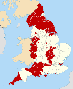
The ceremonial county and unitary authorities from 1 April 2009; the larger "Shropshire" unitary authority (1) and Telford and Wrekin (2)
Shropshire County Council became a unitary authority with effect from 1 April 2009. The way the changes were implemented was that the five remaining districts in the non-metropolitan county were abolished and merged into a single district called Shropshire, but with there being no separate district council. Instead, the existing county council also took on the functions that legislation assigns to district councils. The county council was given the option of omitting the word 'county' from its name as part of the reforms, which it took, becoming 'Shropshire Council'.[15]
Governance
As a unitary authority, Shropshire Council provides both county-level and district-level functions. The whole county is also covered by civil parishes, which form a second tier of local government.[16]
Political control
In 2025, the Liberal Democrats took control of the council. It had previously been under Conservative control since 2005.
Political control of the council since the 1974 reforms has been as follows:[17][18][19]
Following the 2025 election,[32] and a subsequent change of allegiance later in May 2025 from Reform UK to independent, the composition of the council was:[33][34]
Since the last review of boundaries took effect in 2025, the council has comprised 74 councillors representing 72 electoral divisions. Most divisions elect one councillor, but the St Martin's and Wem divisions each elect two councillors. Elections are held every four years.[35]
Premises
In February 2025, the council relocated to the Guildhall in the Frankwell area of Shrewsbury.[36] The Guildhall had been completed in 2004 as the headquarters for the old Shrewsbury and Atcham Borough Council.[37]
The council was previously based at the Shirehall on Abbey Foregate in Shrewsbury, which was purpose-built for the council and opened in 1966. The council announced its intention to vacate Shirehall in 2024.[38]
Prior to 1966 the council was based at the Old Shirehall in Shrewsbury, which was subsequently demolished.[39]
↑ "Compositions Calculator". The Elections Centre. University of Exeter. Retrieved 21 May 2025. (Put "Shropshire" in search box to see specific results.)
This page is based on this Wikipedia article Text is available under the CC BY-SA 4.0 license; additional terms may apply. Images, videos and audio are available under their respective licenses.