
The River Severn, at 220 miles (354 km) long, is the longest river in Great Britain. It is also the river with the most voluminous flow of water by far in all of England and Wales, with an average flow rate of 107 m3/s (3,800 cu ft/s) at Apperley, Gloucestershire. It rises in the Cambrian Mountains in mid Wales, at an altitude of 2,001 feet (610 m), on the Plynlimon massif, which lies close to the Ceredigion/Powys border near Llanidloes. The river then flows through Shropshire, Worcestershire and Gloucestershire. The county towns of Shrewsbury, Worcester and Gloucester lie on its course.
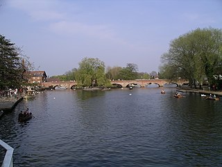
The River Avon in central England flows generally southwestwards and is a major left-bank and easternmost tributary of the River Severn. It is also known as the Warwickshire Avon or Shakespeare's Avon, to distinguish it from several other rivers of the same name in the United Kingdom.

The River Lugg rises near Llangynllo in Powys, Wales. From its source, it flows through the border town of Presteigne and then into Herefordshire, England. It meets its main tributary, the River Arrow, to the south of Leominster, then flows into the River Wye downstream of Hereford at Mordiford, around 63 miles (101 km) from its source. Its name comes from a Welsh root, and means "bright stream".

Lake Vyrnwy is a reservoir in Powys, Wales, built in the 1880s for Liverpool Corporation Waterworks to supply Liverpool with fresh water. It flooded the head of the Vyrnwy valley and submerged the village of Llanwddyn.

The River Clun runs mostly through Shropshire, England and joins the River Teme at Leintwardine, Herefordshire. The Clun Valley is part of the Shropshire Hills AONB.

Meifod, formerly also written Meivod, is a small village, community and electoral ward seven miles (11 km) north-west of Welshpool in Montgomeryshire, Powys, Wales, on the A495 road and located in the valley of the River Vyrnwy. The River Banwy has a confluence with the Vyrnwy approximately two miles (3.2 km) to the west of the village. The village itself had a population of 317. The community includes the village of Bwlch-y-cibau and the hamlet of Allt-y-Main.

The River Perry is a river in Shropshire, England. It rises near Oswestry and flows south to meet the River Severn above Shrewsbury. Along its 24 miles (39 km) length, its level drops by some 320 feet (95 m). The channel has been heavily engineered, both to enable water mills to be powered by it, and to improve the drainage of the surrounding land. There were at least seven corn mills in the 1880s, and the last one remained operational until 1966. The middle section of the river crosses Baggy Moor, where major improvements were made in 1777 to drain the moor. The scheme was one of the largest to enclose and improve land in North Shropshire, and the quality of the reclaimed land justified the high cost. A section of the river bed was lowered in the 1980s, to continue the process.

The River Cam is a small river in Gloucestershire, England. It flows for 12 miles (20 km) north-westwards from the Cotswold Edge, across the Vale of Berkeley, into the Gloucester and Sharpness Canal.

The River Salwarpe is a 20.4 miles (32.8 km) long river in Worcestershire, England. It is a left bank tributary of the River Severn, which it joins near Hawford.

The Clywedog Reservoir is a reservoir near Llanidloes, Wales on the head-waters of the River Severn. The construction of the reservoir was enabled by an act of Parliament, the Clywedog Reservoir Joint Authority Act 1963, which asserted that "At certain times the flow of water in the river is inadequate ... unless that flow were regulated so as to ensure that at those times water in addition to the natural flow will flow down the river."
Canoe Wales is the national governing body for paddlesport in Wales. It covers all branches of the sport from recreational canoeing, kayaking, stand up paddleboarding and rafting to whitewater racing, slalom racing and wildwater racing; flatwater sprint racing and marathon racing; canoe sailing; canoe polo; surf kayaking and canoeing; and extreme racing. The organisation has over 2,700 members including individual paddlers as well as affiliated club members. Full adult members of Canoe Wales are also by default Welsh members of Paddle UK.

The River Unk is a small river in Shropshire, England that runs for 9.7 miles (15.6 km) before flowing into the River Clun.

The River Onny is a river in Shropshire, England. It is a major tributary of the River Teme.

Dolanog or Pont Dolanog is an ecclesiastical parish or chapelry that was formed in October 1856. It comprises the townships of Dolwar in Llanfihangel portions of Coedtalog in Llanerfyl, Cynhinfa in Llangyniew and Gwaunynog in Llanfair Caereinion. The total area of this parish is 3,100 acres. Dolanog was within the historic county of Montgomeryshire, which now forms part of Powys, Wales. Dolwar Fechan in Dolanog was the home Ann Griffiths, the Methodist hymn writer.

The Afon Iwrch is a river near Llanrhaeadr-ym-Mochnant in Clwyd, Wales. It is a tributary of the River Tanat and is 8.9 miles (14.4 km) in length. Its headwaters lie on the eastern slopes of Cadair Berwyn, the highest peak of the Berwyn range, and the river flows broadly southeastwards to join the River Tanat, itself a tributary of the River Vyrnwy.

The River Worfe is a river in Shropshire, England. The name Worfe is said to derive from the Old English meaning to wander which the river is notable for in its middle section. Mapping indicates that the river begins at Cosford Bridge where the Cosford Brook and Albrighton Brook meet.

The River Cain is a river in north Powys which flows into the River Vyrnwy.

The Afon Dulas is a river in Powys, Wales. It is a headwater tributary of the River Severn, which it joins at Llanidloes opposite the confluence with the Afon Clywedog. Its principal tributary is the Afon Brochan. The total length of the Dulas and Brochan is 19.6 km. Other tributaries include Nant Cydros, the Rhydyclwydau Brook and Nant Gynwydd.

The River Morda is a minor river in Wrexham County Borough and Powys, Wales and Shropshire, England, lying mainly to the south-west of the town of Oswestry. The river flows in a generally eastward direction from its source near Llechrydau, Wrexham, across the England–Wales border to its convergence with the River Vyrnwy near Domgay.
There are a large number of reservoirs in Wales reflecting the need for the supply of water for both industry and for consumption, both within the country itself and in neighbouring England. A number also provide hydroelectricity and many old reservoirs also provided motive power for industries, especially for the processing of minerals such as metal ores and slate.

