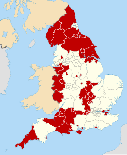
Central Bedfordshire

Last updated

Central Bedfordshire
Leighton Buzzard, market cross - geograph.org.uk - 5615323.jpg
The Alameda, Ampthill - geograph.org.uk - 5746951.jpg
Shefford High Street.jpg
Central Bedfordshire Council.svg
Central Bedfordshire UK locator map.svg
Shown within Bedfordshire
Sovereign state United Kingdom
Constituent country England
Region East of England
Ceremonial county Bedfordshire
Founded1 April 2009
Admin. HQ Chicksands
Government
  Type Unitary authority
  Body Central Bedfordshire Council
   Leadership:Leader & Cabinet
  Executive: No overall control
   MPs: Richard Fuller (C)
Rachel Hopkins (L)
Alex Mayer (L)
Alistair Strathern (L)
Blake Stephenson (C)
Area
  Total
276 sq mi (716 km2)
  Rank 45th
Population
 (2022)
  Total
301,501
  Rank Ranked 47th
  Density1,100/sq mi (420/km2)
Ethnicity (2021)
[1]
   Ethnic groups
List
Religion (2021)
[1]
   Religion
List
Time zone UTC+0 (Greenwich Mean Time)
  Summer (DST) UTC+1 (British Summer Time)
ISO 3166-2 GB-CBF
ONS code 00KC (ONS)
E06000056 (GSS)
Website centralbedfordshire.gov.uk

Central Bedfordshire is a local government district in the ceremonial county of Bedfordshire, England. It is administered by Central Bedfordshire Council, a unitary authority. It was created in 2009.

Contents

Formation

Central Bedfordshire was created on 1 April 2009 as part of a structural reform of local government in Bedfordshire. The Bedfordshire County Council and all the district councils in the county were abolished, with new unitary authorities created providing the services which had been previously delivered by both the district and county councils. Central Bedfordshire was created covering the area of the former Mid Bedfordshire and South Bedfordshire Districts. [2] [3]

The local authority is called Central Bedfordshire Council.

Parliamentary representation

Following the 2023 Periodic Review of Westminster constituencies, Central Bedfordshire would be split between five parliamentary constituencies: [4]

Towns and villages

Map of wards within Central Bedfordshire Central Bedfordshire UK ward map 2010 (blank).svg
Map of wards within Central Bedfordshire

Central Bedfordshire comprises a mix of market towns and rural villages. The largest town is Leighton Buzzard followed by Dunstable and Houghton Regis. Dunstable and Houghton Regis form part of the Luton/Dunstable urban area. Central Bedfordshire includes the following towns and villages.

See also

Related Research Articles

<span class="mw-page-title-main">Bedfordshire</span> County of England

Bedfordshire is a ceremonial county in the East of England. It is bordered by Northamptonshire to the north, Cambridgeshire to the north-east, Hertfordshire to the south and the south-east, and Buckinghamshire to the west. The largest settlement is Luton (225,262), and Bedford is the county town.

<span class="mw-page-title-main">Leighton Buzzard</span> Town in Bedfordshire, England

Leighton Buzzard is a market town in Bedfordshire, England, in the southwest of the county and close to the Buckinghamshire border. It lies between Aylesbury, Tring, Luton/Dunstable and Milton Keynes, near the Chiltern Hills.

<span class="mw-page-title-main">South Bedfordshire</span> Former local government district in England

South Bedfordshire was a local government district in Bedfordshire, in the East of England, from 1974 to 2009. Its main towns were Dunstable, Houghton Regis and Leighton Buzzard.

<span class="mw-page-title-main">History of Bedfordshire</span> History of Bedfordshire County in England

Bedfordshire is an English ceremonial county which lies between approximately 25 miles and 55 miles north of central London.

<span class="mw-page-title-main">South West Bedfordshire (UK Parliament constituency)</span> Parliamentary constituency in the United Kingdom, 1983-2024

South West Bedfordshire was a constituency represented in the House of Commons of the UK Parliament. As with all constituencies of the UK Parliament, it elected one Member of Parliament (MP) by the first past the post system of election.

<span class="mw-page-title-main">Luton South and South Bedfordshire (UK Parliament constituency)</span> Parliamentary constituency in the United Kingdom, 1983 onwards

Luton South and South Bedfordshire is a constituency in Bedfordshire represented in the House of Commons of the UK Parliament since 2019 by Rachel Hopkins, a member of the Labour Party.

<span class="mw-page-title-main">Parliamentary constituencies in Bedfordshire</span>

The ceremonial county of Bedfordshire is split into 7 seats – 2 borough and 5 county constituencies.

<span class="mw-page-title-main">Houghton Regis</span> Town and civil parish in Bedfordshire, England

Houghton Regis is a market town and civil parish in the Central Bedfordshire district of Bedfordshire, England.

<span class="mw-page-title-main">Luton Rural District</span> History of Bedfordshire

Luton Rural District was a local authority in Bedfordshire, England from 1894 to 1974. It covered an area which almost surrounded but did not include the towns of Luton and Dunstable.

Luton was a constituency including the town of Luton in Bedfordshire. It returned one Member of Parliament (MP) to the House of Commons of the UK Parliament from 1885 to 1974, elected by the first past the post system.

<span class="mw-page-title-main">Stanbridge, Bedfordshire</span> Human settlement in England

Stanbridge is a village and civil parish in Bedfordshire which lies 3 miles (5 km) east of Leighton Buzzard. It also borders the Bedfordshire villages of Hockliffe, Eggington, Tilsworth, Totternhoe and Billington.

<span class="mw-page-title-main">South Bedfordshire (UK Parliament constituency)</span> Parliamentary constituency in the United Kingdom, 1950–1983

South Bedfordshire was a county constituency in Bedfordshire. It returned one Member of Parliament (MP) to the House of Commons of the Parliament of the United Kingdom, elected by the first past the post system.

Manshead was a hundred of Bedfordshire in England. It covered an area in the south-west of the county stretching from Salford to Studham and from Leighton Buzzard to Houghton Regis and Dunstable.

<span class="mw-page-title-main">Luton/Dunstable urban area</span> Conurbation in Bedfordshire, England, which includes Luton, Dunstable and Houghton Regis

The Luton/Dunstable urban area, according to the Office for National Statistics, is the conurbation including the settlements of Luton, Dunstable and Houghton Regis, in Bedfordshire, East of England.

<span class="mw-page-title-main">Central Bedfordshire College</span>

Central Bedfordshire College is a British further education college located in Bedfordshire, England. The college was established in 1961 in Dunstable. On 14 January 2010, the college was renamed Central Bedfordshire College. The college is part of the Bedford College Group since 2023. Sarah Mortimer CBE, principal and chief executive explained that the change of name was to reflect the College's commitment to Central Bedfordshire as a whole and be recognised as the premier post sixteen institution in the area.

<span class="mw-page-title-main">Dunstable</span> Market town and civil parish in Bedfordshire, England

Dunstable is a market town and civil parish in Bedfordshire, England, east of the Chiltern Hills, 30 miles north of London. There are several steep chalk escarpments, most noticeable when approaching Dunstable from the north. Dunstable is the fourth largest town in Bedfordshire and along with Houghton Regis forms the westernmost part of the Luton/Dunstable urban area.

<span class="mw-page-title-main">Central Bedfordshire Council</span>

Central Bedfordshire Council is the local authority for Central Bedfordshire, a local government district in the ceremonial county of Bedfordshire, England. The council is a unitary authority, being a district council which also performs the functions of a county council. It has been under no overall control since 2023, being run by an independent-led administration. The council is based at Chicksands.

<span class="mw-page-title-main">Luton to Dunstable Busway</span>

The Luton-Dunstable Busway is a guided busway system in Bedfordshire, England, which connects the towns of Dunstable, Houghton Regis and Luton with Luton Airport. It was built on the route of a disused railway track and opened in September 2013. The busway runs parallel to the A505 and A5065 for 13.4 kilometres (8.3 mi), of which 7.7 kilometres (4.8 mi) is guided track with a maximum speed of 50 mph. It is claimed to be the second longest busway in the world.

<span class="mw-page-title-main">Dunstable and Leighton Buzzard (UK Parliament constituency)</span> Parliamentary constituency in the United Kingdom, 2024 onwards

Dunstable and Leighton Buzzard is a constituency of the House of Commons in the UK Parliament. It was first contested at the 2024 general election. The current MP is Alex Mayer of the Labour Party.

References

  1. 1 2 UK Census (2021). "2021 Census Area Profile – Central Bedfordshire Local Authority (E06000056)". Nomis. Office for National Statistics . Retrieved 5 January 2024.
  2. The local authority is called Central Bedfordshire Council. "About Central Bedfordshire Council | Central Bedfordshire Council". Archived from the original on 4 March 2016. Retrieved 30 October 2015.
  3. http://www.legislation.gov.uk/uksi/2008/907/note/made Archived 5 January 2015 at the Wayback Machine - The Bedfordshire (Structural Changes) Order 2008
  4. "Eastern | Boundary Commission for England". Boundary Commission for England . Retrieved 20 June 2023.