Breckland District

Last updated
Breckland District
Dereham market place.JPG
Dereham, the administrative centre of the district and the second-largest settlement in the district
Breckland UK locator map.svg
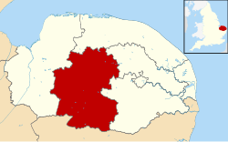
Breckland shown within Norfolk
Sovereign state Flag of the United Kingdom.svg  United Kingdom
Constituent country Flag of England.svg  England
Region East of England
Non-metropolitan county Norfolk
Status Non-metropolitan district
Admin HQ Dereham
Incorporated1 April 1974
Government
  TypeNon-metropolitan district council
  BodyBreckland District Council
  Leadership Leader & Cabinet (Conservative)
   MPs George Freeman
Liz Truss
Area
  Total1,035.1 km2 (399.7 sq mi)
  Rank17th (of 309)
Population
 (2021)
  Total141,476
  Rank158th (of 309)
  Density140/km2 (350/sq mi)
  Ethnicity
98.5% White
Time zone UTC0 (GMT)
  Summer (DST) UTC+1 (BST)
ONS code 33UB (ONS)
E07000143 (GSS)
OS grid reference TG018081
Website www.breckland.gov.uk
Thetford is the largest settlement in the district Cmglee Thetford market.jpg
Thetford is the largest settlement in the district

Breckland is a local government district in Norfolk, England. Its council is based in Dereham. The district had a population of 130,491 at the 2011 Census. [1]

Contents

The district derives its name from the Breckland landscape region, a gorse-covered sandy heath of south Norfolk and north Suffolk. The term "Breckland" dates back to at least the 13th century.

Attleborough, the third-largest settlement in the district St Mary's church Attleborough - geograph.org.uk - 3269362.jpg
Attleborough, the third-largest settlement in the district

The district is predominantly rural, with five market towns - Dereham, Thetford, Attleborough, Swaffham and Watton - and over 100 villages (full list below).

History

Breckland District was formed on 1 April 1974 by the merger of the municipal borough of Thetford, East Dereham Urban District, Swaffham Urban District, Wayland Rural District, Mitford and Launditch Rural District, and Swaffham Rural District.

Swaffham, the fourth-largest settlement in the district The buttercross at Swaffham Market Place - geograph.org.uk - 2108169.jpg
Swaffham, the fourth-largest settlement in the district

Politics

The Council consists of 49 Councillors elected every four years, the last election being May 2019.

It is currently controlled by the Conservative Party who won 37 of the 49 seats on the council at the last election.

Leader of the Council

The Leader since May 2019 is Sam Chapman-Allen (Conservative) (Forest Ward).

The Deputy Leader since May 2019 is Paul Claussen (Conservative) (Mattishall Ward)

Chairman of the Council

The Chairman is Roy Brame (Thetford Castle Ward)

The Vice-Chairman is Mike Nairn (Bedingfield . 8, 2005)

Past Chairmen of the Council

Election Results

For the results of the last election to the council click on this link, Breckland District Council election 2019.

For further information on previous elections click on link, Breckland District Council - Elections

UK Youth Parliament

Although the UK Youth Parliament is an apolitical organisation, the elections are run in a way similar to that of the Local Elections. The votes come from 11 to 18 year olds and are combined to make the decision of the next, 2 year Member of Youth Parliament. The elections are run at different times across the country with Breckland's typically being in early Spring and bi-annually.

The current Member of Youth Parliament for Breckland is Jake Dorman MYP. [2] [3] [4]

Watton, the fifth-largest settlement in the district St. Mary, the parish church of Watton - geograph.org.uk - 2967395.jpg
Watton, the fifth-largest settlement in the district

Council parishes

The council is entirely parished, and is made up of 113 civil parishes. At the time of the 2001 census, the district had an area of 1,305 km2 (504 sq mi), with a population of 121,418 in 50,715 households. [5]

The council contains the following civil parishes:

Related Research Articles

<span class="mw-page-title-main">Swaffham</span> Town in Norfolk, England

Swaffham is a market town and civil parish in the Breckland District and English county of Norfolk. It is situated 12 miles east of King's Lynn and 31 miles west of Norwich.

<span class="mw-page-title-main">South West Norfolk (UK Parliament constituency)</span> Parliamentary constituency in the United Kingdom, 1885 onwards

South West Norfolk is a constituency represented in the House of Commons of the UK Parliament since 2010 by Liz Truss of the Conservative Party, who briefly served as Prime Minister of the United Kingdom from September to October 2022.

<span class="mw-page-title-main">North Elmham</span> Human settlement in England

North Elmham is a village and civil parish in the English county of Norfolk. It covers an area of 7.41 sq mi (19.2 km2) and had a population of 1,428 in 624 households at the 2001 census, including Gateley and increasing slightly to 1,433 at the 2011 Census. For the purposes of local government, it falls within the Elmham and Mattishall division of Norfolk County Council and the Upper Wensum ward of Breckland District Council. The village is located along the B1145 a route which runs between King's Lynn and Mundesley.

<span class="mw-page-title-main">Mid Norfolk (UK Parliament constituency)</span> Parliamentary constituency in the United Kingdom, 1983 onwards

Mid Norfolk is a constituency represented in the House of Commons of the UK Parliament since 2010 by George Freeman, a Conservative.

<span class="mw-page-title-main">Gateley</span> Human settlement in England

Gateley is a village and civil parish in the Breckland district of Norfolk, England.

<span class="mw-page-title-main">Watton, Norfolk</span> Human settlement in England

Watton is a market town in the district of Breckland in the English county of Norfolk, about 25 miles (40 km) west-southwest of Norwich and 14.5 miles (23.3 km) northeast of Thetford. The annual Wayland Agricultural Show in its west is one of the oldest one-day such shows in England.

<span class="mw-page-title-main">Bawdeswell</span> Small rural village and civil parish in Norfolk, England

Bawdeswell is a small rural village and civil parish in Norfolk, England. At the time of the 2011 census it had a population of 828 and an area of 487 hectares. The village is situated almost in the centre of Norfolk about 14 miles (23 km) northwest of Norwich. For the purposes of local government it falls within the Upper Wensum Ward of Breckland District Council and the Elmham and Mattishall Division of Norfolk County Council. It is on a Roman road that ran east–west between Durobrivae near modern Peterborough and Smallburgh, crossing the Fen Causeway.

<span class="mw-page-title-main">Billingford, Breckland</span> Human settlement in England

Billingford is a village and civil parish in the Breckland district of Norfolk, England, about 3+12 miles (5.6 km) north of East Dereham. The village is just north of the River Wensum, which forms the southern boundary of the parish. The village is on the B1145 road, which links King's Lynn and Mundesley. The 2011 Census recorded the parish population as 253.

<span class="mw-page-title-main">Twyford, Norfolk</span> Human settlement in England

Twyford is a hamlet and civil parish in the English county of Norfolk. It is situated on the A1067 road, some 12 km (7.5 mi) south-east of the town of Fakenham and 28 km (17 mi) north-west of the city of Norwich.

<span class="mw-page-title-main">South Pickenham</span> Human settlement in England

South Pickenham is a small village and civil parish in the Breckland district of mid Norfolk, East Anglia, England. It has an area of 758 hectares and it had a population of 101 in 40 households at the 2001 census. This had dropped to an estimated 85 as at the 2007/2008 Breckland yearbook. The Parish Council Tax 1 April 2007 was £28.75. It was once in the Hundred of South Greenhoe. At the 2011 Census the village population had again fallen to less than 100 and was included in the civil parish of Cockley Cley.

<span class="mw-page-title-main">North Pickenham</span> Human settlement in England

North Pickenham is a village in the Breckland district of mid-Norfolk, East Anglia, England. It lies three miles from the Georgian market town of Swaffham.

<span class="mw-page-title-main">North Tuddenham</span> Human settlement in England

North Tuddenham is a civil parish in the English county of Norfolk, North Tuddenham is 3 miles (4.8 km) east of East Dereham, and is close to the A47 road.

<span class="mw-page-title-main">Holme Hale</span> Human settlement in England

Holme Hale is a village situated in the Breckland District of Norfolk and covers an area of 1069 hectares with an estimated population of 444 as of UK census 2001. The village lies 1+12 miles (2.4 km) south of Necton and 5+12 miles (8.9 km) by road east from Swaffham.

<span class="mw-page-title-main">Little Cressingham</span> Human settlement in England

Little Cressingham lies 2.5 miles (4.0 km) south east by road from Great Cressingham, 3 miles (4.8 km) west of Watton and 8 miles (13 km) south of Swaffham in the Breckland District of Norfolk. It covers an area of 11.90 km2 (4.59 sq mi) and had a population of 157 in 70 households at the 2001 census It is in the civil parish of Great Cressingham. The village is located on the edge of the Stanford Battle Area.

<span class="mw-page-title-main">East Tuddenham</span> Human settlement in England

East Tuddenham is a village in the English county of Norfolk. The village is located 5.6 miles (9.0 km) south-west of Dereham and 9.5 miles (15.3 km) north-west of Norwich and is bisected by the A47 between Birmingham and Lowestoft.

<span class="mw-page-title-main">2009 Norfolk County Council election</span>

The Norfolk County Council election took place on 4 June 2009, coinciding with local elections for all county councils in England.

<span class="mw-page-title-main">2019 Breckland District Council election</span>

The 2019 Breckland District Council election took place on 2 May 2019 to elect members of Breckland District Council in England. This was on the same day as other local elections. The boundaries for this election were the same as those used in 2015.

References

  1. "Local Authority District population 2011". Neighbourhood Statistics. Office for National Statistics. Retrieved 26 July 2016.
  2. "Members of Youth Parliament - Norfolk County Council". www.norfolk.gov.uk.
  3. "Your Norfolk -". yournorfolk.norfolkpublications.org.uk.
  4. Cope, Lauren (30 March 2018). "Norfolk's four new Members of Youth Parliament are announced". Eastern Daily Press.
  5. "404 Page Not Found - Norfolk County Council". 2017-02-11. Archived from the original on 2017-02-11. Retrieved 2023-01-08.{{cite web}}: Cite uses generic title (help)
  6. Imossi, R. (1987-06-01). "Bnldag Vax Gmail". doi:10.2172/1157450. OSTI   1157450.{{cite journal}}: Cite journal requires |journal= (help)

Coordinates: 52°38′N0°59′E / 52.633°N 0.983°E / 52.633; 0.983