Dacorum

Last updated

Dacorum
Borough of Dacorum
Hemel Hempstead New Town Square.jpg
Hemel Hempstead town centre
Dacorum Coat of Arms.svg
Dacorum UK locator map.svg
Dacorum shown within Hertfordshire
Sovereign state United Kingdom
Constituent country England
Region East of England
Administrative county Hertfordshire
Founded1 April 1974
Admin. HQ Hemel Hempstead
Government
  Type Non-metropolitan district
  BodyDacorum Borough Council
   Leadership: Leader & Cabinet
   MPs: Gagan Mohindra
Mike Penning
Area
  Total82.0 sq mi (212.5 km2)
  Rank 141st
Population
 (2021)
  Total155,217
  Rank Ranked 133rd
  Density1,900/sq mi (730/km2)
Ethnicity (2021)
[1]
   Ethnic groups
List
Religion (2021)
[1]
   Religion
List
Time zone UTC+0 (Greenwich Mean Time)
  Summer (DST) UTC+1 (British Summer Time)
Postcode
HP
ONS code 26UC (ONS)
E07000096 (GSS)

Dacorum is a local government district with borough status in Hertfordshire, England. The council is based in Hemel Hempstead. The borough also includes the towns of Berkhamsted and Tring and surrounding villages. The borough had a population of 155,081 in 2021. [2] Dacorum was created in 1974 and is named after the ancient hundred of Dacorum which had covered a similar area. The borough of Dacorum is the westernmost of Hertfordshire's ten districts. It borders St Albans, Three Rivers, Buckinghamshire and Central Bedfordshire.

Contents

History

Dacorum means "of the Dacians" in medieval Latin. [lower-alpha 1] [3] The name appears to reference a period in Saxon times when the area formed part of the Danelaw which covered much of what is now eastern England, although the duration and extent of Danish occupation in this area is unclear and continues to be debated by historians. In 1086, the Domesday Book records a hundred called Danais (also meaning "of the Danes") and a neighbouring hundred called Tring; the two had merged into a single hundred by about 1200 which was thereafter called Dacorum. [4] From the seventeenth century onwards, hundreds gradually declined in importance as administrative divisions, with their functions passing to other bodies such as the county courts. The final administrative functions of hundreds were extinguished in 1886. [5]

The modern local government district of Dacorum was created on 1 April 1974 under the Local Government Act 1972, covering the whole area of five former districts and parts of another two, which were all abolished at the same time: [6]

The new district was named Dacorum after the medieval hundred, which had covered a similar area. [7]

The district was granted borough status in 1984, allowing the chair of the council to take the title of mayor. Hemel Hempstead had maintained Charter Trustees from 1974 to 1984. The amalgamation of the former local authorities was symbolised in the seven oak leaves which surround a Tudor rose on the Dacorum coat of arms, issued in 1992. [8]

Governance

Dacorum Borough Council
Dacorum Borough Council.svg
Type
Type
Leadership
William Allen,
Liberal Democrats
since 17 May 2023
Ron Tindall,
Liberal Democrats
since 17 May 2023 [9]
Claire Hamilton
since October 2020 [10]
Structure
Seats51 Councillors
United Kingdom Dacorum Council elections 2023.png
Political groups
Administration (28)
  Liberal Democrats (28)
Opposition (23)
  Conservative (18)
  Labour (3)
  Independent (2)
Elections
Plurality voting system
Last election
4 May 2023
Next election
2027
Meeting place
The Forum, Dacorum Borough Council.jpg
The Forum, Marlowes, Hemel Hempstead, HP1 1DN
Website
www.dacorum.gov.uk

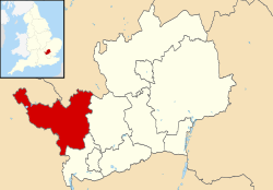
Hertfordshire has a two-tier structure of local government, with the ten district councils (including Dacorum Borough Council) providing district-level services, and Hertfordshire County Council providing county-level services. In some areas there is an additional third tier of civil parishes. [11]

Political control

The Liberal Democrats won a majority of the seats on the council at the 2023 election. Prior to 2023 the Conservatives had held a majority of the seats since 2003.

The first election to the council was held in 1973, initially operating as a shadow authority alongside the outgoing authorities until the new arrangements came into effect on 1 April 1974. Political control of the council since 1974 has been as follows: [12] [13]

Party in controlYears
Labour 1974–1976
Conservative 1976–1995
Labour 1995–1999
No overall control 1999–2003
Conservative 2003–2023
Liberal Democrats 2023–present

Leadership

The role of mayor is largely ceremonial in Dacorum. Political leadership is instead provided by the leader of the council. The leaders since 1995 have been:

CouncillorPartyFromTo
Julia Coleman [14] Labour 19951999
Andrew Williams Conservative 199917 May 2023
Ron Tindall Liberal Democrats 17 May 2023

Composition

Following the 2023 election, the composition of the council was: [15]

PartyCouncillors
Liberal Democrats 28
Conservative 18
Labour 3
Independent 2
Total51

The next election is due in 2027.

Premises

The council is based at The Forum on Marlowes in Hemel Hempstead. From the council's creation in 1974 until 2017, the council was based at Dacorum Civic Centre, also on Marlowes in Hemel Hempstead. That building had previously been called Hemel Hempstead Town Hall, having been built for Hemel Hempstead Borough Council in 1966 to replace the Old Town Hall on High Street. On 16 January 2017 the council opened its new headquarters at The Forum, on the corner of Marlowes and Combe Street, immediately south of the Civic Centre, which was demolished shortly afterwards. [16]

Elections

Since the last boundary changes in 2007 the council has comprised 51 councillors, representing 25 wards, with each ward electing one, two or three councillors. The whole council is elected together every four years. [17]

Wards

The borough's wards are: [17]

Parishes

Hemel Hempstead is an unparished area. The rest of the borough is divided into 16 civil parishes, with Berkhamsted and Tring parish councils taking the style "town council". The civil parishes are: [18]

Arms

Coat of arms of Dacorum
Dacorum Coat of Arms.svg
Notes
Granted 21 January 1992.
Crest
A sprig of seven oak leaves Proper and acorns Or inflected to the sinister out of a mural crown Or.
Escutcheon
Or seven oak leaves stalks inward Vert radiating from a Tudor rose Proper.
Supporters
Two stags in trian aspect Proper attired and unguled Or gorged with a wreath Or and Gules ribbons flowing outward depending therefrom a bezant charged with oak leaves and a Tudor rose as in the Arms standing on a compartment Vert strewn with sprigs of oak leaves Proper and acorns Or. [19]

Media

In terms of television, Dacorum is served by BBC London and ITV London with television signals received from the Crystal Palace transmitter [20] and the Hemel Hempstead relay transmitter. [21] However, Tring receive regional overlaps of both Sandy Heath (BBC East/ITV Anglia) [22] and Oxford (BBC South/ITV Meridian) transmitters. [23]

Radio stations for the area are:

Local newspapers are Hemel Hempstead Gazette and St Albans Observer.

Town twinning

Two of the civil parishes in the borough also maintain their own separate twinning arrangements:

See also

Related Research Articles

<span class="mw-page-title-main">Hertfordshire</span> County of England

Hertfordshire is a ceremonial county in the East of England and one of the home counties. It borders Bedfordshire to the north-west, Cambridgeshire to the north-east, Essex to the east, Greater London to the south and Buckinghamshire to the west. The largest settlement is Watford, and the county town is Hertford.

<span class="mw-page-title-main">Berkhamsted</span> Town in Hertfordshire, England

Berkhamsted is a historic market town in Hertfordshire, England, in the Bulbourne valley, 26 miles (42 km) north-west of London. The town is a civil parish with a town council within the borough of Dacorum which is based in the neighbouring large new town of Hemel Hempstead. Berkhamsted, along with the adjoining village of Northchurch, is encircled by countryside, much of it in the Chiltern Hills which is an Area of Outstanding Natural Beauty (AONB).

<span class="mw-page-title-main">Hemel Hempstead</span> Town in Hertfordshire, England

Hemel Hempstead is a town in the Dacorum district in Hertfordshire, England. It is 24 miles (39 km) northwest of London. The population at the 2021 census was 95,961.

<span class="mw-page-title-main">Tring</span> Market town in Hertfordshire, England

Tring is a market town and civil parish in the Borough of Dacorum, Hertfordshire, England. It is situated in a gap passing through the Chiltern Hills, classed as an Area of Outstanding Natural Beauty, 30 miles (50 km) from Central London.

<span class="mw-page-title-main">Hemel Hempstead (UK Parliament constituency)</span> Parliamentary constituency in the United Kingdom 1918-1983 & 1997 onwards

Hemel Hempstead is a constituency in Hertfordshire represented in the House of Commons of the Parliament of the United Kingdom. It elects one Member of Parliament (MP) by the first-past-the-post system. Since 2005, it has been represented by Mike Penning, a member of the Conservative Party.

<span class="mw-page-title-main">South West Hertfordshire (UK Parliament constituency)</span> Parliamentary constituency in the United Kingdom, 1950 onwards

South West Hertfordshire is a constituency in the House of Commons of the UK Parliament, represented since 2019 by Gagan Mohindra, a Conservative.

<span class="mw-page-title-main">Adeyfield</span> Human settlement in England

Adeyfield was the first planned neighbourhood to be built in the postwar new town expansion of Hemel Hempstead, in the English county of Hertfordshire. The keys to the first houses to be occupied, in Homefield Road, were handed over to their tenants in February 1950. The Queens Square shopping parade was visited by Queen Elizabeth II on 20 July 1952, to lay the first foundation slab of St. Barnabas Church.

<span class="mw-page-title-main">River Bulbourne</span> River in Hertfordshire, England

The River Bulbourne is a small river in Dacorum, Hertfordshire, England. The word bourne derives from the Anglo-Saxon word for a stream. It is an unnavigable tributary of the River Gade, which flows into the River Colne, which in turn is a tributary of the River Thames. The Bulbourne is an example of a chalk stream, which is a watercourse that flows from chalk-fed groundwater. Chalk streams are a very rare habitat globally, with more than 85% of all the 210 chalk streams in the world are found in England. The river is reduced in size, due to human activity, the main one being the building of the London to Birmingham Grand Union Canal through the narrow valley which takes most of the river's water.

<span class="mw-page-title-main">Hemel Hempstead Rural District</span> Former English rural district

Hemel Hempstead Rural District was a rural district in Hertfordshire, England from 1894 to 1974.

<i>Hemel Hempstead Gazette & Express</i>

The Hemel Hempstead Gazette & Express is a local newspaper in the United Kingdom that covers the towns of Hemel Hempstead, Berkhamsted and Tring and the surrounding area in Hertfordshire.

<span class="mw-page-title-main">Little Gaddesden</span> Human settlement in England

Little Gaddesden is a village and civil parish in the borough of Dacorum, Hertfordshire 3 miles (4.8 km) north of Berkhamsted. As well as Little Gaddesden village, the parish contains the settlements of Ashridge, Hudnall, and part of Ringshall. The total population at the 2011 Census was 1,125.

<span class="mw-page-title-main">Primary schools in Dacorum</span>

This article gives brief information on schools that cater for pupils up to the age of 11 in the Dacorum district of Hertfordshire, England. Most are county maintained primary schools, sometimes known as "junior mixed infant" (JMI). A small number are voluntary aided church schools or independent (fee-paying). The Local Education Authority is Hertfordshire County Council.

<span class="mw-page-title-main">Cow Roast</span> Human settlement in England

Cow Roast is a hamlet within the civil parishes of Northchurch and Wigginton in Hertfordshire, England. It is between Tring and Berkhamsted, along the A4251, adjacent to the Grand Union Canal and the West Coast Main Line. Today it comprises a row of 20th-century houses and a marina, together with several older properties including a restaurant. There are three car dealerships and a petrol station beside the main road.

<span class="mw-page-title-main">Potten End</span> Human settlement in England

Potten End is a village in west Hertfordshire, England. It is located in the Chiltern Hills, two miles (3.2 km) east-north-east of Berkhamsted, three miles (4.8 km) north west of Hemel Hempstead and two miles south east of the National Trust estate of Ashridge. Nearby villages include Nettleden, Great Gaddesden and the hamlet of Frithsden. The village is part of the parish of Nettleden with Potten End within the borough of Dacorum.

<span class="mw-page-title-main">Dacorum Heritage Trust</span> English history advocacy group

Dacorum Heritage (DH) is a local history advocacy group in the United Kingdom. It collects and records the history of the Borough of Dacorum, Hertfordshire, in the south of England, and aims to encourage the appreciation of the heritage of Dacorum.

<span class="mw-page-title-main">Danais (hundred)</span>

DanaisHundred was a judicial and taxation subdivision of Hertfordshire, in the west of the county, that existed from the 10th to the 19th century. It gave its name to the modern local government district of Dacorum, established in 1974, which covers a similar area. Danais was Latinised to Dacorum in 1196. The name Danais means the Hundred of the Danes and refers to its incorporation into the Danelaw for a period in the tenth century.

Harpenden and Berkhamstead is a proposed constituency of the House of Commons in the UK Parliament. Further to the completion of the 2023 Periodic Review of Westminster constituencies, it will first be contested at the next general election.

<span class="mw-page-title-main">The Forum, Hemel Hempstead</span> Commercial building in Hemel Hempstead, England

The Forum is a municipal building in Marlowes, Hemel Hempstead, Hertfordshire, England. The building accommodates the meeting place and offices of Dacorum Borough Council as well as the local library.

References

  1. Dacorum literally means "of the Dacians", a term which was used in the Middle Ages for the Danes based on a legend (now dismissed as erroneous) that certain tribes from Dacia in south-eastern Europe had migrated to Denmark in the distant past.
  1. 1 2 UK Census (2021). "2021 Census Area Profile – Dacorum Local Authority (E07000096)". Nomis. Office for National Statistics . Retrieved 5 January 2024.
  2. "Census 2021 Data".
  3. Latin Dictionary, accessed 10 August 2022
  4. Williamson, Tom (2010). The Origins of Hertfordshire. Hatfield: Hertfordshire Publications. pp. 106, 226. ISBN   978-1-905313-95-2.
  5. Riot (Damages) Act 1886 (49 & 50 Vict. c. 38), s.2
  6. "The English Non-metropolitan Districts (Definition) Order 1972", legislation.gov.uk , The National Archives, SI 1972/2039, retrieved 12 May 2023
  7. "The English Non-metropolitan Districts (Names) Order 1973", legislation.gov.uk , The National Archives, SI 1973/551, retrieved 12 May 2023
  8. "About Dacorum". Archived from the original on 18 December 2008. Retrieved 13 April 2009.
  9. "Council meeting, 17 May 2023". Dacorum Borough Council. 17 May 2023.
  10. Patel, Holly (6 August 2020). "Dacorum Borough Council appoints new chief executive". Hemel Today. Retrieved 16 May 2023.
  11. "Local Government Act 1972", legislation.gov.uk , The National Archives, 1972 c. 70, retrieved 3 March 2023
  12. "Compositions calculator". The Elections Centre. 4 March 2016. Retrieved 14 May 2023.
  13. "Dacorum". BBC Online . Retrieved 24 February 2010.
  14. "Tributes paid to former Hemel Hempstead Mayor Les Taber". Hemel Today. 12 April 2017. Retrieved 15 May 2023. Julia Coleman was the leader of Dacorum Borough Council from 1995 to 1999...
  15. "Local elections 2023: live council results for England". The Guardian.
  16. "New £15m home for Dacorum Borough Council and library officially opens in Hemel Hempstead". Hemel Today. 16 January 2017. Retrieved 25 December 2021.
  17. 1 2 "The Borough of Dacorum (Electoral Changes) Order 2007", legislation.gov.uk , The National Archives, SI 2007/139, retrieved 17 May 2023
  18. "Community connections". Dacorum Borough Council. Retrieved 17 May 2023.
  19. "East of England Region". Civic Heraldry of England. Retrieved 8 March 2021.
  20. "Full Freeview on the Crystal Palace (Greater London, England) transmitter". May 2004.
  21. "Hemel Hempstead (Hertfordshire, England) Full Freeview transmitter". May 2004.
  22. "Full Freeview on the Sandy Heath (Central Bedfordshire, England) transmitter". UK Free TV. 1 May 2004. Retrieved 21 April 2024.
  23. "Full Freeview on the Oxford (Oxfordshire, England) transmitter". UK Free TV. 1 May 2004. Retrieved 21 April 2024.
  24. "Radio Dacorum" . Retrieved 21 April 2024.
  25. "Tring Radio" . Retrieved 21 April 2024.

Sources

51°46′N00°32′W / 51.767°N 0.533°W / 51.767; -0.533