
Hitchin is a market town in the North Hertfordshire district of Hertfordshire, England. The town dates from at least the 7th century. It lies in the valley of the River Hiz at the north-eastern end of the Chiltern Hills. It is 16 miles (26 km) north-west of the county town of Hertford, and 35 miles (56 km) north of London. The population at the 2021 census was 35,220.

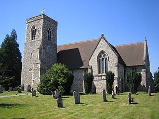
Preston is a village and civil parish about 3 miles (4.8 km) south of Hitchin in Hertfordshire, England. At the 2011 Census the population was 420.
North Hertfordshire is one of ten local government districts in the county of Hertfordshire, England. Its council is based in Letchworth Garden City and the largest town is Hitchin. The district also includes the towns of Baldock and Royston and numerous villages and surrounding rural areas. Part of the district lies within the Chiltern Hills, a designated Area of Outstanding Natural Beauty.

Markyate is a village and civil parish in north-west Hertfordshire, close to the border with Bedfordshire and Buckinghamshire.

Everton is a small rural village of about 200 dwellings and civil parish in the Central Bedfordshire district of Bedfordshire, England about 9 miles (14 km) east of the county town of Bedford.

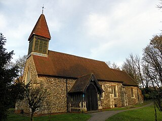
Ickleford is a large village situated on the northern outskirts of Hitchin in North Hertfordshire in England. It lies on the west bank of the River Hiz and to the east of the main A600 road. The population at the time of the 2011 census was 1,833.
Lilley is a small village and civil parish situated between Hitchin and Luton in Hertfordshire, England. Lilley stands on high ground: nearby Telegraph Hill is just over 600 feet above sea level.
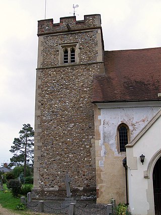
Hexton is a small village and civil parish in Hertfordshire, England, about 6 miles (10 km) west of Hitchin.
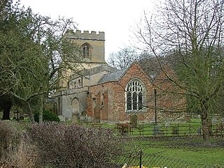
Little Wymondley is a village and former civil parish situated between Hitchin and Stevenage, now in the parish of Wymondley, in the North Hertfordshire district, in the county of Hertfordshire, England. Paradoxically, it has a larger population than its near neighbour Great Wymondley. At the 2011 Census the population of the built-up area of Little Wymondley was 995. In 1931 the parish had a population of 445.

Bendish is a hamlet located in the parish of St Paul's Walden in Hertfordshire. In the 18th century, Bendish was a small town. It is about 3 miles east of Luton, 5 miles south of Hitchin and 4.5 miles north of Harpenden. Many services such as the grocers, the 3 pubs and the Church have all closed.
Shephall is a neighbourhood of the new town of Stevenage in Hertfordshire. It was formerly a separate village and parish, being absorbed into Stevenage in 1953.

Caddington is a village and civil parish in the Central Bedfordshire district of Bedfordshire, England.

The Counties Act 1844, which came into effect on 20 October 1844, was an Act of Parliament of the United Kingdom which eliminated many outliers or exclaves of counties in England and Wales for civil purposes. The changes were based on recommendations by a boundary commission, headed by the surveyor Thomas Drummond and summarized in a schedule attached to the Parliamentary Boundaries Act 1832. This also listed a few examples of civil parishes divided by county boundaries, most of which were dealt with by later legislation. This Act was repealed in its entirety by the Local Government Act 1972.

Hitchin is a parliamentary constituency in Hertfordshire and Bedfordshire which returned one Member of Parliament (MP) to the House of Commons of the Parliament of the United Kingdom from 1885 until it was abolished for the 1983 general election.

Clifton is a village and civil parish in the English county of Bedfordshire. The original hundred of Clifton is named after it.

Hertford Heath is a village and civil parish near the county town of Hertford in Hertfordshire, England. The population at the 2011 Census was 2,672.
Ballingdon Bottom is a valley in Hertfordshire, England. It forms part of the boundary between the civil parishes of Flamstead and Great Gaddesden.
Hitchin Rural District was a rural district in Hertfordshire, England from 1894 to 1974, covering an area in the north of the county.

Kensworth is a village and civil parish located in the Central Bedfordshire district of Bedfordshire, England. The parish is located on the edge of Dunstable Downs, and includes the hamlets of California and Kensworth Lynch.

Fancott is a hamlet located in the Central Bedfordshire district of Bedfordshire, England.


