Ashwell, Hertfordshire

Last updated • 5 min readFrom Wikipedia, The Free Encyclopedia

Ashwell
St. Mary - the parish church of Ashwell - geograph.org.uk - 1246802.jpg
Hertfordshire UK location map.svg
Red pog.svg
Ashwell
Location within Hertfordshire
Population1,870 (2011 Census) [1]
OS grid reference TL265398
District
Shire county
Region
Country England
Sovereign state United Kingdom
Post town BALDOCK
Postcode district SG7
Dialling code 01462
Police Hertfordshire
Fire Hertfordshire
Ambulance East of England
UK Parliament
List of places
UK
England
Hertfordshire
52°02′32″N0°09′25″W / 52.04217°N 0.15699°W / 52.04217; -0.15699

Ashwell is a village and civil parish in Hertfordshire situated 4 miles (6 km) north-east of Baldock. [2]

Contents

History

To the southwest of the village is Arbury Banks, the remains of an Iron Age hill fort which have been largely removed by agricultural activity.

In 2002 a local metal detector, Alan Meek, found a silver Roman figurine of a goddess, Dea Senuna. A subsequent archaeological dig over four summers revealed 26 more gold and silver objects situated in a major open-air ritual site. [3]

The Buckinghamshire family of Nernewt (Nernuyt) held land here in the 14th century, which was originally part of the Abbot of Westminster's manor. This land became the manor of Westbury Nernewtes. [4] [5]

The village has a wealth of architecture spanning several centuries. There was also a great fire of Ashwell on Saturday 2 February 1850, without fatalities. [6]

The village itself is mostly in a fine state of preservation, from the medieval cottage to the fine town house, plastered or timbered, thatched or tiled, in Tudor, Carolean or Georgian brick. 'Scheduled' listed buildings include the St. John's Guildhall of 1681, the carefully restored Foresters Cottages, the Chantry House with its 15th-century window, the 16th-century town house (now a local museum), the Maltings (now converted into flats), and a small brick house which was first built in 1681 as a school by the Merchant Taylors. Ashwell Bury, a large Victorian house, was remodelled by Edwin Lutyens in the 1920s. Lutyens also designed the Grade 2 listed Ashwell War Memorial, unveiled in 1922. Ashwell also has a village lock-up that was used to detain drunks and suspected criminals. The village used to be home to a number of local breweries and, accordingly, a variety of public houses in its past, but currently has just three pubs: The Rose and Crown, the Three Tuns and the Bushel and Strike.

Since 1850 the village has been served by Ashwell and Morden railway station which is about a mile and half from the centre of the village in the hamlet of Odsey in Cambridgeshire.

Church

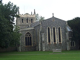
The parish church of St Mary the Virgin dates almost entirely from the 14th century and is renowned for its ornate church tower which stands at 176 feet (54 m), and is crowned by an octagonal lantern with a leaded 'spike'. [2] The church contains medieval graffiti carved on its walls which highlight the plight of survivors of the bubonic plague pandemic known as the Black Death.There is also a graffito depiction of Old St Paul’s Cathedral.

In 2013, the village church became the centre of a nationally reported row over the quarter-hourly chiming of the clock. Complaints about the chimes during the night were initially received in the summer of that year, which North Hertfordshire District Council (NHDC) was legally obliged to investigate. In December, the council ruled that the chimes are "prejudicial to health" and have to be silenced between 11 pm and 6 am. Complying with the ruling has meant turning off the chimes altogether, although the parish council has asked the Diocese of St Albans if it can install a timing mechanism that will restrict the chimes to the legally appointed hours, and has launched an appeal to raise the £1,900 cost. The chiming clock was initially installed in 1898, but was turned off for 18 months in 2011 and 2012 while repairs were carried out. A public meeting on 19 January 2014 discussed the future of the chimes. [7] [8] [9] [10] In May 2015, a timer had been installed to reduce the volume of the church bells overnight. [11]

Geography

Ashwell Springs, a biological Site of Special Scientific Interest, is a perennial source of the River Cam. The cool water of the chalk springs contain a rare species of stenothermic flatworm (Platyhelminthes; Tricladida) associated with cold surface waters or subterranean groundwater that is only known from this location within East Anglia. The springs now depend upon artificial flow augmentation during drier periods, due to the impact of local groundwater abstraction from the chalk aquifer for public water supply.

The village is a "green oasis" with many trees and this contrasts with the surrounding landscape dominated by intense agricultural production, principally of wheat, with rather limited aesthetic or biodiversity interest.

Governance

Ashwell has three tiers of local government at parish, district and county level: Ashwell Parish Council, North Hertfordshire District Council, and Hertfordshire County Council.

Ashwell is an ancient parish, and it was part of the hundred of Odsey. Ashwell was included in the Royston Poor Law Union from 1835. [12] The Local Government Act 1894 created parish and district councils. The parish of Ashwell was included in Ashwell Rural District from 28 December 1894, and Ashwell Parish Council came into being on 31 December 1894, taking over the secular functions of the parish vestry. Despite the name, Ashwell Rural District Council was based in the town of Royston rather than in Ashwell itself. Ashwell Rural District was abolished in 1935, becoming part of Hitchin Rural District, which in turn was abolished in 1974, becoming part of North Hertfordshire. [13]

Sport

Ashwell has several successful sports teams from under-12s to veterans. The adult first football team have won several trophies and are currently in the Hall's of Cambridge Sunday league premier division. The cricket team won the Cambridgeshire Junior Cup in 2003 and currently play in Division 1 of the Cambridgeshire league. There are many other clubs and societies catering for all interests. Ashwell have a junior soccer side called the Academicals, which are from age 5 to 18.

Notable residents

Related Research Articles

<span class="mw-page-title-main">Royston, Hertfordshire</span> Town in Hertfordshire, England

Royston is a town and civil parish in the District of North Hertfordshire and county of Hertfordshire in England.

<span class="mw-page-title-main">Baldock</span> Town in Hertfordshire, England

Baldock is a historic market town in the North Hertfordshire district of Hertfordshire, England. The River Ivel rises from springs in the town. It lies 33 miles (53 km) north of London and 14 miles (23 km) north northwest of the county town of Hertford. Nearby towns include Royston to the northeast, Letchworth and Hitchin to the southwest and Stevenage to the south.

<span class="mw-page-title-main">Buntingford</span> Market town in Hertfordshire, England

Buntingford is a market town and civil parish in the district of East Hertfordshire and county of Hertfordshire in England. It lies next to the River Rib and is located on the historic Roman road, Ermine Street. As a result of its location, it grew mainly as a staging post with many coaching inns and has an 18th-century one-cell prison known as The Cage, by the ford at the end of Church Street. It has a population of 7879, as of the 2021 UK Census.

<span class="mw-page-title-main">North Hertfordshire</span> Non-metropolitan district in England

North Hertfordshire is one of ten local government districts in the county of Hertfordshire, England. Its council is based in Letchworth. The district borders East Hertfordshire, Stevenage, Welwyn Hatfield, St Albans, Central Bedfordshire, Luton, and South Cambridgeshire.

<span class="mw-page-title-main">Hinxworth</span> Human settlement in England

Hinxworth is a village and civil parish in North Hertfordshire, England. It sits just off the Great North Road between Baldock and Biggleswade. It has a village hall, a park, a pub, a small church, a bus stop and a post box. The population at the 2011 Census was 313.

<span class="mw-page-title-main">Melbourn</span> Village in England

Melbourn is a large, clustered village in the far south-west of Cambridgeshire, England. Its traditional high street is bypassed by the A10, intersecting the settlement's other main axis exactly 3 miles (4.8 km) northwest of the traditional focal point of Royston, Hertfordshire, the nearest larger settlement. It has over 4,600 inhabitants and is in the South Cambridgeshire district.
<span class="mw-page-title-main">Therfield</span> Human settlement in England

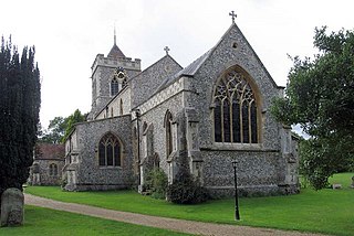
Therfield is both a small village of approximately 4,761 acres (19 km²) and a civil parish which sits upon the chalk range, three miles southwest of Royston, and six miles (10 km) northeast of Baldock and within the English county of Hertfordshire.

<span class="mw-page-title-main">Odsey</span> Human settlement in England

Odsey is a hamlet in the civil parish of Steeple Morden, Cambridgeshire, England, close to the border with Hertfordshire. It lies just off the A505 road roughly equidistant between Royston and Baldock. It is the location of Ashwell and Morden railway station, which serves the nearby villages of Ashwell, Steeple Morden and Guilden Morden, and offers direct train links to Cambridge and London Kings Cross.

<span class="mw-page-title-main">Guilden Morden</span> Human settlement in England

Guilden Morden is a village and parish located in Cambridgeshire about 16 miles (26 km) south west of Cambridge and 9 miles (14 km) west of Royston in Hertfordshire. It is served by the main line Ashwell and Morden railway station 3 miles (5 km) to the south in the neighbouring parish of Steeple Morden.

<span class="mw-page-title-main">Barkway</span> Human settlement in England

Barkway is a long-established village and civil parish in the North Hertfordshire district of Hertfordshire, England, about five miles south-east of Royston, 35 miles from London and 15 miles from the centre of Cambridge. The Prime Meridian passes a mile or so to the west of Barkway.

<span class="mw-page-title-main">Barley, Hertfordshire</span> Human settlement in England

Barley is a village and civil parish in the district of North Hertfordshire, England. According to the 2001 census, it has a population of 659, increasing to 662 at the 2011 Census. The place-name refers to a lea or meadow and not to the grain-producing plant. Coincidentally to the southwest lies the village of Reed. The Prime Meridian passes to the west of Barley, which is located on the Royston to Saffron Walden road, as well as the medieval London to Cambridge road.

Bassingbourn cum Kneesworth is a civil parish in the South Cambridgeshire district of Cambridgeshire, England, 14 miles south-west of Cambridge and just north of Royston, Hertfordshire. Since the 1960s the parish contains the villages of Bassingbourn and Kneesworth.

<span class="mw-page-title-main">Melbourn Rural District</span> History of Cambridgeshire

Melbourn Rural District was a rural district in Cambridgeshire, England, from 1894 to 1934.

<span class="mw-page-title-main">Kelshall</span> Human settlement in England

Kelshall is a small village in North East Hertfordshire, England. It is near the town of Royston. It has a village hall and the local church is St Faith's. Kelshall is also the name of the civil parish. Kelshall also has a major road running along one of its boundaries. In the 1880s the church was described as being "ancient, plain, and good, with a tower; and contains a few brasses and monuments".

<span class="mw-page-title-main">Hitchin (UK Parliament constituency)</span> Parliamentary constituency in the United Kingdom, 1885–1983

Hitchin was a parliamentary constituency in Hertfordshire which returned one Member of Parliament (MP) to the House of Commons of the Parliament of the United Kingdom from 1885 until it was abolished for the 1983 general election.

<span class="mw-page-title-main">Reed, Hertfordshire</span> Human settlement in England

Reed is a small village and civil parish in North Hertfordshire. It is situated on a chalk ridge, approximately 3 miles (4.8 km) south of the market town of Royston. The Prime Meridian passes just to the east of the village, between Reed and Barkway. The modern A10 road passes just to the west of the village. The population of the parish was 310 at the time of the 2011 census.

<span class="mw-page-title-main">Steeple Morden</span> Human settlement in England

Steeple Morden is a village and civil parish in Cambridgeshire, England, about 15 miles (24 km) south west of Cambridge and 5 miles (8 km) west of Royston. It is part of the South Cambridgeshire local government district.
<span class="mw-page-title-main">Great Chishill</span> Village in England

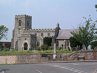
Great Chishill is a village and former civil parish, now in the parish of Great and Little Chishill, in the South Cambridgeshire district, in the county of Cambridgeshire, England. The village is about 1 mile (1.6 km) east of the county boundary with Hertfordshire and about 4 miles (6 km) east of Royston. In 1961 the parish had a population of 293. The 2011 Census recorded Great and Little Chishill's population as 678.

Ashwell Rural District was a rural district in Hertfordshire, England from 1894 to 1935, covering an area in the north-east of the county.

<span class="mw-page-title-main">Odsey (hundred)</span>

Odsey was a judicial and taxation subdivision of Hertfordshire, in the northeast of the county, that existed from the 10th to the 19th century.

References

  1. "Civil Parish population 2011". Neighbourhood Statistics. Office for National Statistics. Retrieved 25 October 2016.
  2. 1 2 AA Book of British Villages. Drive Publications Limited. 1980. p. 35. ISBN   9780340254875.
  3. Lucas, Julie (10 August 2018). History: the goddess of Ashwell. Hertfordshire Life.
  4. Parishes of Ashwell from British History
  5. National Archives
  6. Josephine Lohoar-Self; Olivia Lohoar-Self. "Great Fire of Ashwell". www.ashwellmuseum.org.uk. Retrieved 18 February 2016.
  7. (23 December 2013) Complaints silence church bells for first time in 117 years telegraph.co.uk
  8. (19 August 2013) Ashwell villagers row over 'silencing' church bells BBC News – Beds, Bucks & Herts
  9. (23 December 2013) Ashwell silences 'sleep disturbing' St Mary's church chimes BBC News – Beds, Bucks & Herts
  10. Ross-Millar, Lucy (12 December 2013) Church bells at risk from pleas for silent night cambridge-news.co.uk
  11. "Church bells upset Hertfordshire village harmony". BBC News. 19 March 2015.
  12. Higginbotham, Peter. "Royston Poor Law Union". The Workhouse. Retrieved 11 December 2021.
  13. "Ashwell Civil Parish / Ancient Parish". A Vision of Britain through Time. GB Historical GIS / University of Portsmouth. Retrieved 11 December 2021.