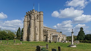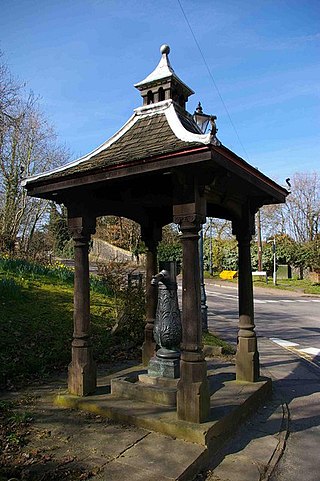
Hursley is a village and civil parish in Hampshire, England with a population of around 900 in 2011. It is located roughly midway between Romsey and Winchester on the A3090. Besides the village the parish includes the hamlets of Standon and Pitt and the outlying settlement at Farley Chamberlayne.

The Diocese of St Albans forms part of the Province of Canterbury in England and is part of the wider Church of England, in turn part of the worldwide Anglican Communion.

Bengeo is a suburb and former village and civil parish on the north-west edge of the county town of Hertford in Hertfordshire, England. It is an electoral ward of Hertford. In 1891 the parish had a population of 2586. In 1894 the parish was abolished to form Bengeo Rural and Bengeo Urban.

St Paul's Walden is a village about 5 miles (8 km) south of Hitchin in Hertfordshire, England. The civil parish of St Paul's Walden also includes the village of Whitwell and the hamlet of Bendish. At the 2011 Census, the population of the civil parish was 1,293.

Watton-at-Stone is a village and civil parish in Hertfordshire, England, and is midway between the towns of Stevenage and Hertford in the valley of the River Beane.

Aldenham is a village and civil parish in the borough of Hertsmere in Hertfordshire, England. The parish includes Radlett and Letchmore Heath as well as Aldenham village itself. The village of Aldenham lies 3.5 miles (5.6 km) north-east of Watford and 2 miles (3.2 km) southwest of Radlett. Aldenham was mentioned in the Domesday Book of 1086, and is one of Hertsmere's 14 conservation areas. The village has eight pre-19th-century listed buildings and the parish itself is largely unchanged, though buildings have been rebuilt, since Saxon times when the majority of the land was owned by the abbots of Westminster Abbey.

Anstey is a village and civil parish in the East Hertfordshire district of Hertfordshire, England, about 15 miles (24 km) northeast of Stevenage. According to the 2001 census the population of the parish was 338, reducing to 299 at the 2011 census.

Asheldham is a village and civil parish in Essex, England. It is located about 14 km (8.7 mi) southeast of Maldon and is 26 km (16 mi) east-southeast from the county town of Chelmsford. The village is in the district of Maldon and the parliamentary constituency of Maldon & East Chelmsford. The village is part of the combined Asheldham and Dengie Parish Council.

Shenley is a village and civil parish in Hertfordshire, England, between Barnet and St Albans. The village is located 14 miles from Central London. As of 2021, the population of the parish was 5,390; however, the parish stretches far beyond the village itself; it is the largest parish in Hertsmere and is very rural, including hamlets and farming settlements such as Dancers Hill, Green Street, Kitts End, Ridge, Saffron Green, Shenleybury, and the largest other settlement, South Mimms.
Little Munden Primary School is a Church of England voluntary controlled primary school in the village of Dane End, near Ware in Hertfordshire. It is a one-form entry school educating boys and girls aged between four and 11 years. There are four classes organised by age. The school roll varies but is generally between 85 and 100.

Stanstead Abbotts is a village and civil parish in the district of East Hertfordshire, Hertfordshire, England; it lies on the county boundary with Essex. At the 2001 census, the parish had a population of 1,983.

Milton is a village and civil parish about 3 miles (5 km) west of Didcot and a similar distance south of Abingdon. The 2011 Census recorded the parish's population as 1,290.

Hertingfordbury is a small village in Hertfordshire, England, close to the county town of Hertford. It was mentioned in the Domesday Book of 1086. Hertingfordbury is also the name of a neighbouring civil parish, which does not contain the village. Hertingfordbury village is within the Castle ward of Hertford Town Council. The population of the civil parish as of the 2021 census was 689.

Standon is a village and civil parish in Hertfordshire, England. The parish includes the adjoining village of Puckeridge. The village church of St Mary has Saxon origins with much Victorian restoration. It contains the ornate tomb of the Tudor courtier Sir Ralph Sadler.

Essendon is a village and civil parish in Hertfordshire, England, 6 miles (10 km) south-west of Hertford.

Great Munden is a village and civil parish in Hertfordshire, England. The parish, in the district of East Hertfordshire, spans 3,758 acres (5.872 sq mi), of which 1,895.75 acres (2.96211 sq mi) are arable land, 927.5 acres (1.4492 sq mi) are permanent grass and 97 acres (0.152 sq mi) are wood. It has a population of 477, reducing to 339 at the 2011 Census, and is situated 6 miles (9.7 km) north of the town of Ware. The village includes the church of St Nicholas, Munden Bury, and a rectory that includes the remains of a moat. Other settlements in the parish include Nasty and Levens Green. A detached portion of Little Munden was added to the parish in 1888.

Little Munden or Munden-Frewell or Munden Parva is a civil parish in the East Hertfordshire district, in the county of Hertfordshire, England. In 2011 the parish had a population of 952.

Gilston is a village and civil parish in the East Hertfordshire district of Hertfordshire, England. It is located a little over one mile north of the town of Harlow in the neighbouring county of Essex. Together with the nearby village of Eastwick, it forms the parish council of Eastwick and Gilston Parish Council. It is within the Hunsdon ward of East Hertfordshire District Council. At the 2001 Census, the population was 180, and 228 at the 2011 Census.

Standon is a village and civil parish in the Stafford district, in the county of Staffordshire, England. Standon has a church called Church of All Saints and one school called All Saints C of E First School. In 2001 the population of the civil parish of Standon was 823, and in the 2011 census it had a population of 879.


